Looking back on historic December floods that swamped Western Washington with significant damage
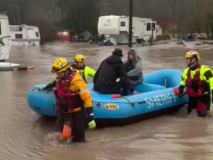
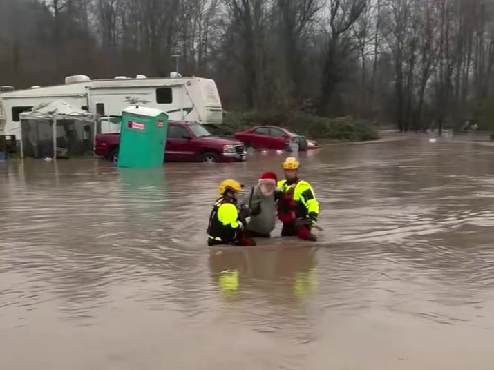
Water rescue at RV park in Orting, Wash. (Photo: Pierce County Sheriff's Dept.)
By: Scott Sistek, Emerald City Weather Blog, and Brie Hawkins, Little Bear Creek Weather
A multiple day atmospheric river onslaught led to a historic flooding event across much of Western Washington in early December, leaving at least one dead, thousands evacuated and likely millions of dollars in damage in its wake as it rewrote record books on several rivers.
The storm system’s evolution began on the other side of the globe, as a train of heavy rainfall began by tapping into a vast reservoir of warm, tropical moisture in southeastern Asia.
This atmospheric river then stretched thousands of miles across the entire Pacific Ocean before taking direct aim at Western Washington. And while it was well forecast ahead of time by forecast models, the storm system still stunned local meteorologists on the length and breadth of its journey.
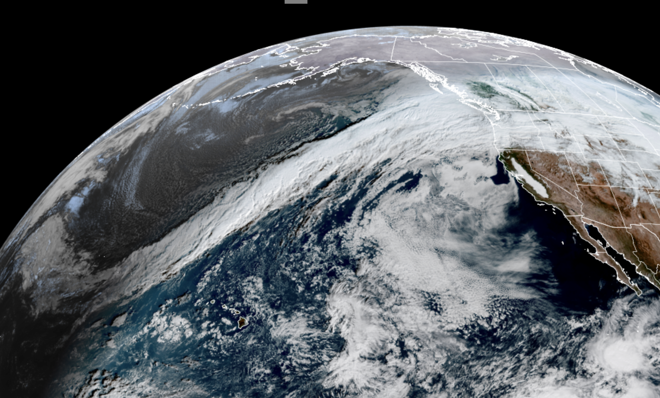
The atmospheric river first arrived on Dec. 7 and spread heavy rain throughout the region well through Dec. 8. With the storm’s warm, tropical origins, snow levels were far above much of the height of the Cascades and Olympics.
And with a powerful jet stream sending winds screaming over 100 mph at mountain peak elevations, slamming that moisture-infused air into the windward sides of the mountains, it was a recipe for relentless torrential rains that had nowhere to go but finding its nearest river basin. And coming off a mild November with little, if any snowpack on the ground ahead of the storm, there was no snow to sop up the rain and prevent it from spilling into rivers, adding to the flooding woes.

The storm system gave Western Washington a brief pause on Dec. 9 as the atmospheric river moved south into northern Oregon for a day, but came back even stronger and lasting longer on the 10th, renewing heavy rains into the 11th before rains subsided.
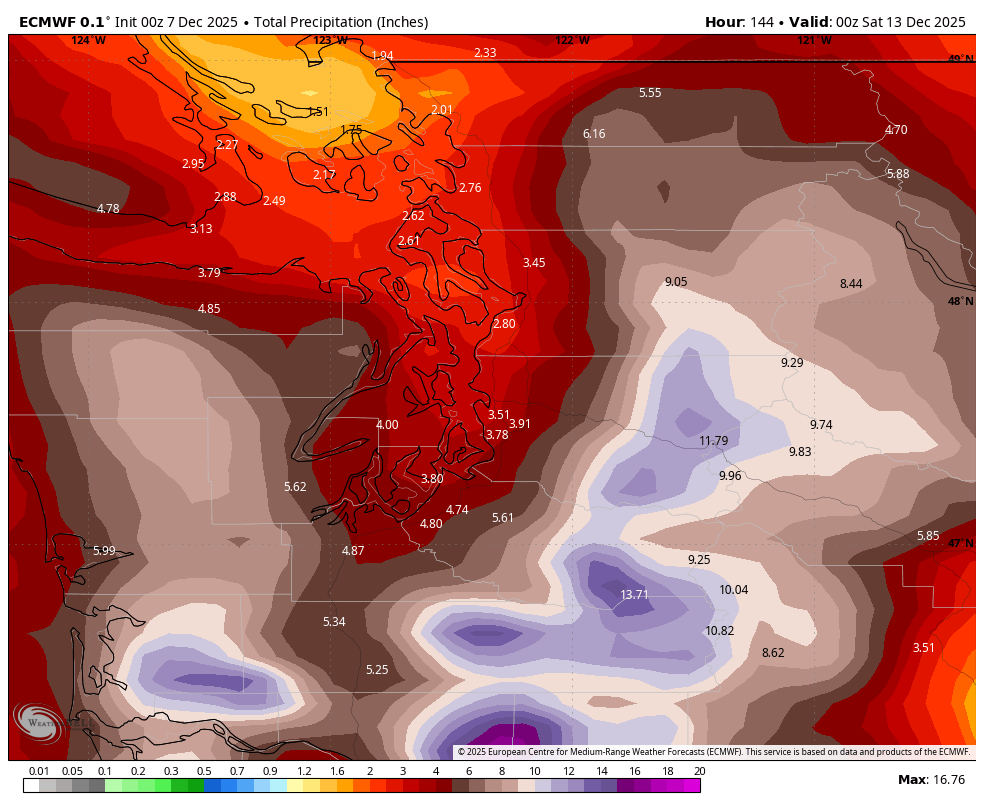
HOW MUCH RAIN FELL?
Storm totals for atmospheric river rainfall totals featured 9-15 inches in the Olympics and Cascades with Quinault nearing 17 inches. The Skykomish basin had just over 13 inches, while Snoqualmie reported 11.2 inches. Silverton and Finney Creek had over a foot of rain.
Southwestern Washington lowlands had even 5-8 inches or more. Olympia had just over 6 inches of rain, including 3.03 inches on Dec. 8 that is one of their Top 25 wettest days on record.
About 2-4 inches In the Northwest Interior and Seattle area, though the Olympic Rain Shadow really cut down on rainfall in the Northern Puget Sound area.
How much water is that? Let’s run some numbers using an overall average rainfall for this event at 5 inches of rain.
We know that 1 cubic foot is 7.5 gallons of water, but if you convert that to a depth of 5 inches of rainfall, that comes to 3.12 gallons per square foot. If you scale that up to a 20 square mile area which is only a 4×5 mile square….in that area alone it rained about 1.74 BILLION gallons of water.
Now imagine if you think about all the rain that fell inside the roughly 12,000 square miles of Western Washington between Portland and the Canadian border — using 5 inches as an average, that is approximately 1.04 TRILLION gallons of water!
That comes to much more than the amount of water in Lake Washington, which has about 706 billion gallons of water. These are relatively rough approximations but should put into perspective how much water actually fell during this event.
HOW BAD DID THE RIVERS GET?
All of that water put an incredible amount of strain on our area rivers which was reflected by the catastrophic record breaking flooding in many areas of the state.
More than a dozen rivers went into major flooding stage with a few setting all time record crests, rivaling or surpassing the epic floods of November 1990.
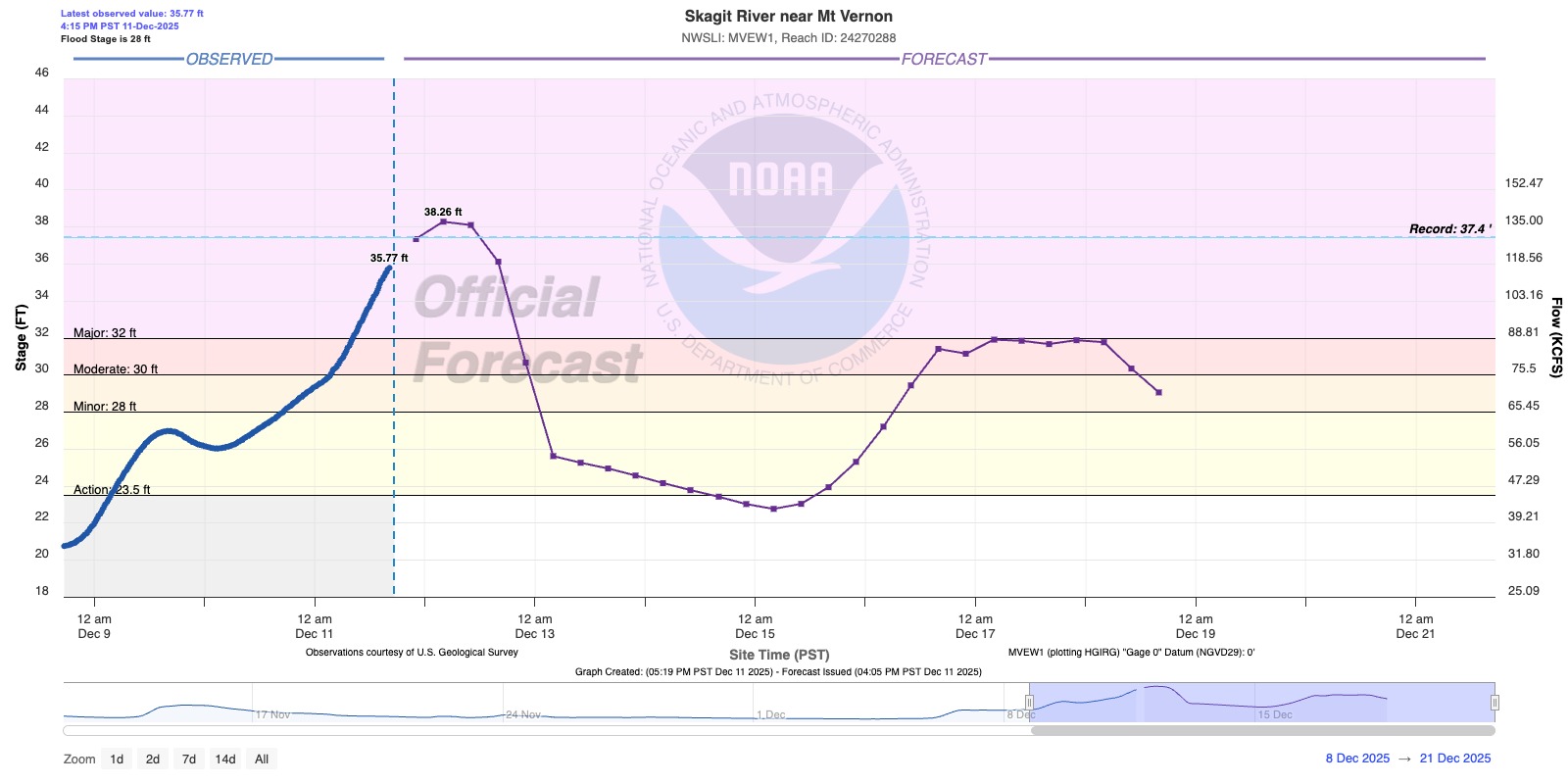
The Skagit River crested at 37.73 feet at 1 a.m. on Dec. 12, breaking its record from November 1990 of 37.4 feet.
The Nooksack at N. Cedarville and Cedar River at Renton also set new records, while the Puyayllup River tied its record at Orting and the Skykomish and Newakum were within fractions of a foot of their records. The Snoqualmie River went well into major flood stage.
One area in particular that got hit hard was the Snohomish River at downtown Snohomish and out into the valley.
The Snohomish River at Snohomish set a new record with crest of 34.15 feet, breaking its previous record of 33.5 feet, according to NOAA’s River Forecast Center.
HOME WASHED AWAY IN DEMING
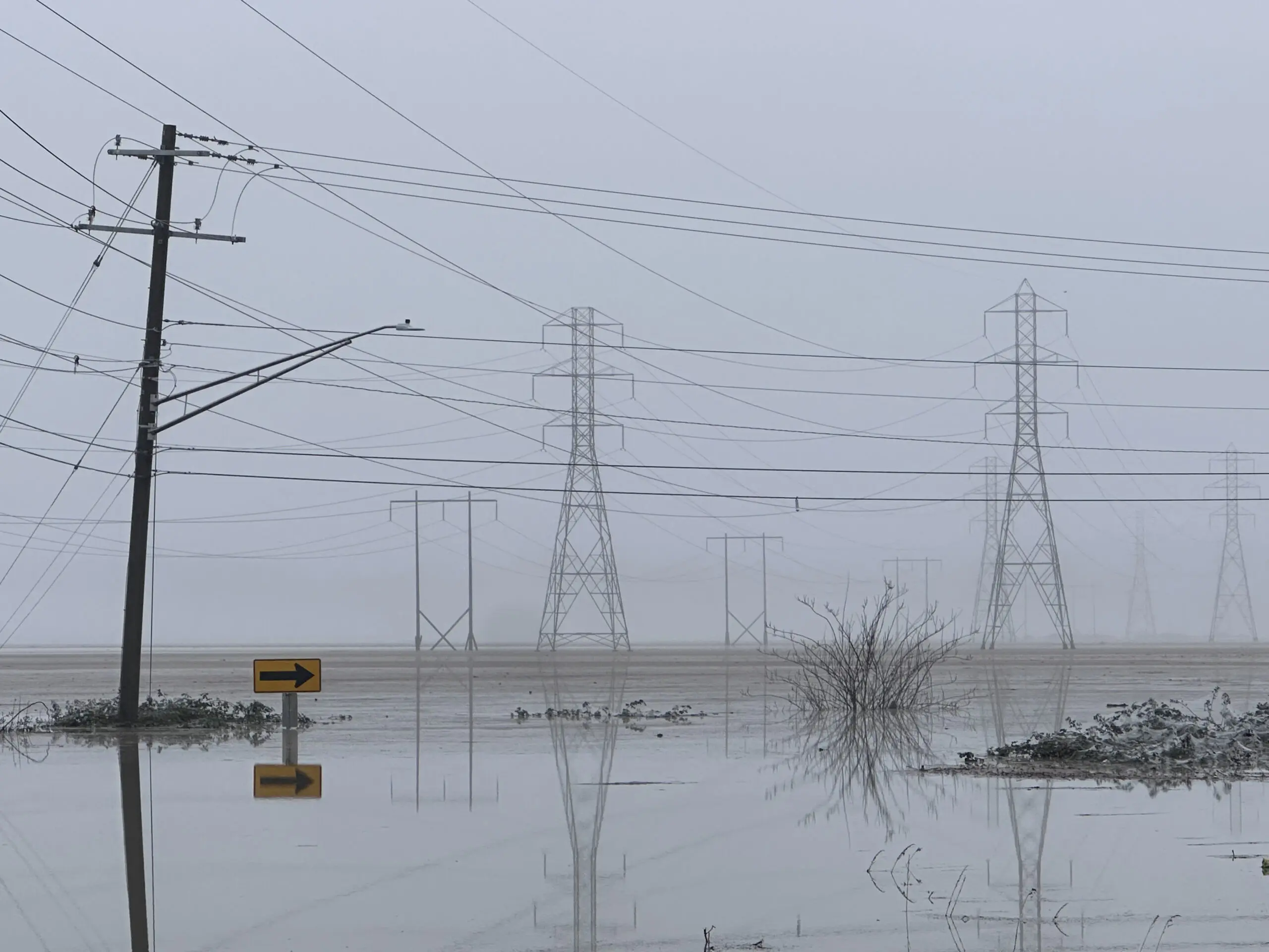
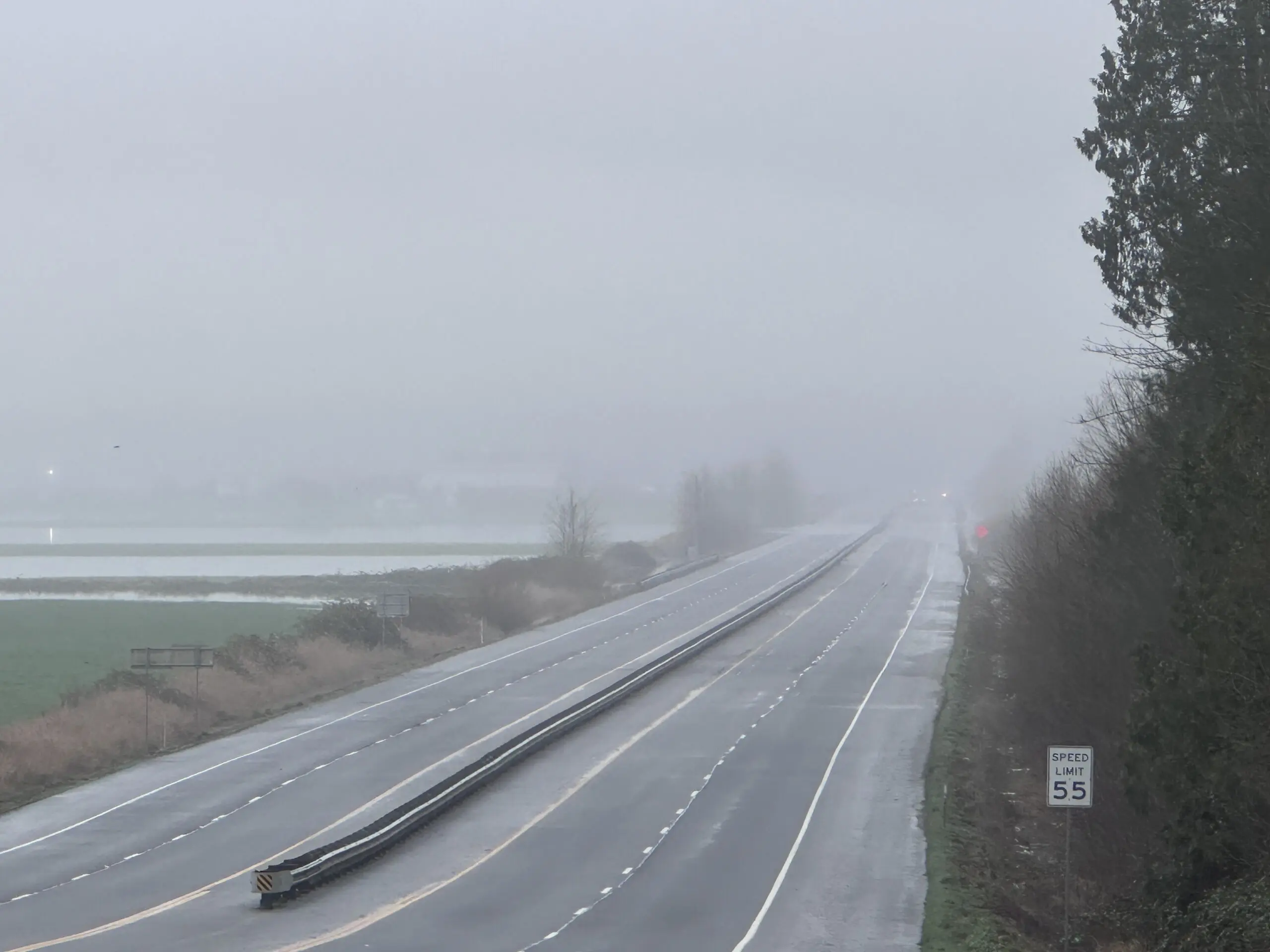
Highway 9 was shut down for days as the water overtook the roadway and inundated the surrounding farmland. What was normally a sprawling valley became what looked like a lake!
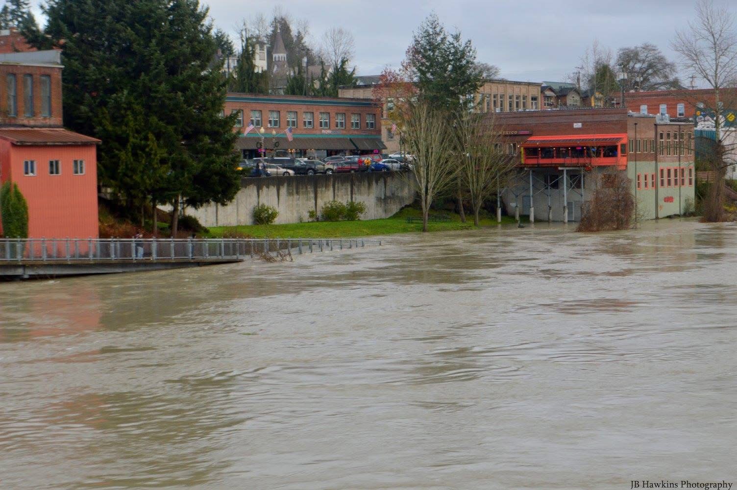
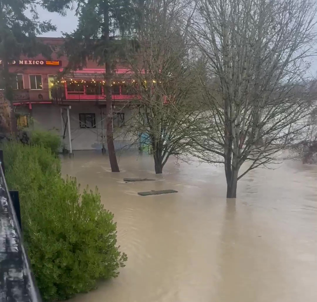
One of the best markers to show the floodwaters is a long standing painted “gauge” on the side of the Mexican Restaurant in downtown Snohomish – over the years the different flood levels have been marked along the side of the building, with the record flood of 1990 the top of the marker.
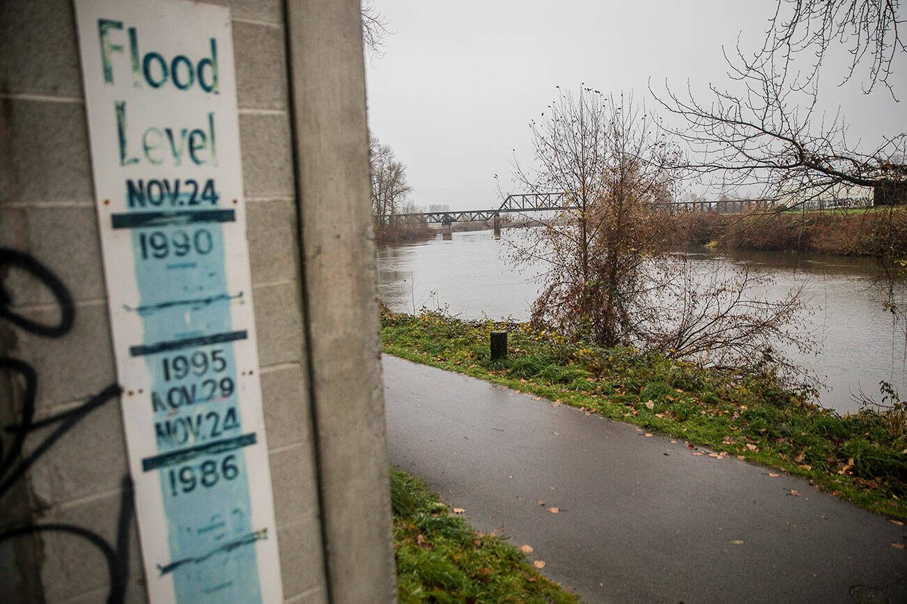
You can see the marker on the concrete building with the Snohomish River at normal flow in the background. The Second image is a view from across the river toward the building during a minor to moderate flood, the building with the marker in the right hand side of the image.
And last, the following image is looking down from the street above where the cars are parked in the photo above, toward the marker on the building which was entirely obscured by the record flooding. An absolutely wild scene!
The flooding wasn’t only an issue in Snohomish, the Skagit River near Concrete and also in Mount Vernon hit record breaking flood stage, and area Emergency Services issued evacuation orders for thousands of people in the area.
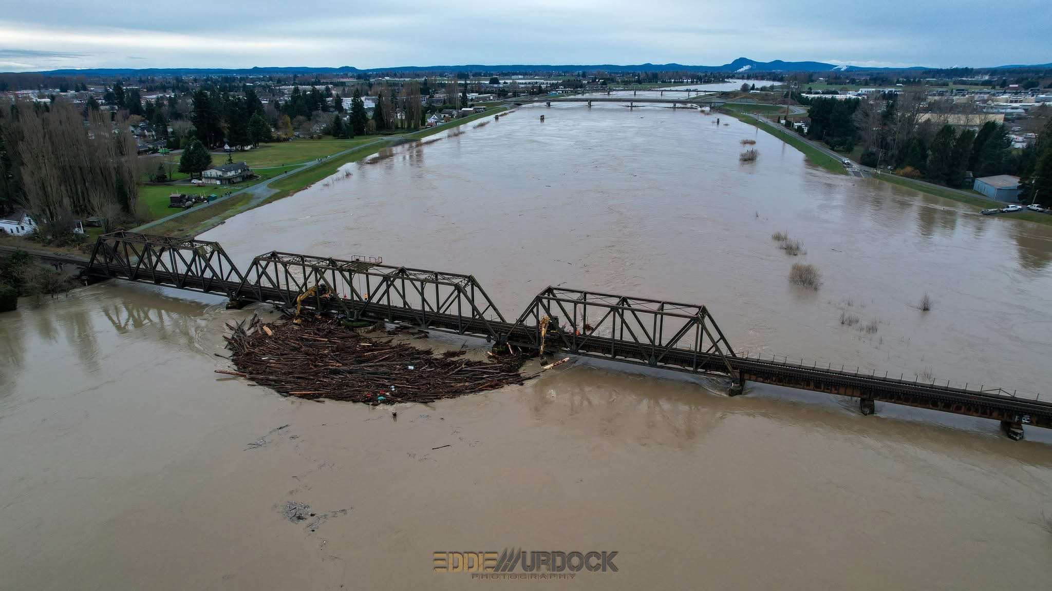
Houses and businesses were flooded, log jams occurred against the bridge across the Skagit in Mount Vernon and unfortunately an entire family’s home was swept away into the floodwaters near Deming.
Thankfully the family made it out safe.
Farther south around Pacific near Auburn, the Green River breached a levee resulting in the issuance of a Flash Flood Warning.
Emergency Services went going door-to-door to evacuate those who were likely to be affected by the rapidly rising flood waters, and a helicopter circled above with a verbal evacuation alert.
Crews were able to work quickly to repair the levee with a temporary fix and residents were allowed to return to their homes a day or two later to assess any damages caused by the floodwaters.
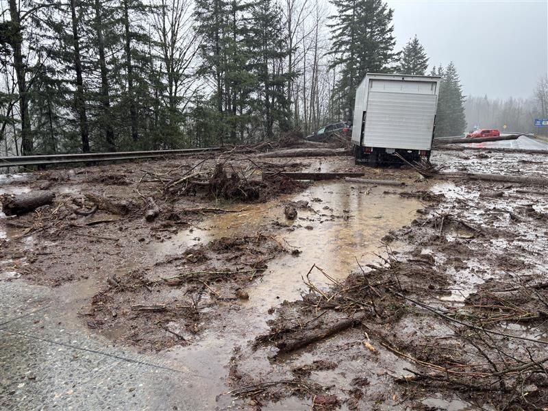
MUDSLIDES WIPE OUT MULTIPLE ROADS
Not only did the excessive rainfall cause flooding, but soils became heavily saturated, resulting in numerous landslides and debris flows across the region. These landslides caused extensive damage to Highway 2, closing the highway from approximately Skykomish on the west side all the way to Leavenworth on the east side of the pass.
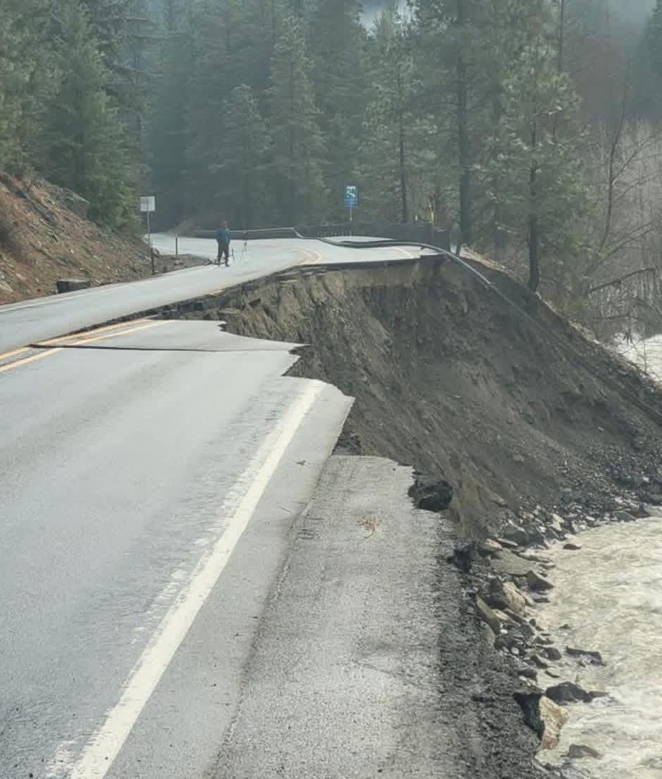
A large chunk of the highway washed out in the Tumwater Canyon near Leavenworth, and the paved parking lots at Stevens Pass were heavily damaged in spots due to the heavy rainfall.
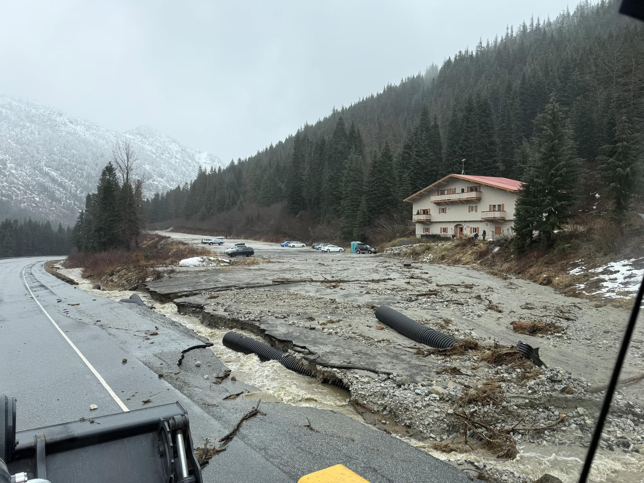
Stevens Pass reopened from the west side to the summit on Jan. 1, after a lengthly 3 week closure, where DOT crews worked around the clock to repair the damage. From just east of the summit at milepost 66, a 5 mile stretch of road to milepost 71 remains pilot car only during the day and is closed from 6 p.m. to 6 a.m.
A final detour is still in place at Coles Corner, redirecting traffic out through Plain and back out to Leavenworth as the road through Tumwater Canyon is not expected to reopen until mid-March. I-90 near Snoqualmie Pass also suffered damages in a number of spots, causing periodic closures along the highway there as well.
One of the area’s hidden gems, the tiny town of Stehekin on the north end of Lake Chelan, was devastated by debris flows caused by the intense rainfall. Mud and debris overtook a portion of the town (photos below), resulting in lengthy power outages and extensive damage to the town’s critical infrastructure.
Since the event, teams have worked tirelessly to clean up the damage and make repairs before the summer tourist season returns. Stehekin is well known for being only accessible by boat and is a cherished spot to visit for many.
Overall, one person died in Snohomish County and there were more than 30 road closures along Washington highways across 12 counties. Gov. Bob Ferguson activated the National Guard and said as many as 100,000 across the state are facing evacuations due to rising flood waters.
More to explore:
- Evacuations ordered as ‘catastrophic’ flooding possible along Skagit, Snohomish rivers from relentless atmospheric river
- Locally ‘catastrophic’ flooding possible along Skagit, Snohomish rivers as atmospheric river pummels Northwest
- Atmospheric river triggers widespread, potential record flooding as second wave begins
Thanks for the recap of December’s historic flooding. Even though it has only been a month since it happened, it is easy to forget just how much damage the flood caused, and how many areas were impacted. The 1990 floods were before my time, but I do remember some of the 2003, 2006, and 2007 floods. While those were bad, last month might have been worse.
JAW DROPPING PHOTOS! AND VIDEOS! intense story! WOW
Hello! I’ve been following your website for a while now and finally got the courage to go ahead and give you a shout out from New Caney Texas! Just wanted to tell you keep up the good job!