Atmospheric river triggers widespread, potential record flooding as second wave begins

Flooding along Snoqualmie River in Fall City on Dec. 9, 2025. (Photo courtesy: Benjamin Jurkovich / Washington Weather Chasers)
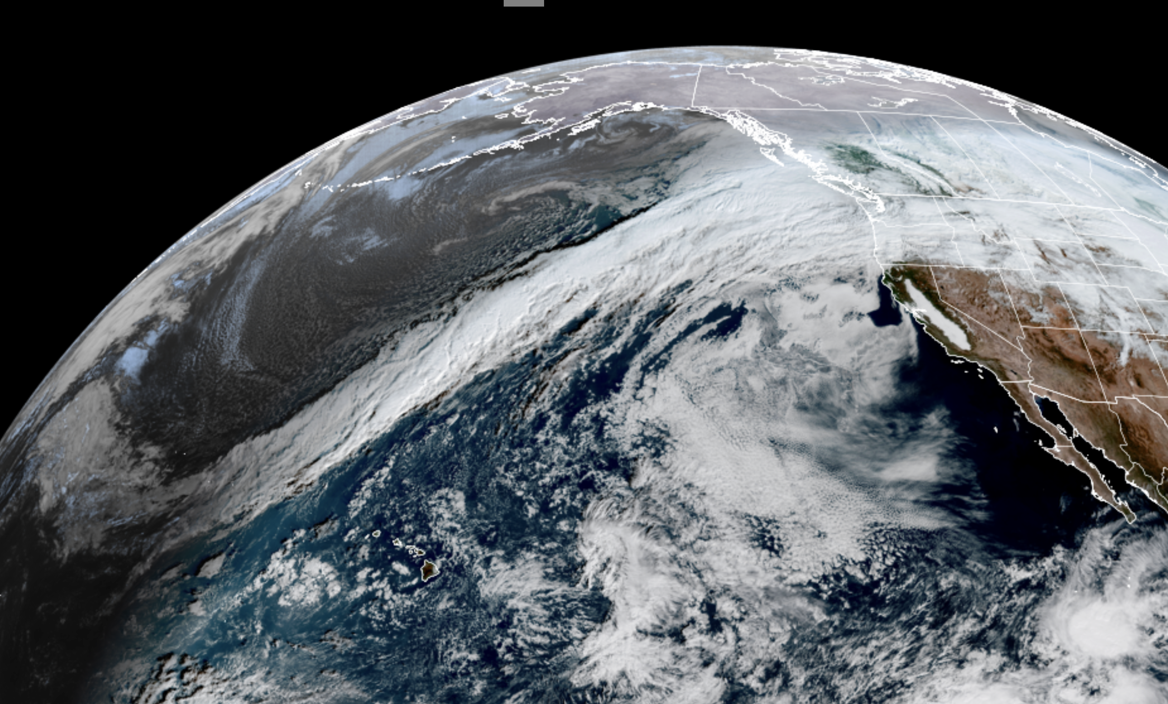
Round 2 of our atmospheric river is now getting back under way and the latest projections are not what we want to see, with now multiple rivers currently projected to reach record flood stages, including some of the ones along more populated areas.
(The AR never “went away” it just shifted south Tuesday soaking Portland and northern Oregon for a while but now it’s coming back north as expected to re-soak Western Washington.)
This second wave’s rain rates may be slightly less than the first round, but it is expected to last longer than the first, soaking the region for a good 24-30 hours, and with rivers now already at much higher levels and the ground that more saturated, river flooding is expected to be worse with this second wave.
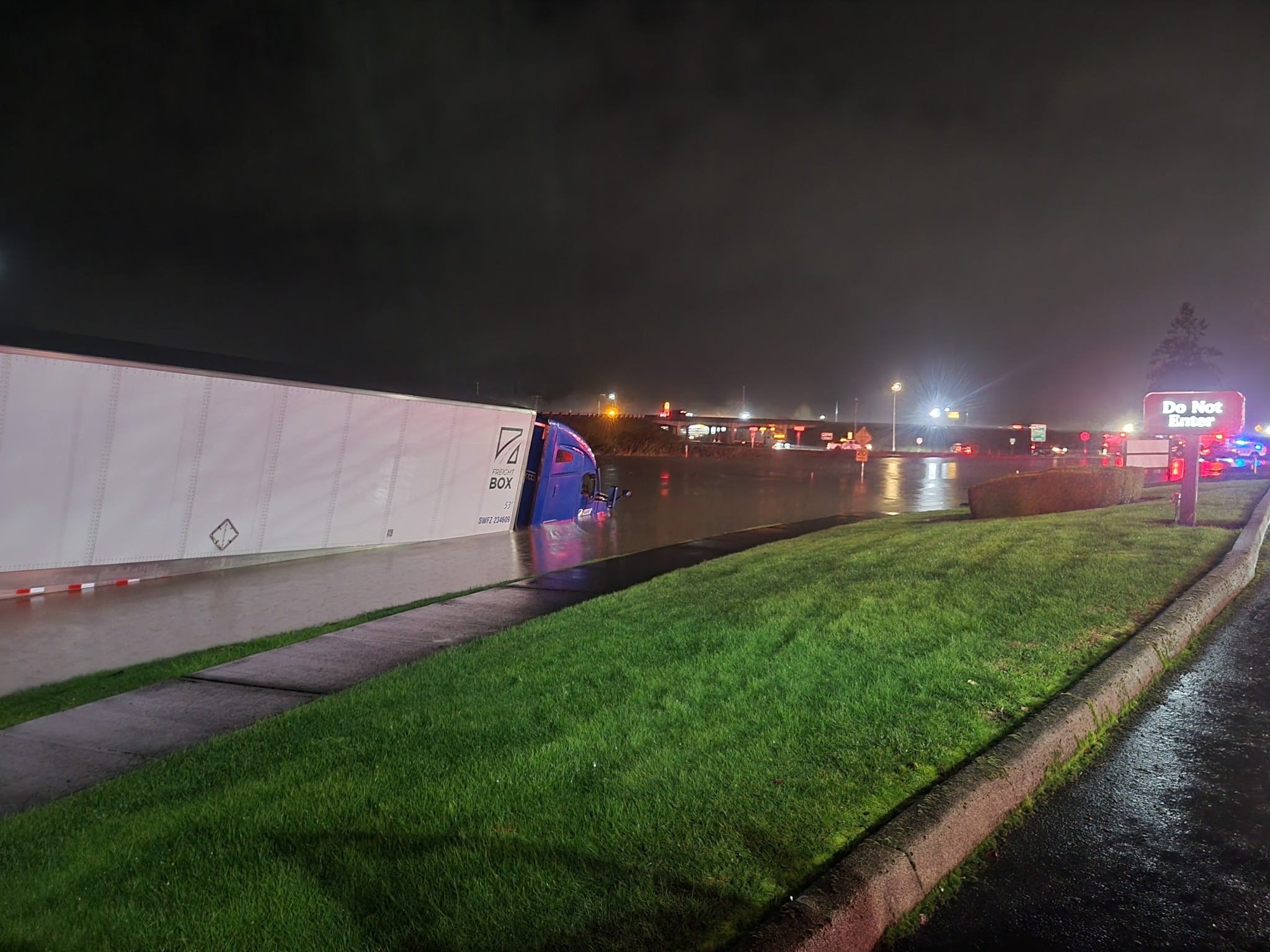
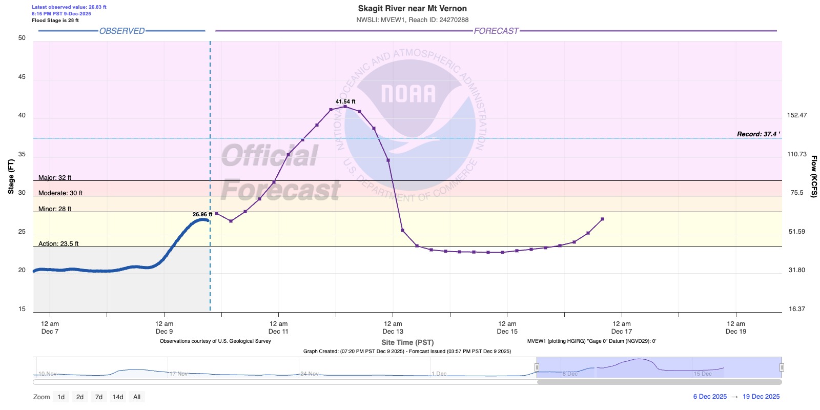
The Skagit River is now forecast to reach several feet beyond its record crest. The predicted peak at Mount Vernon was 41.54 feet Thursday night — over 4 feet above the record crests from 1990, 1995 and 2021. A post from Mount Vernon police shows the city was working on erecting their flood wall along the river banks.
The Snohomish River at Snohomish forecast was back at peaking a few inches over record flood stage Thursday and Friday.
The Cedar River at Renton is also expected to come within fractions of a foot either way around its record crest, and up on the Olympic Peninsula, the Elwha River is forecast to hit a record crest Wednesday night at the McDonald Bridge.
Gov. Bob Ferguson has moved the state emergency operations center to a Level 1 activation — the highest level of activation.
Snohomish County has declared a state of emergency allowing streamlined government disaster response.
In Grays Harbor County, Lake Sylvia State Park is closed while crews respond to impacts brought on by this week’s heavy rain. The current atmospheric river weather event has raised lake levels and placed added stress on the 100-year-old Lake Sylvia dam. County officials say elevated water levels and continued rainfall are creating concerns about the pressure placed on the century-old dam. Crews are continuously monitoring the dam and at this time there are no visual structural changes. Water levels have receded by approximately one foot since Monday evening.
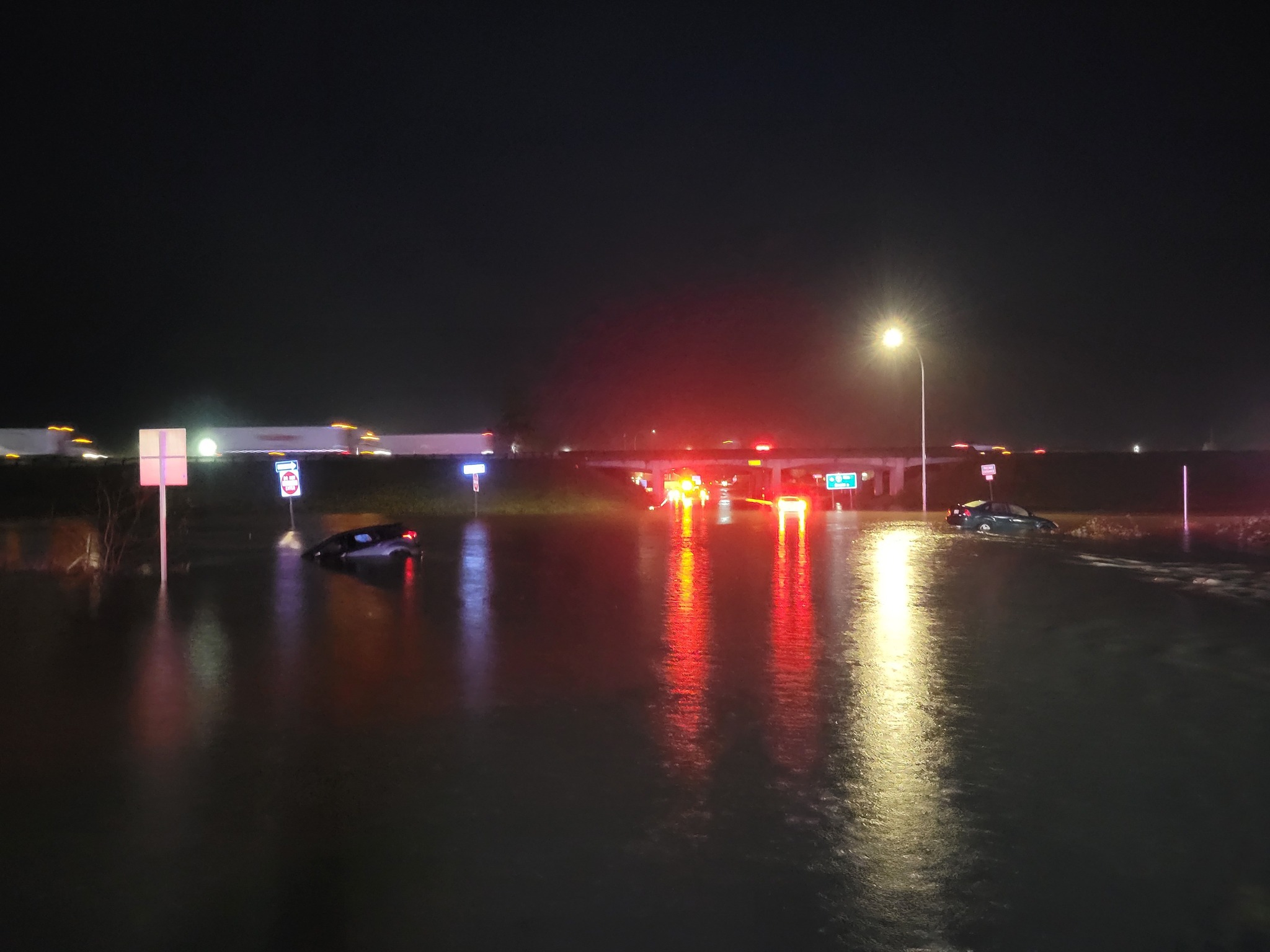
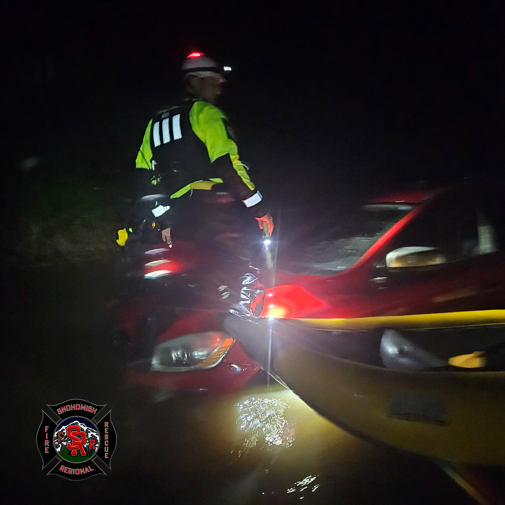
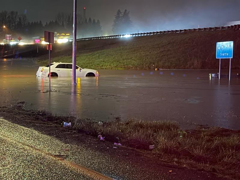
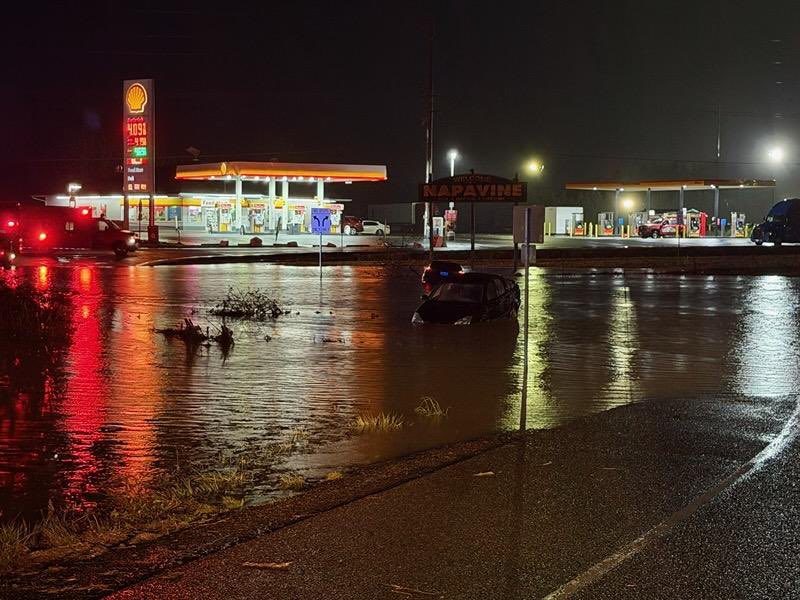
In Lewis County, Exit 72 in Napavine was closed due to flooded roads that required 5 drivers to be rescued, according to Lewis County Fire Protection #5 officials. None were injured. Multiple other water rescues were made along the Skykomish River, according to Snohomish Regional Fire & Rescue.
There were 19 rivers on Flood Warning as of mid Tuesday evening, with 15 river gauges in major flood stage or forecast to get there, including along the Snoqualmie, Snohomish, Tolt, Cedar, Puyallup, Cowlitz and Carbon.
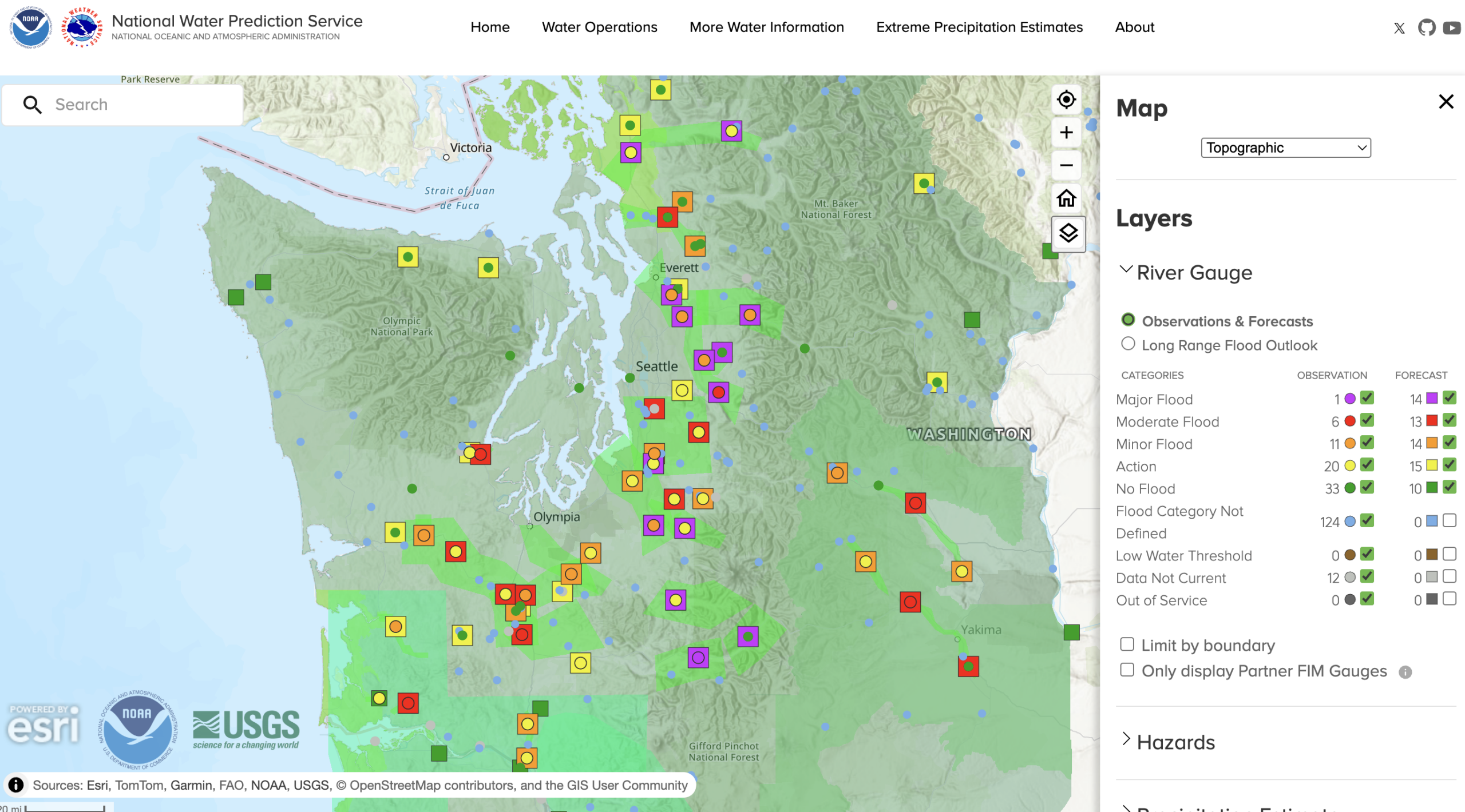
The Snohomish River at Monroe is forecast to crest within inches of its record height.
Down on the Snoqualmie River, drone video from Benjamin Jurkovich with Washington Weather Chasers showed farm lands were already flooded in Fall City as the river reached Stage 4 flood alert on the King County System.

The river is still expected to crest even higher on Thursday well into major flood stage.
Over at Snoqualmie Falls, the river reached heights not seen in 10 years.
REALTIME FLOOD INFORMATION: RIVER FORECASTS & LEVELS // CURRENT FLOOD WARNINGS
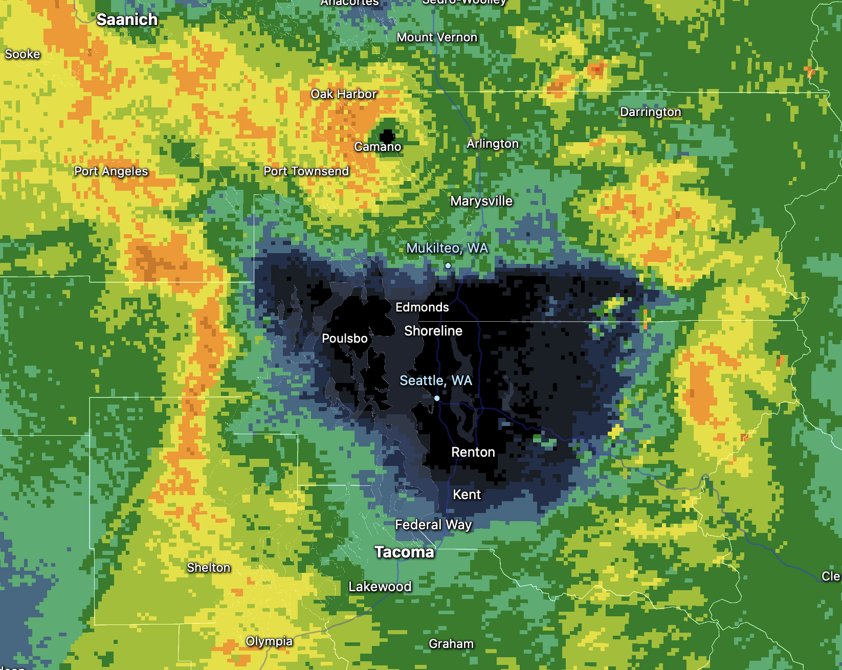
Rainfall totals with the first storm varied widely across Western Washington, an ode to the vast terrain difference and ensuing microclimates. Some of the higher mountains in the Olympics and Cascades registered 7-8 inches of rain through early Tuesday.
In the lowlands, Southwestern Washington got the brunt of the rain with nearly 4 inches in Chehalis and Olympia. Rainfall totals averaged about 1.5-3.0 inches in the Seattle–Tacoma area, while a robust Olympic Rain Shadow shielded the heavy rains for hours in the North Sound, leaving places like Everett and Marysville with barely a half inch of rain.
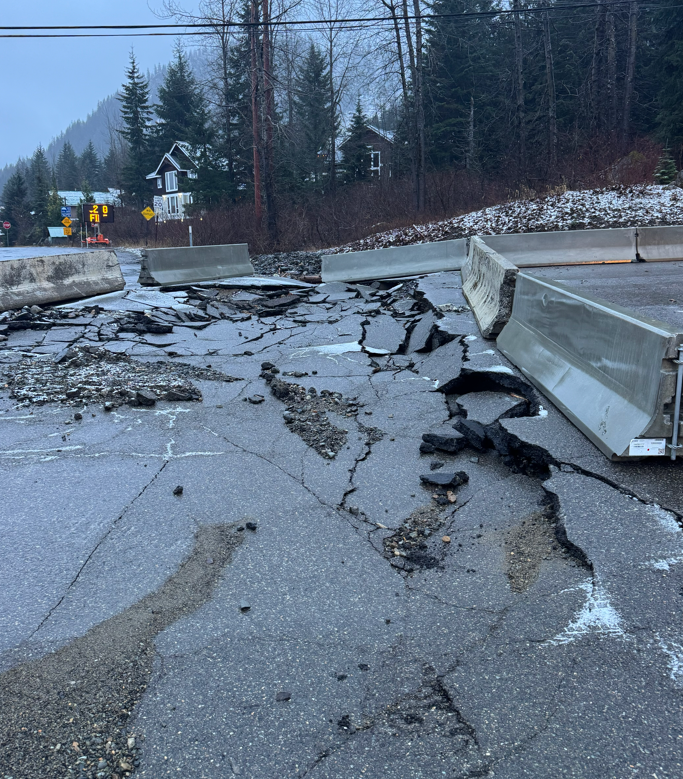
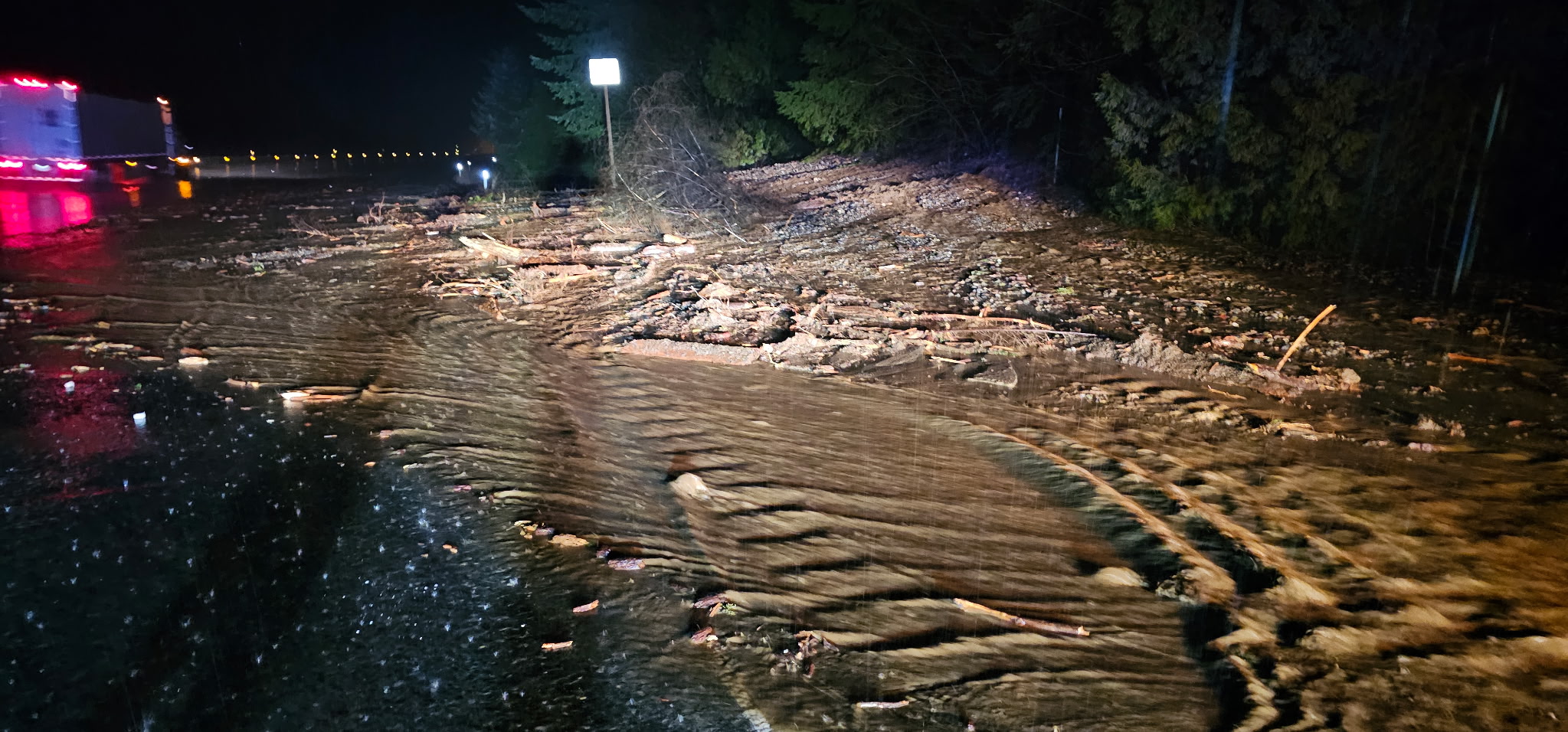
Mudslides are a growing risk as the grounds continue to become saturated. Already, a mudslide blocked the eastbound lanes of I-90 near North Bend early Tuesday morning, forcing a temporary closure.
Still, the atmospheric river, rating a level 4 out of 5 so far, has caught the attention of NOAA. They were able to get Hurricane Hunters with the Air Force Reserve’s 53rd Weather Reconnaissance team to fly into the atmospheric river Monday to collect realtime data on the storm and another plane is scheduled to fly into the storm again Tuesday.
The storm has tapped into tropical moisture thousands of miles away in central Pacific Ocean, with analysis showing part of the moisture source reaching as far west as the Philippines.
The second round may be slightly lighter rain rates but will last longer with steady rains expected to last through all of Wednesday. Rainfall totals are still on track for storm totals 3-6” in lowlands; 6-10” in mountains with areas of 12” or more.
Gusty winds will pick up again as the rain returns at similar speeds to Monday. Wind Advisories re-issued from late Tuesday through much of Wednesday.
Rain will finally taper late Wednesday or early Thursday but rainy weather remains in the forecast well into next week — just not quite as wet as this one but it may extend flood impacts as it’ll slow the receding process.
RAINFALL TOTALS THROUGH STORM 1:
MORE TO EXPLORE:
- ‘Hurricane Hunter’ requested to fly mission into strong atmospheric river event this week
- Strong atmospheric river system threatens flooding, winds as Hurricane Hunters may now investigate
- Sequim’s ‘blue hole’; and how the Olympic Rain Shadow literally shines on the city
What I found interesting is the rainfall amounts just east of the cascades were impressive too. I was at the edge of the rain shadow in Cle Elum and clocked 2.4”. I thought these rivers were usually lower in the atmosphere and didn’t make much progress over the Cascade crest.