‘Hurricane Hunter’ requested to fly mission into strong atmospheric river event this week
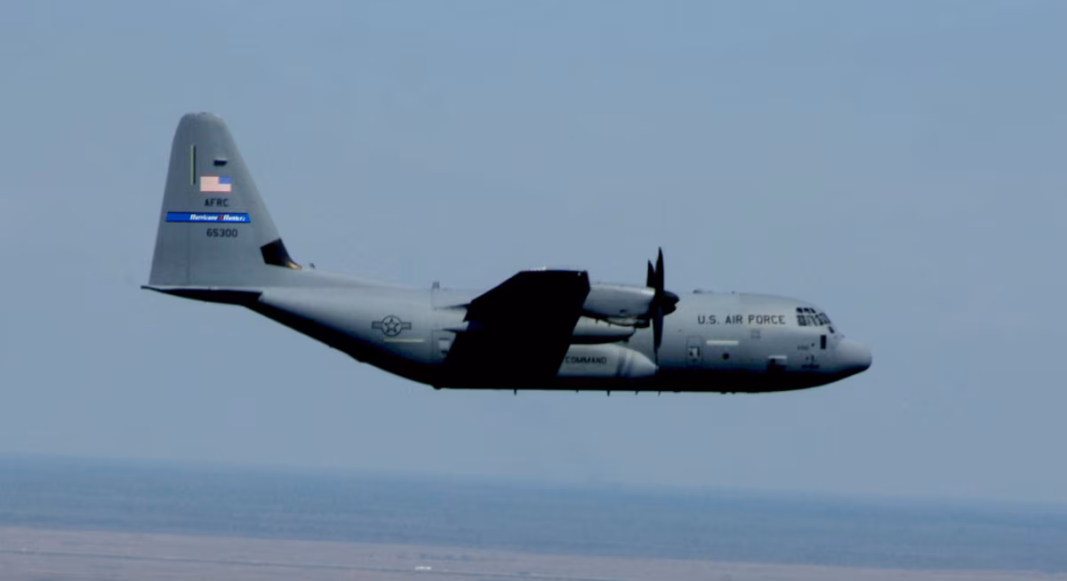
WC-130J "Super Hercules" aircraft. (Photo: U.S. Air Force Reserve)
The strong atmospheric storm bearing down on the Pacific Northwest has local meteorologists busy tracking the system and getting the word out about potential heavy rains, flooding and landslides.
But now we might be getting an assist from folks who usually track much larger storms: Hurricane hunters!
It’s not that unusual, nor does it signal a particularly hurricane-type dire storm — though this storm is expected to bring significant impacts.
Now that the Atlantic hurricane season is over — it ended on Nov. 30 — it’s the West Coast’s turn to take advantage of the hearty aircraft and storm expertises of the research teams and their pilots to go “hunting” some of the West Coast’s most powerful storms.
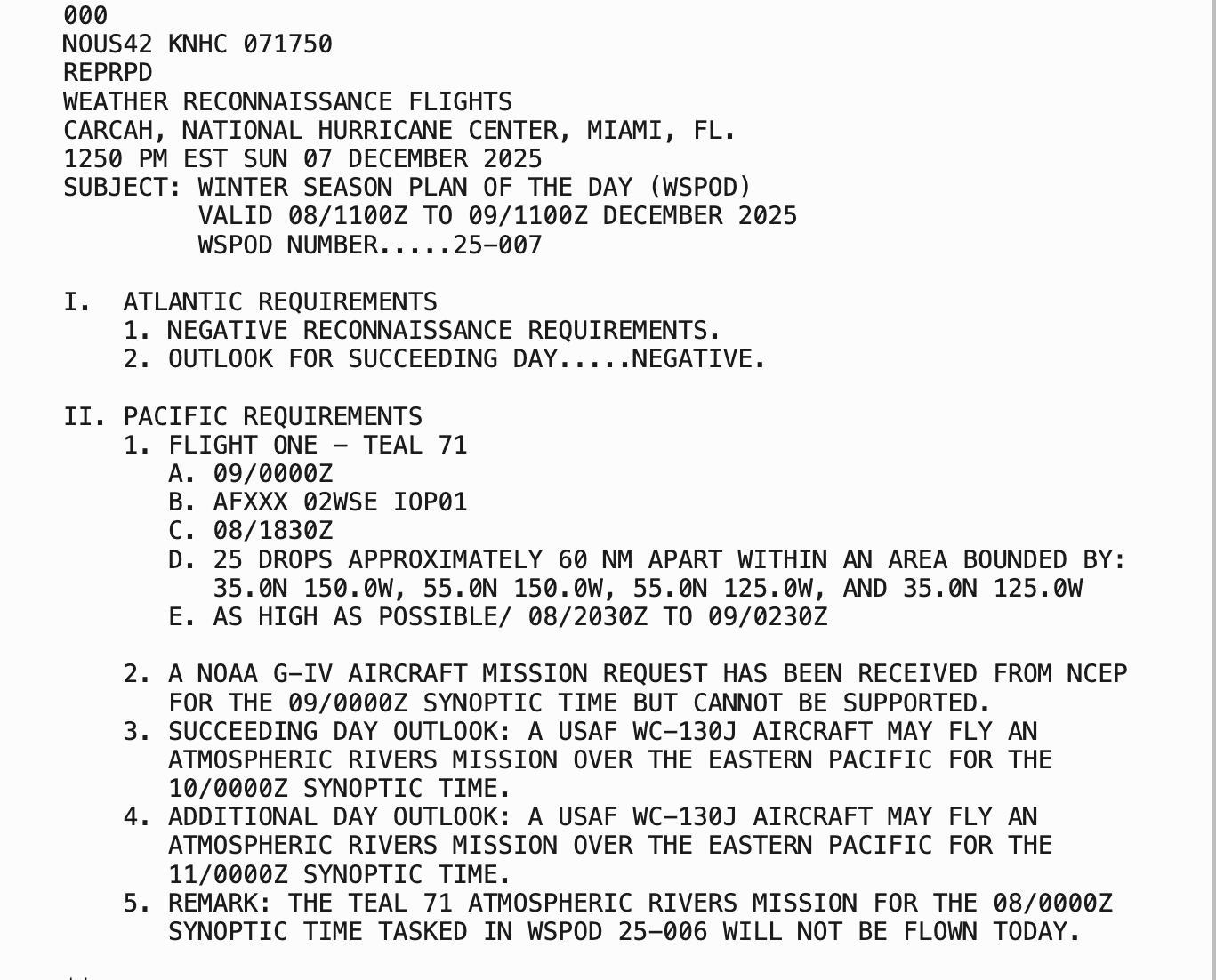
Both NOAA and the 53rd Air Force Reserve Weather Reconnaissance have planes that fly into the teeth of hurricanes and other major storms. In Monday’s case, NOAA is requesting an Air Force WC-130J aircraft “TEAL 71” to fly into our storm inside a 20×25 degree box off the Pacific Coast (roughly 1,200 x 1,000 miles) and make “25 drops” about 60 nautical miles (70 miles) apart to obtain current weather observations.
The “drops” are dropsondes — small cylinders containing weather instruments that are dropped from the plane into the water and collect and transit real-time weather on its journey down through the clouds. It’s sort of like an inverse weather balloon, which collects data from the ground up.
The data is then fed into our computer models to help get a better understanding of the storm’s development over an area where otherwise the only data comes in from satellite sensors and scattered ship, pilot and buoy reports.
While there isn’t an “eye wall” to punch through and get dramatic scenes of stadium effects like in a hurricane, atmospheric river storms still carry strong winds and torrential rains fueled by a stream of tropical moisture and an intense jet stream that makes for anything but a smooth flight.
When the hurricane season ends, the Hurricane Hunters are available on “resources permitting status” in the Pacific through December, then usually fully assigned to the Pacific in January and February, according to Scripps Institution of Oceanography.
WHY THE FUSS? ISN’T IT JUST A BIG RAIN STORM?
Atmospheric Rivers can be some of the more impactful storms to strike the West Coast during the autumn and winter.
Depending on the strength of the storm, where they aim, and how long they last, they can drop several inches of rain to an area, creating both devastating river flooding as well as flash flooding and mud and landslides.
And sometimes the frontal boundaries and accompanying low pressure centers can create strong wind events, so it’s important to know as much as you can about the budding storms.