Seattle’s unbeatable ice box: Why the January 1950 records may stand forever
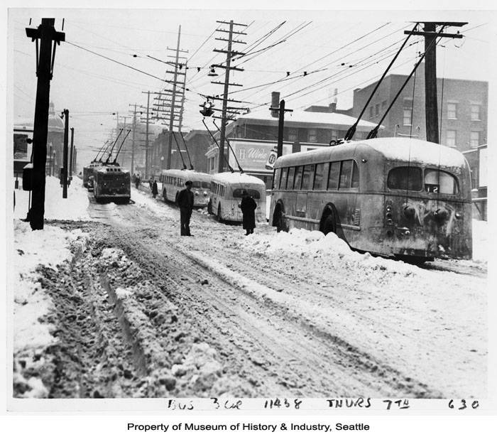
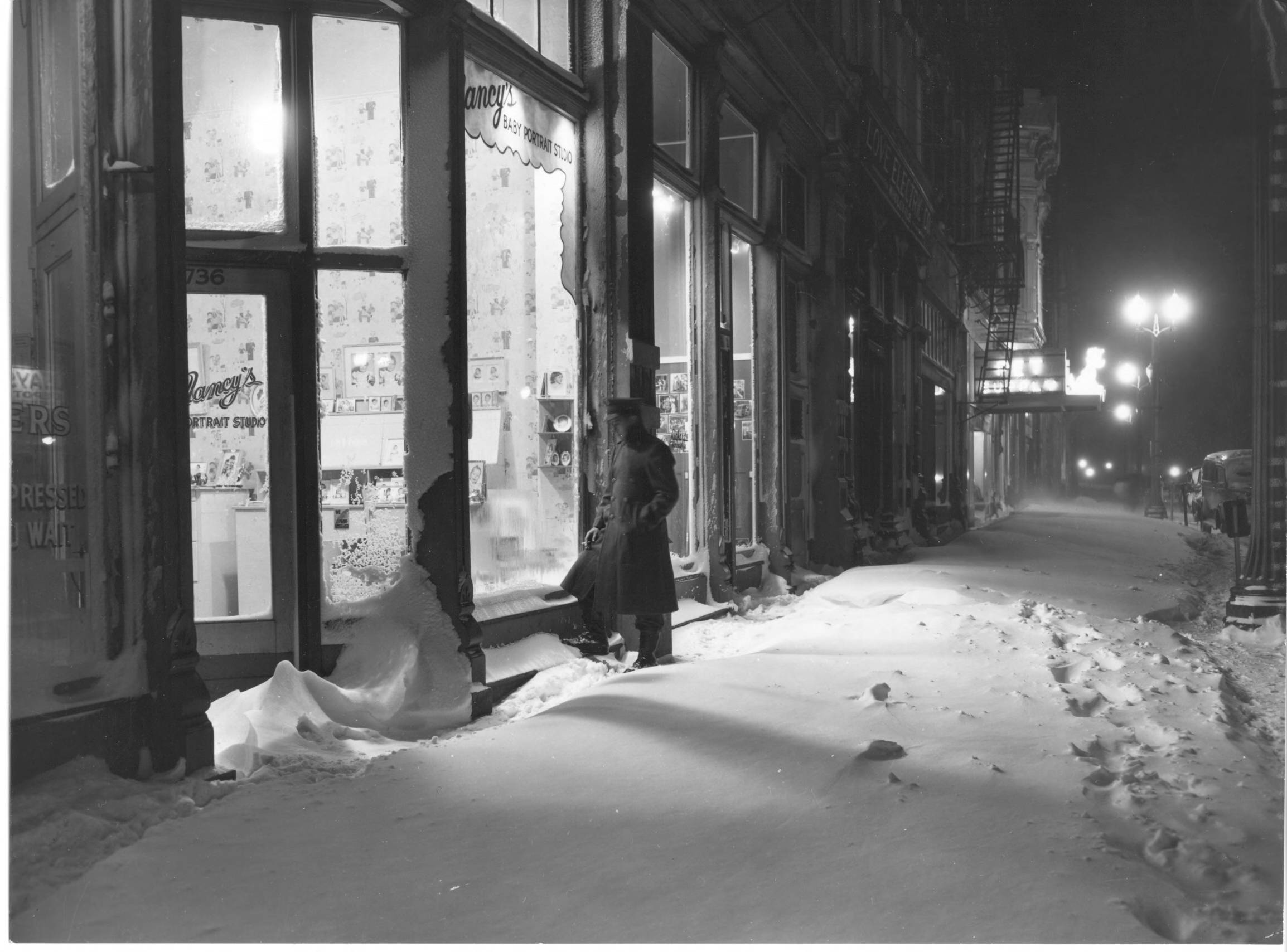
Buses stuck in snow on downtown street, Seattle, January 1950 (Photo: Seattle Museum of History & Industry / MOHAI)
Tuesday may be a record-setting day for parts of Seattle and Western Washington.
Just probably not the record anyone longtime Seattleite might think about when it comes to January 13th.
As high temperatures set to reach the upper 50s, if not touch 60 degrees in some locales on Jan. 13, 2026, winter fans will instead celebrate the 76 year anniversary of one of Seattle’s greatest snow storms amid one of the region’s greatest periods of arctic weather ever before seen.
January 13, 1950 still holds the record for greatest one-day snowfall at Sea-Tac Airport of 20.0 inches. Its only rivals are the 21+ inches that fell in Downtown Seattle during the Feb. 2, 1916 blizzard (obviously before Sea-Tac was around) and the 5-ish feet that fell over a week during the Jan. 1880 storms that was before official weather records were kept in Seattle.
But what makes the 1950 storm unique was not only the storm itself, but that it came amid *6* weeks of some of the harshest temperatures ever recorded.
In fact, Seattleites were already steeled to the chill by the time that storm had arrived. Snow began on Jan. 1 when nearly 7” fell. Up in Bellingham, its airport reported a temperature of 4 degrees that night with a 64 mph wind gust for a wind chill of -26. The wind tipped over five planes at Bellingham Airport, causing $27,000 in damage (1950 dollars, of course).
Then it snowed in bits and pieces every day except Jan. 4 leading up to the big storm. The lows on Jan. 2 and 3 had been just 6 degrees in Seattle, with highs only int he mid 20s. It moderated just a little for the 5th through the 7th (highs in the upper 30s). Jan. 10 finally got over 40 degrees (42), then it quickly cooled again.
With arctic air now again well entrenched, a monster 983 mb storm rolled in off the Pacific Ocean into around the mouth of the Columbia River, dropping copious amount of moisture into the freezing air.

Unlike the Storm of 1880 that kept Seattle cold but relatively wind free, this storm brought ferocious winds from the Fraser Valley. Temperatures in Bellingham were stuck between 2-4 degrees, according to the Bellingham Herald (via University of Washington research professor Mark Albright) with gusts up to 75 mph (for a wind chill of -30).
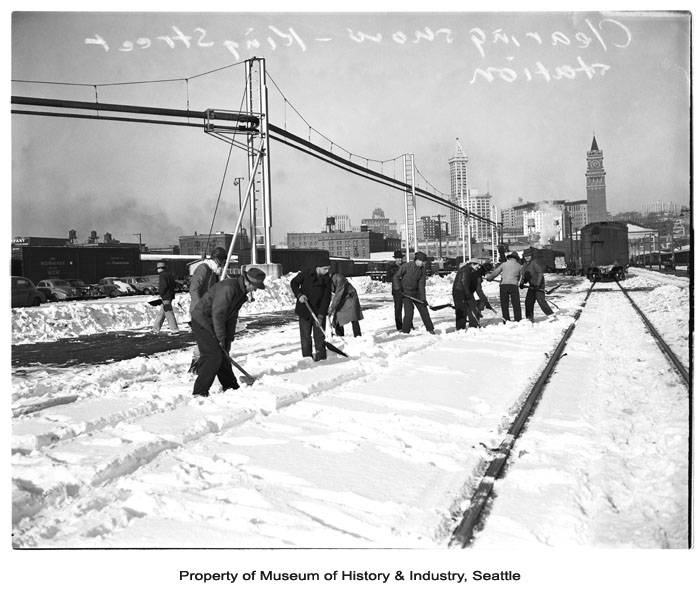
In Seattle, it was piles of snowfall. “Only” 10 inches fell in Downtown, but 20 inches fell at Sea-Tac Airport. The high only made it to 19 that day with a low of 11.
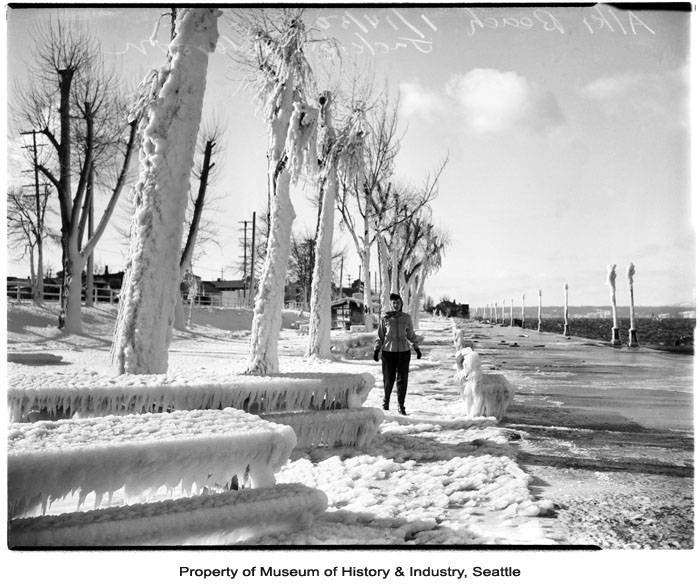
“High winds lifted the waters of Elliott Bay onto the waterfront and frozen salt water instantly stuck to anything it splashed,” local historian Paul Dorpat wrote on HistoryLink.
The State Patrol urged everyone from Seattle to Bellingham not to use public highways for 48 hours unless extreme emergency, according to the Bellingham Herald.
Down in Tacoma, 9 inches of snow fell, but strong winds brought snow drifts as high as 5 feet.
Low temperature records would fall for the next six days as readings ranged from 8-15 and the snow kept coming, although mostly adding about 1-2 inches here and there in spurts.
Seattle still had 7 inches on the ground when it finally warmed to 42 degrees on January 19 arrived and it must have felt like it was finally over. Snow turned to rain. Woo….?
Turns out, the arctic blast was only at halftime! And guess what the halftime show was? A Pineapple Express!
Rain poured heavily on the 19th. The 20th and 21st saw temperatures zoom to 48 degrees amid more rain. Imagine the slush! By the 22nd, Seattle had received nearly 3.5 inches of rain!
Then people started noticing… hey, does it feel like it’s getting colder again?
Ummm, yes.
By Jan. 24, it’s back into the ice box with highs in the mid 20s and lows of 10 and 7 for the 24th and 25th, respectively. Both set records.
January 26th was greeted with another mega snow event — 10 more in Seattle, but surprisingly, not a record low as it “only” cooled to 21. Snow tapered off on the 27th as lows dropped to 19.
Then came the coldest stretch of weather in Seattle history — a mini-ice age, if you will. For the next seven days, lows would drop into the single digits, including 0 degrees on Jan. 31 and 1 degree on Feb. 1. The zero degree reading remains the coldest day in Seattle history and aside from that following day’s 1 degree reading, no other day is close. The next coldest day in any record book is 6 degrees in 1900.
Several large lakes including Green Lake, Lake Sammamish and the northern end of Lake Washington, as well as parts of Gig Harbor froze solid.
A family video shows people ice skating in the Gig Harbor marina as boat sit frozen in ice on the docks.
Finally, on Feb. 4, it warmed to 41 and the weather became relatively sane after that. And Western Washington has yet to have seen anything resembling that weather pattern since.
The damage: 18 of Seattle’s 34 record lows between Jan. 1 and Feb. 3 still remain from 1950, and 12 of them are in single digits. Only two of the Jan. 1950 lows that had been under 20 degrees have since been topped — Jan. 12 (18 degrees in 1950; 13 in 1963) and Jan. 27 (19 in 1950; 11 in 1957).
Seattle hasn’t had a single-digit temperature since Feb. 4, 1989 (7 degrees).
With urban heating, it’s unlikely Seattle will ever get even close to those record lows again and they will likely stand the test of time. Seattle has only managed to dip below 15 twice since 2000 (both 14 degrees.)
But record highs? Easy peasy. 17 of the record highs between Jan. 1 and Feb. 3 have occurred since 2015, including Jan. 13 (58 degrees in 2018.)
WOW! That was quite the story! Western Washington sure had a frigid, wild winter in 1950! Thanks for telling the tale!