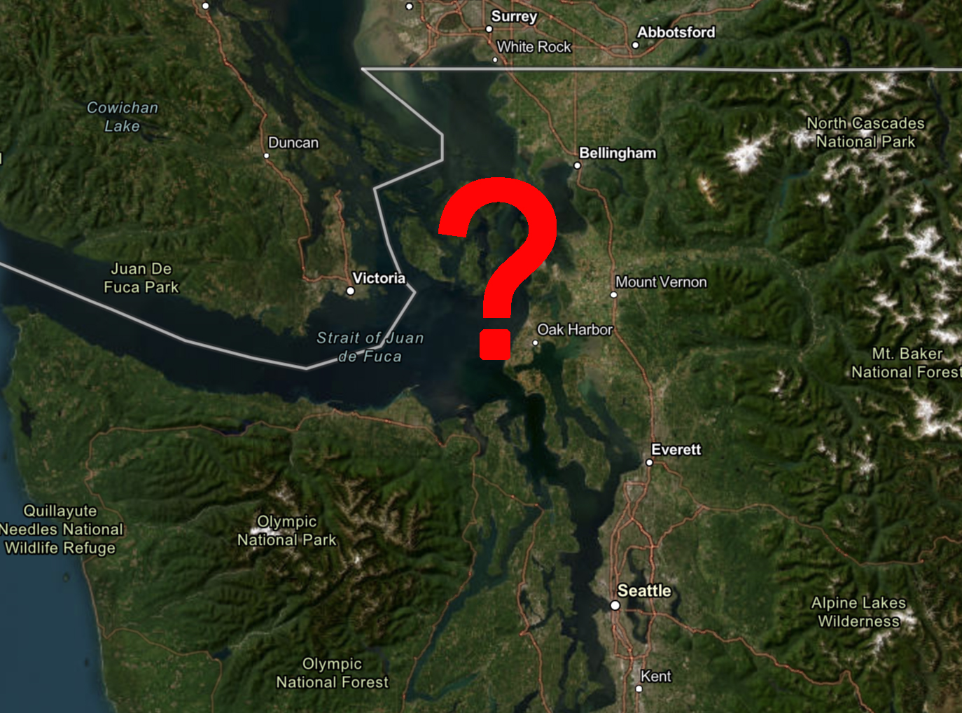
Northwest Interior Question Map
When the windstorms come for Western Washington, you’ll see a lot of forecasts typically mention the windier spots will be along the coast and “Northwest Interior.”
I’ve had a lot of questions over the years asking whether their town was included, so here is a good primer:
I describe the Northwest Interior as drawing a line from about Marysville to Port Townsend, then go north to the Canadian border. So that would include:
- Bellingham/Whatcom County
- Skagit County
- The San Juan Islands
- Camano Island
- Whidbey Island
- Admiralty Inlet
- And northern Snohomish County.
I don’t really think it includes Everett — you’re kinda on the fringe — and southern Snohomish County.
The NW Interior is mentioned a lot because it is susceptible to a strong southeast wind when a low pressure center slides by to the northwest up into central or northern Vancouver Island. Those that live there know that 40-55 mph wind days are much more common than down closer to the Puget Sound region.
You can see on this map below from an NWS forecast showing a pattern where it’s windier in the NW Interior and the coast vs not much wind in the Puget Sound area:
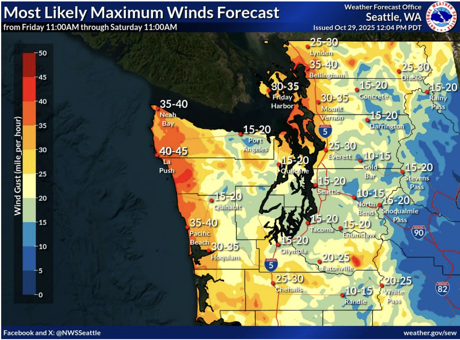
Why? Because the Olympic Mountains act as a barrier to southeast winds down in the Seattle-Tacoma area…and even Everett is on the fringe. Instead, for those areas, the strong winds have to wait until the low pressure center passes due north of the I-5 corridor — then we all get a surge of gusty south wind.
If the low center stays over Vancouver Island or even just offshore and never crosses I-5 or the interior of BC, then the Seattle area usually misses out on the strong winds. So if you ever see Wind Alerts for the coast and NW Interior that don’t really carry over into the Seattle area, that’s what’s up.
Loving the new blog, Scott. Congratulations!