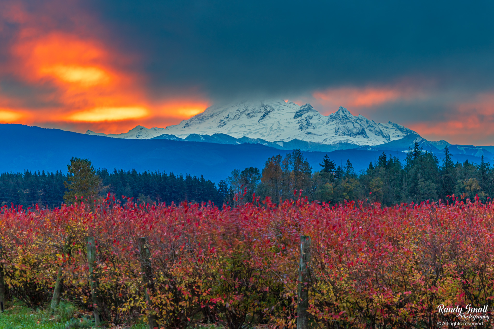
Sunrise over Mt. Baker from Custer, Wash. on Oct. 28, 2025. (Photo: Randy Small Photography)
I figure I usually lead with the stormy days in the forecast headlines so today I’m leading with the sunshine headline, totally not bumming out the sun fans with the fact that Halloween still looks very wet and blustery. Nope, totally WON’T mention that at all in the lede. You’re welcome, sun fans!
Most of you are probably reading this when it’s raining outside or was not that long ago. We had a nice front sweep through Tuesday night that brought a little wind up north and on the coast, but otherwise no big deal for Seattle.
We’ll see a few lingering showers early Wednesday but drying as the day goes on. This doesn’t even count as the sunny day I’m teasing. It’s like a BONUS almost sunny, almost dry day!
An apparently lost ridge of high pressure wanders our way for Thursday and while it stops for directions to find places that are supposed to be sunnier the last week of October (easy rule of thumb: Go south), we’ll benefit from a rather clear and pleasant day.
It’ll be a little breezy in the foothills as we get a brief switch to east winds, but nothing major. It’ll just clear out the skies and yeah, just wow. Go get your cameras ready and snap some photos of the Cascades and Olympics showing up their fresh coat of snow. (And then post them here or send to the email listed on my page!)
WAIT, LAST POST SAID SOMETHING ABOUT GORTEX MONSTERS FOR HALLOWEEN COSTUMES, CAN I GO BACK TO BEACHWEAR FOR MY COSTUME?
Umm, no. On multiple levels.
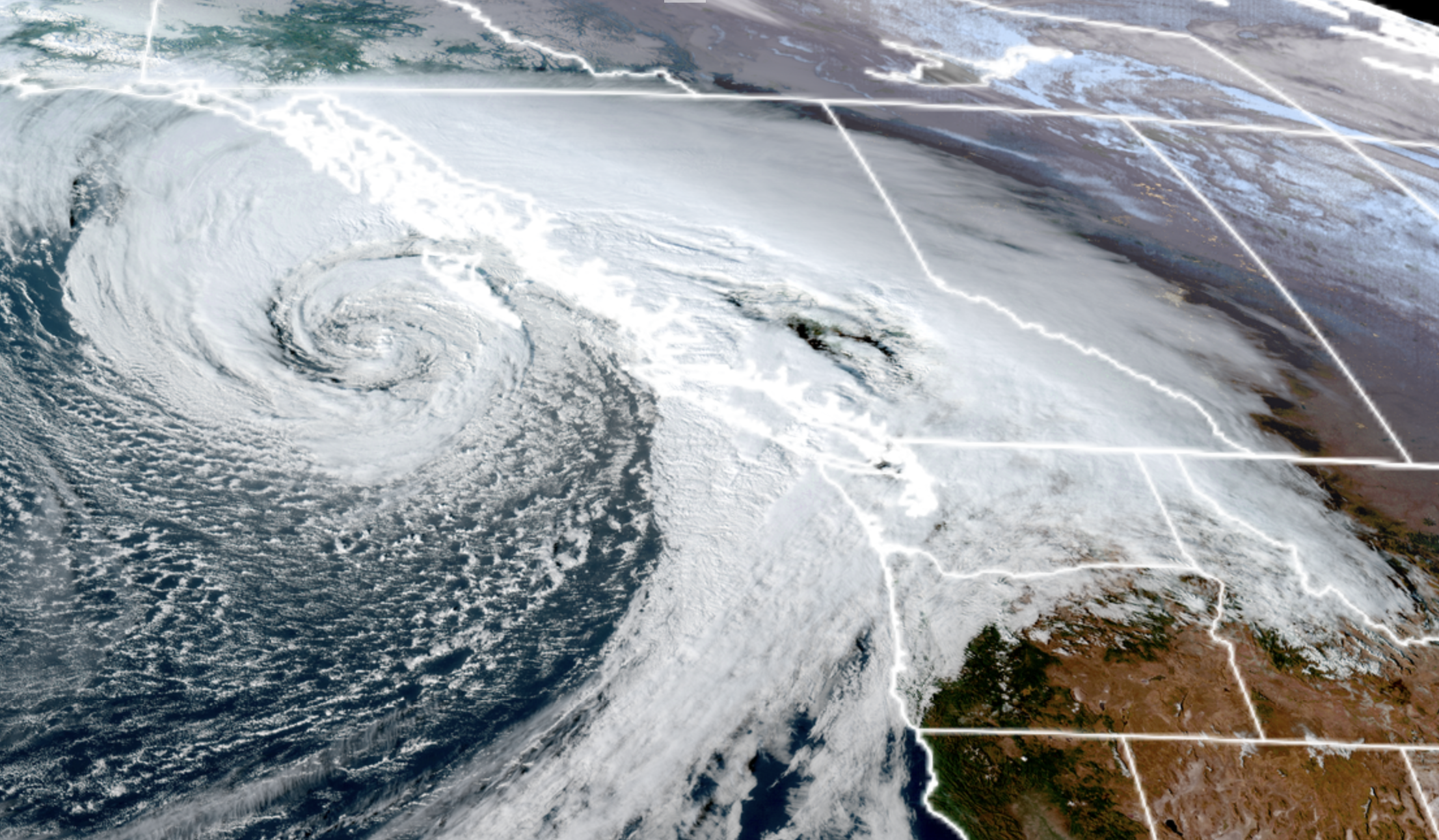
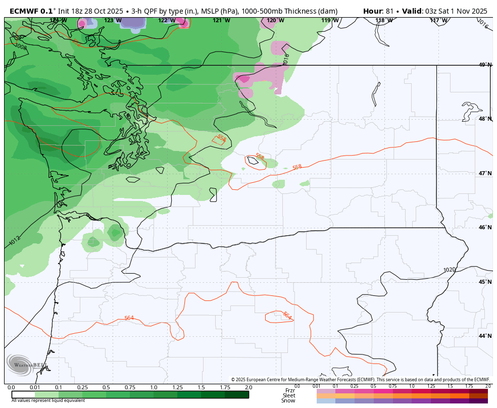
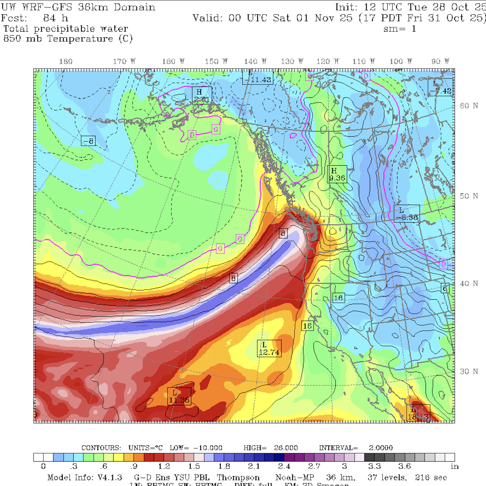
Weather-wise we still have a potent atmospheric river-storm heading our way for Halloween Friday that will pretty much soak the day — maaaaybe we scoot through the first half of the day on the drier side if the front takes a little extra time, but Friday evening/peak trick-or-treat time is still looking confidently soggy.
Still time to get that GoreTex dragon outfit squared away. Or maybe I’ll go as an Emergency Kitten. The fur keeps you warm, right?
But it’ll also be blustery. Not super windstorm-windy but the coast and Northwest Interior could see gusts to 40-45 mph, similar to Tuesday night. After last Saturday’s wind storm cleared the dead branches, we’re better equipped to handle those wind speeds, and I haven’t noticed much of many power outages Tuesday night with those speeds there.
We’re still waiting to see if any rivers might spill their banks, but so far it’s just looking like the always-vulnerable Skokomish may be the only one. But hey — time for salmon to swim across the road in Mason County?
Showers will linger through Saturday and then it’ll be cool and a few lingering showers on Sunday.
The long range models are hinting at a continued active pattern next week — hey you can’t spell November without… OK, dang I was hoping there’d be a good rainy weather word hidden in there. Should have looked before I started typing.
It will be a little on the mild side with these atmospheric river storms so… you can’t spell November without “No Br”?? (Chemists reading this: “No Bromine???”)
Anyway, models are honing in on Tuesday, November 4 as our next potentially rainy and blustery day, with some hints at Nov. 6 or 7 too. Hey at least that GoreTex dragon outfit will still have some use!