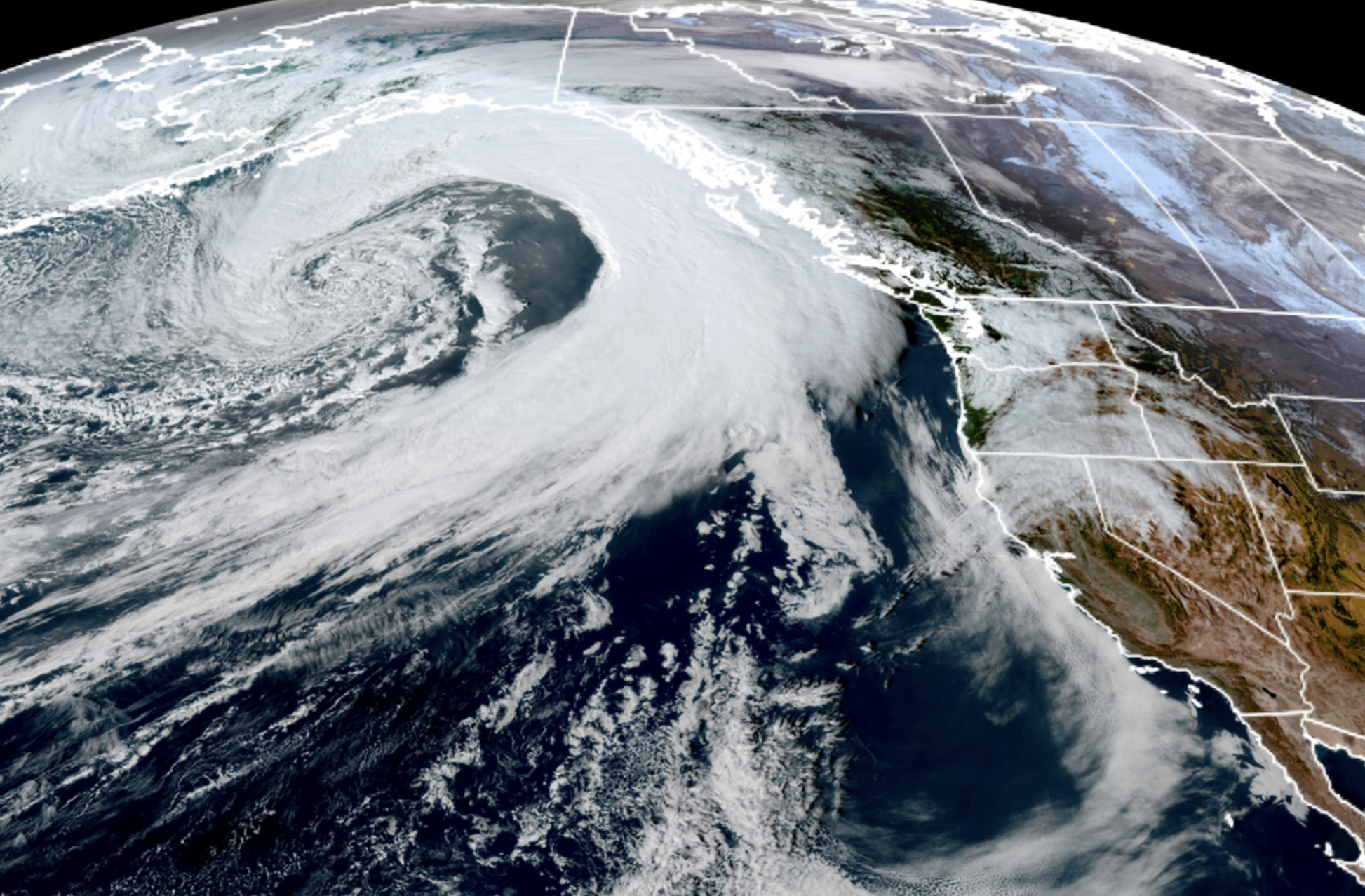
GOES-18 satellite image showing Atmospheric River looms for Halloween. (NOAA / CIRA / RAAMB)
FRIDAY LATE A.M. UPDATE:
Saturday may be windier now than originally thought. Latest models now develop a low pressure center to come through the heart of the Puget Sound region Saturday during the day. Somewhat similar in track to last weekend’s wind. NWS is still analyzing; will have updates on any new advisories this afternoon. I’ll update here later today…
Got your Halloween costume picked out? (Tell me it’s a GoreTex Dragon?)
Mother Nature sure does. She’s going door-to-door around the Pacific Northwest dressed as an atmospheric river. Definitely going with more trick than treat this year…
We’ve already had a few atmospheric river storms this autumn but this one may be the most impactful in the rain department, at least up to this point. However, some spots will get some wind too…
Rain will start in Friday morning and be light for most of the morning and midday and could even be a little bit of a lull in the early afternoon. It might give a bit of false sense of security because you’re going to look outside and go, “Pbbbbbt. C’mon Scott, I didn’t need to outbid 35 other Seattleites for the GoreTex Dragon costume on Ebay for this…”
But hang in there because heavier rain is indeed going to spread inland during the afternoon and into the evening. And all signs still point to wet… and blustery.
(1/2) 🌧️🎃 Heavy rain and breezy winds are on the way to dampen this year’s Halloween. But don’t be tricked – take precautions like clearing clogged storm drains and gutters to mitigate flooding risks for trick-or-treating. #WAwx pic.twitter.com/tLVbhYBkBA
— NWS Seattle (@NWSSeattle) October 30, 2025
For those on the coast and Northwest Interior, there’s even a Wind Advisory for gusts to 45-50 mph to last into the late evening. The core Seattle and Puget Sound area will dodge the impactful winds but it’ll still gust around 20-35 mph.
All in all, not the best trick or treat weather unless, you know, GoreTex Dragon…
But the rains will keep going overnight and through a good chunk of Saturday too, with additional rounds of blustery winds. Rainfall totals in the lowlands are about 1-1.5 inches by late Saturday but 2-4 inches in the Olympics and North Cascades with some isolated spots up to 5 inches.
So now we’re looking at some sharp river rises.
The National Weather Service says so far, only the Skokomish River is forecast to go over flood stage into “minor flooding” status, which the Skokomish going over flood stage is about as rare as a Jaxon Smith-Njigba 100 yard catch day.
But some of our other local rivers may at least nudge close to flood stage, including the Skagit, Snohomish, Skykomish, Snoqualmie and Bogachiel. So those in those flood plains keep a close eye on the weather in case the atmospheric river over performs.
For the rest of us, we will likely have widespread reports of localized flooding from clogged street drains as the deciduous trees are well on their way of shedding their beautiful canopies.
We’ll taper back to showers Sunday but it remains a very active weather pattern next week. The long range forecasts are indicating multiple potential atmospheric river storms; weaker at the start of the week, but potentially stronger ones lurking at the end of the week.
Now that we’ll have filled the river basins with rain from this next storm, we’ll have to really keep on guard for river flooding with those later storms. Wind may be a factor too.
In other words, convince your office or school GoreTex dragons are a perfectly acceptable part of the dress code.
are we in the foothills/I-90 corridor anticipating any serious winds over the weekend?