Hello, November: Atmospheric river storm to pack strong wind punch Saturday

GOES 18 Satellite Image on Oct. 31, 2025. (NOAA/ CIRA/ RAAM-B)
It’s seems it’s not a true Seattle Halloween with out rain…
And it’s not a true Seattle November without wind.
The forecast for Saturday has bumped up in the wind department. Latest computer models have picked up on a developing low pressure center along the sprawling frontal boundary pushing the atmospheric river storm our way, and is tracking it right over the heart of Western Washington — actually in a somewhat similar path the storm we had last weekend.
This new storm is looking a notch weaker still than last week’s so we’re not thinking bonkers wind speeds like the 60s and 70 mphs that dotted the region last weekend, but the similar track is still a recipe for potent wind.
Also unlike the last storm which came in the heart of the night, this one is aiming for the middle of the day. It may be a Saturday, but the storm is going full Dolly Parton mode and workin’ 9-to-5 and it’s a way to make leaves driven.
(Too much of a stretch? Sorry Dolly!)
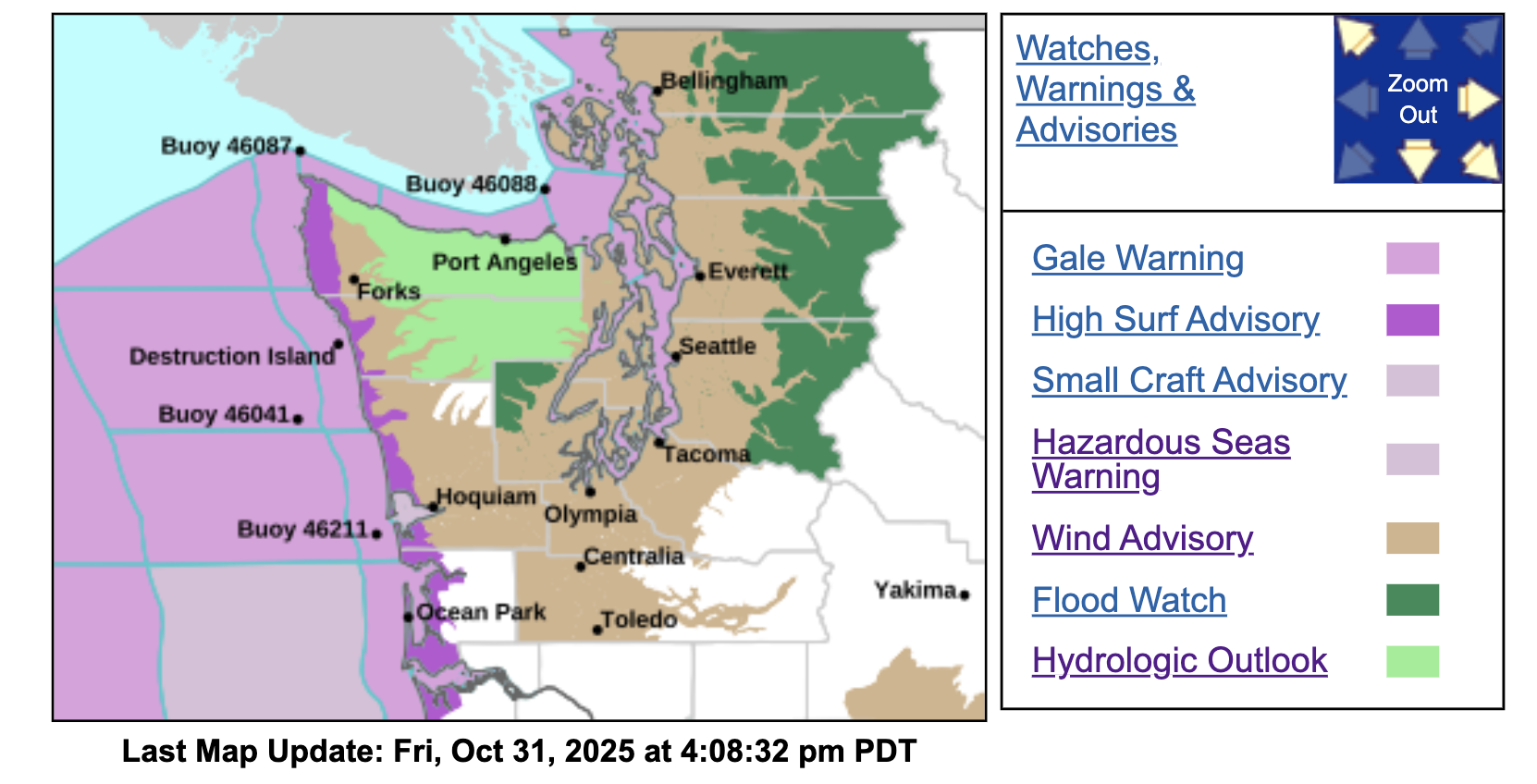
Wind Advisories are now posted across much of Western Washington for Saturday — including Seattle and the Puget Sound region. (However NOT the far northern interior like Bellingham/Whatcom and the San Juan Islands. I’ll explain why in a moment.)
Winds will start to pick up along the coast around dawn, and then start to get breezy in the Puget Sound and I-5 corridor around 7-10 a.m.
The peak winds so far look to be around 10 a.m. to 2 p.m. as the low tracks across the area. The Wind Advisory is for 45 mph peak gusts, but the HRRR hourly models have been on the stronger side with peak gusts in the 50-55 mph range in the Puget Sound area. So I’d at least be prepared for gusts in the low 50s — and that would be pretty close to the Sunday storm for the Seattle area (Sea-Tac was 56 mph).
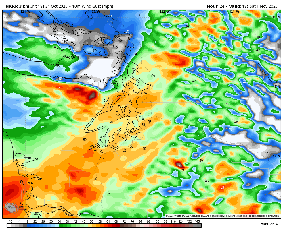
Winds will then slowly fade as we get into the late afternoon and evening, though westerly winds will continue in the storm’s wake down the Strait of Juan de Fuca and into Whidbey Island.
WHY IS BELLINGHAM AND THE SAN JUANS LEFT OUT OF THE SATURDAY WIND ADVISORY?
It’s because they look to be on the relatively “quieter” north side of the storm. The current projected track has the storm cutting somewhere across Skagit or Snohomish County midday Saturday.
The strong southerly winds come on the southern side of the low center, but the northern side tends to be a lot quieter and that’s where Whatcom County and the San Juans would lie. (Note just to make things confusing they ARE in a lingering Wind Advisory from the front on Friday but that expires at 10 p.m.)
ANYTHING ELSE OF NOTE?
I’d say last weekend’s storm did a good job of pruning the trees from summer and now the trees are less leafy, so I think we’re better equipped to handle those winds speeds than we were before last weekend’s storm.
Though those wind speeds could still trigger power outages, so be prepared, but I suspect if the forecast holds, the number will be quite a bit fewer than last time.
WHAT ABOUT THE RAIN?
The atmospheric river is still here through Saturday too so expect rain at times. Flood Watches are in effect for rivers in King, Snohomish, Mason, Skagit and Whatcom Counties.
Storm total rainfall could reach 3-5 inches in the Cascades and Olympics and drive several rivers close to flood stage, including the Skokomish, Snohomish, Skykomish, and Snoqualmie, and to a lesser extent, the Skagit, Stillaguamish, and Nooksack rivers, according to the NWS’s Flood Watch.
Sunday will calm down both in the rain and wind department, but more storms are lurking next week, particular mid week and then again at the end of the week. Heavy rains and gusty winds will come with each one, so, welcome, November!