What does the “Particularly Dangerous Situation” Fire Weather Warning mean for Eastern Washington?
 Scott Sistek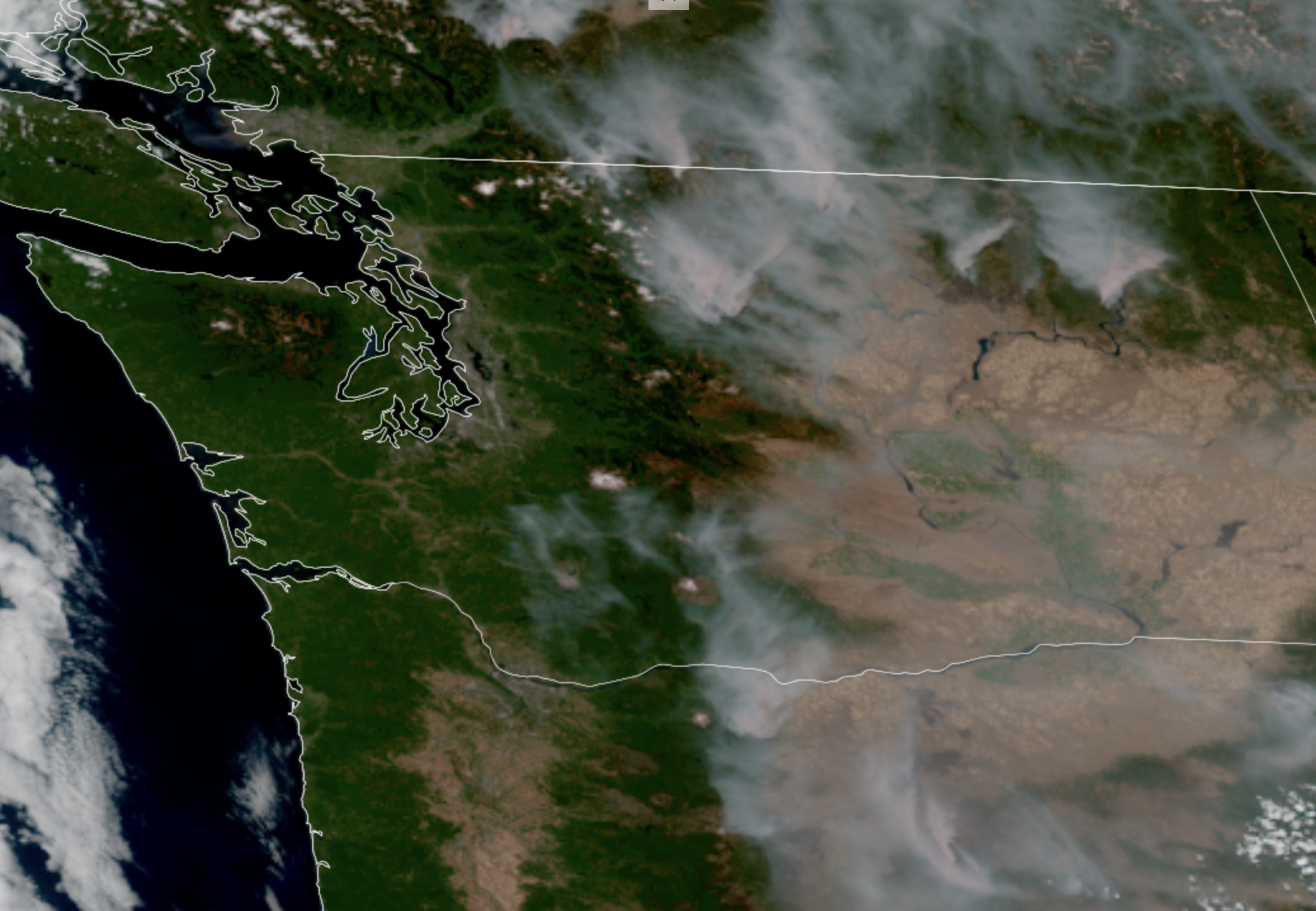
GOES-18 satellite image from July 31, 2026 showing wildfires and their smoke burning in Eastern Washington. (NOAA / CIRA / RAAM-B)
The weather situation in Eastern Washington has gone from concerning to dire when it comes to potential wildfire dangers this weekend.
The National Weather Service has now issued not only a “Red Flag Warning” for Eastern Washington, but gave it a “Particularly Dangerous Situation” designation. This may sound both new and concerning and that’s because they are both correct. I’ll try to answer some questions here on what this all means.
WHAT IS A “RED FLAG WARNING?”
That is essentially what I would more colloquially call a “Fire Weather Warning”.
(IMO, I feel like the NWS should change that name as “Red Flag Warning” seems vague. When I worked at FOX Weather, their style guide was to always change that to “Fire Weather Warnings” in scripts.)
Basically it means that weather conditions are or will soon be ripe for not only starting new fires, but for explosive growth in new — and currently burning fires. Usually it’s primarily a combination of strong winds and dry humidity on drought-parched land. (Hot weather helps too but you can have fire weather conditions in winter too so it’s not temperature dependent.)
Red Flag Warnings are fairly common in the summer in the West. But this one is extra…
WHAT IS A “PDS” OR “PARTICULARLY DANGEROUS SITUATION” DESIGNATION?
It is, as the name implies, a higher level alert than just a basic Red Flag Warning. So in Eastern Washington’s case, this setup warrants a higher threat level than usual.
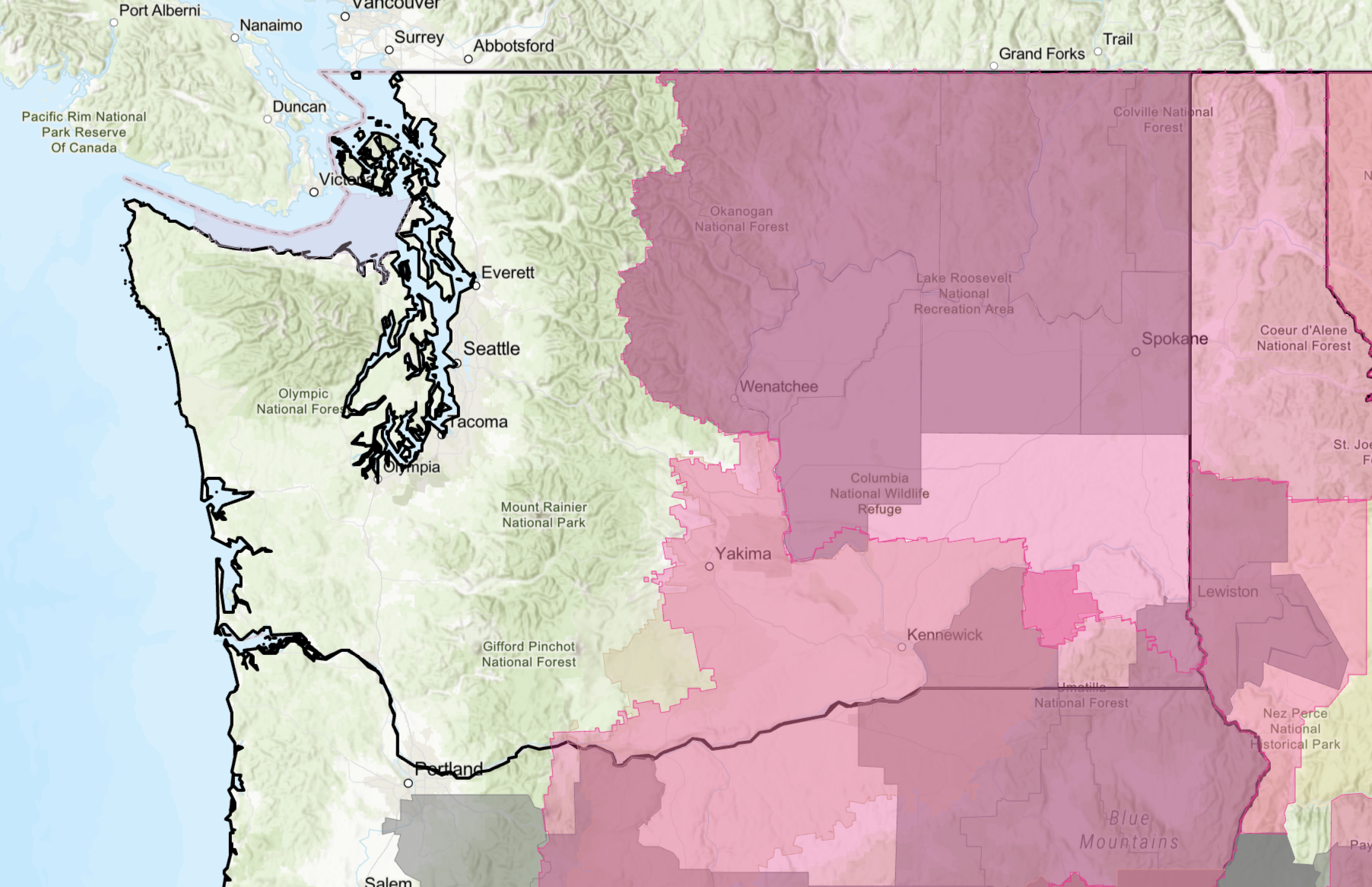
The name may sound unfamiliar because this term is new to fire weather forecasting — it’s only the second summer that has been an option for forecasters, and it’s the first time it’s being used in Washington.
Basically, the NWS borrowed it from severe weather forecasting where in recent years forecasters began using the “PDS” designation to highlight increased potential threat and intensity to severe weather outbreaks. Forecasters could issue “PDS” Tornado Watches and/or Warnings when the forecast was for widespread strong to destructive tornadoes or a significant tornado was bearing down on a populated area. (They also now have “Tornado Emergency for the highest threat level.) There have been PDS Severe Thunderstorm Watches/Warnings when it looks like a line of storms will bring destructive straight line winds.
But quite simply: An added PDS designation means the threat has gone from bad to worse.
WHAT’S HAPPENING WITH THE WEATHER TO CAUSE THIS?
While much of the West is going to be broiling under the influence of a sprawling heat dome Saturday, a cold front is expected to push through Washington as a storm moves into British Columbia.
Aside from some rain to Western Washington and the mountains, it will usher in a batch of cool air.
But it’s in the 90s in Eastern Washington Friday. And the big temperature drop is bringing strong winds to Eastern Washington, but unfortunately the Cascades will block any rain from making it out East.
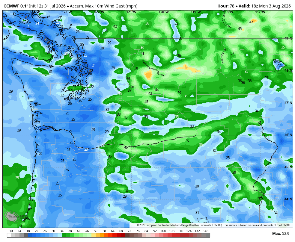
The result is wind gusts of 30-50 mph but still bone dry air of 15-25% humidity, on top of parched ground that hasn’t seen much rain in ages.
Those three ingredients are conspiring to make for what NOAA’s Storm Prediction Center is calling “extremely critical” fire weather danger.
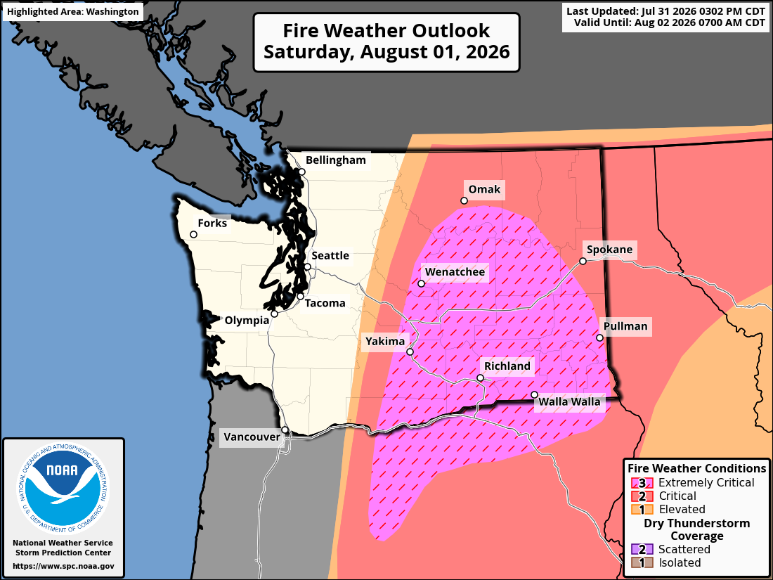
Aside from the fire danger, these winds could trigger areas of blowing dust and minor power outages so driving may be a challenge at times too.
WHAT IS THE MAIN CONCERN?
Any spark will not only have a chance to start a fire with the dry air and dry vegetation, but the strong winds will make it prone to explosive growth. A town could go from having a quiet Saturday to urgent evacuation orders in short time frames.
Meanwhile, there are already large existing wildfires burning across Eastern Washington that will now be fed gusty dry air to make for rapid spread. The fires have been burning north but these winds will shift to the west, pushing them now to the east.
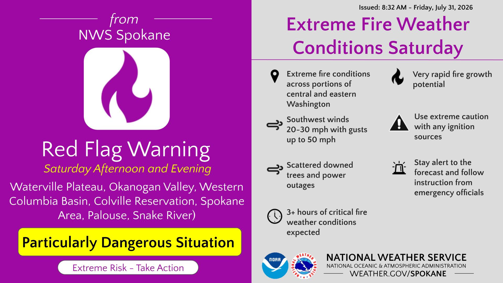
It’s critical that acute care be given to not create any sparks. There is no lightning forecast for Saturday in Washington so any new fire starts are going to likely be manmade. Also anyone who is inside this PDS fire warning zone needs to be hyper vigilant to your favorite local media source…and the skies.
RESOURCES:
- Washington InciWeb Wildfire Info
- Washington Weather Chasers Facebook Live Updates
- Washington Wildfire Smoke Blog
If you see smoke or a fire on the horizon heading your way, it may not take as long as you might think to reach your area in these strong winds. Always err on the side of caution when it comes to evacuating. So many historical fires in the West are dotted with stories of people who lost their lives trying to evacuate and getting stuck in the flames.
IS THERE ANY SILVER LINING?
A small one: Temperatures will briefly be much cooler for firefighters – into the 80s on Saturday and even just 70s or so on Sunday. But the heat will return next week back to close to 90.
For Western Washington, persistent onshore flow should keep the fire dangers lower and should keep the smoke away as well. But if there are even more fires started in the East, it’s more smoke that could exacerbate the already areas of poor air quality over there, and have that much more smoke potential to blow smoke into Western Washington next time the wind shifts to offshore flow.
WHEN DOES THIS FIRE DANGER END?
The critical / PDS fire alerts end Saturday night as the winds ease, but fire danger will remain high on Sunday as air mass remains dry and parched. Next week’s weather looks like a return to sunny, hazy and hot over there, but the winds should ease further.
We may not be totally clear of the fire danger until the rainier season starts to come back in late September and October.
READ MORE:
- How Seattle is dodging a massive heat dome set to bake the West with triple-digit heat
- How Seattle’s rare August rain could make the wildfire situation worse in Eastern Washington