How Seattle is dodging a massive heat dome set to bake the West with triple-digit heat
 Scott Sistek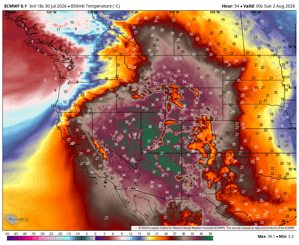
ECMWF showing 850 mb temps (in Celsius) for Saturday, illustrating the expansive heat dome except in Washington.
Summer is about to turn on its highest broil setting across much of the western U.S.,as a massive and intense heat dome is pushing back this way after cooking the Midwest the past several days.
Notice though I said “much of” the western U.S. and not “all” of the western U.S.
Seattle, we get a pass.
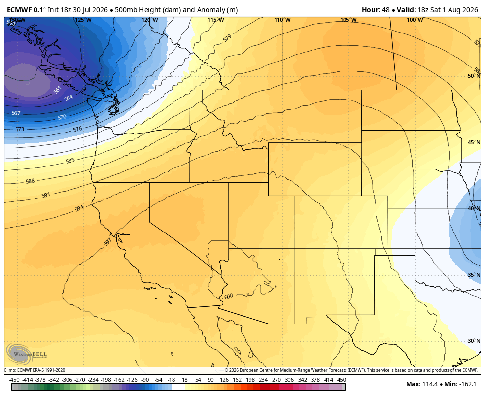
The low pressure center that’s just off the coast of B.C. will be our knight in shiny, air-conditioned armor. (I’ll pause here while you try to picture what exactly that would look like. Or, let’s let see if ChatGPT would have an idea…)

It’s moving ashore into B.C. and western Washington this weekend, not only bringing some rain for SeaFair, but acting like a sword-wielding force field and keeping that heat dome’s tentacles at bay well to our south.
WAIT, WHAT EXACTLY ARE WE GETTING PROTECTED FROM? IS THIS TURNING INTO AN ‘ODYSSEY’ THING?
Metaphors aside, it’s just a really big blob of hot air. *Really* big. And really hot.
Many areas across California, the Desert Southwest, and even parts of the Inland Northwest are set to soar well past 100, including wide swaths of southern Idaho, Montana and even into Alberta.
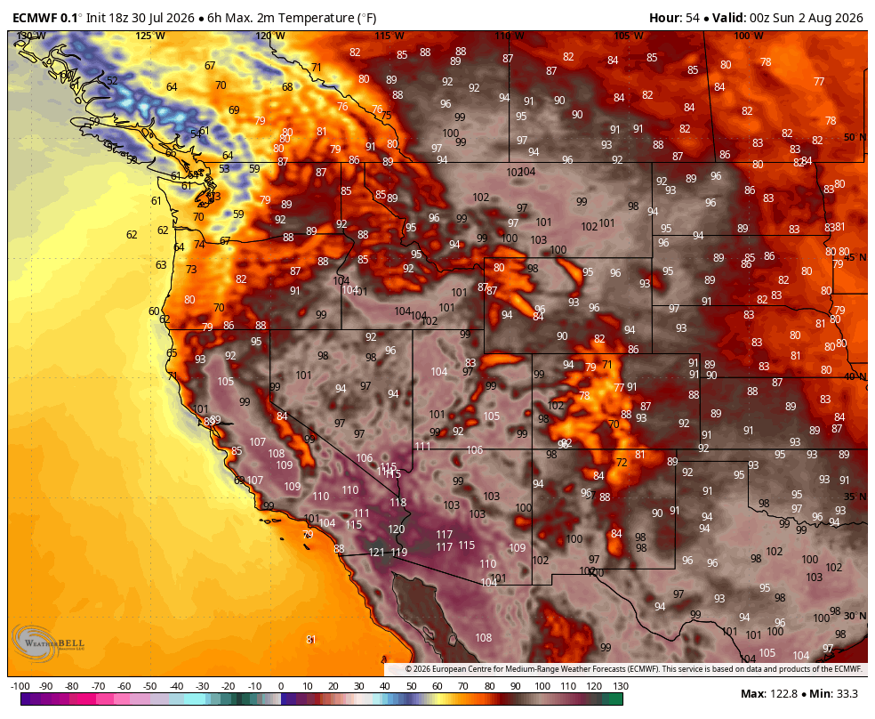
Parts of Utah and the California’s Central Valley are going over 105-110.
Las Vegas is pushing 115 while Phoenix is set to go over. Some spots in the Desert Southwest may even reach 120 degrees.
Here in Seattle? With the low moving in instead, we’ll barely cross the 70s on Saturday. And we’re still looking at a little rain – not a lot in the Puget Sound area, but likely enough to measure.
Eastern Washington gets protected too from the big heat. But as mentioned yesterday, our cool air does come with a cost for Eastern Washington.
READ MORE: How Seattle’s rare August rain could make the wildfire situation worse in Eastern Washington
The rush of cooler air and deflating heat arrives via gusty winds of 30-50 mph, but still nearly bone dry humidity that will stay in the 15-25% range.
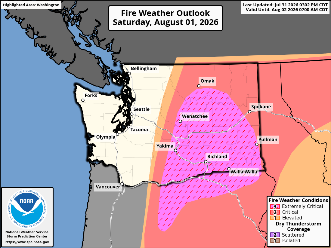
Thus, rare “Particularly Dangerous Situation” Fire Weather Warnings from the National Weather Service, and an also rare “extremely critical fire condition” designation by the NOAA’s Storm Prediction Center remain in effect for much of Eastern Washington, meaning wildfires are easy to start and are in danger of explosive growth and rapid spread via those gusty, dry winds. Just be really careful not to light any sparks; and be in tune to local media in case any urgent or short-notice evacuations are needed.
WHAT HAPPENS ONCE OUR A/C “KNIGHT” MOVES ON TO GREENER PASTURES?
Luckily, just as we begin to lose our protective “force field”, the heat dome begins to abate as it continues to move west into California.
By the middle of next week, the ridge of high pressure looks to reestablish right along the West Coast but at more traditional strength that will bring a return of sunny skies and warmer temperatures across Washington. For Seattle, we may edge back into the 80s next week – probably exceeding the “Goldilocks” weather I wrote about earlier this week but shouldn’t be “heat dome” hot.
So no Emergency Kittens needed anytime soon. (Though I guess these days I should track down some “Emergency Jimothy” videos? 🦝)