La Nina still here, but may not last long. Here’s what that means for our winter:
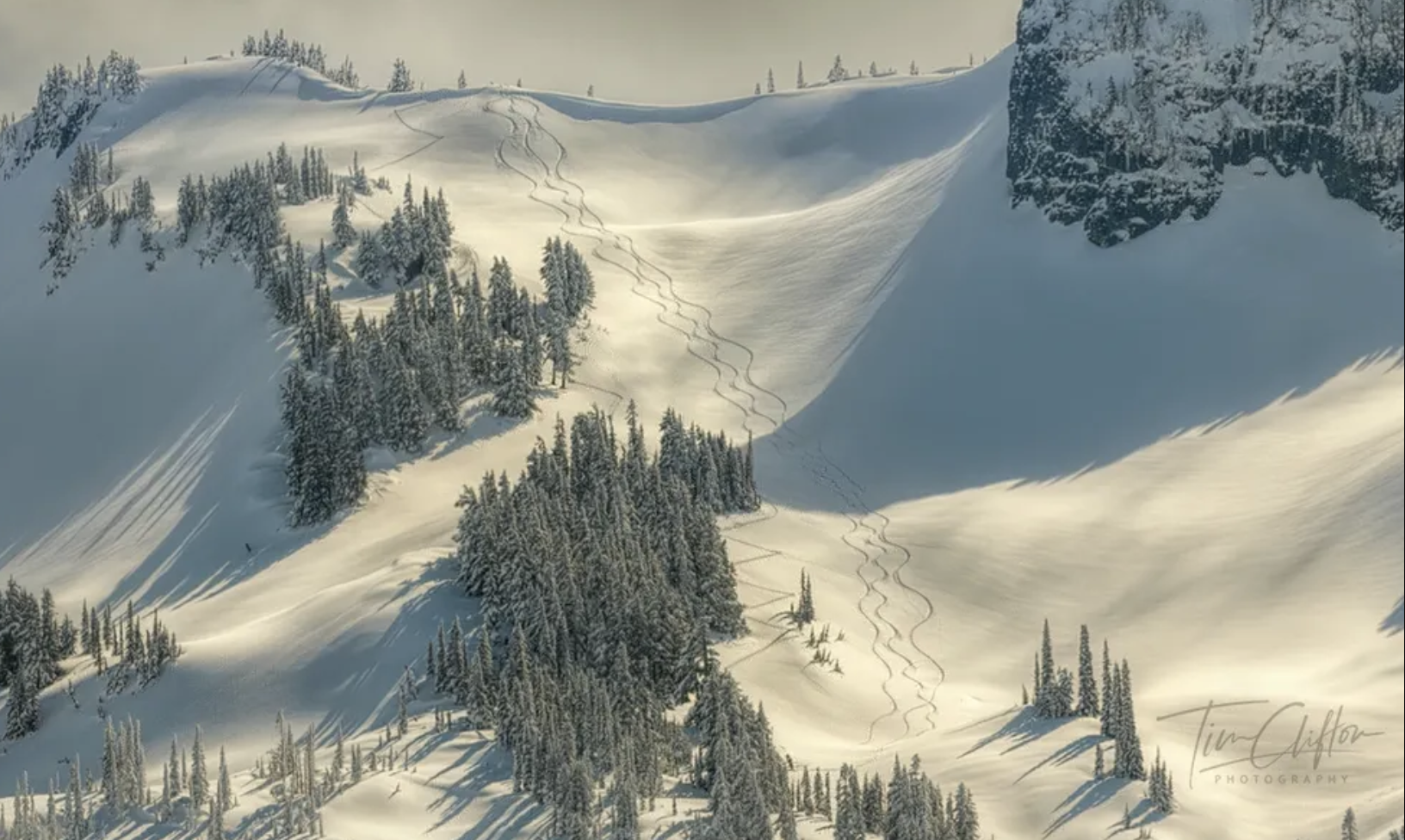
Snow in the Cascades. (Photo: Tim Clifton Photography)
Good news for those who like rainy autumn weather with decent mountain snows, La Niña is still here.
But it may not last very long.
NOAA has posted their monthly update on the status of the El Niño/La Niña oscillation and we are still in a weak La Niña pattern. But their latest data continues to suggest La Nina may barely survive into the new year.
FIRST: SCOTT LONG BLOG POST WATCH UPGRADED TO A WARNING
Lots to dive into here. If you’re looking for short and sweet TL;DR, here is your blog exit offramp: Weak La Niña expected to hold till early next year then fade. That means we’re still looking good for cooler/wetter than average conditions for the next couple months then outlook gets hazy toward the back half of winter.
For those who have a full cup of coffee and a taste for more details, here we go:
CAN YOU REFRESH MY MEMORY ON WHAT THIS WHOLE FUSS ABOUT LA NINA MEANS?
Quick Recap: La Niña is part of a 3-7 year ocean cycle that formally goes by the name El Niño Southern Oscillation, or ENSO. It’s based of measurements of water temperatures in the central Pacific Ocean, whose changes have been found to influence global weather pattern.
Researchers have learned that when those sea surface temperatures (“SSTs”, if you’ve ever seen that before) in a certain part of the tropical Pacific cool to more than below 0.5 degrees C below average (0.9 degrees F), we get conditions consistent with what we call “La Niña”. If it’s warmer than average, it’s an El Niño, and near average it’s formally called “neutral” conditions and informally called “La Nada”.
Right now the waters trending about -0.5C to -0.7C, so just barely into the La Niña threshold. But NOAA noted that the weather patterns across the region are decidedly feeling a La Niña influence.
IS THIS WHY MY SKIER FRIENDS KEEP CANCELING HANGOUTS AND BLOCKING OUT HUGE CHUNKS ON THEIR CALENDAR?
They certainly want to free up some dates!
In the La Niña phase, two important things typically frequently happen for the Pacific Northwest: The Polar Jet Stream arcs high to the north into Alaska and the Yukon, then dives south into the northern tier of the U.S. pulling cool air down along with it. In addition, the Pacific Jet Stream generally sets up shop aiming right off the ocean and into the heart of the Northwest, steering all the storms our way.
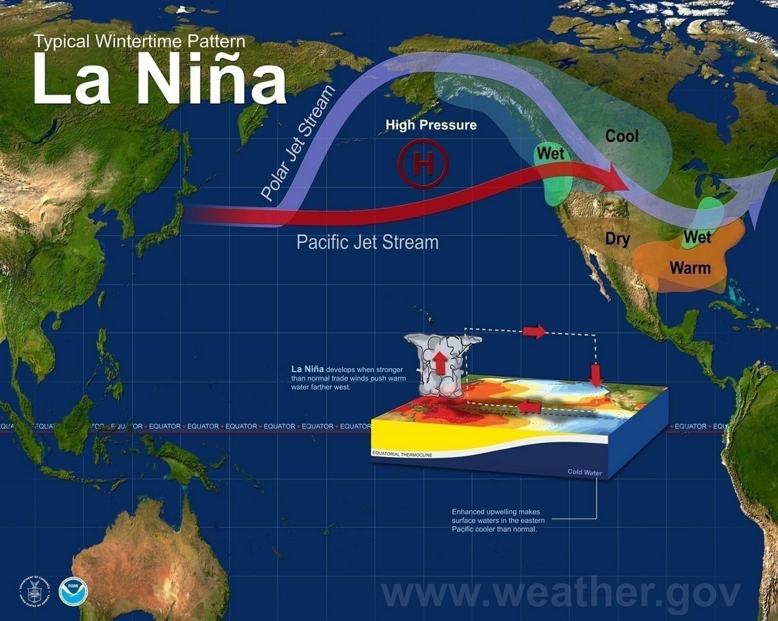
That combo makes for an autumn and winter that in most instances leads to above average precipitation and below average temperatures — though with weaker La Ninas like we are in now, that signal is not as robust as when it’s a moderate or strong La Niña.
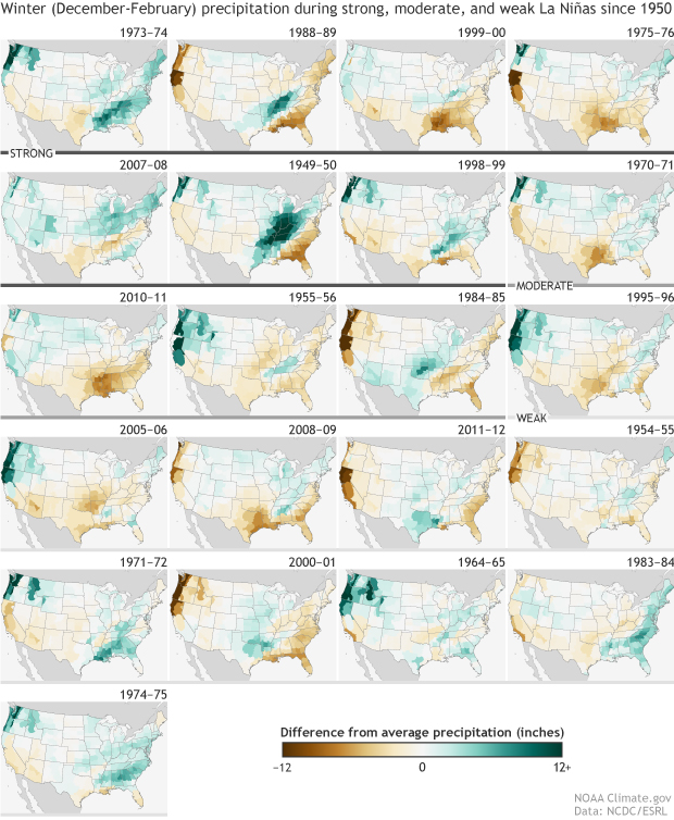
During weak La Ninas, the cooler temperature signal seems to hold better than the wetter signal. Looking back at 10 weak La Nina winters from 1950-2017, just about all of them ended up cooler than average for temperatures, but about 50/50 on precipitation.
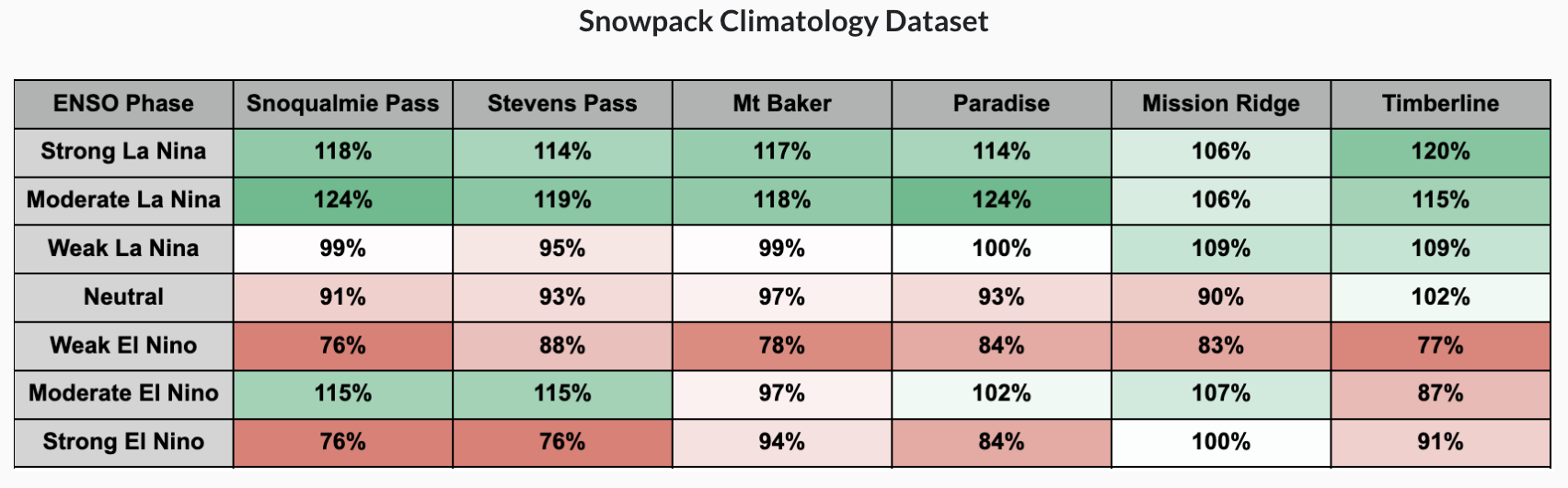
The Northwest Avalanche Center notes in weak La Niña years, the Snoqualmie and Stevens Pass snowpack ends up right about average (versus 15-20% above average in stronger La Ninas).
But an average snowpack is a good snowpack!
Last season was also a weak La Niña and ended up a bit below average for snowpack in the Cascades, surprisingly. Remember La Niña patterns are good for overall trends but doesn’t mean we can’t get extended mild/dry stretches amidst a La Niña winter too.
WHAT HAPPENS IF LA NINA GOES ‘POOF’ MID WINTER?
With La Niña barely over the threshold, NOAA’s current projections have La Niña only holding on until about late December or January. Then it drops to 50/50 odds of La Nina’s survival into early next year, with about a 65% chance its outta here by mid winter.
Easing out of La Niña would drop us back into that neutral/La Nada winters. If we lose La Nina’s influence, then the weather patterns get more variable. Last winter was a La Niña but acted more like a neutral winter with long periods of rain (November/December) then long dry stretches (January) then possible long cold stretches (February).
This would lead me to believe maybe January and especially February and March will be more variable. That could be good for a good storm (snow storm?) or good wind storm… or a good stretch of fog and nada for 10-12 days. Or both! Or neither! Can you tell I’m hedging my bets?! But be distracted by all these exclamation points to make it sound more confident!
I’M SURE YOU HAVE MORE FANCY CHARTS TO SHOW US, RIGHT?
Indeed!
For the shorter term, NOAA’s 3-4 week outlook is leaning cooler than average to finish off November and kick off December
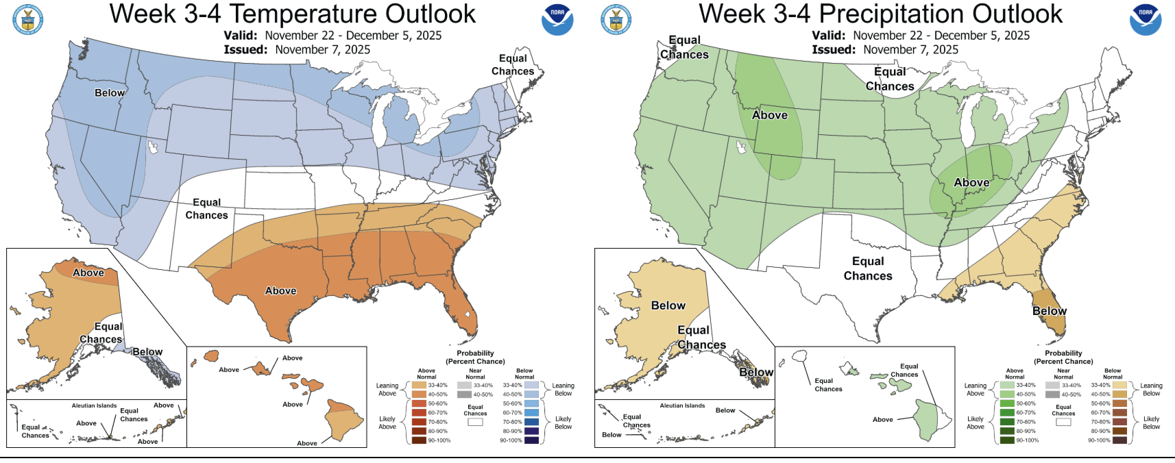
Their current seasonal outlooks are still leftover from mid October — they update those the third Thursday of each month so fresh maps will come on Nov. 20. But their latest charts still keep a La Nina-esque influence of cooler and wetter than average conditions in the Pacific Northwest through the heart of winter.

We’ll see if any changes come to those maps next week but in the grand scheme of things, I think in a nutshell, the late autumn and winter outlook is generally
- Good news for skiers and snowboarders
- Good news for water managers
- Good news for Seattle rain and lowland snow fans
- Not so good news for those who like mild, dry winters.
- Not the best for those who already struggle with the Big Dark.
For those in the latter two categories, you’ll want to root for an El Niño winter and the way the cycle works, that should be in the offing perhaps next winter or if not, the winter after.
And for those that made it this far — thanks for reading!