Soggy pattern continues for Northwest as storms go to pick on California
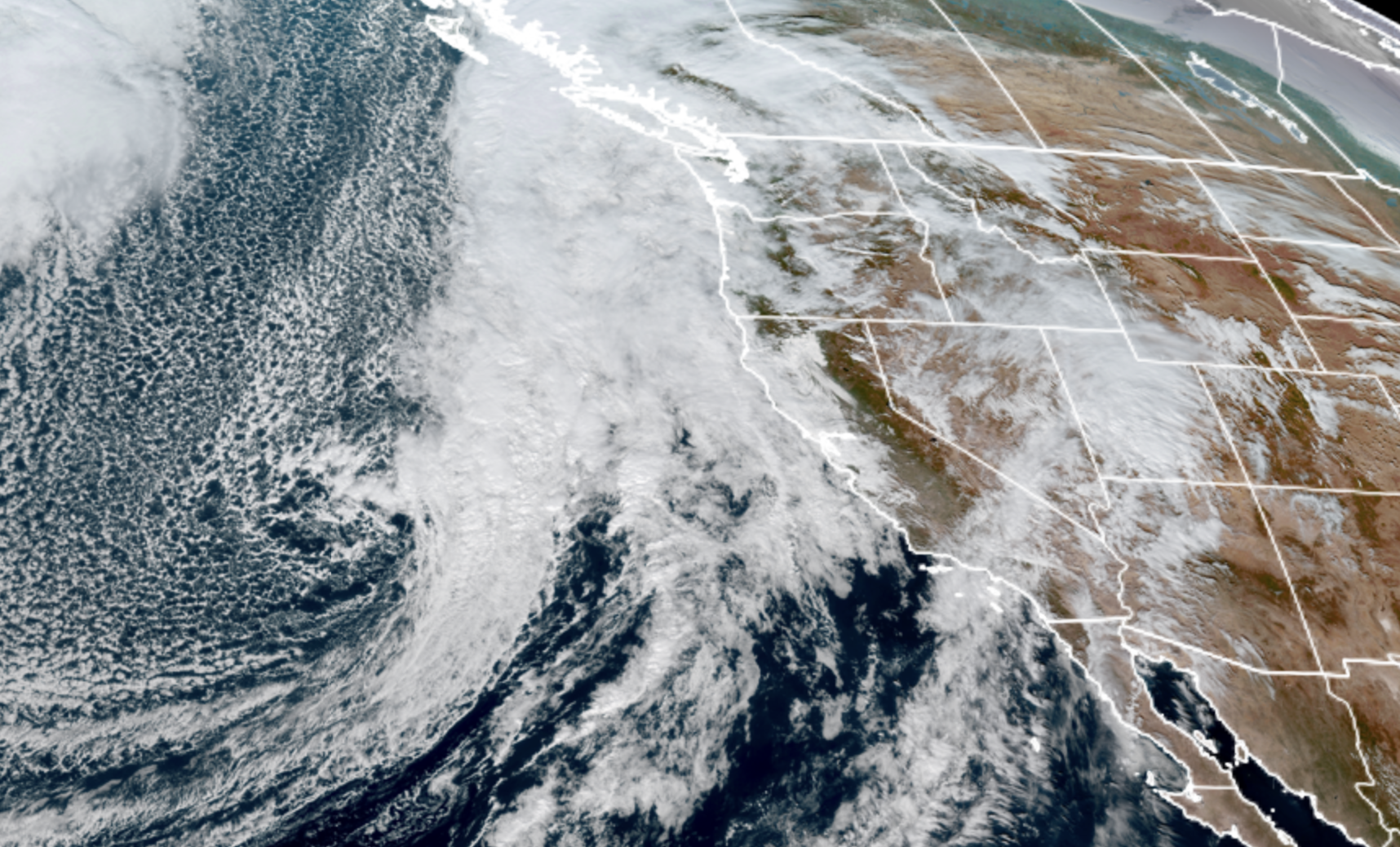
GOES 18 Satellite Image Nov. 12, 2025. (NOAA/ RAAM-B / CIRA)
We have ceded the mic.
While the weather will get back to its rainy ways around Western Washington to finish off the week, the larger weather headlines are reserved for California, whose weather maps already look like getting a jump start on decorating for the holidays with all the colorful alerts strewn across the region.
For us around Seattle and the Pacific Northwest, we’ll see increasing showers through Wednesday, graduating to a full on rainy day for Thursday.
There is still a lingering chance of the Northern Lights again this evening, but so far the new solar wave hasn’t been quite a strong as advertised (just caught that autocorrect originally changed that to “hasn’t been quite as ‘sturgeon’ as advertised”. Apparently this solar event is NOT fishy…)
And it’s still cloudy anyway with rain likely overnight, so we’ll just have to hope for clear skies the next time the sun lets out a big belch…
Then again if it happens in the next few days, it’ll STILL be cloudy.
A storm system Thursday will take up much of the Pacific Coast but as alluded to earlier, will focus most of its wrath in California, and even into Southern Oregon. High Wind Warnings are up around San Francisco for gusts to 60 mph (!) and the Sierra Nevada will get some decent snow.
But around here, Thursday will just feature rain at times, even much of the time. It’ll be a little breezy at times but the HRRR model shows a peak wind gust of just 28 mph in Seattle which won’t provide much of a sockeye, argh, I mean sock to the region.
Lingering showers hang around on Friday here as the main storm shifts its wrath down into Southern California.
The weekend features ho-hum weather systems drifting through — lighter, scattered periods of rain on Saturday; steadier, more moderate rains on Sunday so far. We could see some mountain snow on the backside of Sunday’s system.
No real change in the forecast pattern for next week. With the jet stream still floundering (yes, I MEANT the fish this time, autocorrect) around the regions, we’ll continue to see storm systems at times next week.
The ones for early next week still are trending on the weaker side so far, with perhaps some signals for wetter, windier weather leaning toward the end of next week, provided the storms end up as sturgeon as advertised.