‘Winter break’ looms for mid-January with potential extended dry, warm stretch in Northwest
For most of us, “winter break” just ended on Monday. For Mother Nature, it’s starting next week.
Long range forecasts continue to suggest a major shift in the weather pattern starting over the weekend that will feature a massive ridge of high pressure set to anchor across the West.
It’s not great news for skiers and water managers looking to keep boosting the snowpack, but it will represent the longest break we’ve had from active weather since the stormy season began in late October.
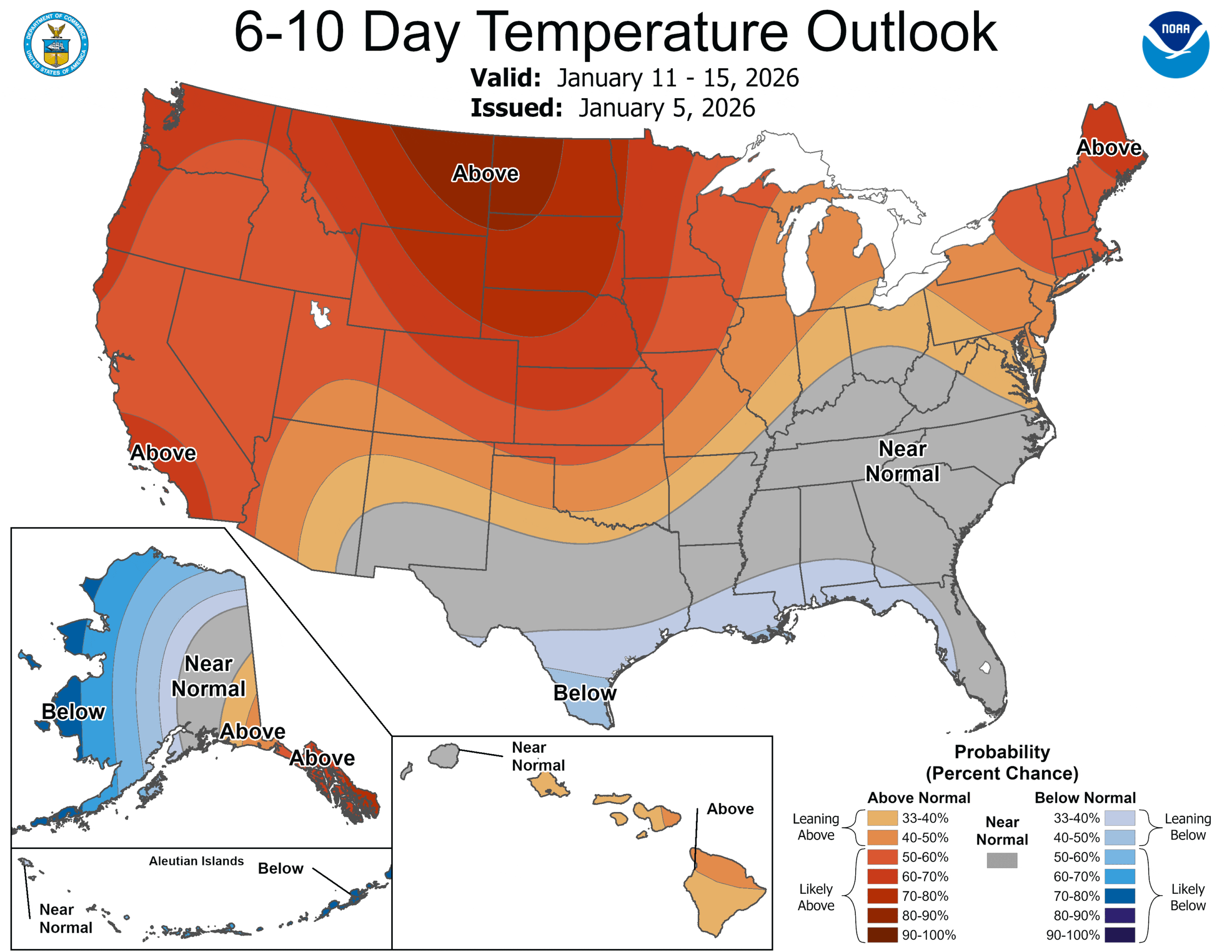
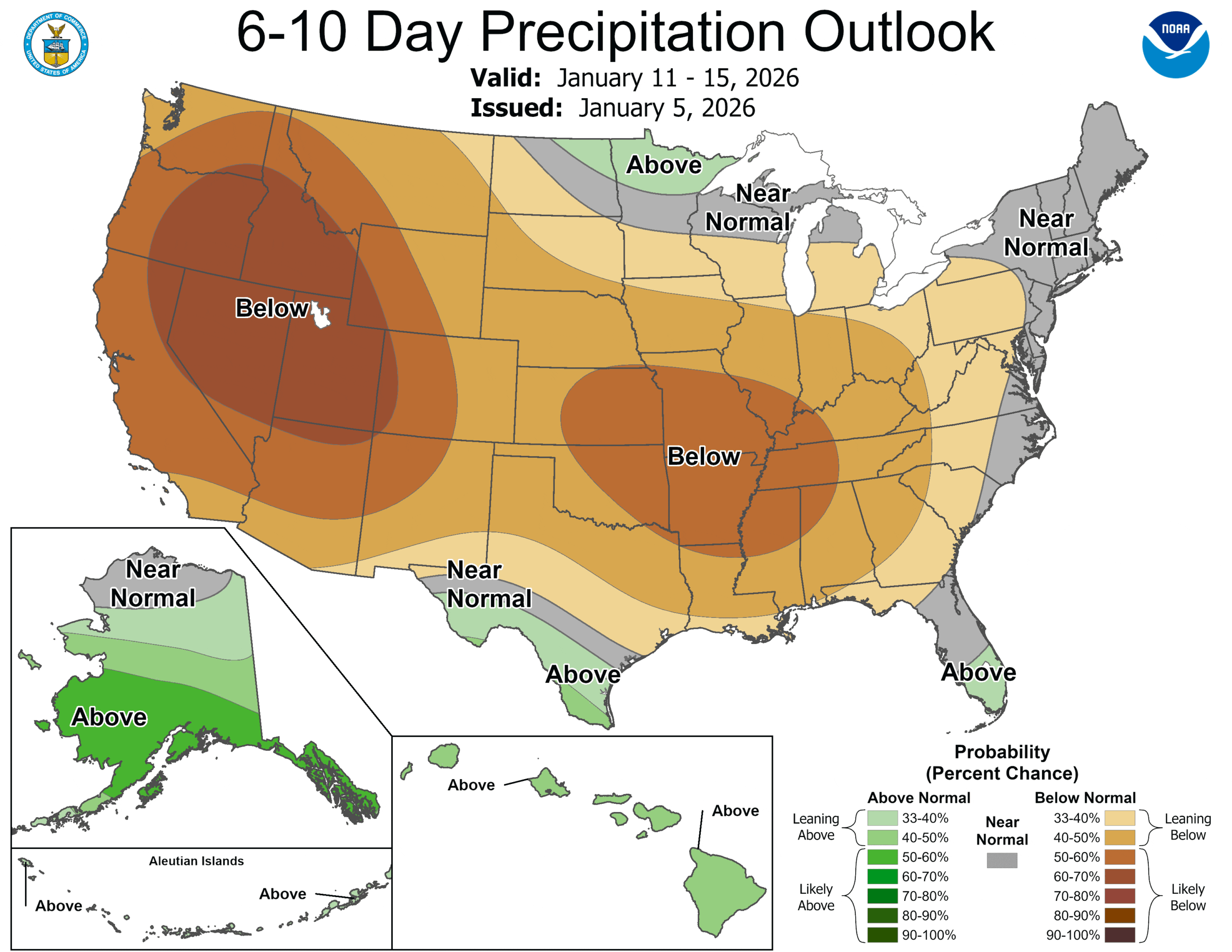
Both the 6-10 day outlook and 8-14 day outlooks from NOAA’s Climate Prediction Center are indicating high confidence in both a warmer and drier than average period of weather across the West (and into the Rockies and Plains too), essentially covering all of mid-January.
Many areas this month have already had a taste of mild winters, with record breaking “heat” across the South and East this week.
But in winter, just because it’s dry and “warm” doesn’t mean it’ll be warm on the ground. Instead, this would be a prime setup for temperature inversions, where the air is warmer at higher elevations than near the surface.
Inversions occur when clear nights allow the day’s warmth to radiate back into the skies, cooling the ground. Cold air is heavier than warm air so it gets trapped near the ground, allowing warmer air to sit on top. If winds are light, as is common during high pressure weather patterns, we don’t get a good mixing and that cold air can just sit there like a couch potato that just discovered a new 10 season series to binge watch on Netflix. (It’s a literal chill, not metaphorical!)
The trapped air can lead to poor air quality and, depending on how cold it gets and how much lingering ground moisture is around, can also lead to hours of dense fog in the nights and mornings that may be stubborn to clear.
The South Sound like around Olympia and the Chehalis Valley are well versed in being in the fog due to cold air getting trapped in the valleys and will likely spend a lot of this dry period in the fog.
On the other hand, going up in the hills and mountains may afford some of the nicest, warmest weather in the region. It’s not uncommon in these patterns to find it’s in the 30s and 40s around Seattle, but mid 50s or better up in the sunny and warm mountains above the inversion. With all the new snow coming to the mountains this current week, next week’s skiing may be epically pleasant, at least at the start of the pattern.
MORE: Back-to-back storms to pummel Cascades with 2-4 feet of snow
Unfortunately, the pattern looks to linger quite some time, so by the time we get into the January 20s, ski resorts will have to work on their own snow as Mother Nature will not be providing her own.
But for those who struggle with the extended gray periods in winter, this will provide a nice way to recharge a bit. Even if you end up in foggy weather, it won’t be hard to find sunshine close by.
A dry period would be most welcome after all of the rain we’ve been getting lately.