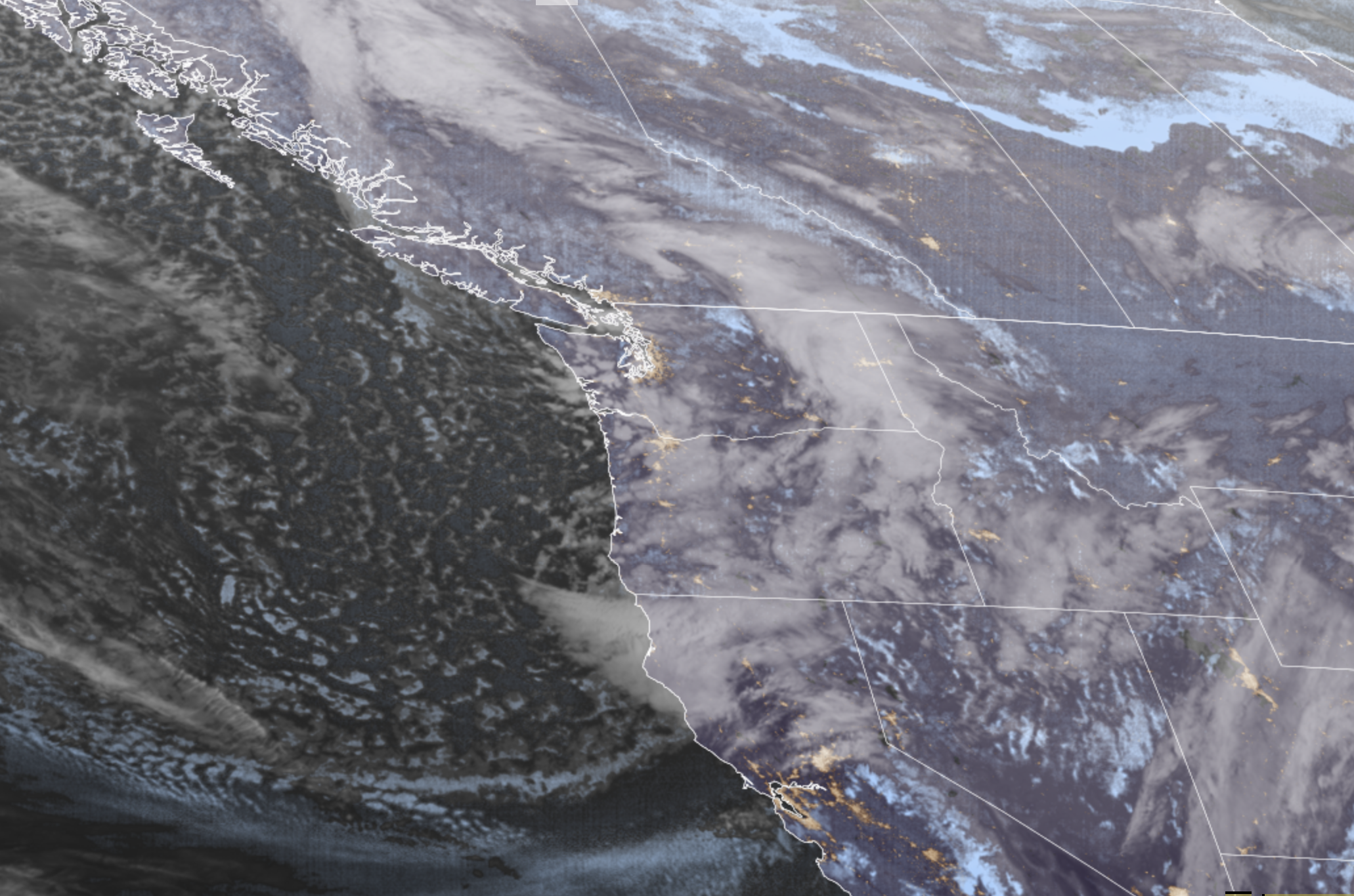
GOES-18 Satellite showing chilly rain showers and snow showers around the Pacific Northwest on Jan. 7, 2026. (RAAM-B/CIRA)
Winter has been more of a “lose”ter for cold and snow fans so far, but there may be at least a wintry teaser Wednesday night and Thursday morning in the wake of our second storm rolling through the area.
A little cooler air will move in overnight, dropping snow levels down to about, oh, 700-1,000 to so feet. But heavier showers can temporarily knock the snow levels down a little lower, allowing for bursts of wet snow that may at least whiten the grass and trees before it starts to melt again.
The best chances are in the Cascade and Olympic foothills with their elevation advantage — there was even a Snow Advisory up for Lake Cushman over on the Olympic Peninsula for up to 3” of wet snow earlier Wednesday. The Hood Canal area has also had some wet snow so far.
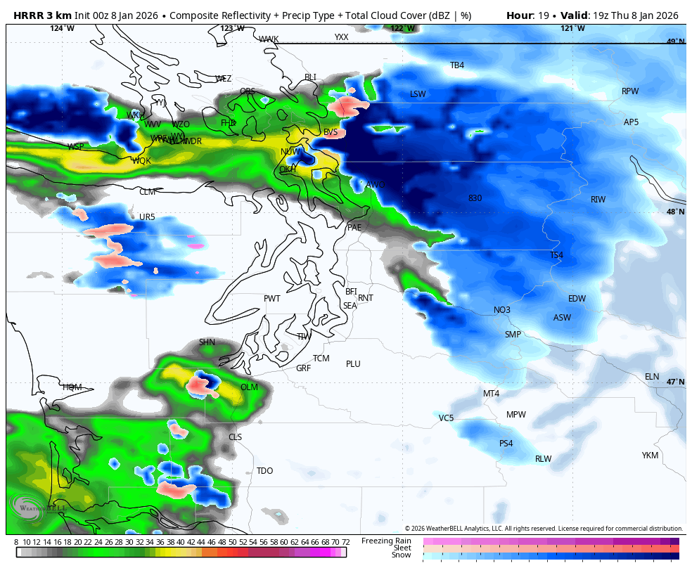
But even some of the higher hills in the Puget Sound area may see a little wet snow here and there. Again, road temperatures are warm and air temperatures are not expected to get to or below freezing overnight or Thursday so no real impacts expected. Sorry, snow fans :/
However, if you DO need to find snow, the mountains have gobs. More than a foot of new snow already fell at Stevens and Snoqualmie Passes through Wednesday evening with another 8-18 inches of new snow through Thursday afternoon. Winter Storm Warnings remain in effect there.
We’ll see lingering showers early Friday then a break in the weather later Friday through much of Saturday.
Long range models suggest one more storm coming in Saturday evening and Sunday. And while it’s not a full-fledged atmospheric river soaker, it’s atmospheric river…ish.

The storm will tap into some milder air, so snow levels rise back above the pass levels for rain on top of all this new snow, but the storm is not expected to carry impactful amounts of moisture, so flooding is not a concern except for maybe the always-vulnerable Skokomish.
But once that storm scoots out Sunday night, we go from MildStorm to MegaRidge. (If that sounds like a great name for a Transformers duo, too late I’m already working on the trademark 😉 ).
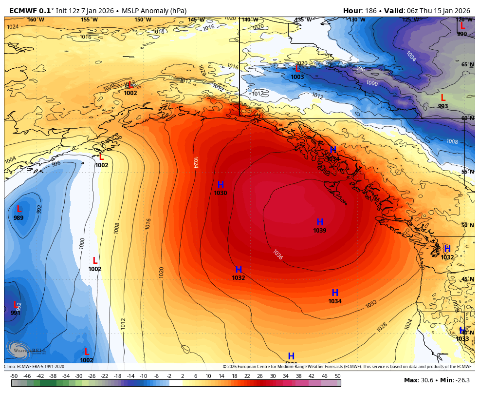
The extended forecasts continue to suggest a huge ridge of high pressure will form that will wipe out all precipitation chances across the entire West Coast for several days, perhaps more than a week. It’ll be foggy and frosty at night, but mild during the days when the fog clears. Sun fans will get their due, but ‘winter’ fans might start wondering if they can trademark ‘lose’ter. (Nope! Working on that too! 😉 * )
(*-not really. Have at it!)