Tropical Storm Watch in San Diego for Rachel is only second tropical alert in West Coast history
 Scott Sistek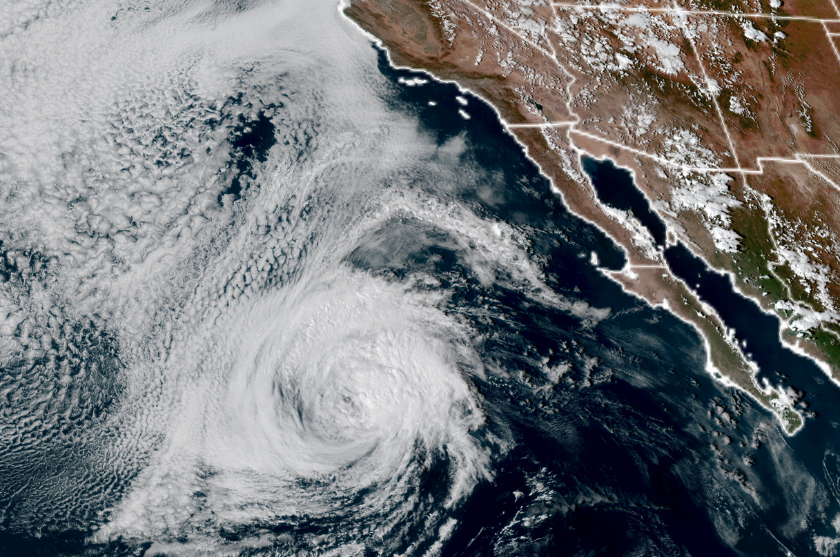
GOES-18 satellite image of Tropical Storm Rachel off the coast of Baja California on Oct. 9, 2026 (NOAA / CIRA/ RAAM-B)
All attention on the tropics has been mostly focused on Hurricane Isaias and its dangerous trek into the Gulf Coast Friday — and rightfully so, it’s a major hurricane. But in a nod to how unusual this Super El Nino-infused tropics season is, there are also now tropical alerts ON THE WEST COAST, for only the second time in NOAA history.
Tropical Storm Rachel is swirling off the coast of Baja Mexico and up until recently, had been pegged to weaken and make landfall as a post-tropical storm down along the Mexico coast — still spreading some rain into Southern California and the Desert Southwest, but more “on the edge of Rachel’s remnants.”
Friday morning’s forecast model runs changed that tune in a hurry, not only now predicting the storm would hold together and maintain its tropical storm status through landfall, but bringing the potential track of the storm farther north. The consensus track now has landfall somewhere near the U.S.-Mexico border Saturday night, but the uncertainty in the track has the forecast cone now include potential landfalls in San Diego County.
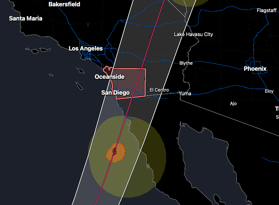
This would be historic on a number of levels.
First of all, the threat prompted the National Hurricane Center to issue a Tropical Storm Watch for San Diego (and San Diego County) — meaning tropical storm force winds (39-74 mph) were possible. It’s only the second time a tropical alert has been issued on the West Coast. (The first was in August 2023 for Hurricane Hilary. The storm didn’t make landfall in California, but its heavy rain caused destructive flooding across Southern California and the Southwest.)
IF Rachel did manage to make landfall in California, it would only be the second confirmed landfall of a tropical system on the West Coast (with an asterisk). A tropical storm came ashore in Long Beach, California in 1939 — also an El Nino winter.
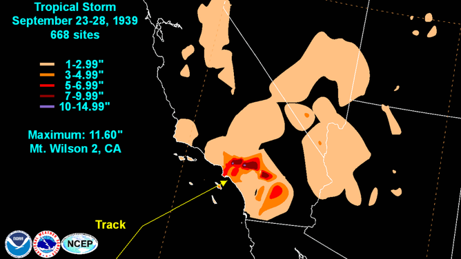
(The asterisk is there are some unofficial records of a storm that hit San Diego in 1858 that could suggest the area was hit by a Category 1 hurricane.)
Right now it seems the majority of scenarios still keep any tropical storm strength winds south of San Diego, but any farther north track in Rachel could bring stronger winds into the city areas. They are also looking at some heavy rains and potential coastal flooding/high surf issues.
WHY ARE TROPICAL SYSTEMS SO RARE IN THE WEST?
San Diego is about the same latitude as Savannah, Georgia. Yet the southeastern Atlantic coast has been peppered with hurricanes for centuries. What gives?
It all has to do with water temperatures. Warm currents feed the coastal Atlantic and keep water temps above 78 degrees in the summer and fall — but water temperatures off California are usually in the low 60s — far too cold for tropical systems….
But not this year. The super El Niño warming combed with a marine warming event already under way has water temperatures in the low 70s off San Diego — some 10 degrees above average.
That’s still too cold for tropical storm development, but it’s warm enough that a mature tropical system with some power and momentum, such as Rachel, can still make it ashore farther north without as much ocean cooling to slow it down — like coming inside out of a hot day and trying to cool off in a room with A/C set at 72 instead of 62.
Once Rachel moves inland, it will bring gusty winds and rain across a swath of the Desert Southwest. And it may not be the only tropical trouble for the Southwest. Hurricane Simon, currently much stronger but much farther south off Mexico, may eventually add a fresh batch of tropical moisture to the Southwest and Plains next week.
No such tropical impacts up here in the Pacific Northwest. If anything, autumn chill is here after Friday morning’s blustery system that will keep highs in the upper 50s to low 60s for a little while — though Seattle may briefly warm into the upper 60s again later next week.