Seattle to ‘chill out’ this weekend as half of autumn weather returns
 Scott Sistek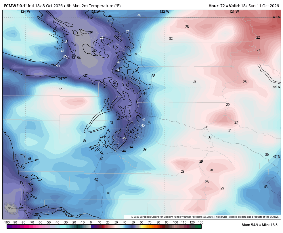
EMCWF predicted low temperatures for Sunday morning.
I have to admit, even as a rain fan who looks forward to the start of the “rainy” season – that was quite the spectacular start to the month of October. Every day so far has had highs in Seattle between 66 and 71 with plenty of sun after some morning fog.
But now? It’s time to get into “real” autumn around here… or at least half of it.
Autumn chill? Check. Autumn rains? Eh…sorta-kinda-not-really
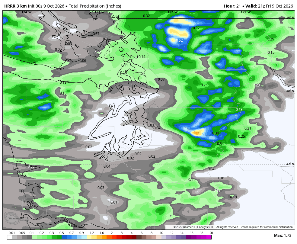
We do have a weak front moving through Thursday night will bring some brief periods of light rain for Friday morning along with some breezy-but-not-too windy wind. It’s the kind of “storm” a Seattleite would nary pay a thought to, like a -20 degree day in Minneapolis or the days the humidity somehow reaches over 100% in Miami.
The showers won’t amount to much in the rain gauge and will taper off by mid-late morning, leaving just a frazzled Puget Sound Convergence Zone in its wake that might leave some stubborn drizzle or light showers in the North Sound that could stick around into the evening.
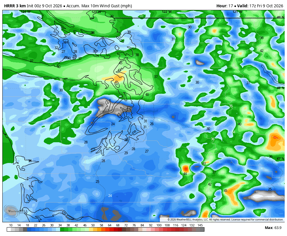
Winds will gust to about 20-30 mph around Seattle, with maybe some stronger westerly gusts in the Strait of Juan de Fuca and the North Sound islands mid-Friday morning as winds chase the front. But on a scale of 1-10 for autumn storms in the Puget Sound area, this rates about a 2.4.
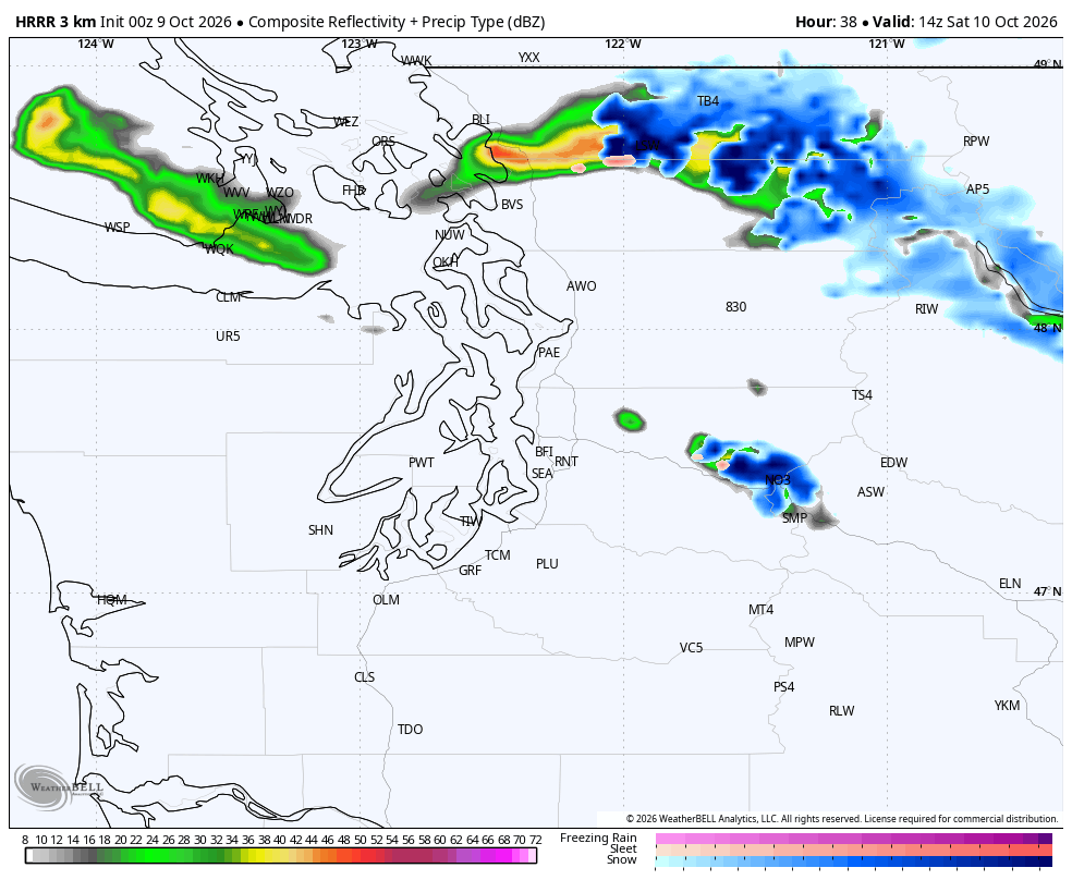
But what you will notice this weekend? While this cold front didn’t put much “front” in the front, it will do decently on its “cold” part. Cooler air will rush in behind the front on Friday, ending our week-plus string of upper 60s. Instead, highs Friday will only reach the low 60s. How “cool” is that? The rain maps even have a few dollops of “blue” on them over the Cascades signaling some mountain snow (very little though, like 1-2” in the higher elevations :/ )
It’ll be even cooler on Saturday as we dry out but suddenly find ourselves with the realization that it is essentially mid-October and even the dry days now struggle to get out of the 50s.
That sets us up for a very chilly Saturday night with lows Sunday morning in the outlying areas getting close to frost levels so planters, take note. (Seattle area not close yet; more like low 40s…)
Sunday and Monday are back to the sun but… where’s the heat? Highs will stay in the upper 50s to low 60s with lows in the upper 30s to mid 40s — now THAT is some legit autumn pumpkin-spicey chill.
Our next chance of light rain is late Tuesday into Wednesday but again, it’s not a very potent system. (Seattle: “What storm?”). About 0.10”-ish for Seattle into early Wednesday morning before drying out again through the end of the week.
SO, WE’RE DONE WITH THE UPPER 60S FOR THE REST OF THE YEAR, RIGHT?
…
Normally, we’d look at a sharp cool down like this and think, well, there went the upper 60s until next spring.
But with Lex Luthor El Niño (one of these names will stick, I’m sure), I feel like autumn still might have some warm tricks up its sleeve. Perhaps as early as the end of next week — the raw European model data this morning painted highs briefly back in the low 70s for Seattle at the end of next week.
All of the long range outlooks that go like 14-21 days out are as orange as a pumpkin for predicting above-average warmth. Let’s just hope El Niño doesn’t end up being skiers’ Kryptonite :/