‘Zombie summer’ returns to Seattle? Warm days return for the end of the week
 Scott Sistek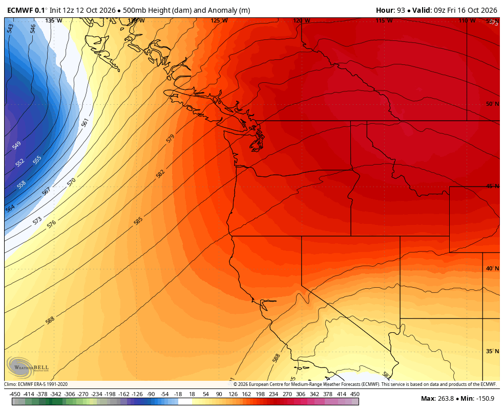
ECMWF model showing a big ridge of high pressure over the West Coast on Friday.
Isn’t summer supposed to be over?
We thought maybe summer was over when we hit 78 on Sept. 9 then had rain…
We thought maybe summer was over when we hit 77 on Sept. 17, then cooled to the 60s the next day…
We thought maybe summer was over when we started October with 8 straight days with sunshine and above average temps of 66 degrees or warmer, only to finally drop into the 50s on October 9?
WE. WERE. WRONG.
Warm weather is back from the dead, making yet another return this week.
It feels like it could be straight from the zombie movies, only instead of bringing back the horrors of undead people with skin care issues, questionable wardrobe choices, language challenges, and a diet not compatible with the survival of modern society, THIS is bringing back the horrors of losing excuses not to take that morning jog, forgetting where you last left your sunglasses, or being stuck inside for that three hour meeting that most definitely, could have been an email.
It doesn’t take a working brain to realize the sun hasn’t been a stranger of late. Through these first 12 days of October, only two have been considered “cloudy” with the rest partly sunny or brighter.
But lately, it’s been feeling like an autumn chill at least. That changes at the end of the week. (Cue the…not scary zombie music!)
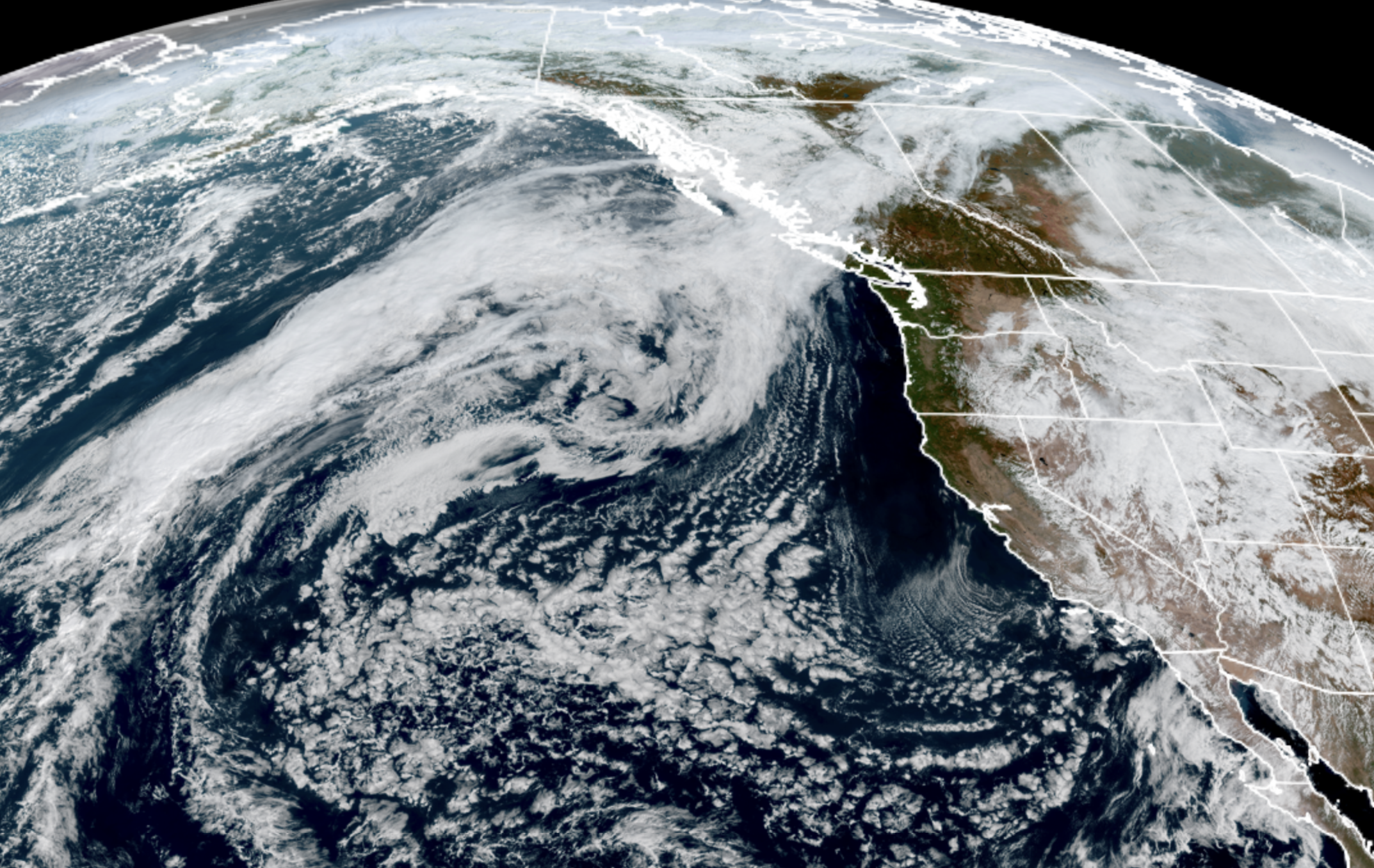
(Anyone else see what looks like a sideways zombie head in the clouds of Oregon?)
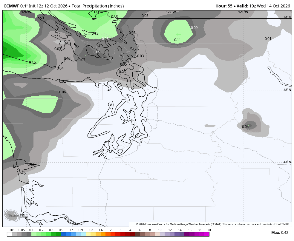
We first have to wade through getting the southern fringe of a storm system heading into central B.C. For the Seattle and Puget Sound area, it’s just going to add a few extra clouds around Tuesday and Wednesday and move us back more toward partly sunny than mostly sunny.
However, the North Coast, Strait and areas from Skagit County north could get a little rain out of this system from late Tuesday into Wednesday. Not a lot but enough to perhaps wet the ground a bit and scatter a few puddles.
Once that system heads out, high pressure comes back in charge and we clear out and warm up into the end of the week.
Thursday will feature sunny skies with highs near 70(!) in Seattle.
THANKS, 2022, FOR RUINING A GOOD HEADLINE
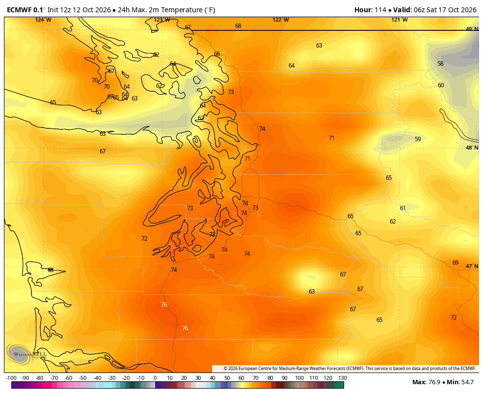
Then Friday, we add in a little offshore wind heating boost and get temperatures in the low-mid 70s around the Puget Sound area.
Had this been any other day around this time of year, we could have used more catchy headlines like “record” heat, or at least “near-record” heat. But this “heat” event picked the wrong date to mess with. The record high for Friday is 88 degrees, when we had that super October heat event in 2022 that destroyed all records for the time frame. (The record highs for October 17-19 are in the low 70s.)
I could see severe levels of office productivity decline as people find any excuses to leave work early and bask in the rare October warmth. It’ll be a fantastic day for Seattle folks to go hiking or camping, be it in the Cascades, Olympics… or the left lane on I-5 😉
OUT: “BRRAAAAIIIINNNNSSS” 🧠
IN: “RRRAAAAAIIIINNSSSS” 🌧️ ?
For those tired of undead summer, the weekend will be your hero. A weak system is expected to move in on Saturday, cooling us off and tossing a few light showers around – doesn’t look like a washout so far, so any outdoor plans still seem OK. But highs will drop back into the low 60s.
The forecast is holding dry for Sunday but wetter weather may loom early next week.
Is summer finally — FINALLY — over?
I’d have to think by then that yes, we’ll have finally vanquished the warm days.
(Anyone else hear that ominous music in the background?…
El Niño: 😈)
MORE TO EXPLORE:
- What is a Kelvin wave? Why Seattle shouldn’t need to worry much about El Niño’s sidekick
- Remembering the great Columbus Day Windstorm of 1962
- First autumn in Seattle? Here’s a weather calendar for what to expect…