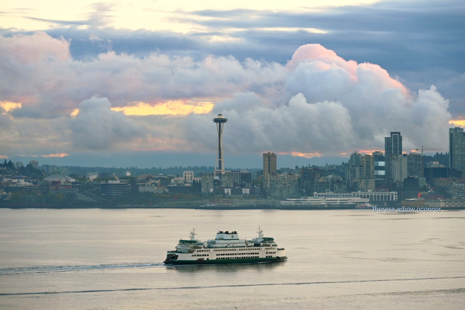
Autumn morning in Seattle. (Photo: Theresa Arbow-O'Connor)
We’ve already ditched the 70s; now it’s time to take another step into the heart of autumn as the weather gets at least a little more active in the coming days.
The headliner is the cool and showery pattern coming up this weekend that could bring the first snow to the higher mountain passes(!)
Until then, it’s cool but relatively tame. A weak area of low pressure offshore will toss a few scattered showers our way Thursday and Friday.
On Friday, the air mass is just unstable enough in the South Sound that there is a minor risk of thunderstorms. In fact, NOAA’s Storm Prediction Center’s thunderstorm risk map has sliced the Puget Sound region, putting Seattle and Bellevue outside the general risk but Tacoma and Olympia inside. (Those of you in Kent and Des Moines, there’s probably some street there where you’re in the risk and your neighbor’s aren’t, or vice versa. Feel free to use that to brag about future property values…)
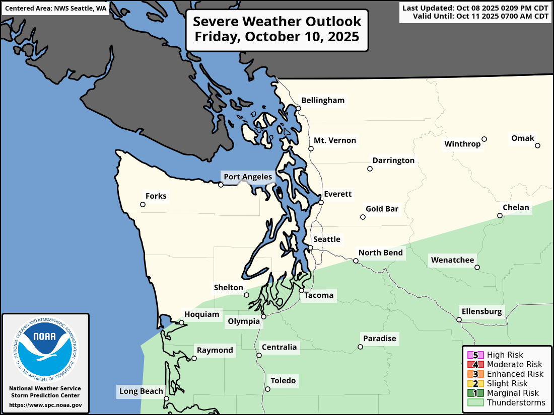
(As a quick aside: this NOAA map is titled “Severe Weather Outlook” but NOAA also uses a light-green shade just to highlight areas of non-severe thunderstorm chances and that’s the deal here. No severe weather.)
But an even cooler air mass (literally…but for snow fans, figuratively too) arrives over the weekend. For much of the region, it’s just ushering in a stretch of showers and sunbreaks where if you don’t like the weather, just wait 10 minutes. No biggie. The most noticeable “impact” will be highs only in the mid 50s and lows in the low 40s in the city, maybe frosty in the outlying areas.
However, snow levels will gradually fall from 6,000 feet early Saturday to around 4,000 feet on Sunday and Monday. That’s not low enough for Snoqualmie Pass to worry about snow — just occasional rain there; no travel worries. But Stevens Pass will be on the edge — especially at night.
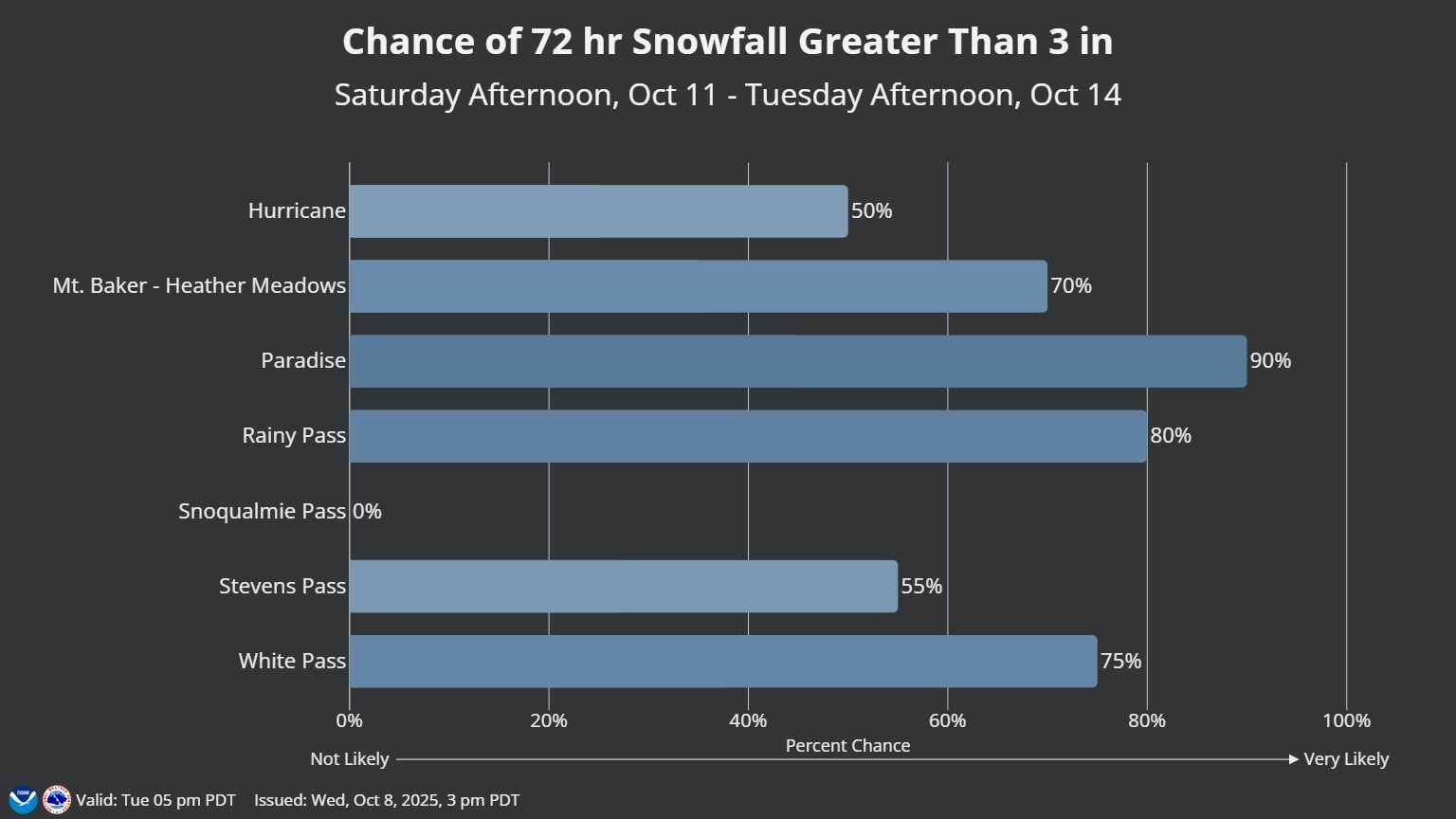
The National Weather Service has given a 55% chance Stevens Pass will see 3” of snow or so over the 72 hours period from Sunday through Tuesday. (75% chance at White Pass!… and 0% at Snoqualmie Pass…)
It’s mostly noteworthy just for being the first than for being a lot. In other words, if this had been a forecast for December 11-12, it would be a disappointing forecast…
But for October 11-12, it’s WOO-HOO!*
(*-For snow fans…)
Though it wasn’t too long ago — just back in 2019 — that we had a significant snow up at Stevens Pass on Oct. 9. Check out this throwback video from my friends at Washington Weather Chasers:
The long range forecast stabilizes for later next week looking relatively calm, but now 50s/40’s starting to become the norm.