There’s (sun)light at the end of this smoky tunnel for Seattle and Western Washington
 Scott Sistek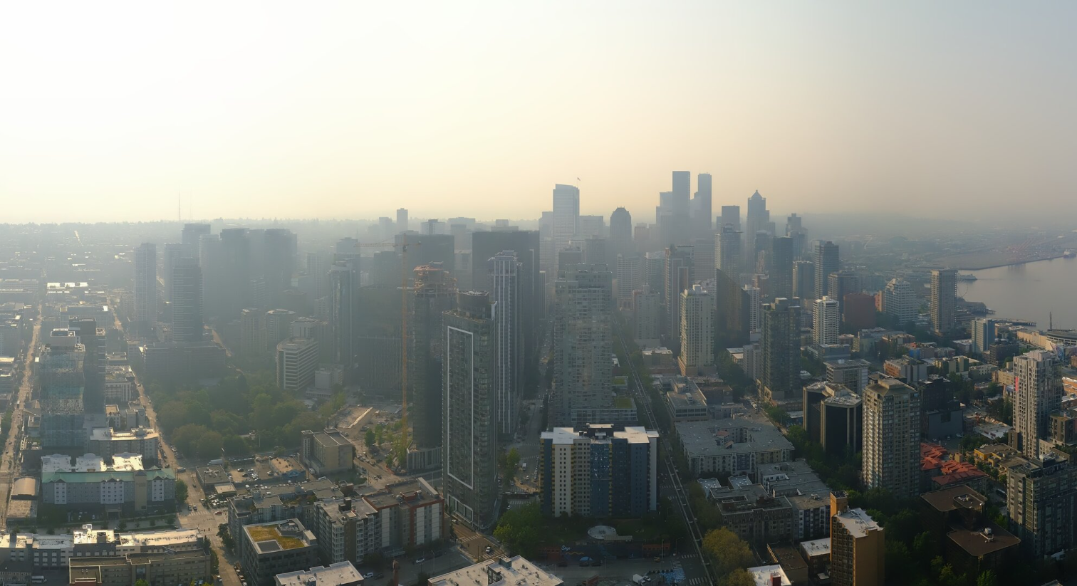
Smoky Seattle Skyline on Aug. 5, 2026 (Photo: Space Needle Web Camera)
Smoke continues to fill the skies across much of the Pacific Northwest on Wednesday. But if you can make it through this one more evening and night, a shift in the weather pattern shift will soon result in a shift of the winds that will bring a literal breath of fresh air.
As mentioned in my last post, we did get the benefit of a localized sea breeze that has helped the air become a bit cleaner right along the Puget Sound shores. From roughly I-5 west to the water, air quality has held in the yellow/moderate category for much of the day (a little bit of orange in southern Snohomish County).
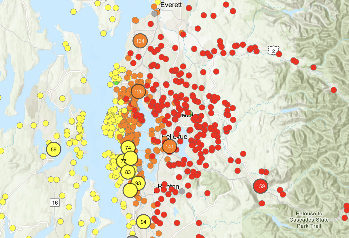
Unfortunately, those breezes did not make it very far inland, and there is a sharp gradient to the east of worsening air quality. For example, at mid-afternoon Wednesday in Seattle, the air quality reading was 65 in Ballard but 135 in Sand Point. Zooming out farther, the air quality map for the Eastside and areas east of I-5 looks more like a chicken pox outbreak with red dots (signaling unhealthy air quality) all over the place.
MORE: Current Air Quality Map for Western Washington
The short term forecast shows that smoke to the east will likely encroach west again and I expect one more evening and early night of worsening air quality in the I-5 corridor — probably into the orange “unhealthy for sensitive groups” and maybe some reds on the eastern sides of Seattle.
OCEAN BREEZE — TO THE RESCUE!?
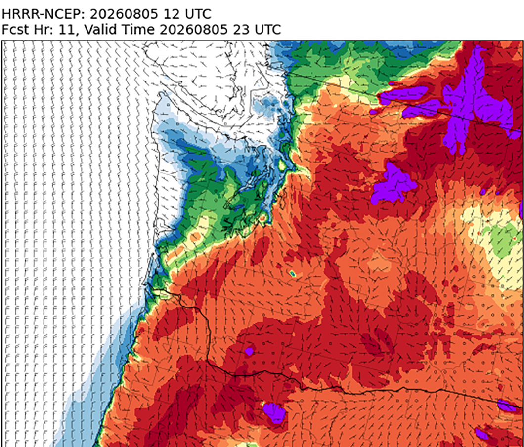
Yes! This should be our last evening for a while of such poor air quality, as it appears we’ll get a weak marine push overnight. Under normal circumstances, this would only amount to maybe a few degrees’ cooling but most importantly for this event, it’ll bring in a weak ocean breeze.
MORE: How to read wildfire smoke forecast charts
It won’t cool us off much, but it should at least shove the smoke that’s currently over the I-5/I-405 corridor in the Puget Sound region and points north off to the east after midnight. This likely won’t be much help for communities right along the Cascade foothills, where it looks like another night stuck in the gunk. But those of us to the west should see some improvement.
HOW’S THE SMOKE FOR THURSDAY?
Thursday should be noticeably better. Not perfect — still some lingering haze around aloft and south of Puget Sound area looks to still have a little bit of stubborn ground smoke. But the air quality map shouldn’t look like another chicken pox outbreak Thursday.
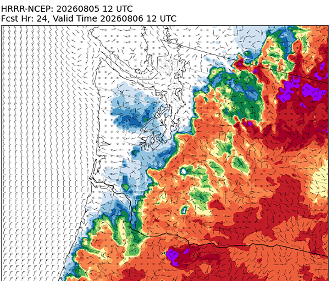
(Unfortunately, the Wednesday night marine breeze isn’t strong enough to make it into Central or Eastern Washington yet so expect another night and Thursday in the thick smoke.)
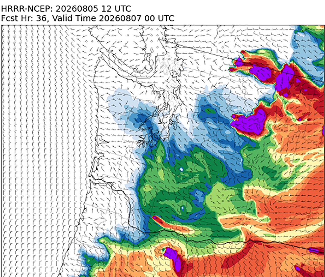
Temperatures will be about the same as Wednesday — mid 80s in Seattle. It’s a bit of a trade with the slight cooling from the winds but thinner smoke allowing more sun to come through.
DONE WITH SMOKE BY FRIDAY?
It looks like for the time being for most of us. A slightly stronger marine push is forecast for Thursday night that should scour out Western Washington and get us back to clear skies, if the winds hold according to current plan. (If weaker than forecast then smoke may linger a bit more.)
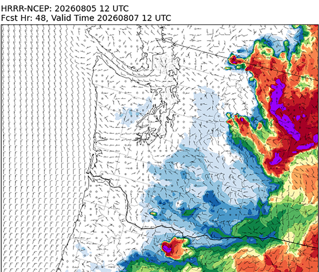
For Central and Eastern Washington, under the current plan, the west winds will reach over there on Friday, pushing the smoke piled up against the Cascade foothills away to the east, and temporarily ending the smoke nightmare that has left places like Wenatchee, Leavenworth, Chelan and Entiat, to name a few, with just ridiculously terrible air quality. (A gauge in Leavenworth showed an AQI over 1,000 again Wednesday. Anything over 300 is considered hazardous.)
MORE: Smoke Outlook for Central Washington
However, it’s not all blue skies and green dots. This pattern will then bring communities that are east of currently burning fires under the influence of their smoke and of course, could start pushing the fire to the east again. For example, Chelan is east of the Little Giant Fire and will likely be stuck with that fire blowing smoke into their area. It should be better than it is now, but not perfect.
WAIT, WEST WIND… DIDN’T THAT CAUSE TROUBLE LAST TIME?
Yes. Unfortunately, as I mentioned in the TL;DR section above, Eastern Washington is stuck with a devil’s bargain.
The west winds should clear out the smoke to the east, but also recreate some of the same critical fire conditions that plagued that part of the state last weekend.
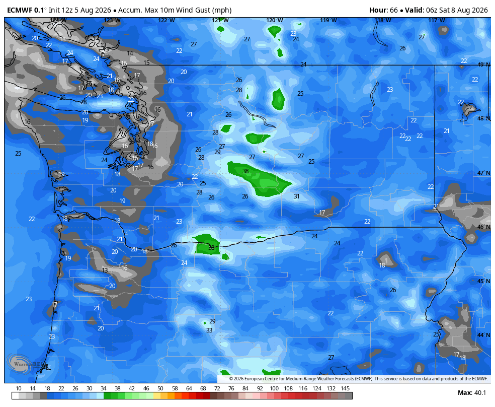
The forecast so far is calling for gusty winds Friday and Saturday of 15-25 mph with gusts to 35 mph, and still very dry relative humidity in the 15-25% range. For wind, this is a notch below last Saturday, which made for historically bad fire conditions.
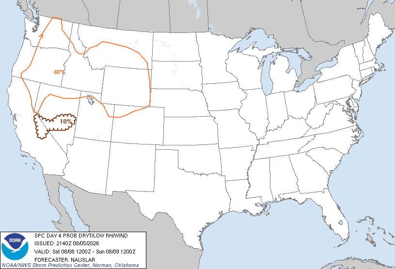
But still, it’s not good, and again firefighters will have to deal with conditions leading to easy fire starts and potential rapid to explosive spread. Plus, it’ll anger the current fires burning, making them want to start spreading east again.
MORE: Latest information on Washington wildfires (InciWeb)
The air in general will be cleaner (save for being directly downwind of current fires) but the winds may create more fires in their wake.
WHAT’S THE CURRENT LONG-RANGE SMOKE OUTLOOK?
For Western Washington, it’s looking pretty good that we’ll remain in the clear at least for a while – through the weekend for sure; likely into at least the middle of next week as we hold onto at least some form of westerly wind.
The Cascades should clear out except for where fires are now so if you’re itching for a hike or a climb; this should be a good weekend (again, away from current fires.)
Eastern Washington’s winds should abate Saturday and go back to relatively calm and hot with smoke hanging mostly close to current fire.
There still remain some inklings that Western Washington could warm up again later next week, and if so, we may see the return of the smoke.
The forecast remains low confidence as the consistency is low — a few days ago it was looking like rain late next week and that seems off the board now. But just feels like this may not be our last smoke rodeo…
MORE TO EXPLORE:
- Here is how to find and read wildfire smoke forecast models for Seattle and the U.S.
- What does the “Particularly Dangerous Situation” Fire Weather Warning mean for Eastern Washington?
- Seattle nearly had its hottest rainy day on record