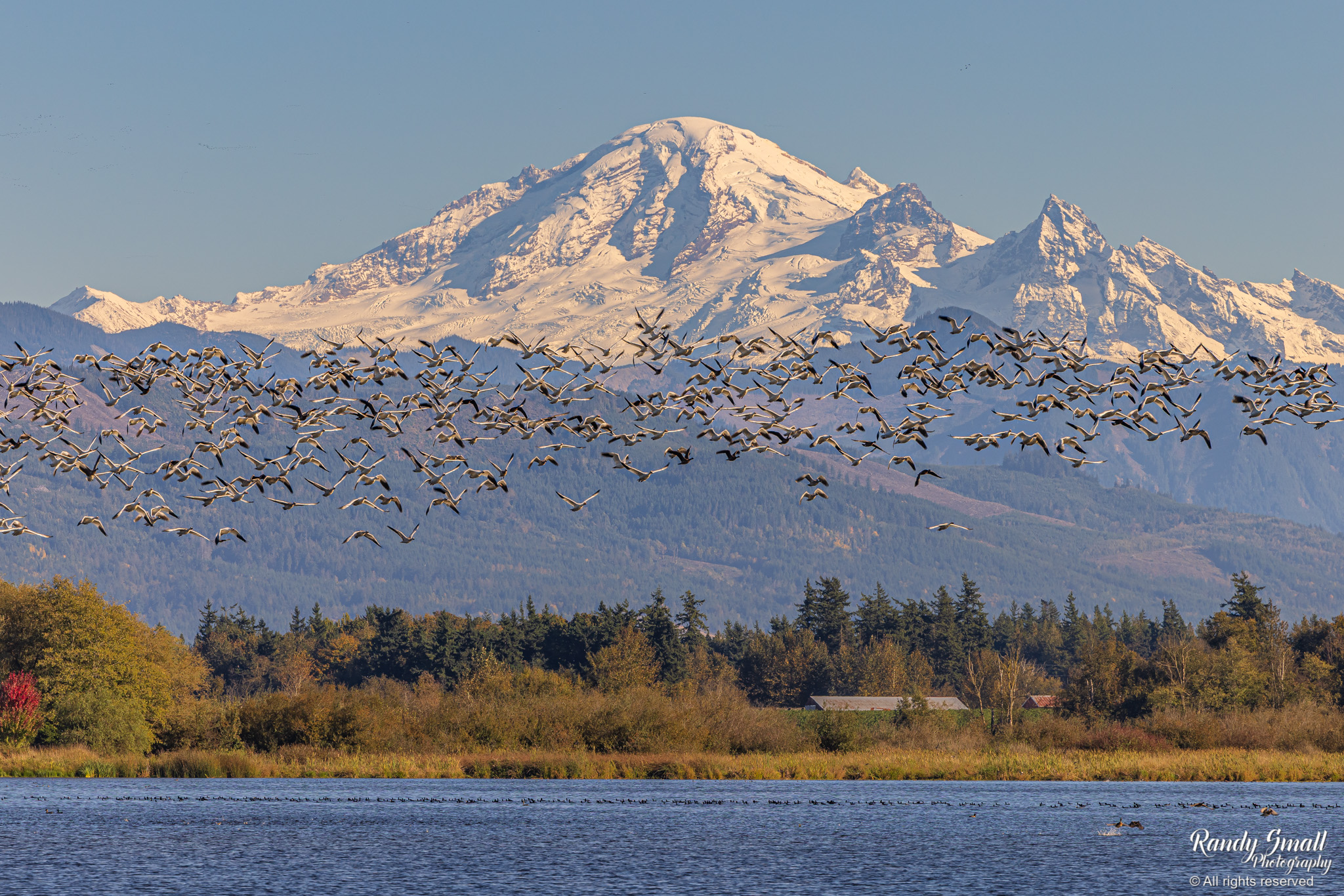
Snow geese in front of Mt. Baker as seen from Lynden, Wash. on Oct. 14, 2025. (Photo: Randy Small Photography)
Sun fans, the clock is ticking. If Monday and Tuesday’s blue-filled skies are your jam, this is your official notice to get out there and absorb as much of Wednesday as you can as it may be a bit before you get such another crystal clear day.
High pressure will linger through Wednesday for another sunny and even slightly warmer day. Walk the dogs. Hit the beach. Finish those outdoor Halloween decorations. Drive with the windows down. OK, so the high is only 62 — maybe just the window a little down. Enjoy every last fleeting second, which feels literal because daylight is leaking fast.
OMG — WHAT HAPPENS THURSDAY?
OK, so.. not much yet. A very weak system will swing through later Thursday evening that won’t do much more than bring a few clouds and cool it off a little. Any rain that falls will be light and spotty.
But think of that weather system like those pilot cars that drive out ahead of the massive oversized trucks on the road with the flashing lights and the “WIDE LOAD” sign clearing the way and warning you what’s coming soon behind.
OMG — WHAT HAPPENS SATURDAY?
In this case, the “WIDE LOAD” is the storm coming in this weekend. It’s not a major storm, but it’ll be a noticeable punch. It actually qualifies as a brief Level 3 out of 5 atmospheric river. Snow levels will jump up to 8,000 feet or higher Saturday and moderate to heavy rains will fall.
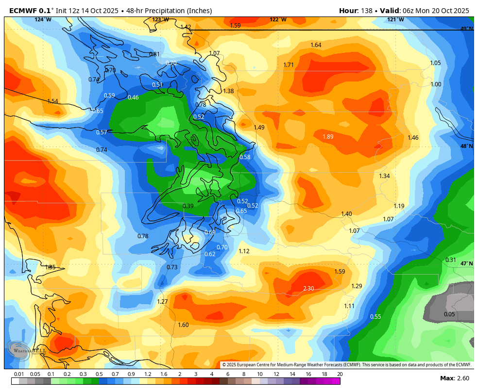
We’re still awaiting better agreement in the long range models of how much rain to expect, but it could be enough to kick off the Skokomish River’s annual barrage of Flood Warnings. Maybe a few other of our more vulnerable rivers too.
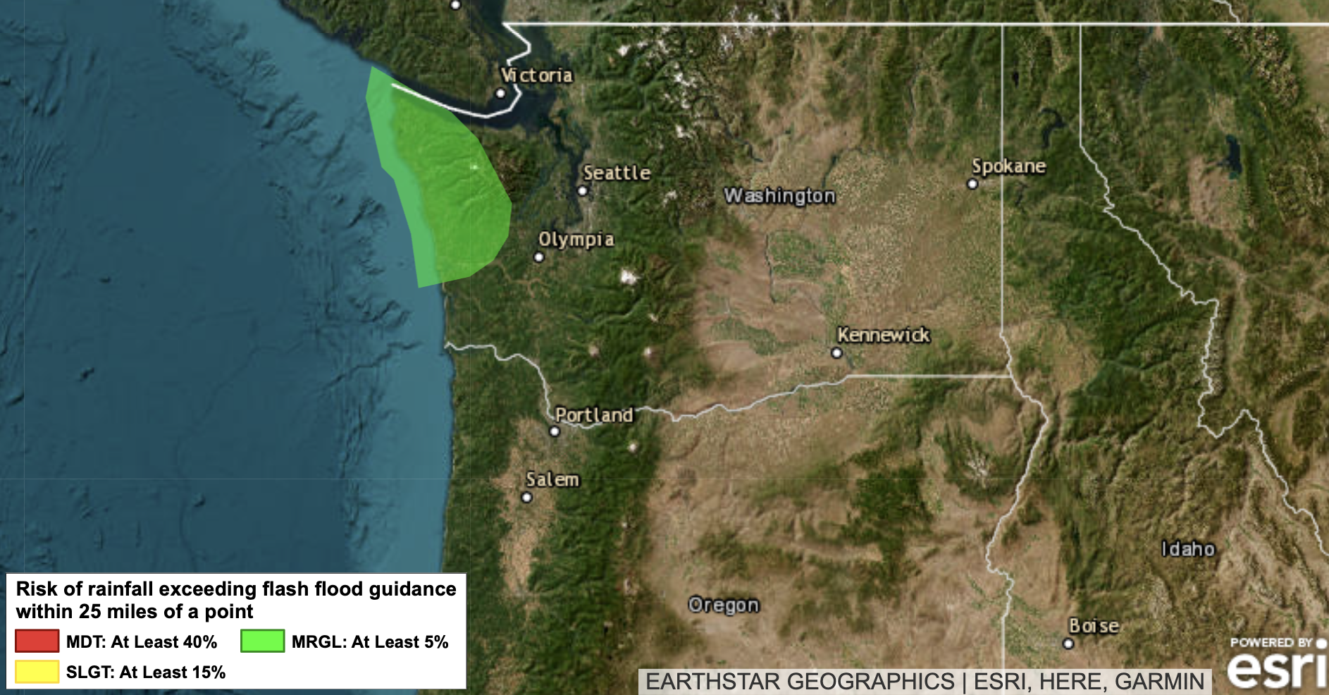
NOAA’s Weather Prediction Center does already paint a large swath of the Olympic Peninsula under a light risk of excessive rain for Saturday.
For Seattle and the lowlands, it’s just a wet weekend on tap; maybe a little blustery too. Oh, go back to my Wednesday to do list and add in “take pictures of the autumn leaves” because there will be quite a few less leaves on trees by early next week.
That storm moves outta here Sunday, leaving us cooler and showery with snow levels dropping back to the higher pass levels.
But this storm is looking like THE ONE that, you know, starts the parade that strikes up the band in late October and then… well, November in Seattle, bay-bee….
OMG — WHAT HAPPENS NEXT WEEK?
Here comes the rainy pattern. There is nothing overly concerning so far, but there will likely be a chance of rain each day for a while, interrupted at times with solid rainy and windy days.
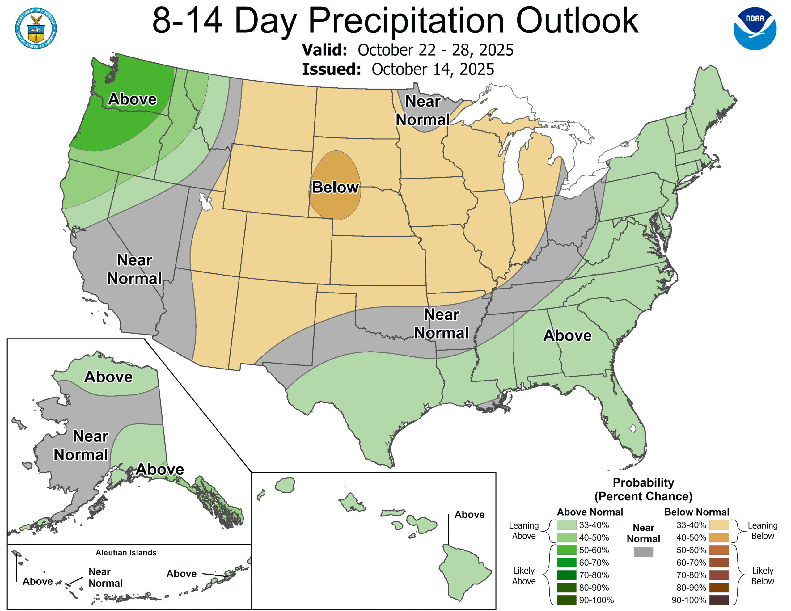
The 8-14 day outlook from NOAA is a pretty dark shade of green over us indicating high confidence of wetter than average conditions. And that’s wetter than LATE OCTOBER average.
So sun fans, yeah, get out there Wednesday. You’ll still see the sun at times after, but it’ll have to share.