Days Since Last Severe Thunderstorm Watch
Heads up Mickey and Minnie: The weather is very un-Southern California-like this morning!
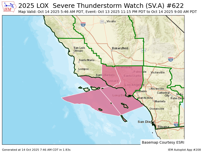
Parts of the Los Angeles area were under an extremely rare Severe Thunderstorm Watch Monday night into Tuesday morning.
Our little storm that blew through the Seattle area over the weekend with our first mountain snow and batch of chilly Fraser Wind strengthened a bit as it moved south down the Pacific Coast, and it brought quite a bit of active weather to SoCal.
The Severe Thunderstorm Watch means thunderstorms that were roaming the area could bring damaging wind gusts to 70 mph and even a few brief tornadoes! The watch expired at 11 a.m. Tuesday morning.
Watches like this are issued by NOAA NWS Storm Prediction Center in Oklahoma and while common in the Plains, are very rare along the West Coast. In fact, this was Southern California’s first such watch for Los Angeles since Jan. 27, 2008 — over 17 years!

Los Angeles had been in a 3-way tie for third-longest stretch in U.S. since their last Severe T-Storm Watch with San Francisco and Bakersfield, but now like the opening credits in the Simpsons, the “Days since” counter resets to 0. (Reno leads the way at just under 20 years, Sacramento is 10 days later.)
(I should also point out while Downtown Los Angeles and Los Angeles County was in the watch, Orange County – home to Disneyland – was not. Still, Mickey and Minnie had storms running around for their morning pre-park open breakfast.)
If this sounds a little familiar though, the Seattle area had its own rare and first Severe Thunderstorm Watch in several years this spring when we had that big batch of thunderstorms and worry about large hail. (Thankfully that storm didn’t pan out as bad.) Seattle and Portland’s counter currently stands at 200 days.
The weather will be slowly calming later in the day.