‘Spring’ break? Swirling low will bring cooling rains to Seattle Tuesday
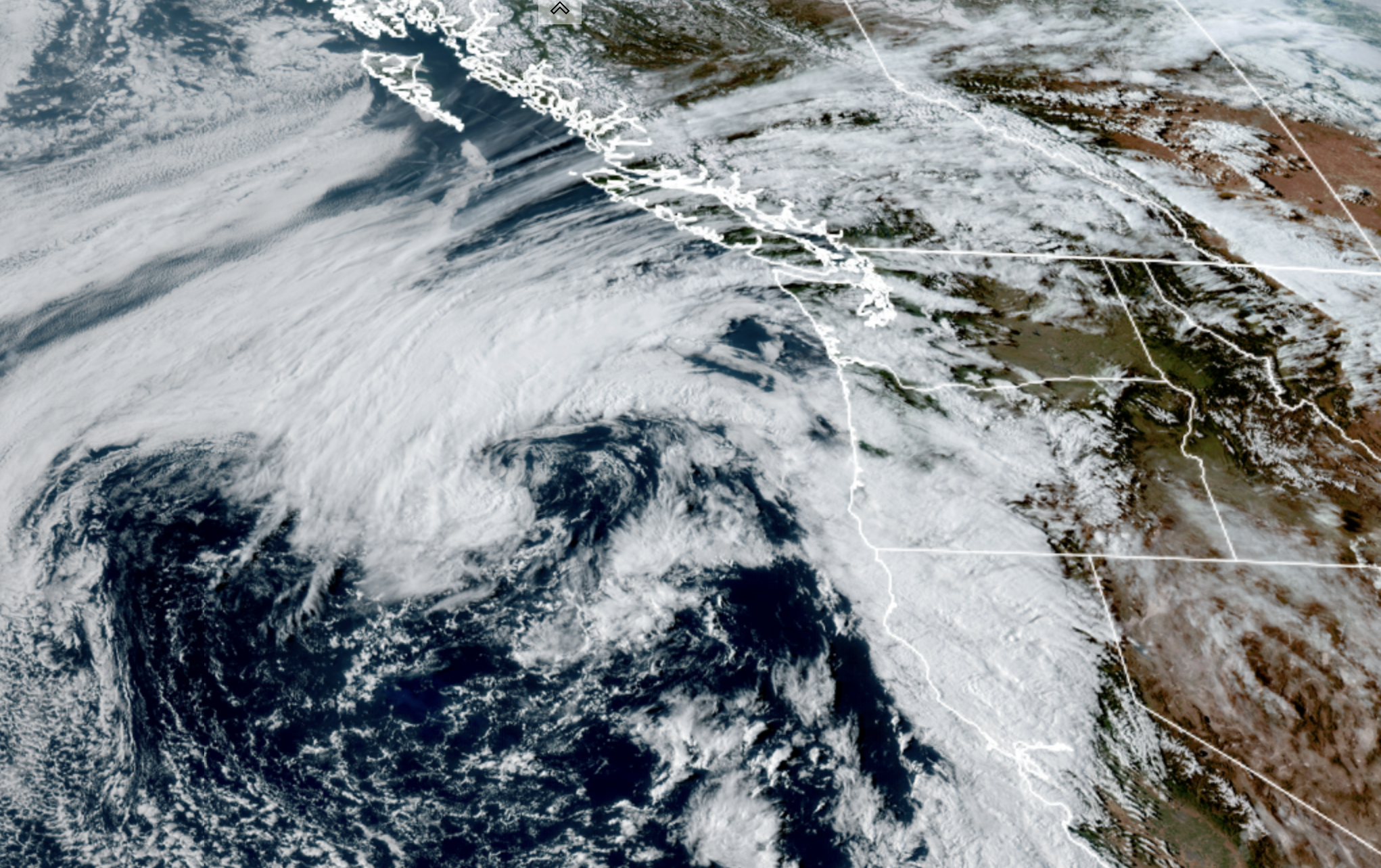
GOES-18 Satellite image for April 20 showing a broad low pressure center off the northern California coast. (NOAA / CIRA / RAAM-B)
Spring time is that odd transition between the end of our stormy season and the upcoming dry season — you know, the other 3 months when they say it “rain 9 months of the year in Seattle.”
In that sense, Tuesday’s weather may be a little ‘odd’ in that the rain showers that will be moving through will becoming from a somewhat unusual direction…. then hit the brakes and start moving the other way.
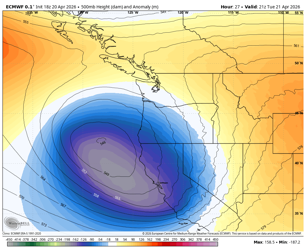
After two days in the 70s in Seattle (74 on Sunday!) a broad area of low pressure swirling just off the Pacific Coast will finally push inland on Tuesday.
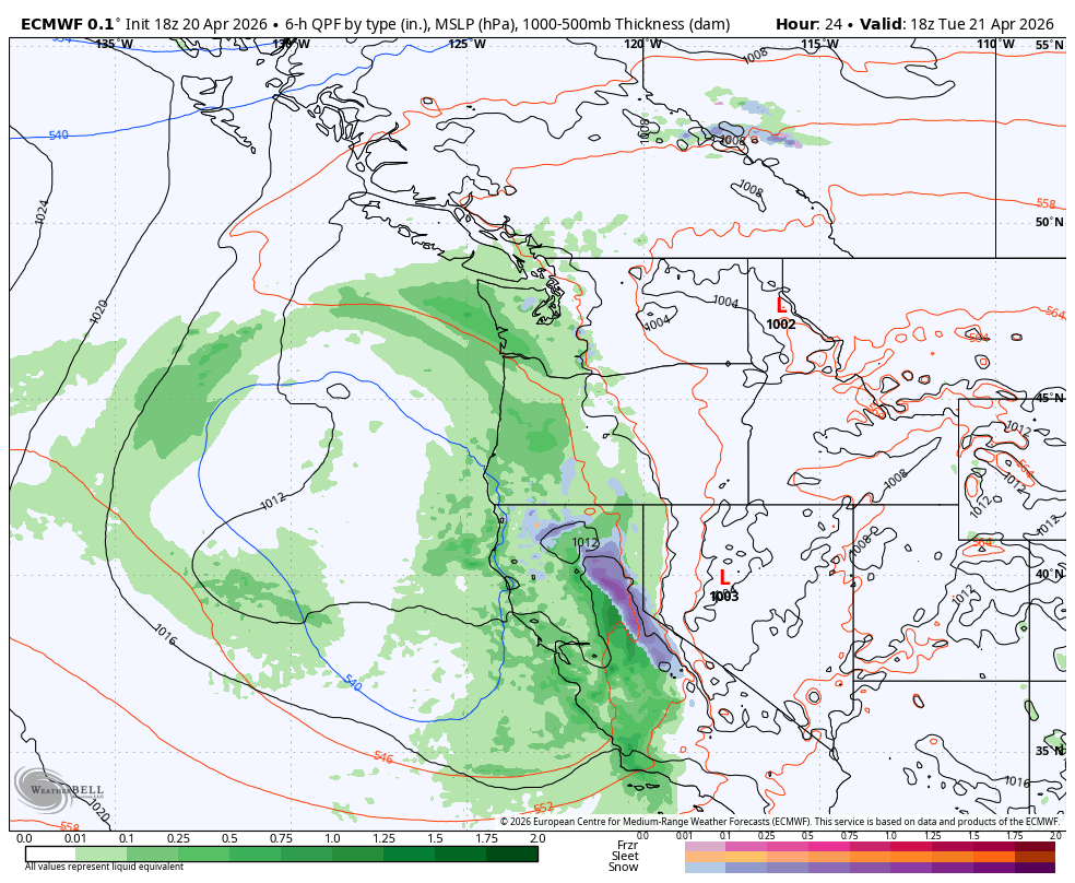
What passes for the ragged center of the low is aiming for landfall around the Oregon/California border (though it’s not very strong, so we’re not worried about any wind or stuff like that…) but it will do a good job “spinning” some rain at times around at us from the south as it moves inland.
Thus expect rain showers moving up from the south/southeast Tuesday instead of the usual approach from the west/southwest, at least at first.
DOES THIS MEAN ANYTHING SIGNIFICANT?
No, not really. You get wet either way. But otherwise the weather’s pretty mundane so.. it’s something to note.
Also, since the atmosphere will be a little unstable, the showers could have a decent burst of rain intensity. I wouldn’t call it heavy rain, but “moderate” might work, and more than a typical shrug-off Seattle shower.
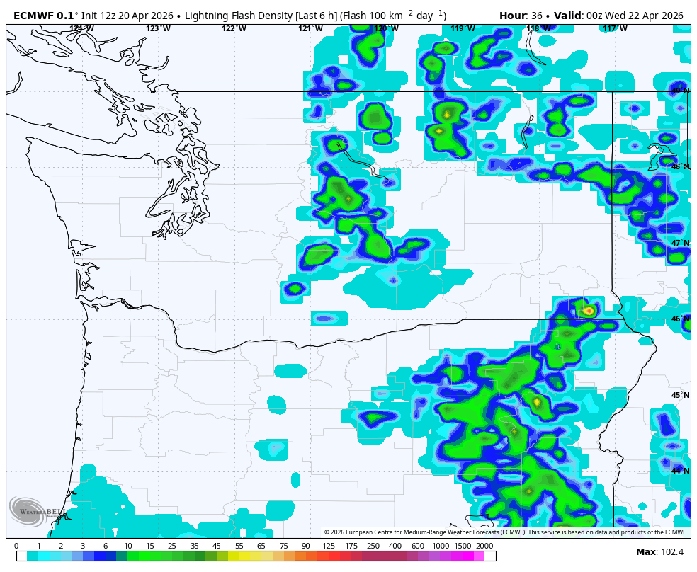
ANY LIGHTNING WE NEED TO WORRY ABOUT?
Normally this kind of weather pattern with rain from the south could bring thunderstorms into Western Washington, but so far the models are unimpressed with the atmospheric dynamics, especially on the west side of the Cascades. It’s probably going to be too cloudy to allow the sun’s heating to add juice to any budding storms.
A few thunderstorms could pop up in the Cascades and over in Eastern Washington, but Seattle and Western Washington look to be in the clear. Just rainy periods, that may be a decent drenching at times, and coming from the south/southeast.
The showers will continue overnight Tuesday but as the low center starts to pull away inland to the east, the showers will reverse course and start to come back at us from the west, following the low inland. Again, not really significant as far as any impacts go, just may look a little unusual on the radar.
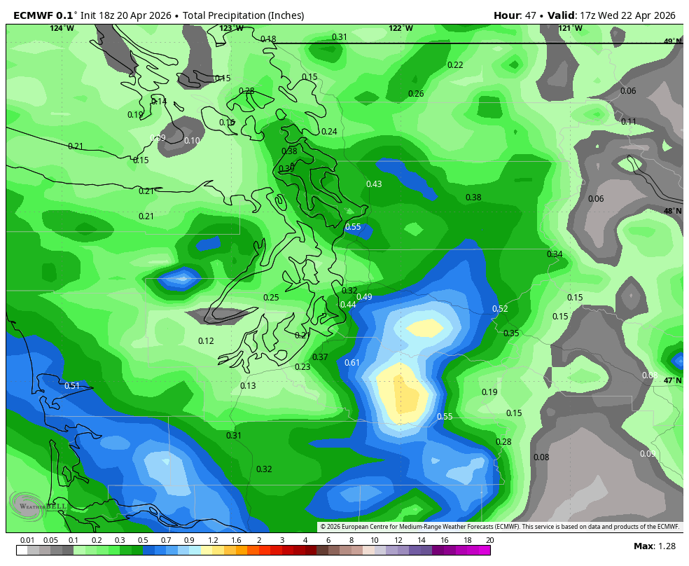
High resolution models are indicating perhaps a few hours of steady rains lingering into Wednesday morning from about Seattle-Bellevue and points south, but those should end by midday as the low moves father inland and drags the showers away with it.
Pleasant weather returns from the rest of Wednesday into the rest of the week and even through the weekend with plenty of sunshine and highs in the upper 60s to low 70s. Looks like I’ll have to hunt around for more oddball weather to write about 🙂