Seattle to get soaked this weekend, then it’s summer’s weekly ‘going out of business’ sale
 Scott Sistek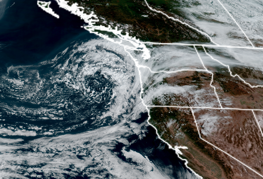
GOES-18 satellite image of large area of low pressure heading into the Pacific Northwest on Sept. 12, 2026. (NOAA/ CIRA/ RAAM-B)
September is usually the time when there’s a tug of war between summer’s last, desperate grasps and autumn’s impending takeover.
Well, there’s going to be a BIG TIME tussle this week! As we’re about to go from steady, pouring November-type rains to a flashback to summer heat(ish) just a few days later.
(What is this, Denver?)
Summer snuck in a few days in the upper 70s earlier this week but autumn is giving it a good shove.
FIRST UP: YEP, MORE RAIN ON A SEATTLE WEEKEND…
A strong area of low pressure is moving in offshore from the north Saturday morning, and then will spend Saturday into the first part of Sunday swirling across northern Oregon and Eastern Washington, spinning batches of rain into Western Washington as it does so.
But these aren’t just like light showers. Models indicate this low has tapped into some serious amounts of moisture and is expected to actually spin quite a bit of rain into much of Western Washington from the south and east.
It’s going to come in two phases, though.
Much of Saturday will actually be dry — just cloudy, as the low still has to work its way inland. But come about Saturday late afternoon or early evening, here comes the first phase, as some initial showers will start moving in from the south/southeast, mainly south of Seattle through 5 p.m. then reaching Tacoma-ish around 6 or 7 p.m and into Seattle around 7-8 p.m.
These initial bands of rain could tap into some atmospheric instability and add in a few thunderstorms roaming around as well. So if you’ve got outdoor plans Saturday evening into early Saturday night, be aware of lightning — especially from about Snohomish County and to the south (and *especially* south of Seattle and toward the Cascades and Olympics.)
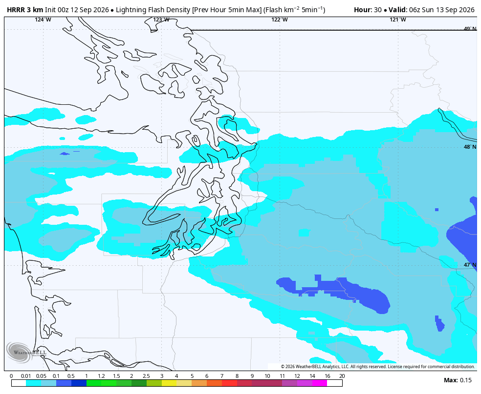
But the fragmented showers will eventually morph into the second phase from late Saturday evening overnight into Sunday morning: Just one really, really big blob of rain.
This will turn into more “stratiform” rain, as in like the kind we get on October/November days where it’s just really wet everywhere. But this should end the thunderstorm chances.
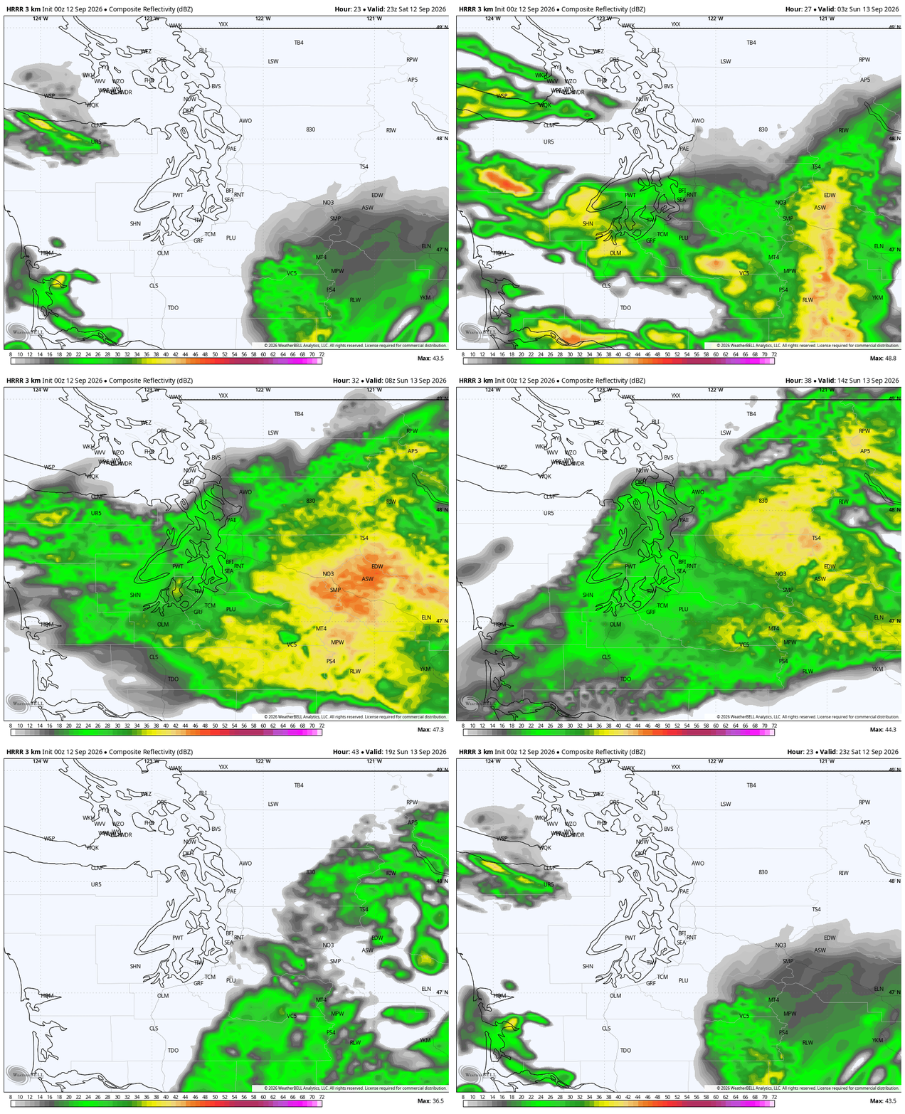
Instead, just those steady, gentle rains that you want to have your window open and just listen to all night. And all night it may go. The rapid hourly update model shows about 10-12 hours of steady rain over the Seattle and Puget Sound area core with a half inch of rain, easy and maybe even a full inch of rain toward the Cascades.
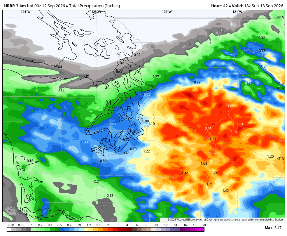
(NOTE: So sorry, Whatcom and maybe even Skagit County. While you were the “rain winners” last rainy go-around, this time you may be too far north to get any of this rain.)
The rains should taper off from west to east Sunday morning and should be dry west of the Cascades by late morning.
(Even better news: This low will bring a decent soaking to Eastern Washington too! Central Washington may get 0.50-1.50” or more toward the foothills as you get reverse upslope rain from the east-to-west push of rain. Isn’t it nice to have east winds bring rain instead of smoke and heat?)
SUMMER: I’MMMMMMM BAAAACK, BAAAYYYBEEEEEEE!!!
The rain will taper off from west to east as Sunday progresses — late morning in Western Washington, later for Eastern Washington.
We’ll dry out to start next week, but still stay on the cool side as strong onshore flow remains and we’ll end up with a Monday and Tuesday not too different from this past Thursday and Friday: Morning clouds then highs around 70.
After that… you ever get those emails where some merchant is like:
<ding*>COME SAVE AT OUR BIGGEST SALE OF THE YEAR!
(*-I say “ding” for email sound; mine is more like a “Bing-bong”, but that’s harder to type and the first time, it autocorrected to “big bong”, so for this exercise, I’ll stick with “ding”…)
And your email over the days are like:
<ding>”OUR BIGGEST SALE ONLY HAS THREE DAYS LEFT!”
<ding>”JUST TWO DAYS LEFT TO SAVE LIKE NEVER BEFORE!”
<ding>”THIS IS IT!!!!! TODAY IS YOUR LAST DAY TO SAVE!”
<ding>”YOU HAVE JUST 6 HOURS LEFT! PRICES WILL NEVER BE SO LOW!”
<ding>”WE MEAN IT, JUST ONE HOUR LEFT AND WE SWEAR IT’LL NEVER BE BACK!”
<ding>”JUST 10 MINUTES LEFT YOU WILL BE SO SORRY YOU MISSED OUT!”
…
…
…
<ding>”OUR AMAZING SALE…HAS BEEN EXTENDED FOR ONE WEEK ONLY!”
Well, that’s what summer is doing. After advertising for days to get out and enjoy last Wednesday’s upper 70s as it Might! Be! It!
Lo and behold, it’s back!
High pressure will rebuild into the area in the middle of the week, bringing sunnier skies and warmer temperatures with high back into the upper 70s around Seattle – dare we think about an 80? Probably not in Seattle, but some of the warmer spots might get there.
The long range models are still a bit undecided if Seattle stays in the upper 70s for a few days or cools back into the lower 70s, but either way, a pretty nice stretch of September weather for summer sun fans to cling to. This time it might even survive to the weekend.
Difficult to tell if it would stay much beyond then, so if I were you and summer is your jam, I’d act now while supplies last 😉
MORE TO EXPLORE:
- Hurricane Lowell brought Hawai‘i’s first ever Tornado Watch
- Strong thunderstorms bring rare ‘shelf clouds’ to Seattle area
- What are some scenarios a historic ‘Super El Nino’ could present for the Pacific Northwest and California?