A brief break before soggy weather returns next week but there’s hope for skiers
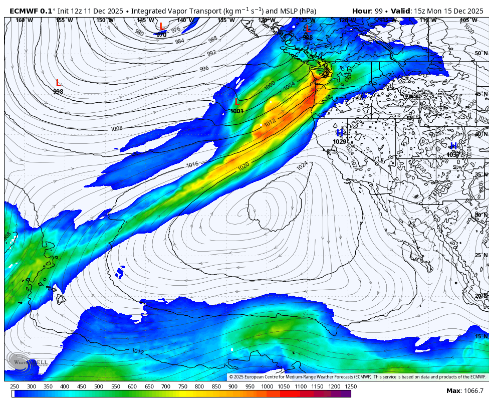
Moisture plume returns to Pac NW for Monday
A well-deserved break is in order from the heavy rains, but the long range forecasts suggest we’re not out of the woods just yet.
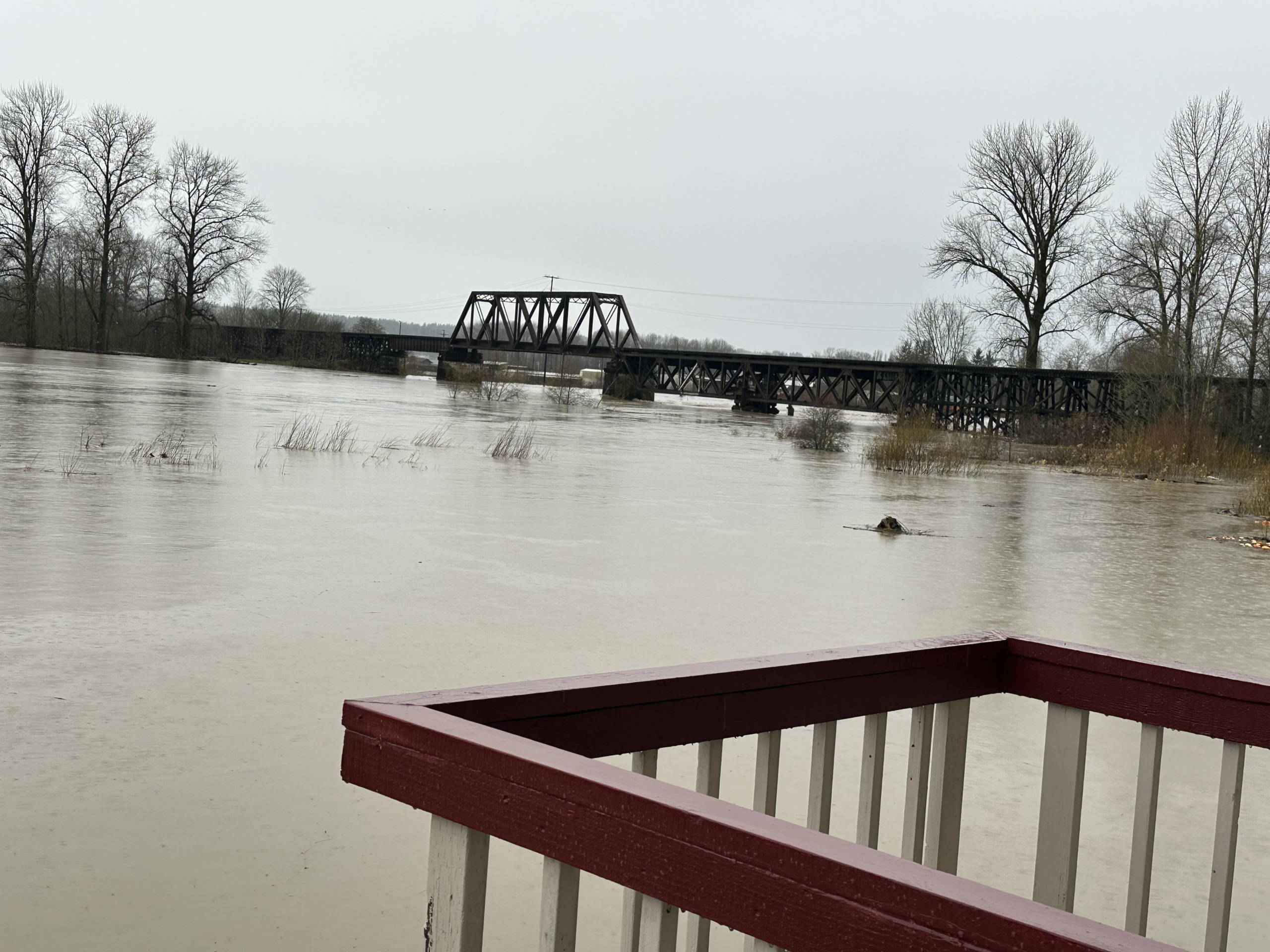
High pressure… ish… is set to briefly build in on Friday and Saturday. There may still be some lingering showers on Friday but Saturday is looking mostly dry. It’ll be a big help to allow rivers to recede and the region to at least start to wring out a little bit.
However, the storm train isn’t so much as “goodbye” as “see you later” and that “later” is next week.
A weak cold front will swing through on Sunday but this is more the typical Seattle light, steady rains we’re used too and while at this point any rain isn’t good for adding to saturated soils, at least this round won’t be a lot of rain.
However, the next storm coming in sometime around Monday and/or Tuesday is looking wet and warm again and dare we say, another atmospheric river. This one won’t be as strong or last as long as this last one, but the area is more vulnerable now so we have to start watching our rivers again.
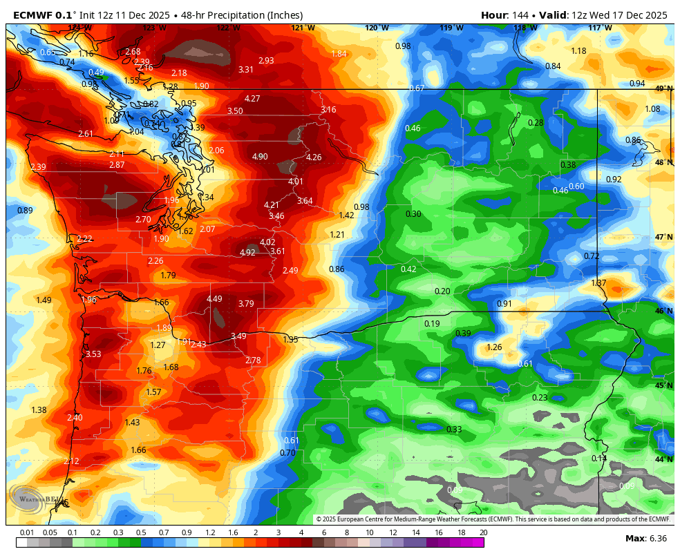
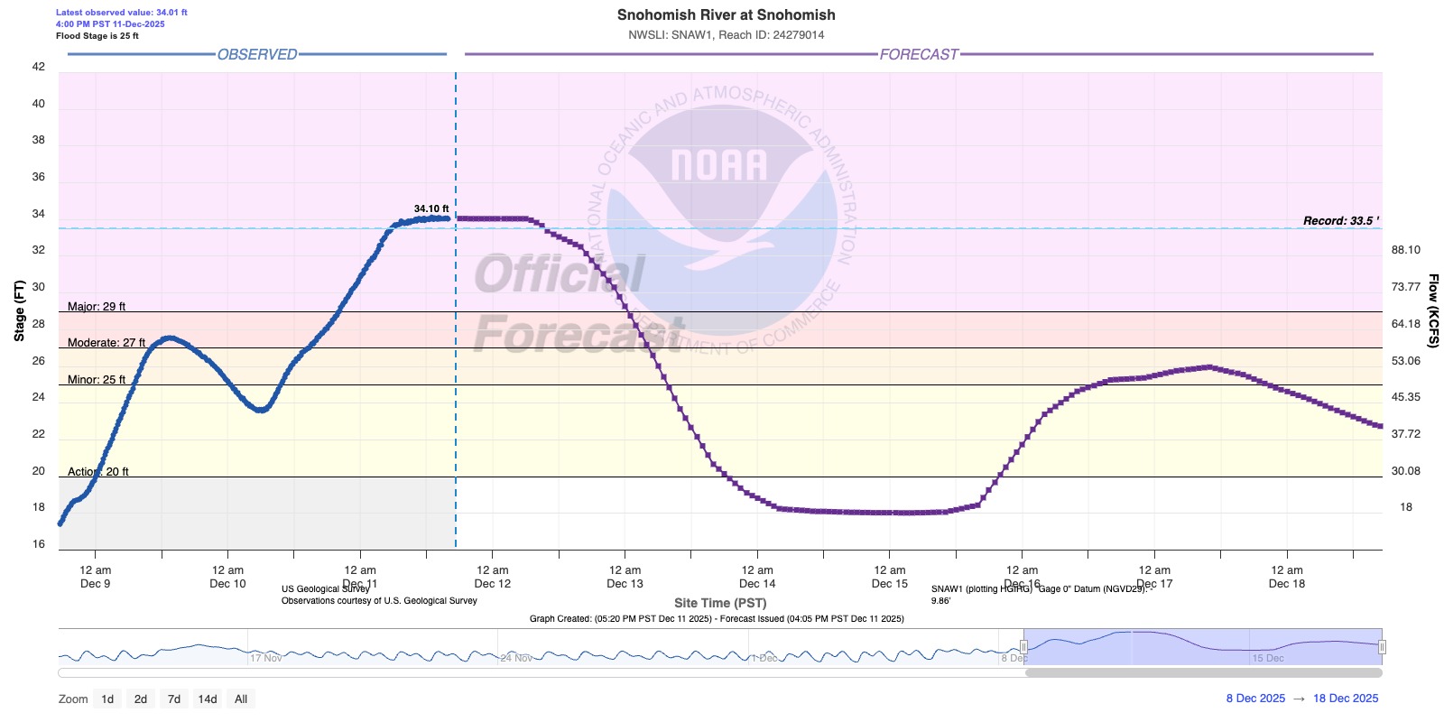
The current river projections do show many rivers starting to rise again with many passing flood stage, though at this point it is looking more like minor to maybe moderate flooding, as opposed to major-tor-record flooding.
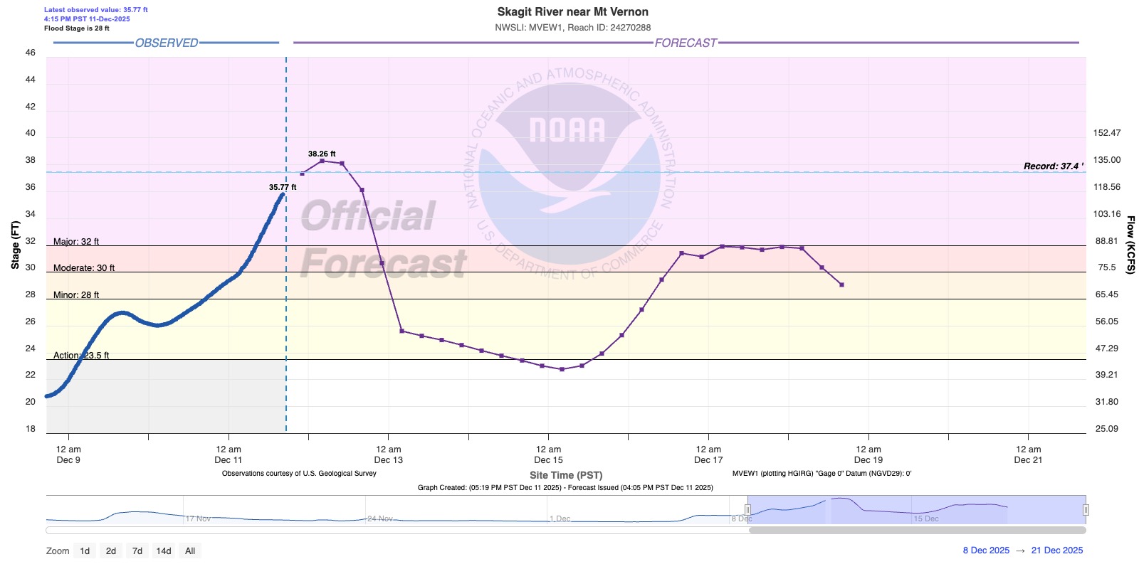
We’ll keep a close eye on it.
There is some hope in the longer range forecast that won’t exactly appease the sun fans, but WILL start hopefully appeasing the skiers and snowboards. Those next rounds of storms look cooler with lower snow levels that we should start piling up some decent snowfall in the mountains.
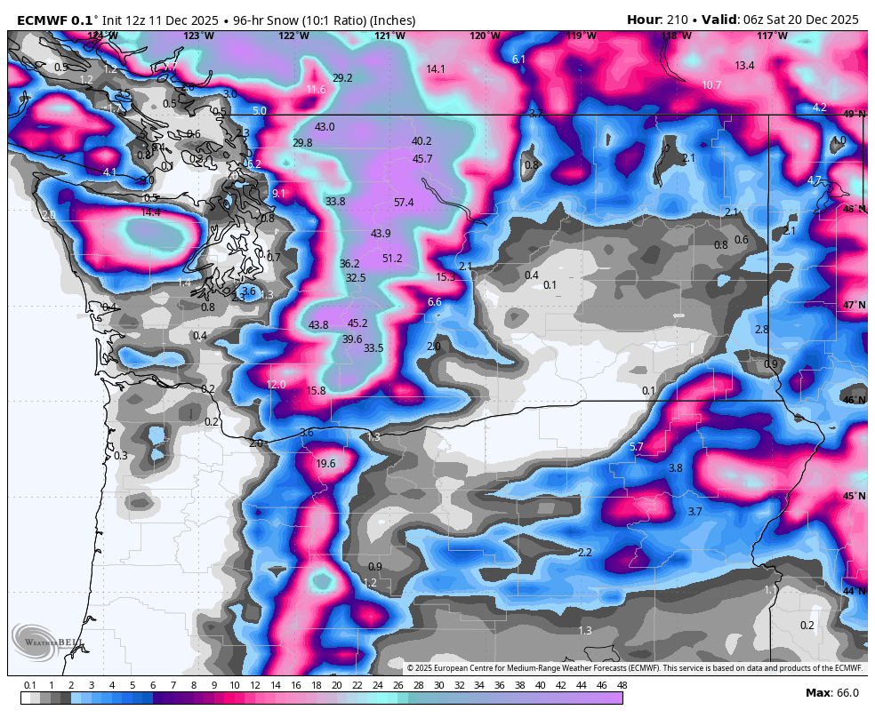
For the lowlands it just means more days of dark gray and moderate-to-heavy rains next week, but the mountain snow should keep much of that water from running off into the rivers.
At least that’s the hope for now. We’ll for sure keep an eye on the forecast but skiers, don’t give up hope just yet!