My parents live on the bluff in Port Angeles and have seen their share of wacky weather before from having the Strait of Juan de Fuca be essentially in their backyard. It has led to frequent days where it’ll be foggy in the backyard and sunny in the front yard, or in the 50s on the back porch, and 60s or 70s in their driveway. They’ve even had accumulating snow in the front and mix in the backyard.
But during Wednesday’s storms they had a new one…
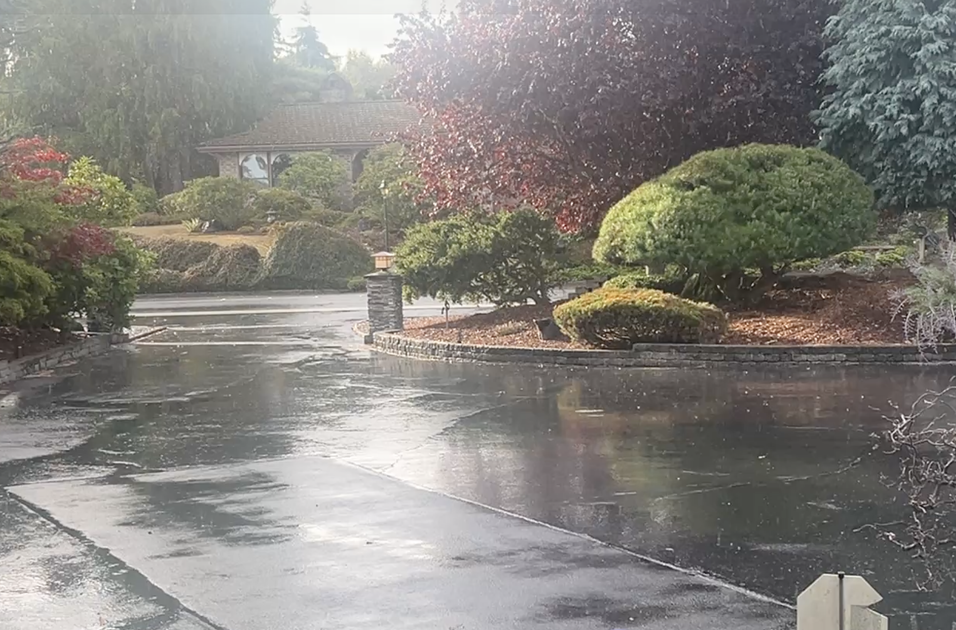
My Dad sent me the video attached here of it raining in their driveway.
Seems routine at first glance, but if you look closely, it appears to be really heavy rain falling in the street and toward the far end of their driveway — note the large drops and splotches on the pavement in the back of the video.
But closer in the foreground, the rain seems lighter. The drops aren’t “bouncing” off the pavement; it’s more like a typical Pacific Northwest rain. The driveway is open; there aren’t big trees blocking or overhanging it that would obviously affect an apparent rainfall rate.
At first, I was like “Oh, come on that can’t be.” It’s just got to be the way the video was shot or some mix of angle and daylight that makes it an optical illusion, right?
Maybe it still is, but then I checked the radar and now I’m like, hmmm..
The camera is facing due south; the street out front runs due east-west.
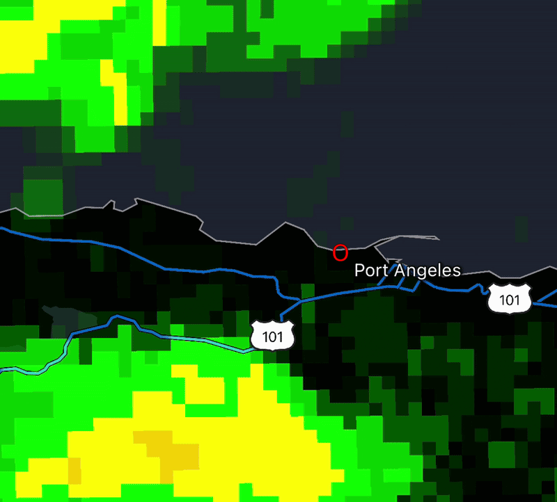
The radar animation I’ve put here (red circle denotes about where their home is) does indeed show a heavy rain cell moving due south-to-north at the time he shot the video. It’s at least conceivable he caught the video just as say the “green” part of the blob on the radar was just moving into the heavier rain/orange part. Perhaps the border between lighter and heavier rain was just moving across the driveway at that time he took the video?
What do you think?