Multiple atmospheric river storms loom in extended forecast, threatening flooding in Cascades
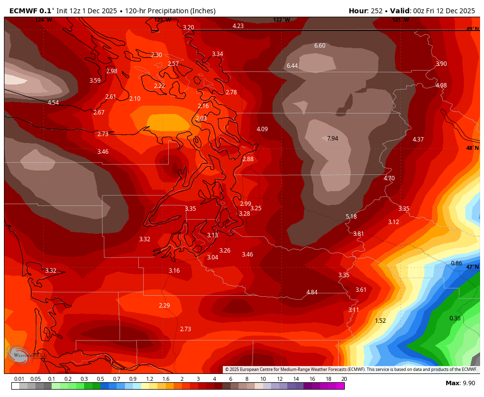
5 day accumulated rainfall map forecast between Saturday and Thursday evening.
Our rather calm stretch of weather is coming to an end soon, and in its place, a much wetter, stormier pattern featuring multiple atmospheric river storms that may present our greatest river flooding risk of the season thus far.
There’s also budding risks of strong winds, some coastal/tidal flooding and landslides.
THE CALM BEFORE THE STORM(S)
The rain on Monday is but a minor blight to kick off the week, which will return to the dry side Tuesday and Wednesday as high pressure reasserts itself.
We’ll see some patches of fog and but these are your days to get any outdoor decorating done and get in those dog walks because the dry periods are about to become few and far between.
GRAB YOUR STOPWATCHES, BREAKS WILL BE FEW AND FAR BETWEEN
The ridge of high pressure breaks down on Thursday, allowing our first dollops of light rain to move through. Then the parade of storms start marching through on Friday and only seem to get wetter as we get into the start of the next week.
Timing any dry breaks right now is futile this early but just be ready for wet each day. If you need an early indication, Saturday and Monday are at least leaning relatively drier than the other days so far…
While these storms are looking to tap into subtropical moisture and get classified as atmospheric river-type storms, none of them individually are looking like a significant impact; instead it’s the additive nature of multiple storms in rapid succession that could overwhelm our (regular) rivers.
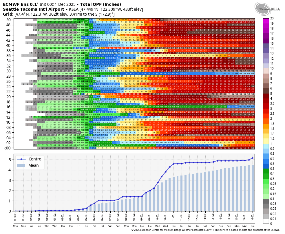
How much rain? It’s a bit early to say for sure but there is strong ensemble model support for 3+ inches of rain just in the Seattle area between Saturday and the middle of next week.
This early, NWS Seattle has put out a probabilistic map of what river flooding might look like next week with current model projections. There is a 50% chance so far of multiple rivers reaching at least Action Stage, especially in Snohomish and Skagit County. There is a 30% chance of multiple rivers reaching minor to moderate flood stage.
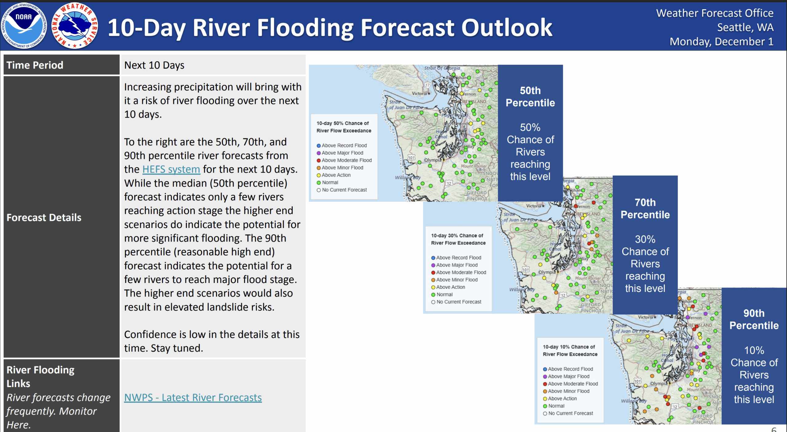
But “the 90th percentile (reasonable high end [10% chance of happening]) forecast indicates the potential for a few rivers to reach major flood stage,” NWS Seattle forecasters wrote. “The higher end scenarios would also result in elevated landslide risks.”
MORE TO EXPLORE:
- November ends up warm; Skiers give 2 thumbs down to early December outlook
- Why did Seattle’s snow forecast map look like this earlier this month?
- What does an “atmospheric river” mean?
We’ll get better specifics once the weekend draws closer. For now, those of you in river flood plains need to start thinking about preparations.
INLAND TIDAL FLOODING POSSIBLE
The storms are also coinciding with the high astronomical “king tides” that come when the full moon (Dec. 4) and sun are aligned in a way to add a touch more gravitational pull on the tides. Lower atmospheric pressure with incoming storms also gently “tug” at the water’s surface, adding a bit more to the flooding potential.
Right now, the NWS is most concerned about the Dec. 5-9 time frame in the Puget Sound and Salish Sea area.
“Current models indicate multiple days of water levels well above minor flood stage,” NWS Seattle wrote in their Monday afternoon forecast discussion, “and a few locations (particularly Cherry Point and Friday Harbor) flirting with moderate or higher flood levels.”
The Pacific Coast will see higher tides too, but so far ocean wave action looks to be muted enough to mitigate coastal flooding concerns.
BREEZY TOO…
Each storm will carry periods of blustery winds, with perhaps stronger winds along the coast and Northwest Interior Sunday and Monday, at least according to early signals. Too early for specifics, though.
WHAT ABOUT THE MOUNTAINS? ANY SNOW OUT OF THIS?
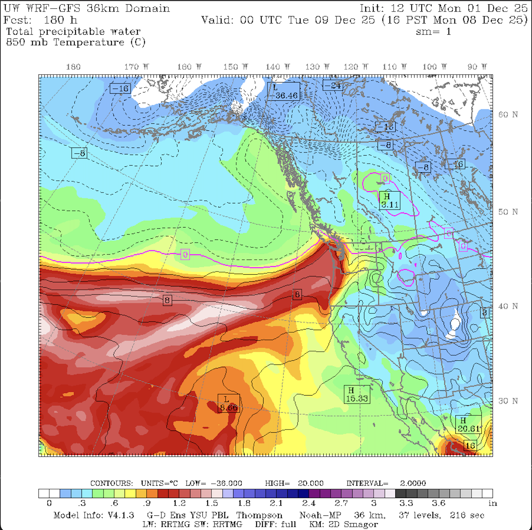
The higher elevations should get some heavy snows out of this, but overall, the storms will still lean on the mild side.
The snow levels look to hang around 4,000-4,500 feet, meaning they’d likely stay above Snoqualmie Pass throughout the events. But that means Stevens Pass could see some some at times along the peaks.
WHEN DO WE DRY OUT AGAIN? MY ANSTY DOG WANTS TO KNOW…
Tell them the long range forecast is still looking “ruff”.