Mt. Rainier, skies put on epic cloud show ahead of next atmospheric river
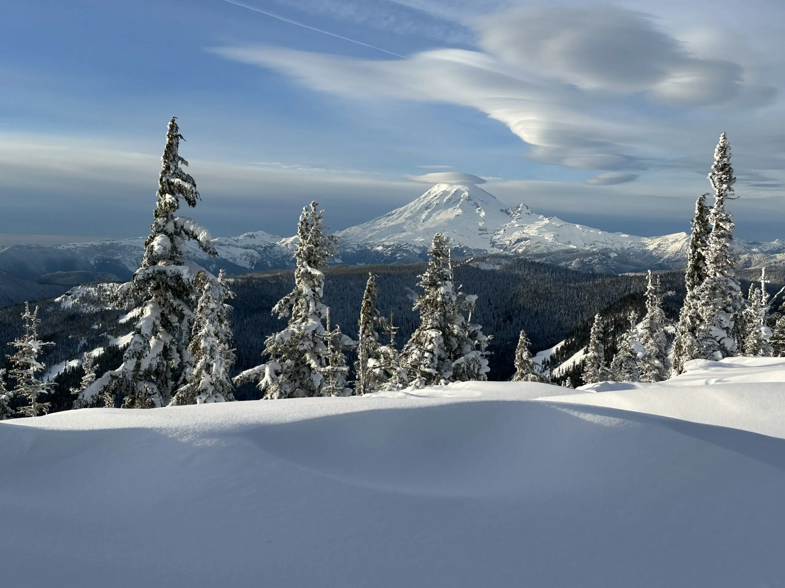
Lenticular Clouds form over Mt. Rainier on Jan. 9, 2026. (Photo courtesy: Matt Markovich)
The ski season hasn’t been the best so far, but Friday was pretty epic. Not only was there feet of new snow from this week’s storms, but the sun even peeked out. To top it off, the clouds put on quite a show!
Matt Markovich was up skiing in the Cascades and saw an incredible display of lenticular clouds, but above and near Mt. Rainier.
These clouds have been mistaken for “flying saucers” over the years but are just an atmospheric trick. The clouds form when the atmosphere is just on the cusp of saturation. Air flowing over Mt. Rainier and the Cascades gives a little bump in altitude and just enough to cool the air the last little bit to reach saturation and turn into a visible cloud. The air then sinks down a short distance later, and it dries out back below saturation levels and ‘disappears”.
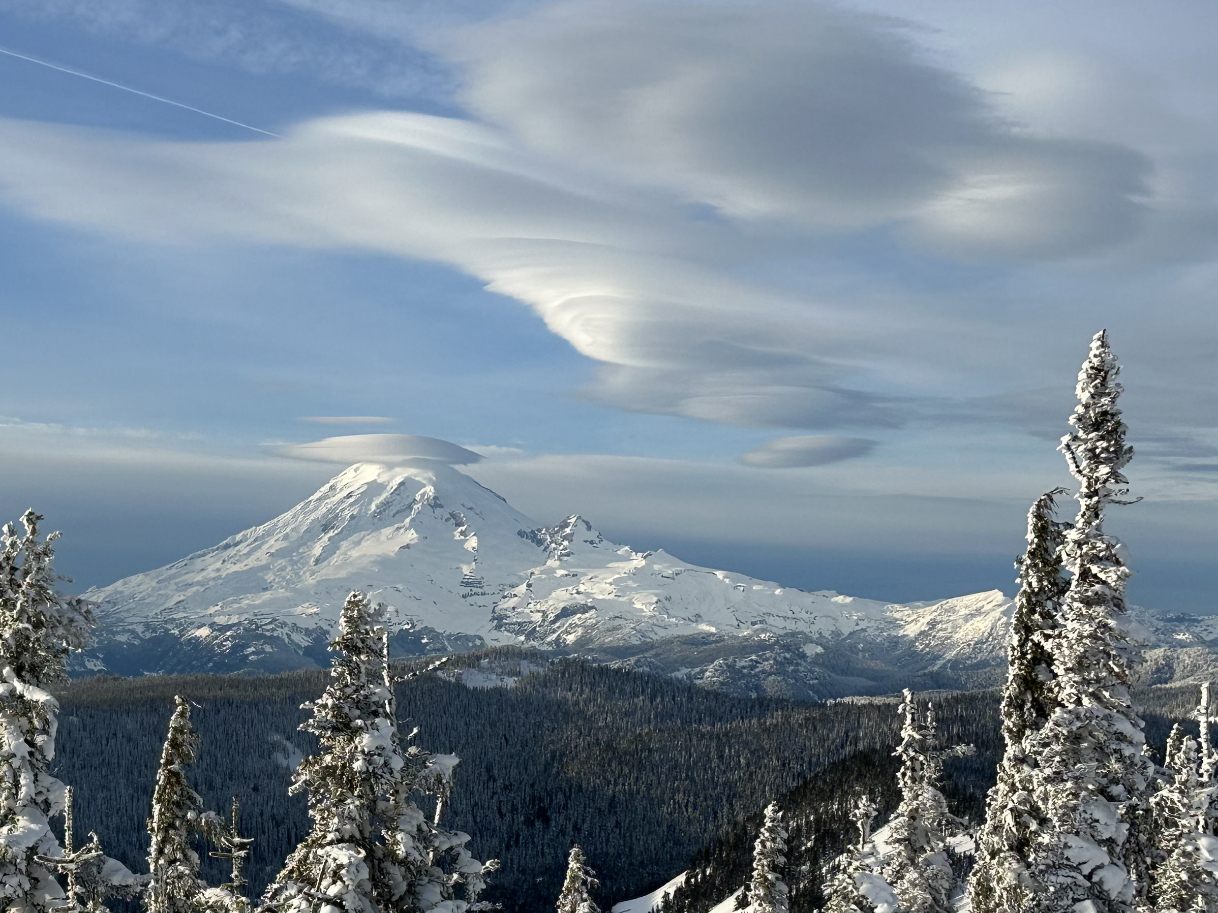
The result is a smooth, wavy cloud that appears stationary, but is essentially “standing in motion.” If you were to time lapse it, you’d see air flowing through the clouds.
Other clouds might look like multiple pancakes stacked atop each other and that is an apt description. Because they are not one cloud, but several thin layers of clouds stacked upon each other like…pancakes.
The clouds usually are a decent sign that rain is on the way within a day or so, as atmospheric moisture increases ahead of the approaching storm and we get these conditions where these clouds are right on the cusp of forming, and given that extra needed boost by moist air moving over the mountain topography.
Sure enough, rain returns to the forecast later Saturday ahead of another atmospheric river due in Sunday and Monday.