Massive solar flare triggers ‘severe’ Geomagnetic Storm, vivid Northern Lights display
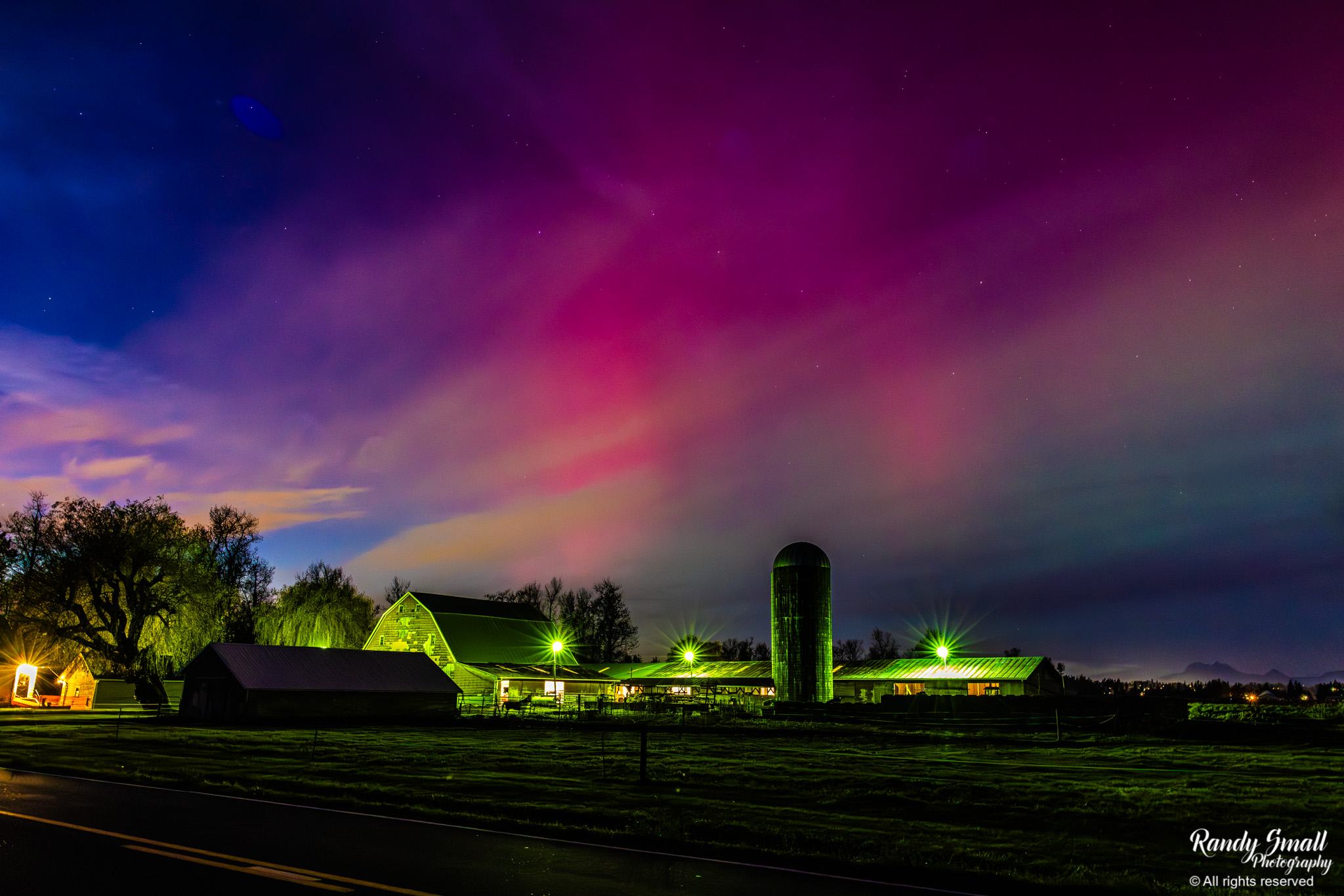
Northern Lights in Whatcom County on Nov. 11, 2025. (Photo: Randy Small Photography)
TUESDAY NIGHT UPDATE: The geomagnetic storm arrived early! Sightings of the Northern Lights exploded across Canada and the U.S. with some reports of sightings as far south as California and Texas.
And that includes Western Washington, where the aurora is fighting nearly overcast skies to peek through.
Brie Hawkins, Randy Small and Kathryn Schipper were among many who snapped a few good photos before clouds moved in.
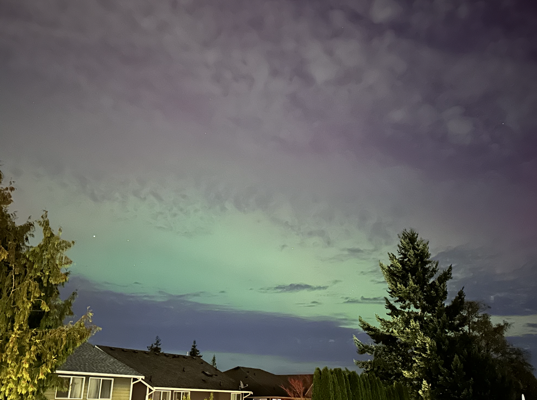
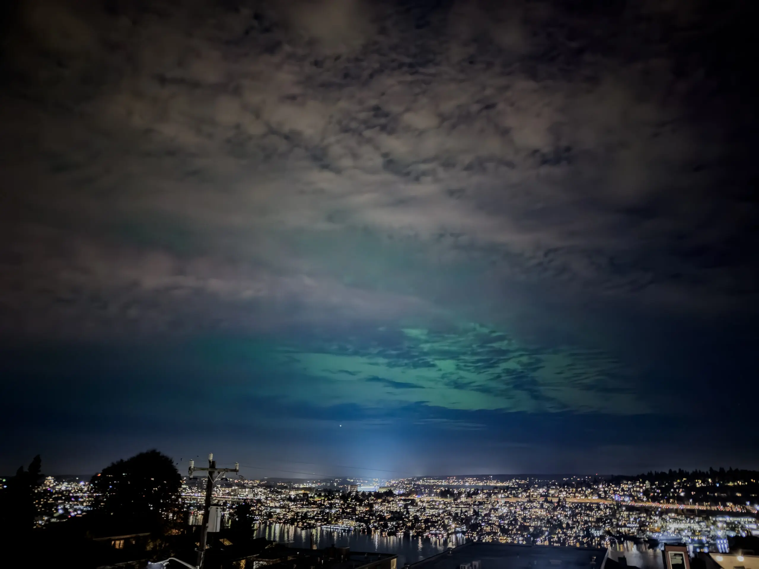
The show is still going and may go through the night. Unfortunately, we will be fighting a mostly cloudy to near overcast sky. However, there have been a few breaks in the overcast to afford some quick but spectacular views!
(WANT TO SHARE YOUR PHOTOS? Email scotts@emeraldcityweather.com or you can post them on my Facebook page story.)
The aurora is courtesy of our sun that is bubbling with activity, with multiple sunspots on its Earth-facing side this week — and one of them just let loose a whopper of a solar flare!
The flare was rated an X5 class, according to SpaceWeather.com. X is the strongest class with each number signifying an increase in strength. Suffice to say, it was a biggie.
It is hurtling a Coronal Mass Ejection “CME” toward Earth that is racing along and may catch up to one or two others out ahead of it from smaller (though still powerful) solar flares from the past few days.
The bottom line for the vast majority of us on the ground is it an intense viewing of the Northern Lights. Perhaps not *quite* to the level of the epic show in May 2024, but getting up there.
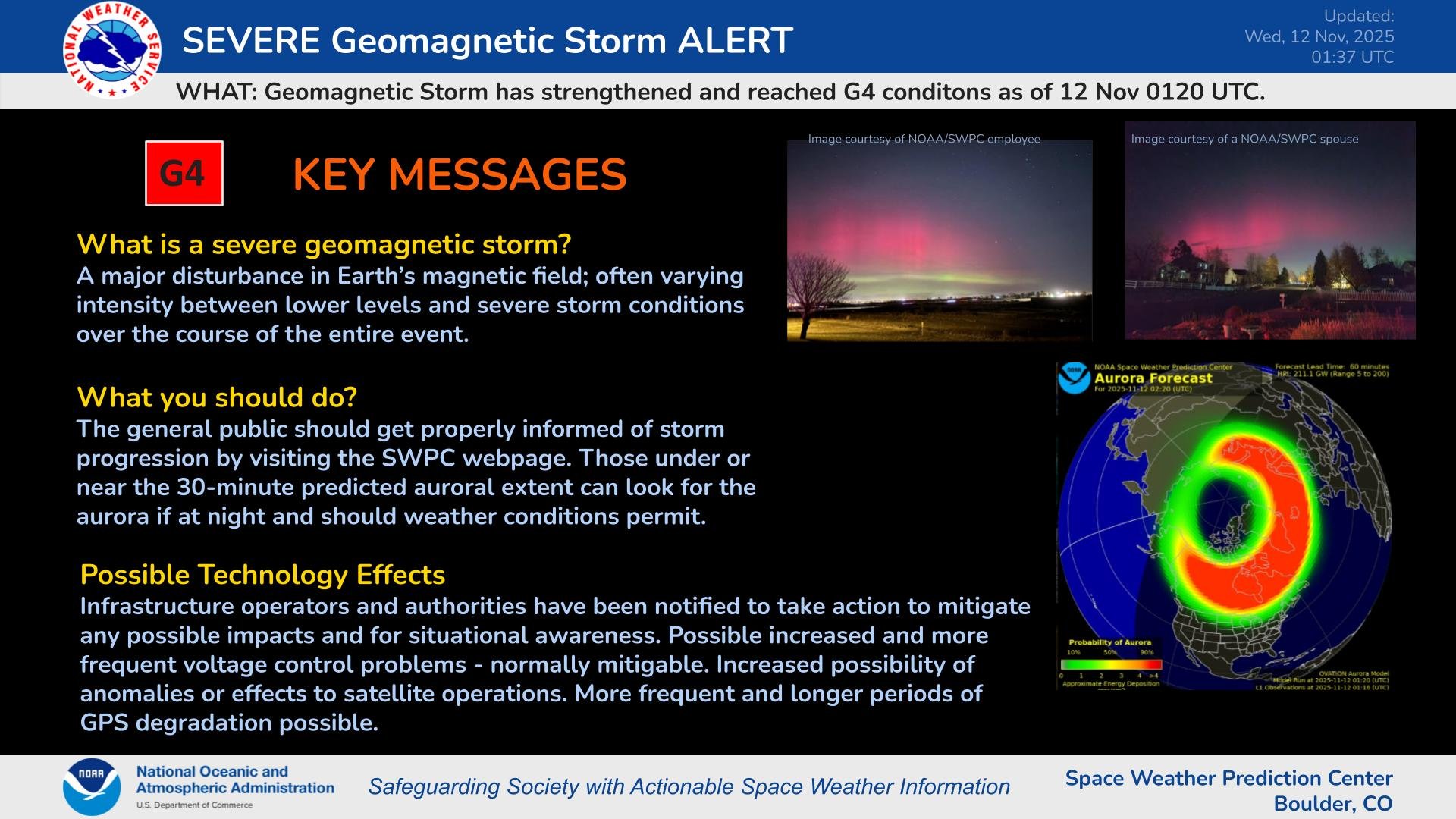 NOAA has now issued a Level G4 “Severe” Geomagnetic Storm Warning for Tuesday, which is only one rung below the top “Extreme” G5 level. (May 2024 was a G5.)
So auroras should continue to dazzle across the Northern U.S. and even stretch well into the central and southern U.S.
Only one problem…
It’s November in Seattle.
Clouds are already encroaching ahead of the next weather system, coming in Wednesday and lasting into Thursday, bringing widespread light rain.
Current NOAA projections still have the solar storm active into Wednesday night, but the current cloud cover forecast remains at or near 100% for just about all of Wednesday night across pretty much the entire Pacific Northwest.
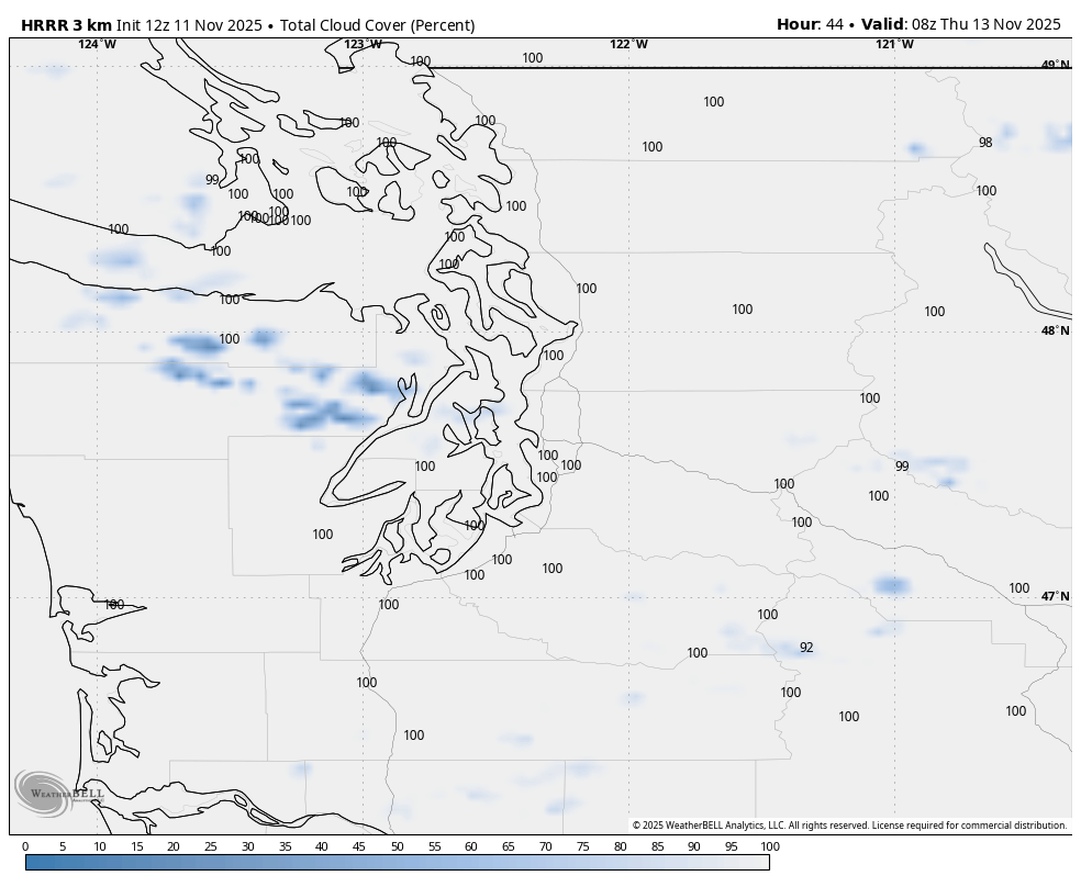
Even Eastern Washington doesn’t look good. About the only hopes within a day’s drive are southern Idaho and maybe far eastern Oregon.
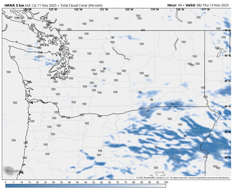
The geomagnetic storm *may* linger into Thursday night but wouldn’t be as powerful (and it’s rare for a storm to last two nights) and even so, the cloud forecast for then isn’t a whole lot better. There are a few breaks in the overcast in the forecast models but they are few and fleeting.
May have to wait the next one for a really big show.
Side Effects: NG-2 Update: New Glenn is ready to launch. However, due to highly elevated solar activity and its potential effects on the ESCAPADE spacecraft, NASA is postponing launch until space weather conditions improve. We are currently assessing opportunities to establish our next launch window based on forecasted space weather and range availability.
Awesome information…!! SO well done… so sad we could not see from our Bluff in Port Angeles…. too many low clouds… 🙁 … oh well .. hope for next time!