Predicted radar showing rain (green) or snow (blue) on evening of Dec. 26.
We didn’t get a White Christmas, but a few folks in the North Sound may get a wimpy consolation prize: A few brief snowflakes on Boxing Day.
(And before I go any further, yes, I know the holiday doesn’t have anything to do with the sport of boxing 🙂 )
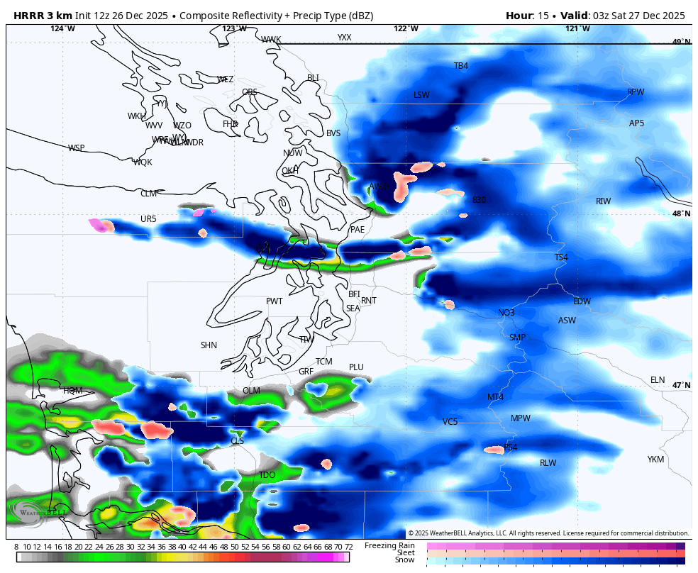
An actual cold front — with cold air behind it — will sweep through the region Friday, mostly just bring some periods of light to moderate rain into the evening.
It’s mostly no big deal in the lowlands, but cooler air coming in behind the front will combine with an expected Puget Sound Convergence Zone this evening to perhaps give an hour or two of a rain/snow mix or even a wet snow to southern Snohomish County and northern King County.
Other spots around here with elevation may also see a brief wet snow or mix, maybe up along Bow Hill in Whatcom County too. Any accumulations would be minor and likely just on grassy surfaces; road temps are relatively warm.
Places near sea level likely just stay rain throughout.
Bottom line: Snowflakes might be fun to see and I’m sure your social media feed will fill with excited photos from those who got lucky in the snow lottery, but it won’t last long or cause issues. The moisture dries up later this evening and it’s just a chilly night in store.
One place where snow will be a bit more of a headache is in the mountains today where a Winter Weather Advisory is in effect through 10 p.m. Snow levels remain well below pass levels all day, and as much as 6-12 inches of new snow could fall there. So those wanting to head back across I-90 Firday and are loathe to drive in snow, see if you can hold off until Saturday.
The weekend and into early next week the weather becomes…calm, but chilly. High pressure is in charge — that storm that we had talked about earlier this week that was looking at us for…basically now has shifted well to the north into British Columbia.
Instead, we’re looking at partly to maybe even mostly sunny days and, with clearing skies, chilly and frosty nights with lows at or just a bit below freezing. There will likely be some patchy fog in the mornings.
The next chance of rain doesn’t really return until maybe New Year’s Eve, or New Year’s Day.
MORE TO EXPLORE