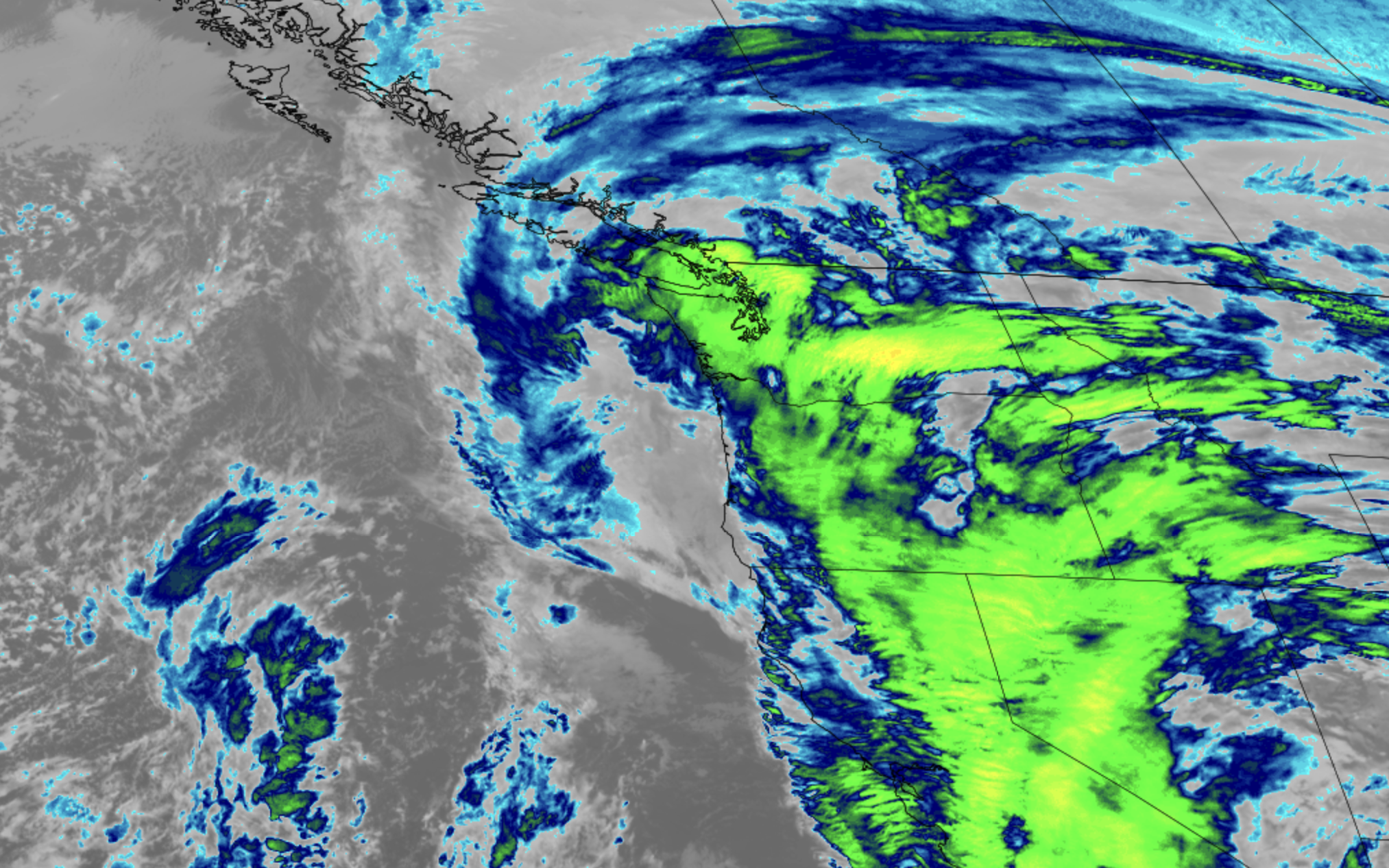
GOES 18 Satellite image Dec. 24 (CIRA/ RAAM-B / NOAA)
2 P.M. WEDNESDAY AFTERNOON BLOG UPDATE: WE’RE OFF THE HOOK
Much like the Los Angeles Rams on Thursday night against the Seahawks, the storm has fizzled late, much to the surprise of pundits. 😂
All wind alerts have been dropped. There is no further risk of impactful weather Wednesday. Any and all plans are a go. Happy Holidays and Merry Christmas!
============================
ORIGINAL BLOG POST BELOW:
I apologize in advance…
I know you’re probably here looking for clarity on the upcoming potential windstorm for Christmas Eve but the forecasts are still murky Tuesday morning. We still have some forecast models painting a very strong wind event for Wednesday midday into afternoon, while others are still adamant this won’t be much of anything in Western Washington.
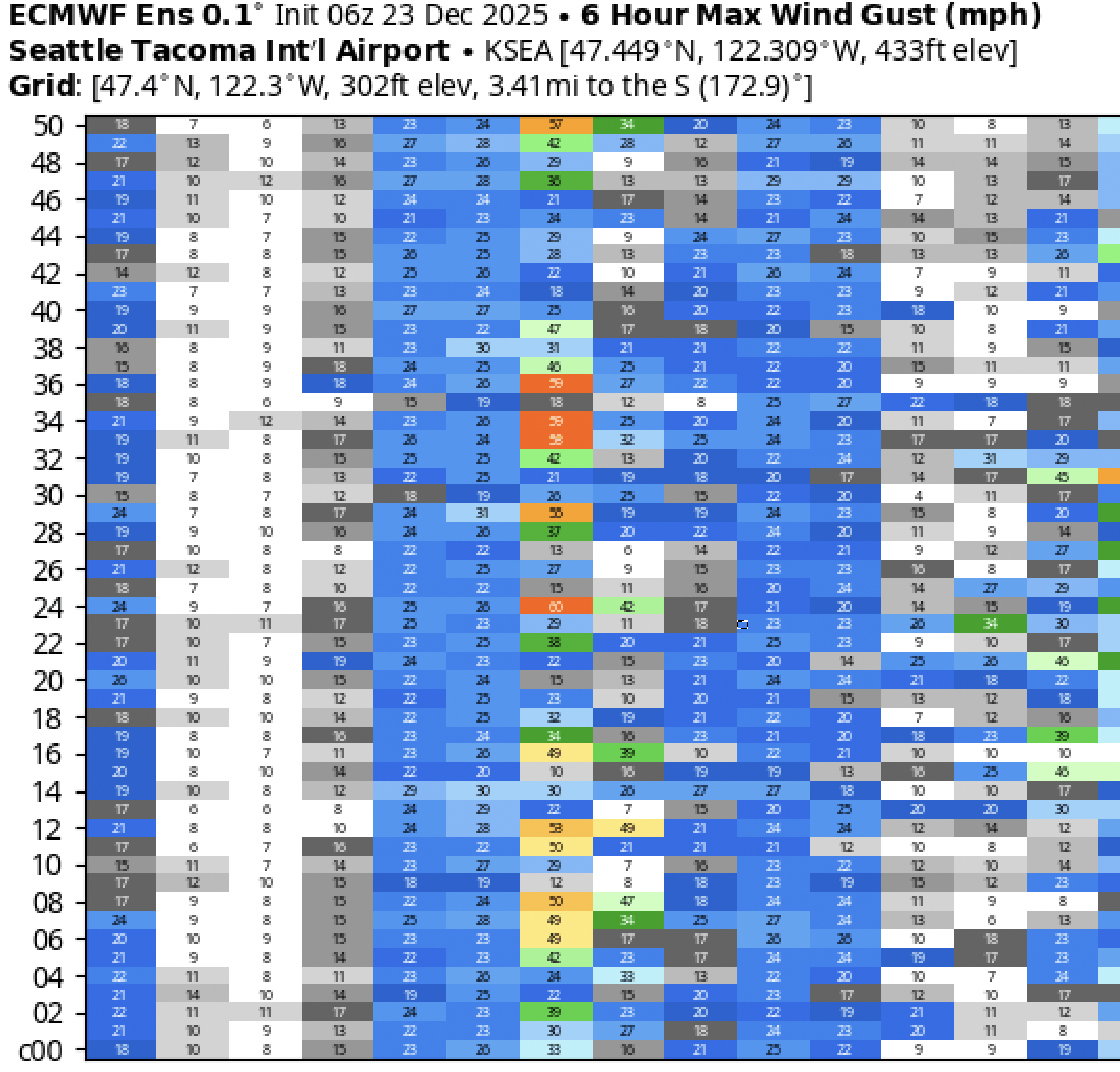
The short summary forecast version for those who want their weather info “on the go” is that there is potential for southerly wind gusts of 50-60 mph — maybe even a few higher gusts — across much of the region including the Seattle/Puget Sound Metro area Wednesday. Right now the primary window for winds is looking like early afternoon. Winds would arrive rather suddenly but taper off fairly quickly Wednesday evening.
THE LONGER, MORE IN-DEPTH VERSION
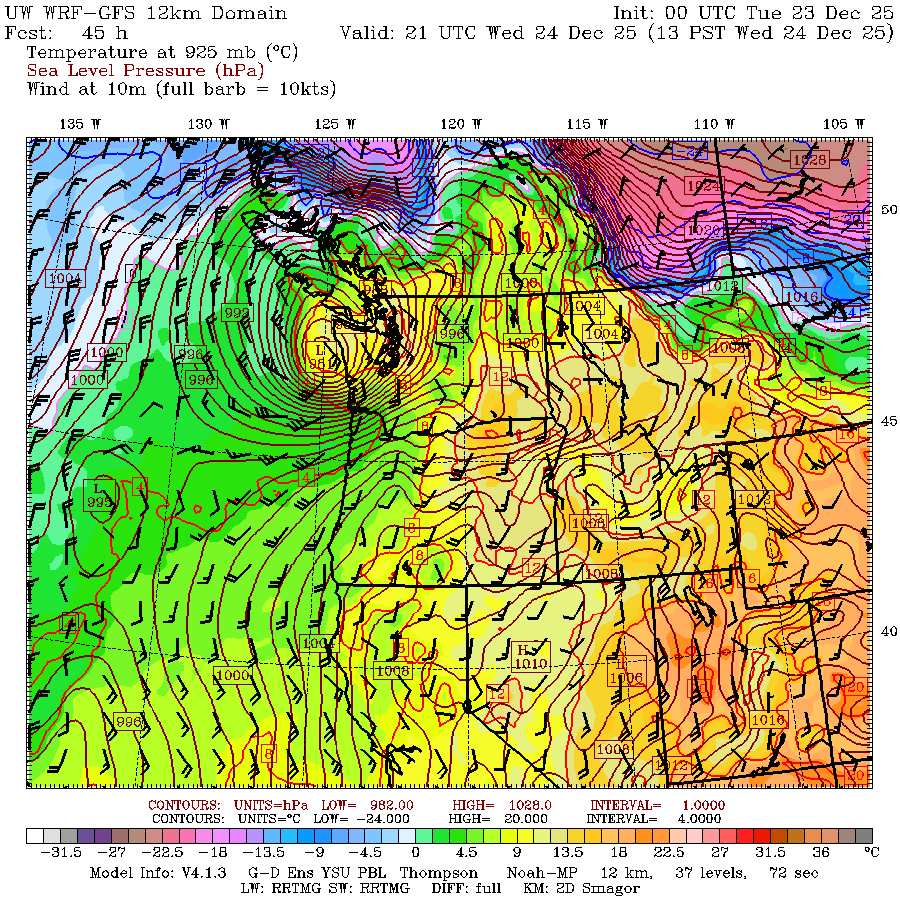
We are still watching for a potent area of low pressure to form later Tuesday off the Northern California coast and intensify as it moves north… or northeast. That’s a crucial distinction on whether the storm comes toward Western Washington or blows inland before it gets here and leaves us off the hook.
Let’s start with the more serious scenario if the storm intensifies and moves north along the Oregon coast Tuesday night before coming either up the Washington coast or up the I-5 corridor on midday Wednesday.
In that case, the storm will bring a fetch of strong southerly wind as it passes. To borrow from my analogy from yesterday’s forecast post here, think of the storm like a speedboat, trailing a large area of wake that spreads out behind, only in our case, it’s wind, not water.
The worst-worst case scenario is the storm comes right up the I-5 corridor and maintains its strength at which case we’re talking very impactful winds of 60-65 mph gusts for just about everyone from Longview to Bellingham and maybe even higher near the water — and even stronger winds down toward Portland/Willamette Valley, if you can believe it.
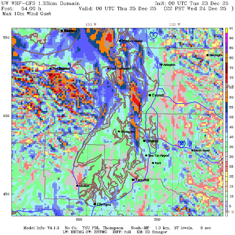
There are a few forecast models (looking at you, NAM) that are going with this and if someone wanted to go for the scare factor on social media, those are probably the scary maps you’re seeing posted on other feeds. It has gusts of 65-75 mph in the Puget Sound area.
Again that is depicting a worst-worst case scenario, and generally I don’t put a lot of faith in that model; I find it tends to frequently overdo storm events (especially wind and snow). But suffice to say, we do not want that one.
The American GFS model is another that is on the aggressive side for winds, and stubbornly so. It has the storm coming up the Oregon and Washington coast and into Vancouver Island — also a very windy scenario that hits the coast and Northwest Interior harder. That scenario would also bring a short burst of easterly winds through the Cascade foothills Wednesday morning into midday (for like the North Bend/Enumclaw/Gold Bar east wind folks) before the southerly winds swept through everyone else that afternoon.
BUT NOT EVERYONE IS ON BOARD
Crucially, there are major forecast models that are not predicting a wind event at all. Namely the European model (“Euro”) and the HRRR model which is a high resolution model that updates every hour.
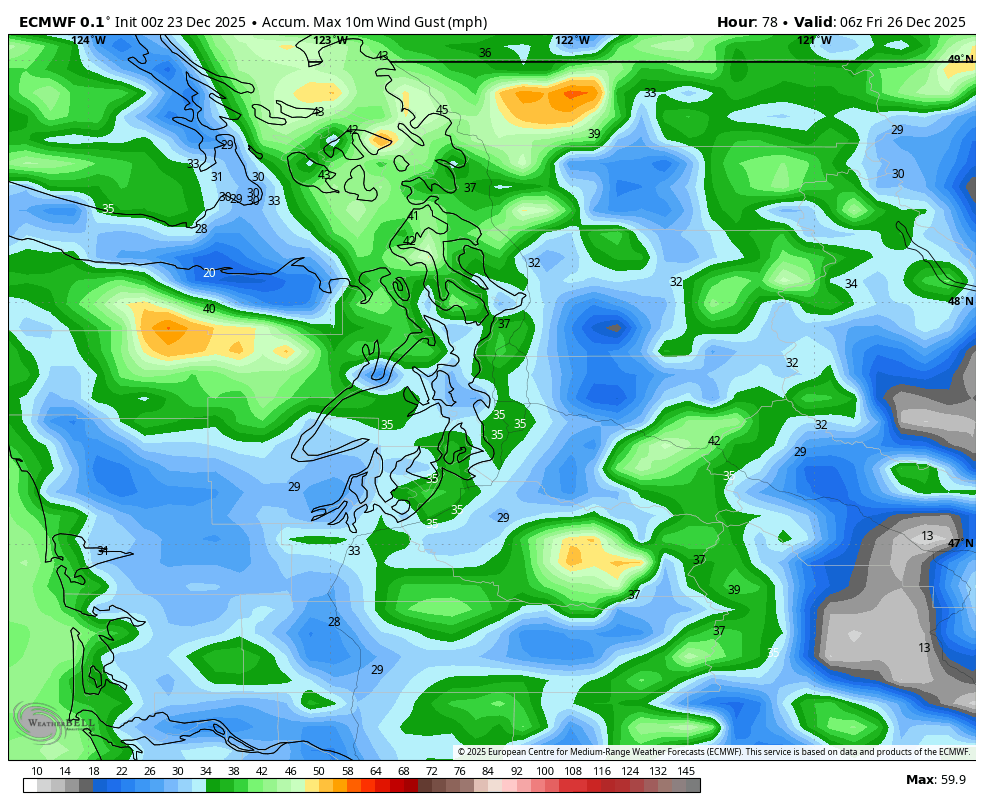
Both of those predict the storm will turn inland well south in Oregon and won’t be anywhere near as intense. Both of those are predicting peak winds in the 25-35 mph range to where Monday will have ended up the windiest day this week.
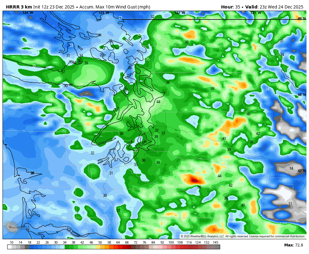
If you look at their “ensemble” models, which make multiple runs of the same model but tweaks input data in attempt to better deduce gaps in weather observations, of their 50 forecast models runs, I count only 9 that have gusts of 50+ which means 41/50… don’t.
WHAT’S THE PLAN THEN?
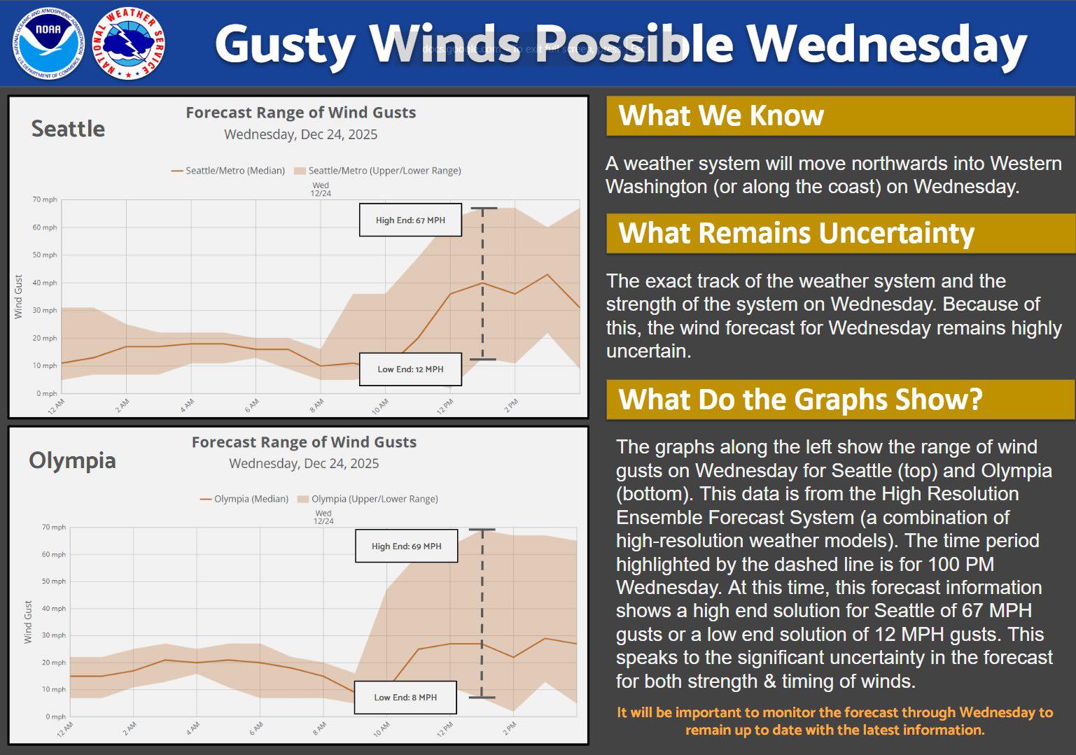
The National Weather Service in Seattle noted in their forecast discussion the high uncertainty but with the wind risk still present, has gone ahead and issued a High Wind Watch for pretty much the entire I-5 corridor including the entire Seattle/Puget Sound Metro area and the coast for Wednesday afternoon (official time of watch: 10 a.m. to 7 p.m.).

They may expand this to the Olympic Peninsula later.
They also put out a great infographic showing the wide range of wind possibilities (12-67 mph!)
WHAT’S YOUR GUT TELLING YOU?
Delving into my own personal opinion, I’m leaning that the windstorm is an underdog. Not like a Cinderella “would be a miracle if it happened” underdog, but one where if you were taking odds, you’d put your money on the non-wind.
I don’t think I’ve ever seen a windstorm play out around here like the most aggressive models are predicting (at least the ones that have the storm coming right up I-5 from California), and I’ve been here long enough to rue walking up the ramps of the Kingdome wondering why escalator technology hadn’t been part of the original plan. Doesn’t mean it can’t happen but just would be exceedingly… weird.
But there is certainly still enough risk that everyone should prepare for possible power outages and other wind-related events on Wednesday. With the saturated ground from our recent barrage of atmospheric rivers, we’re more susceptible to wind gusts and tree/power line falls than in a “normal” winter wind storm with bare trees.
So let’s get those phones charged and maybe make sure your cars are charged or gassed up.
And stay tuned to the forecast, I know that time frame is right in the heart of when local travel may be at its peak for Christmas Eve festivities — I wonder if the more aggressive winds come to pass, ferry runs could be impacted too – even the big runs in the Central Puget Sound.
I’m hoping the worst that happens is you all shake your fist at meteorologists at the dinner table for riling everyone up. (We’re used to that! 🙂 )
It does look like pass travel will be better now on Wednesday with perhaps a period of just rain Wednesday morning. Of course the wind may or may not be a factor, but heavy snows look off the table.
Thanks for the post.
An hour and minute timestamp for each post and its updates could be helpful.
Always interesting and pleasant. Usually intelligible to non-scientists such as me. Sometimes (today) reassuring and calming to windphobes such as me. You were RIGHT all along. Everything in moderation—apparently. Thank you!