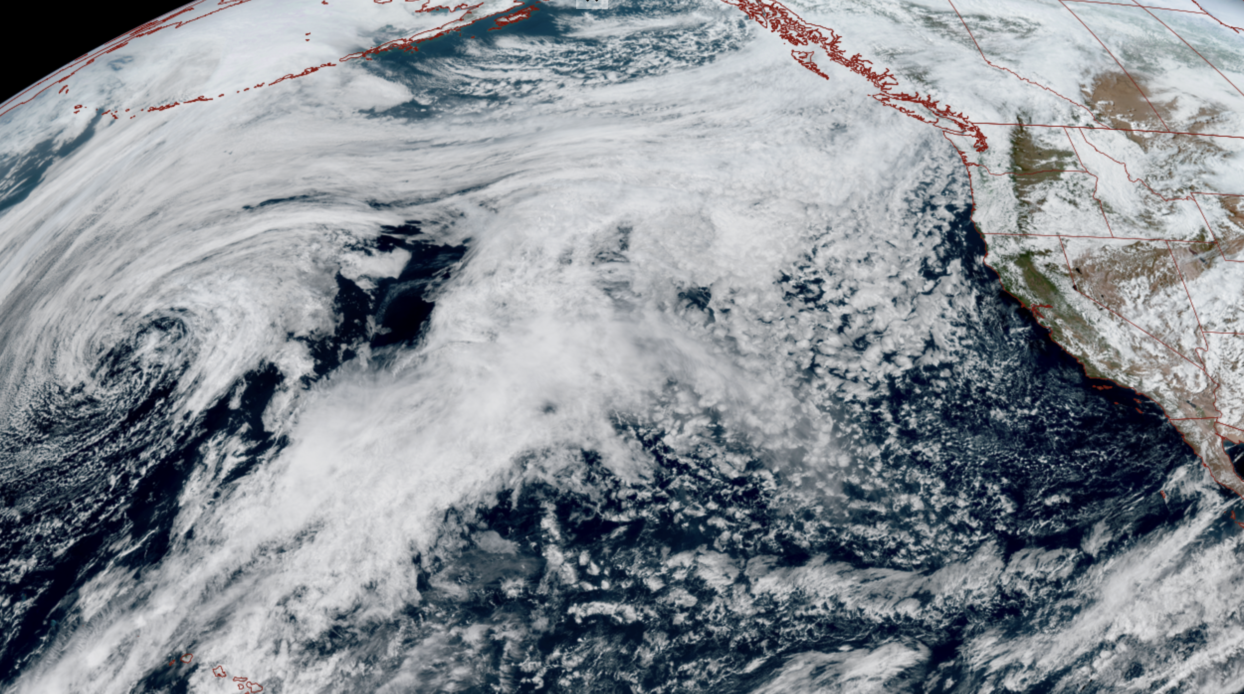
Satellite image April 13 (NOAA / CIRA / RAAM-B)
A rather potent-for-April nothing-false-about-it winter storm is heading toward western Washington Tuesday, set to bring drenching rains to the lowlands, heavy snows to the mountains and some gusty winds too. All while temperatures struggle to get out of the 40s.
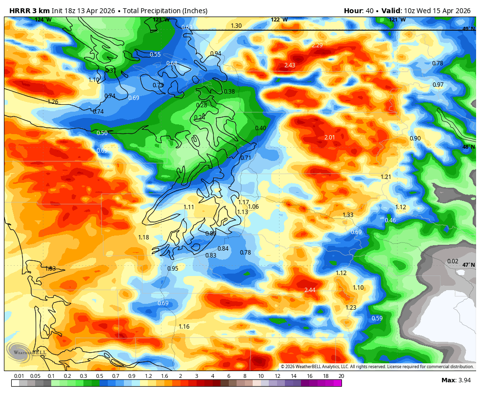
The steady rains will arrive Tuesday morning in Seattle and the Puget Sound region, and just chalk up the day to wet and blustery, with an extra burst of rain around the late evening commute into sunset time frame as the main frontal boundary slides through. Most areas in the Puget Sound area could get over a half inch of rain or so by nightfall.
THAT SOUNDS WET BUT I EXPECT MY HAIR TO LOOK AMAZING TOMORROW. WHAT DO I DO?
I will say the expected rain intensities are bordering on granting exceptions to use an umbrella tomorrow without facing suspension of your Seattle card. (Don’t forget to get those forms in soon! 😉 Or…just wing it like every other rainy day in Seattle and use extra hair gel or spray. )
The Olympic Rain Shadow will be around for the North Sound so…less rain there (Umbrella exemption requests? DENIED! But hair? Better…?)
Besides the umbrella may just bust anyway. While we’re not looking windstorm-level winds, they’ll be just under the cusp with extended periods of gusts of 30-40 mph through much of the day.
Normally those speeds are shrug-worthy but we’re kind of in the opposite realm of what happens in October with our first wind events when trees haven’t shed all their leaves yet and catch the winds for extra power outages. Now we’re on the other end where trees have started re-leafing (is that a word?) so there could be a few power outages, but I don’t expect widespread wind impacts.
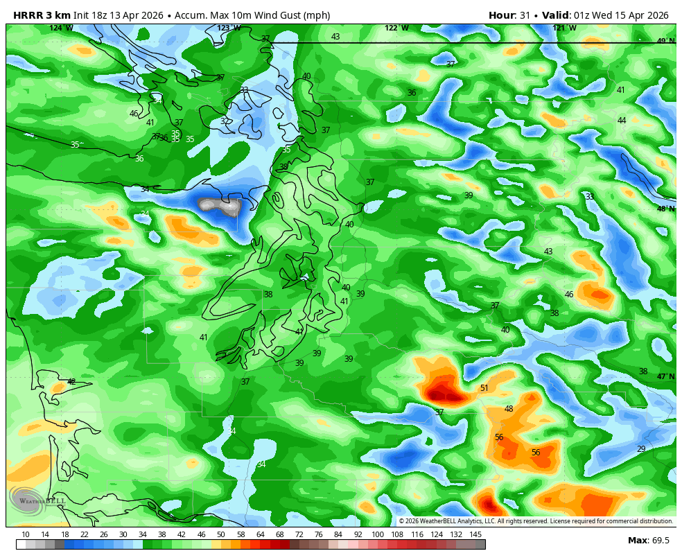
Winds will subside after sunset.
But the storm’s largest calling card will be a seemingly-rare-for-this-winter snowstorm for the mountains. (Skiers: WHERE WAS THIS TWO MONTHS AGO??!)
As mentioned earlier, Winter Storm Warnings are up for the Cascades — including Snoqualmie Pass and Stevens Pass — from 11 a.m. Tuesday through 11 p.m. Wednesday.
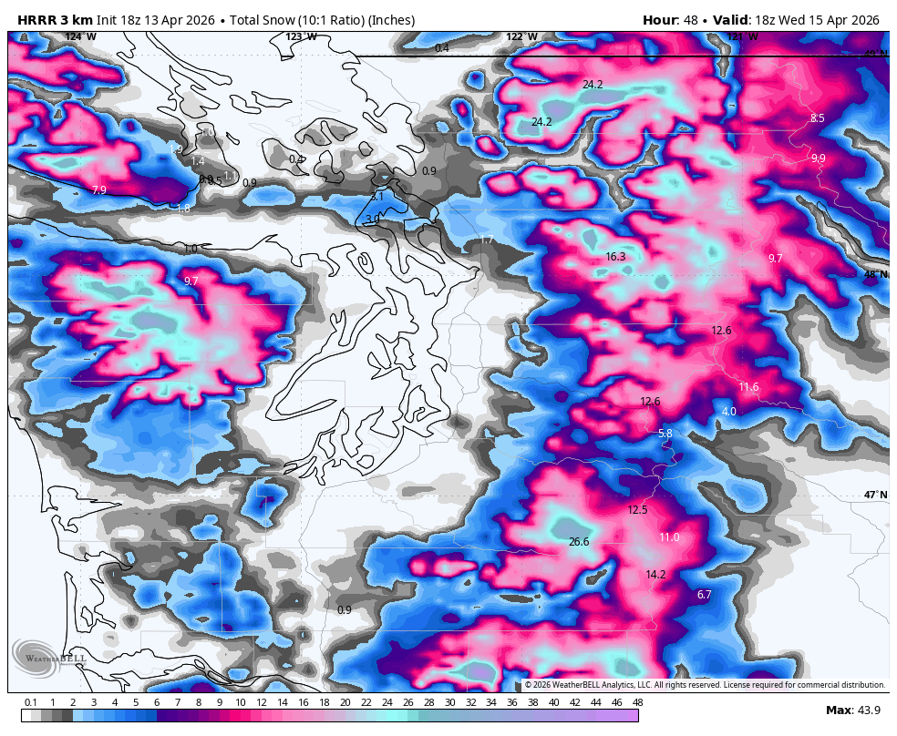
We’re looking at 10-20 inches of new snow — plus the gusty winds up there for very difficult driving conditions. The heaviest snows are expected later Tuesday into early Wednesday.
ANYTHING ELSE ADDING TO FRIZZ POTENTIAL?
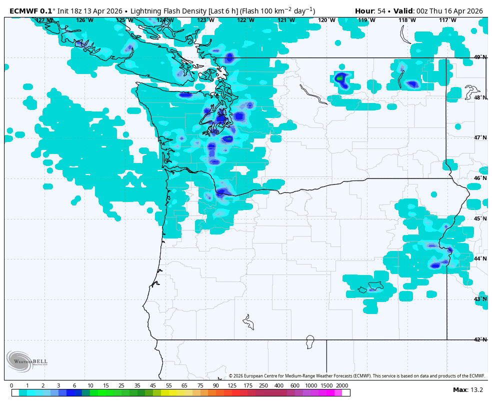
We do also have a risk for a few thunderstorms in the storm’s wake on Wednesday as cool, unstable air arrives. The overall chances are pretty low — best chances along the coast — and these look like garden variety Northwest thunderstorms but any lightning is dangerous so keep an eye to the skies, which of course you can see because you’re not hiding under an umbrella (RIGHT?!)
The chilly air will keep highs around 50 on Wednesday and then clearing skies Wednesday night will see temperatures plummet to the coldest readings since late March with lows in the mid 30s around Seattle and 29-31 degrees in the outlying areas. If your good hair day was one-and-done, you’ll have an excuse for a tuque (beanie?) today as it’ll be chilly enough.
We’ll be back in the sun for Thursday but highs “only” in the mid 50s. Long range forecasts indicate a return of more rain over the weekend — especially Sunday — and then typical “true spring” weather the next week with mix of sun and showers at times… but so far nothing hair-raising foreseen at this time 🙂
MORE TO EXPLORE:
- I watched Netflix’s new “Thrash” movie so you don’t have to
- What would a ‘Super’ El Niño mean for Seattle and the Pacific Northwest?