Another Northwest atmospheric river looks to push rivers near banks again next week
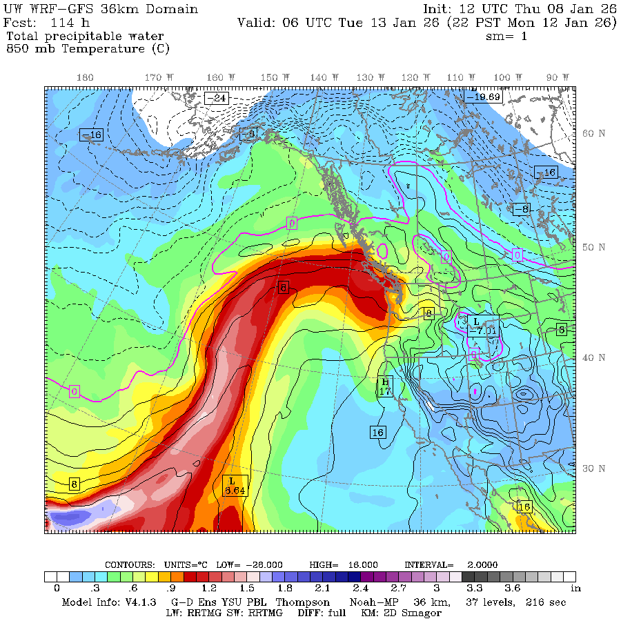
WE'VE FOUND BESSIE! (UW-WRF GFS forecast model showing atmospheric moisture (essentially painting the atmospheric river) for this weekend.
I promise a stretch of dry weather is coming. Just… not yet. One more atmospheric river to get through first.
We’re in the last throes of shaking off the back-to-back storms that rolled through here this week, which did a great job filing the mountains with some new snow. Snoqualmie Pass reported 21” of new snow while 30”+ fell at Stevens Pass.
Now the next storm is set to a good job filling up the river with more water.
It’s a lull in the interim for Friday and even much of Saturday with just mostly cloudy skies and seasonal temperatures. But now forecast models are indicating a storm inbound for late Saturday and Sunday (and Monday!) is tapping into warm, tropical moisture (again) and will qualify as about a moderate-intensity atmospheric river. (Either that, or, looking at the forecast map of water vapor, we’re getting attacked by the Loch Ness monster.)
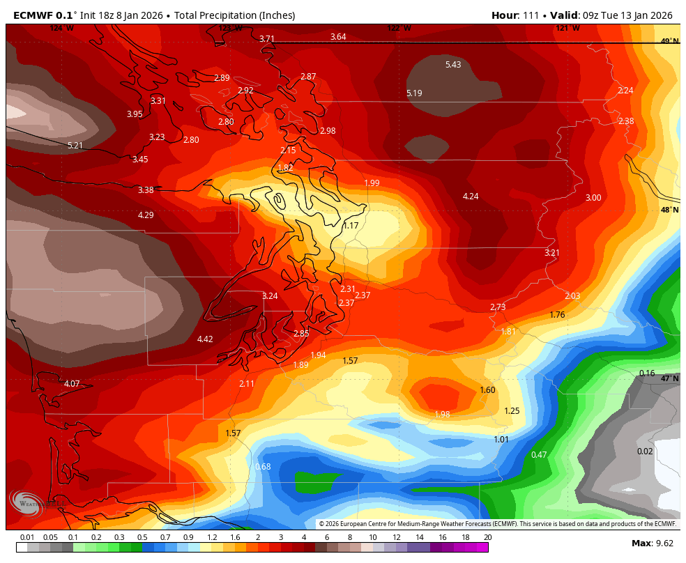
That means higher snow levels and mostly rain, not snow in the mountains. Latest forecast projections are going with greater rain totals (though rest assured, it’s nowhere near the December rain storm levels.)
There is still quite a bit of range in how much rain is predicted, so the risk of any river flooding is still being evaluated. Bu it’s looking like enough rain to push the Skokomish into moderate flood stage and other rivers in the central and northern Cascades to at least getting close to flood stage. The Snohomish is, as of Thursday evening, forecast to reach “action” stage, which is 80% of flood stage.
It’ll bear watching but still nothing alarming so far. For the lowlands, Sunday will be wet, blustery and becoming mild. Rain looks to linger through Monday with highs pushing over 50.
But once the rain stops, it still looks like the spigot will be off for quite some time. Extended models are still adamant that a massive ridge of high pressure (MegaRidge (TM still pending*) ) will take over the entire West Coast, leaving us with foggy, frosty nights and relatively warm, sunny days where the fog and inversion breaks. Remember, going into the mountains may be warmer than the lowlands.
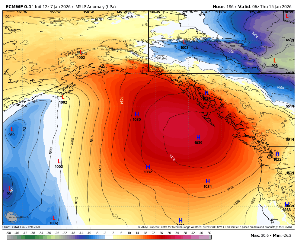
During that pattern shift, there doesn’t appear to be any signs of rain for several days, though there is an inkling that there *maaay* be an inkling of some colder weather in 10-14 day time frame. I know, “Lucy holding the football” again. But La Niña owes us big time. Feels like lowland snow and the Loch Ness monster have a lot in common around here…
Thanks for the heads up! I hope the flooding doesn’t get too bad this time. Our region had more than enough of that last month!
Loch Ness monster! 🤣😂