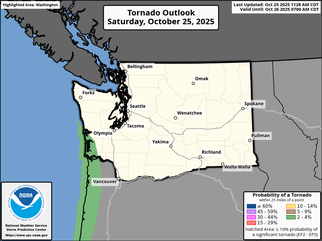
Tornado threat outlook for Washington on Oct. 25, 2025. (NOAA / Storm Prediction Center)
We knew Saturday was going to be an active day in the Pacific Northwest with a potent low pressure center coming ashore, threatening bursts of heavy rain and some gusty-to-strong winds.
But severe weather?
Not in like the traditional outbreak sense you’d think about in the nation’s heartland, but NOAA’s Storm Prediction Center had a bit of an eye-opener when it crafted its national severe weather outlook for Saturday.
It painted much of the Oregon coast and even parts of the southern Washington coast in a Level 1 out of 5 severe weather threat that included a low-end tornado threat (2% chance within 25 miles of any given point).
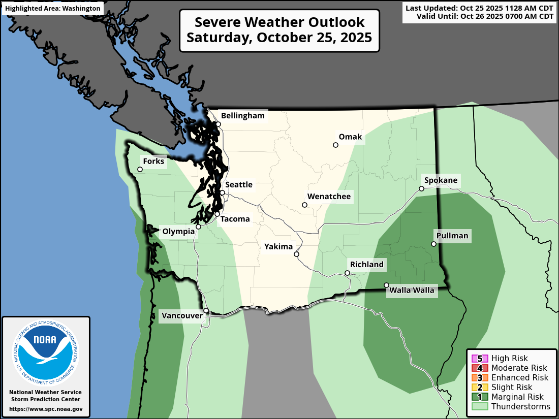
It also gave a low risk of damaging wind gusts.
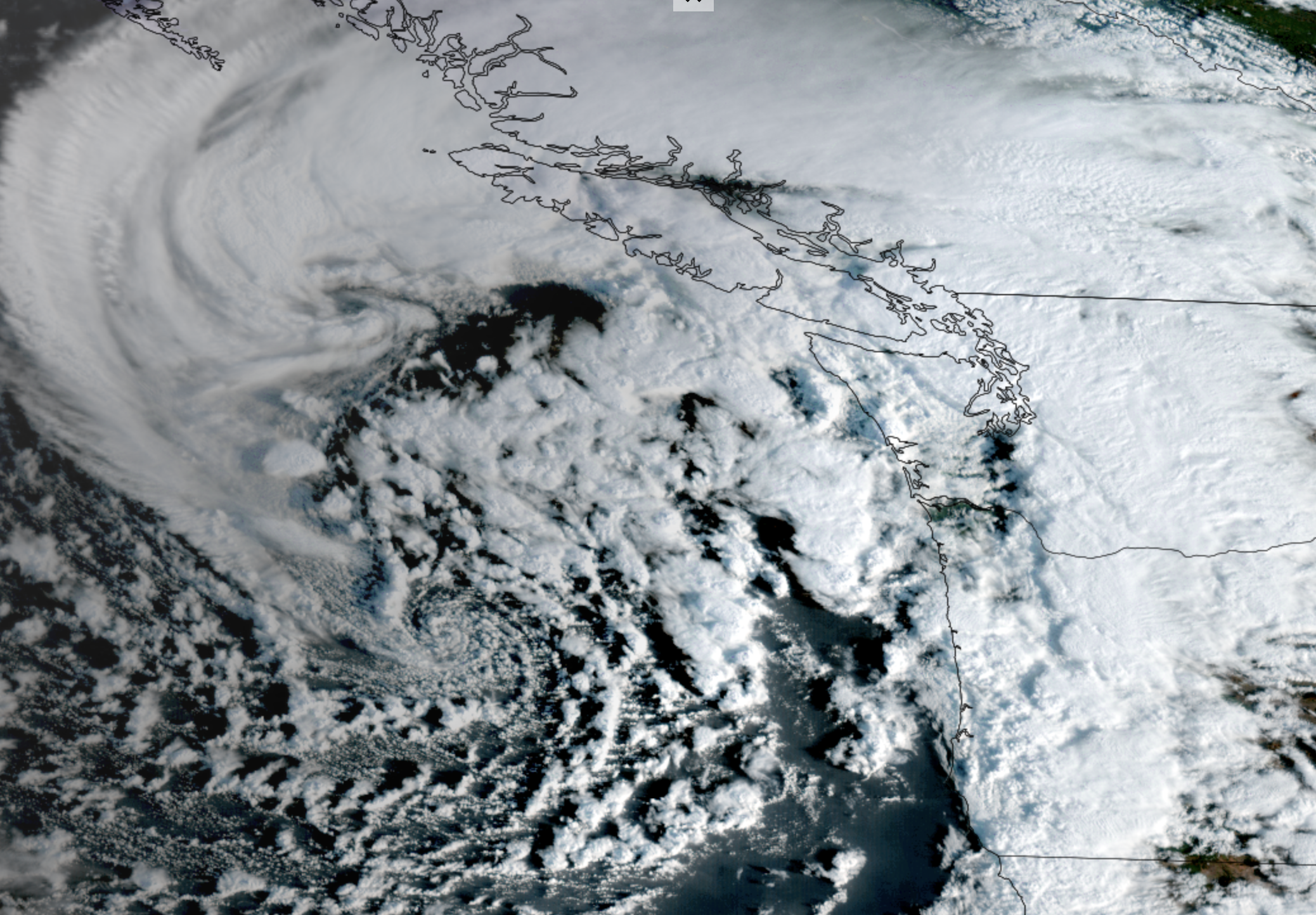
The deal is sprawling low pressure center has brought along a lot of cold, unstable air that is especially buoyant along the coast and just offshore. You can see the bubbling clouds here on that satellite image.
“A brief waterspout/tornado could develop/move ashore near the immediate (Oregon and southern Washington) coast, and marginally severe wind gusts will be possible as low-topped cells move inland,” the SPC said in its severe weather discussion.
It’s not so much a threat in Western Washington or along the rest of the coast north of Raymond because the air is “too cool and stable” for convective development, NWS Seattle said. Though the Seattle area had its own spinning cloud adventures earlier this week with a possible funnel cloud spotted over Edmonds.
There indeed have been some thunderstorms along the Oregon coast this afternoon and it’ll remain occasionally stormy into the evening.
As for the Puget Sound area and Western Washington, it’s not so much thunderstorms that are our impactful weather as the gusty winds. We’re still on track for windy weather late Saturday evening through Saturday night and the few hours before dawn Sunday. Wind Advisories remain in effect for just about all of Western Washington.
It’s not a major wind storm by any stretch but gust could reach 40-45 mph with a few gusts nearing 50 mph and with leafy trees they are more vulnerable to winds and triggering power outages.
Wind is not a concern for Sunday, just chilly showers at times with some snow in the passes if you’re heading over or back across the Cascades.