Back-to-back November storms bring gusty winds, drenching rains to Seattle area
 Scott Sistek
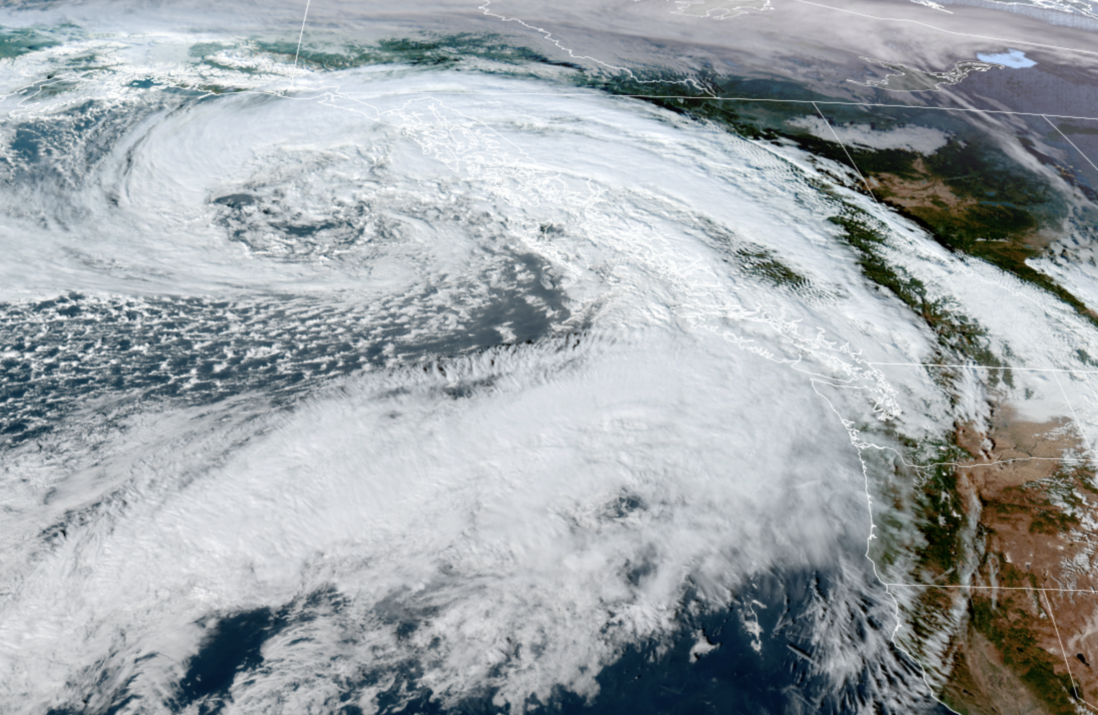
GOES-18 Satellite image showing a large Pacific storm system on Nov. 5, 2026. (NOAA/CIRA/RAAM-B)
What’s more exciting than one November storm to a Seattle meteorologist?
How about TWO storms?
These are the weather patterns we rain fans long for in summer when it’s sunny and 87 outside for the third straight day.
Well guess what, summer fans. IT’S OUR TURN NOW, BAY-BEE!
The good news is these storms, while providing the look and feel of November gray, don’t appear to push the envelope of becoming too much of troublemakers.
But it will bring a period of gusty winds and steady, drenching rains.
The first storm will be moving in early Friday morning. More good news: While this storm does have a low pressure center, it’s not particularly strong (in the low 990s) and is making landfall way up along the northern tip of Vancouver Island.
These kind of storm tracks open up the coast to southerly winds and the Northwest Interior (basically Skagit County north to the Canadian border and the Whidbey/San Juans/Camano Island chains) to strong southeasterly winds.
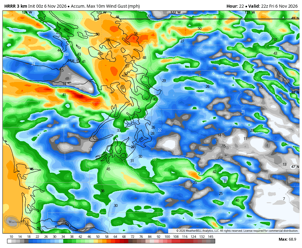
Wind Advisories are in effect for those areas from early Friday morning to Friday afternoon with the peak south/southeasterly winds in the dawn to late morning hours gusting as high as 50 mph — that might sound like a lot, but it’s pretty routine up and over there for November.
But without the low center crossing inland closer to home, that spares the Puget Sound area from any impactful winds. Sure, it’ll still be breezy, blustery day Friday with the rain, but peak gusts look to stay more in 30-35 mph range. With some trees still clinging to some leaves, it does make us a little more susceptible to power outages, but not as much had this been mid September.
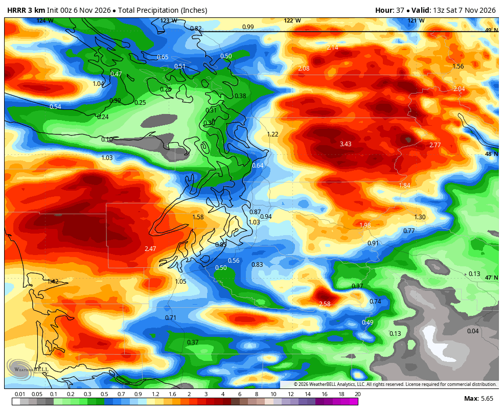
Snow levels will remain moderate to high altitudes and not much of a travel impact.
The wind and rain will taper off late Friday and we’ll get a brief — let’s not call it a dry break but at least a lull on Saturday before storm No. 2 arrives Saturday afternoon into Saturday night.
This one has the low pressure center a bit stronger but also keeps it pretty far away up almost to B.C.’s Haida Gwaii. But its accompanying front looks more potent, so we’ll look for another round of winds — again, peak is along the coast and Northwest Interior and with the stronger storm center, wind speeds might be about 5 mph higher and I expect renewed wind alerts when the storm time draws closer.
It might be enough to nudge Seattle and the Puget Sound area into a low-end Wind Advisory but still not quite sure it’ll reach that threshold.
Otherwise, just round two of rainy/blustery weather Saturday afternoon and night, and even into early Sunday.
AREN’T THESE SUPPOSED TO BE “ATMOSPHERIC RIVERS”?
Actually, yes, both of these storms would technically qualify as atmospheric rivers, but neither look to stay around too long or stall over the area. So while it’ll be quite wet, it doesn’t look like flooding amounts of rain.
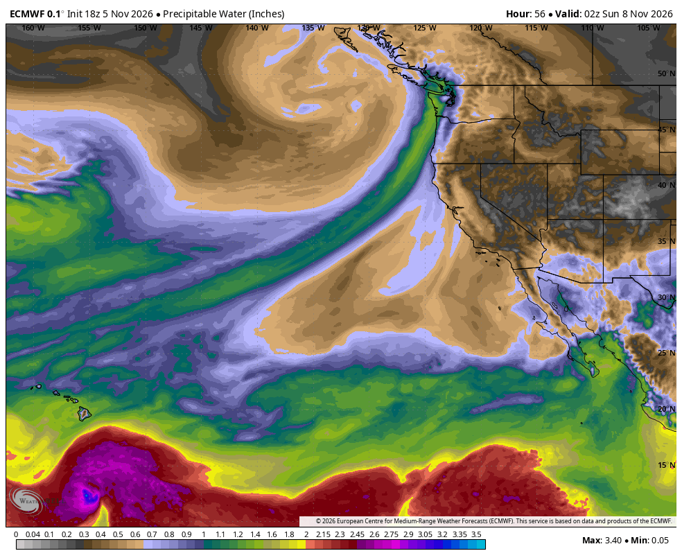
So by the time this second storm tapers off during the day Sunday, we should still be in pretty good shape. The only folks who might have had significant impacts were if you decided early November was a great time to hold that International Card House Building Championship…outdoors… along Alki Beach.
WHAT ABOUT NEXT WEEK?
Earlier forecasts had been a bit foreboding for the middle to end of next week with potential for stronger storms and maybe even a more widespread wind event.
There still maybe yet a third rainy/windy storm around Tuesday-Wednesday next week but later indications are now that the storm track may shift farther south and steer the next group of storms into California. (Is that you, El Niño?) We may still get some rain from them, but it doesn’t look quite as stormy up here.
Still… might be a smart idea to just move that card house contest indoors…