Seattle has less rain than Las Vegas and Los Angeles this October
 Scott Sistek

Photo by Tim Dennert on Unsplash.
We’re going to lose an October rain battle to… Las Vegas?
Seriously?
Despite being massive favorites — Seattle averages about 10 times more rainfall in October than Vegas — the underdog is leading by plenty going into the 4th quarter in what is looking like a significant upset.
Seattle’s rainy season began Oct. 1, yet remains stuck at 0.08 inches of rain through the first three weeks of the month. It’s still technically on pace to be the driest October on record (currently 0.31” set in 1987), though we still have several days left to avoid that dubious distinction.
But Las Vegas is already up to 1.19 inches, with more likely on the way this week as another storm system carves through the Desert Southwest.
Only once before has Vegas out-rained Seattle in October — in 1972. And at least that was close (1.12” vs. 0.72”).
And that might not be Seattle’s only unexpected L in the October rain column. Los Angeles was up to 0.62” by Wednesday evening with more rain falling. San Diego and Palm Springs were already over an inch. Phoenix was not only ahead of Seattle too at 0.42” but was under a rare Severe Thunderstorm Watch Wednesday evening.
(Even rarer? Parts of Northern Arizona had a Tornado Watch Wednesday afternoon. For areas like Flagstaff, it was their first Tornado Watch in 16 years. For Kingman, it was their first EVER Tornado Watch.)
Looks like Arizona is soon to get its first Tornado Watch in 16 years :O https://t.co/JUXjS78QZx
— Scott Sistek (@ScottSeattleWx) October 21, 2026
SUN FANS: “IT’S ABOUT TIME!”
Those who like the sun probably have no such problem with losing this battle. Indeed, this October has featured way more sunshine than usual. Through October 20th, this is the 3rd sunniest October since 2004 (as far back as I can get daily cloud data).
Through Tuesday, Seattle’s October has averaged 58.5% cloud cover during the day. The sunniest October so far was… last year at 55.2% — both sunnier than this past June. In fact, there were 5 Augusts and 2 Julys cloudier than this month so far in Seattle since 2004.
There has also not been a day this October rated as full 100% overcast — that has not happened in at least the last 22 years — but I suspect with 10 days left in the month one of them might hit it.
Temperature-wise, we’re “only” about +1.5 degrees above average — only two days in the 50s so far (and of course, last Friday’s 77 degree day) but spoiler alert, 50s are about to make a comeback.
RAIN FANS: “IS THIS WHERE WE GET TO BLAME EL NINO?”
Actually… this probably is the start of El Niño starting to get its fingerprints on our weather.
It’s not quite the typical El Niño jet stream pattern juuuuust yet despite our dry weather and California’s rain, but looking at the long range models, give it about a week or so because things look very El Nino-ey to start November.
THIS IS THE SAME CITY THAT HAS JSN AND “THE DARK SIDE”, CAN WE RALLY TO BEAT VEGAS?
Maybe, but we’ll have to really “pour” it on.
We have a very weak disturbance — it would actually be an “affront” to call it a front — coming in Thursday that won’t do more than just toss some clouds around and knock high temperatures back into the 50s. Rainfall? Bzzzt; maybe a few sprinkles.
We get more sunshine back on Friday after some patchy fog but it will remain cooler with highs in the upper 50s.
Saturday’s weather is still looking…weird. A storm system races right up to about a couple hundred miles off the coast, then slams on the brakes.
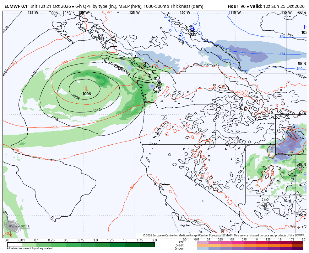
It does look close enough that we’ll get the front edges of its rain for some light rain at times later Saturday into Saturday night, but not really the “meaty” part of the storm, which will instead bug the mariners and fishermen offshore. The models are still debating exactly how close the storm gets. It looks like a solid rainy Saturday along the coast, but only about a range from 0.05-0.20” around the Puget Sound/I-5 corridor — not really a washout. The more recent models are on the drier side even.
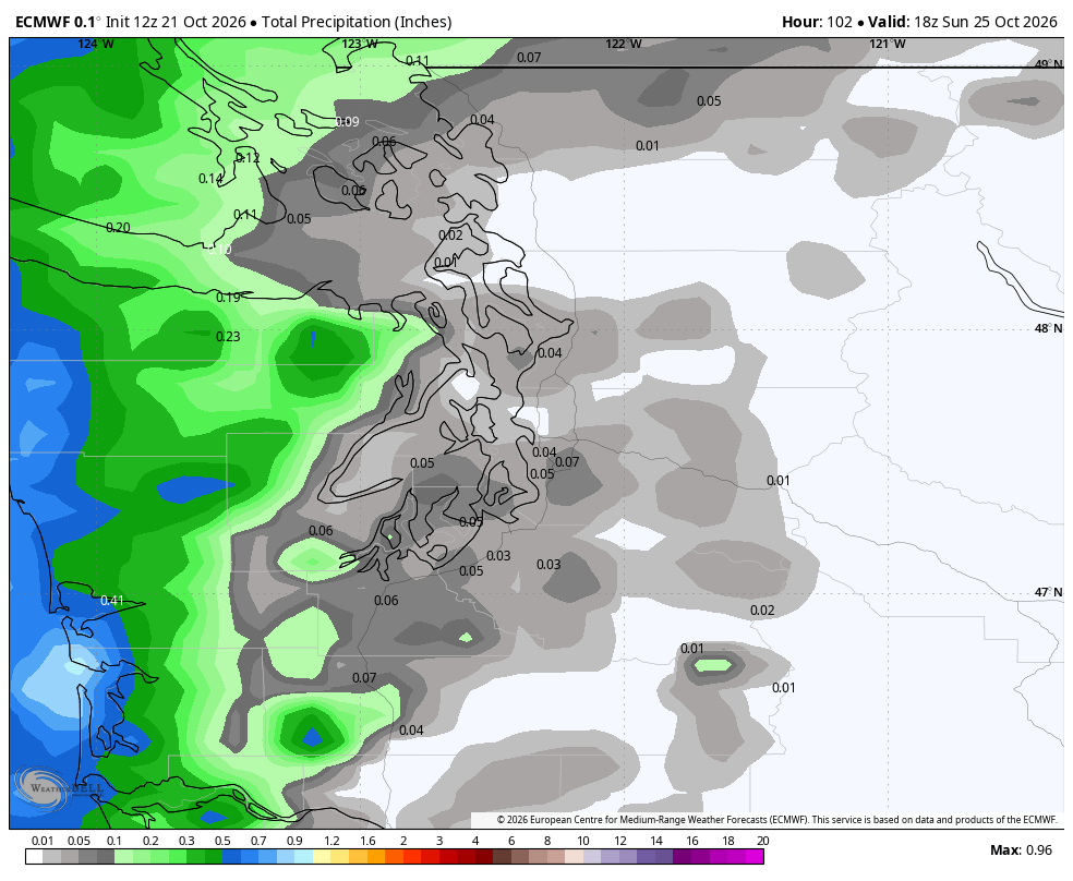
The storm gets cut off from the atmospheric flow and starts to lazily spin offshore for a few days as it decides where to go. That leaves next week’s forecast in a low-confidence flux because models do a poor job at handling cut-off lows. Some models spin the low back out to sea; others bring in a weakened version of the storm ashore into the Northwest like around Tuesday or Wednesday for some more light rain. Meanwhile, the overall jet stream is starting to energize to the south — a calling card of El Niño.
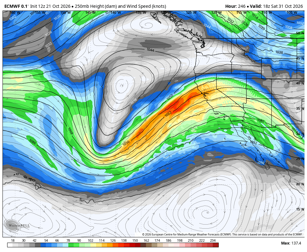
I know everyone wants to know about Halloween but it’s pointless without knowing how that cut off low behaves first; the forecast after it will be essentially dart throws. Already the recent Euro models range from rainy to perfectly sunny for Halloween.
But so far, there’s nothing in any scenario so far looking like it’ll make up our 1+” rain deficits.
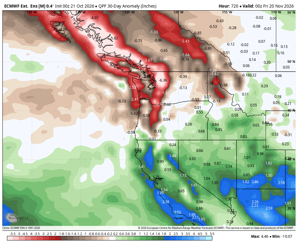
By middle of next week, Vegas can probably go into the kneel-down victory formation. At least their knee pads will get wet and muddy.
MORE TO EXPLORE:
- What is a Kelvin wave? Why Seattle shouldn’t need to worry much about El Niño’s sidekick
- Can you really make an egg stand on its end in Seattle on the first day of autumn?
- Watch: Towering ‘anvil’ cloud stretches dozens of miles… and spans two countries!