Evacuations ordered as ‘catastrophic’ flooding possible along Skagit, Snohomish rivers from relentless atmospheric river
Flooding along Snohomish River in Snohomish (Photo: Andrew Orr)
A dire situation is unfolding in Skagit County and other nearby rivers as relentless torrents of rain fueled by a multi-day atmospheric river storm has threatened to push multiple rivers to heights never before witnessed in recorded history.
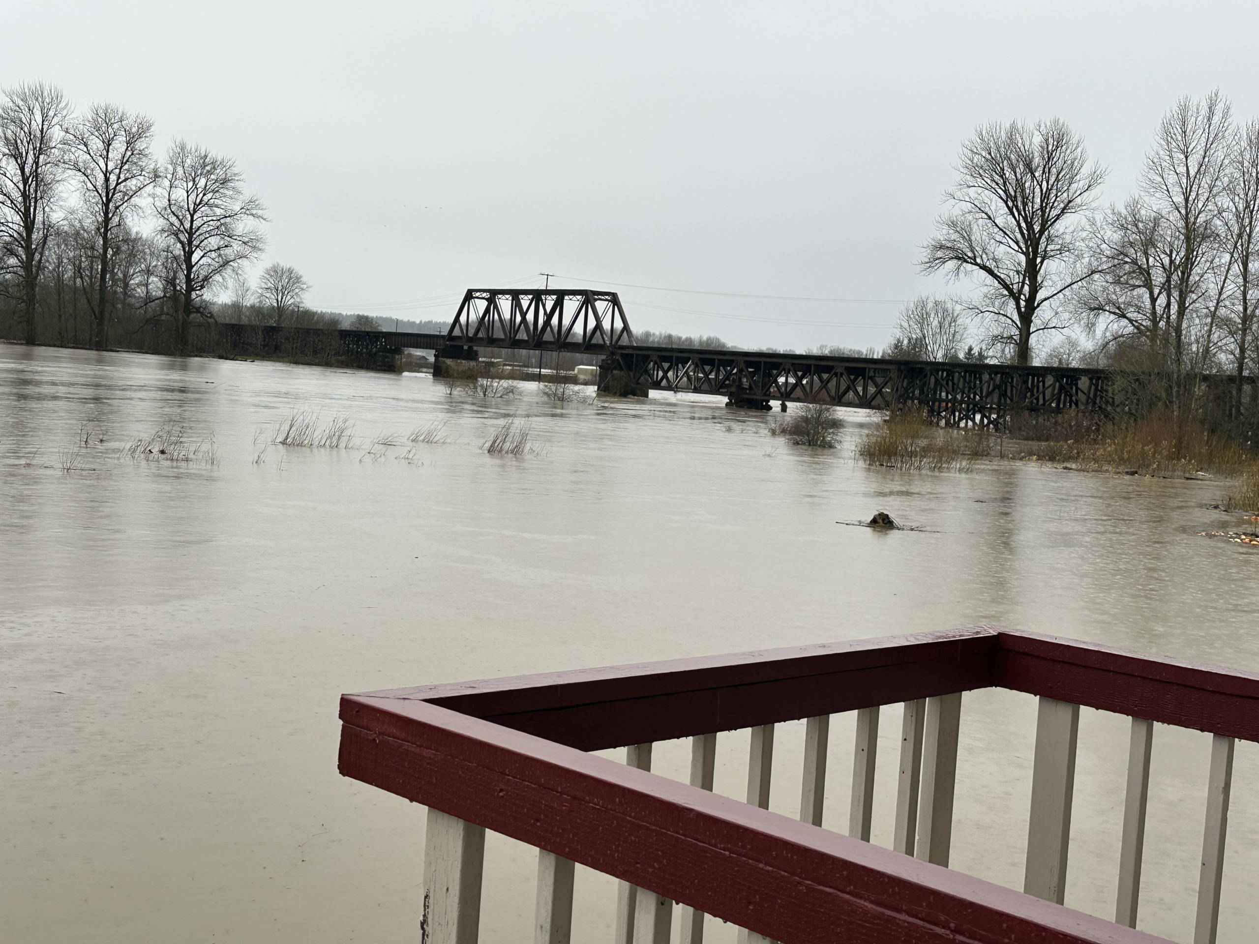
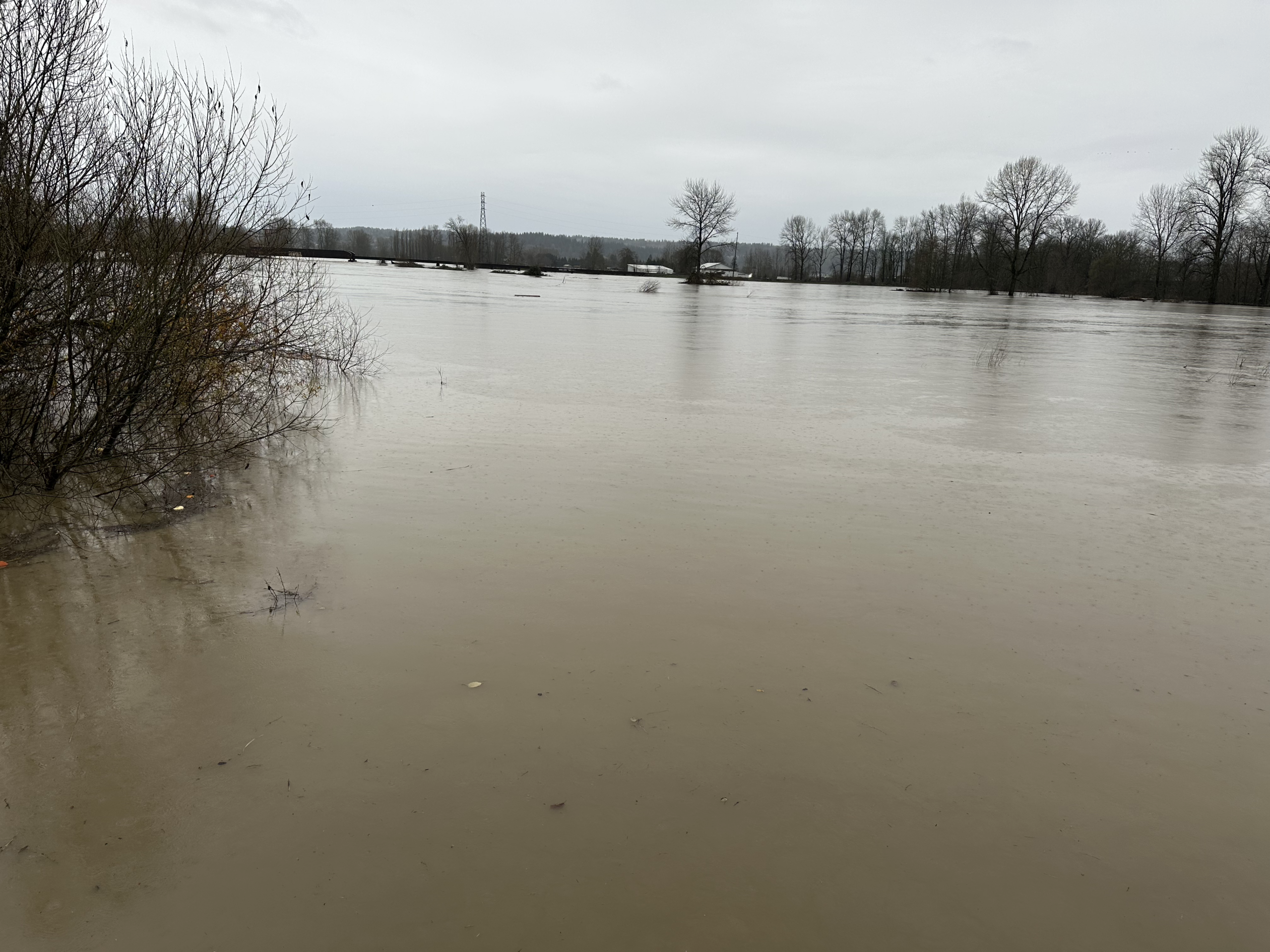
Tens of thousands have been ordered to evacuate along the 100-year flood plain of the Skagit River, where forecasts show water heights reaching well over previous records and and potentially topping dikes and levees along the populated corridor, threatening unprecedented flooding along the likes of Mount Vernon, Concrete and Sedro-Woolley areas.

The National Weather Service has issued a Flash Flood Watch for the Skagit River basin This is DIFFERENT than the Flood Watches/Warnings already in place. Flash flooding is immediate, sudden flooding, usually triggered by convective rain events like thunderstorms but in this case it’s due to potential levee failures releasing sudden torrents of water.
“FLASH FLOOD WATCH FOR THE POTENTIAL FAILURE OF THE LEVEES AND DIKES OF THE SKAGIT RIVER BELOW SEDRO-WOOLEY TO THE MOUTH OF THE SKAGIT RIVER IN EFFECT THROUGH LATE FRIDAY NIGHT,” the NWS alert read. The alert covers Western Skagit county and northwestern Snohomish county; including Burlington, Mount Vernon, La Conner, Edison, Conway, and Stanwood through Friday night.
“This flash flood threat is in additional the to the major flooding expected on the Skagit River,” the NWS said. “Heavy rain is causing extreme flooding of the Skagit River that is forecast to surpass the height of the dike and levee structures. This pressure may cause them to fail, which would cause inundation in areas from Burlington and Mount Vernon into Padilla Bay and Skagit Bay.”
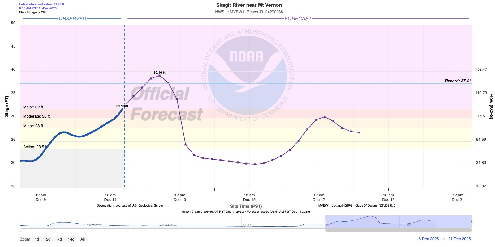
The Skagit at Concrete was just a foot from its record crest Thursday morning.
Flooding in Mount Vernon was set to reach major flood stage by Thursday evening and peak well above the record Friday morning.
9 river gauges around Western Washington were already in major flood stage with 12 more forecast to reach there soon. Another 25 gauges were in various stages of moderate flooding.
REALTIME FLOOD INFORMATION: RIVER FORECASTS & LEVELS // CURRENT FLOOD WARNINGS
Gov. Bob Ferguson has activated the National Guard and said as many as 100,000 across the state are facing evacuations due to rising flood waters. In addition to the Skagit River order, evacuations had already occurred along Ebey Island, and Orting. Ferguson also declared a state of emergency, allowing more state resources to quickly respond.
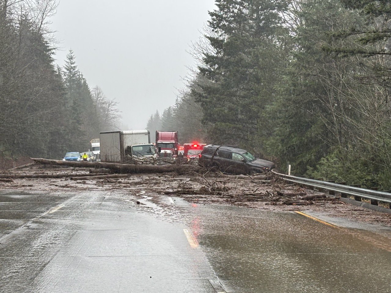
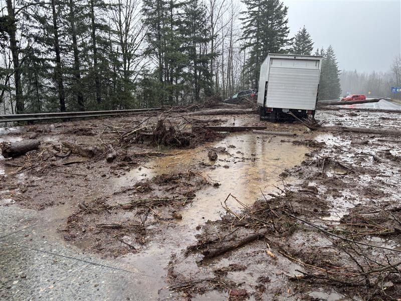
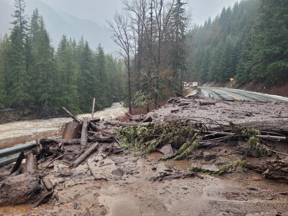
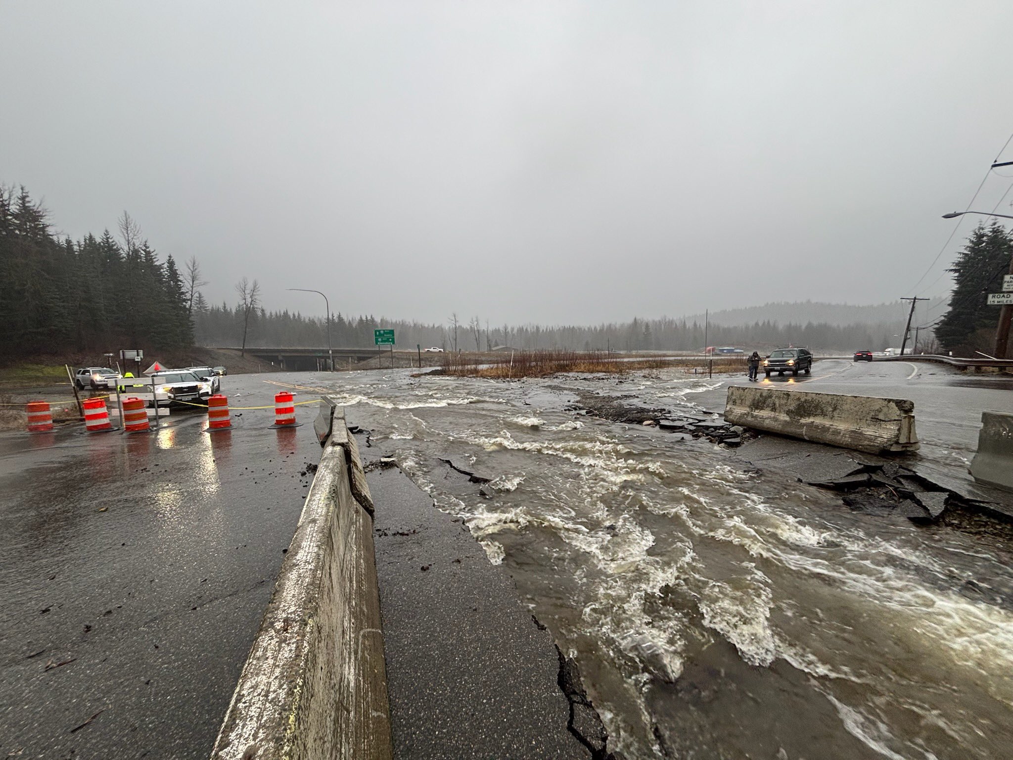
High waters and mudslides wreaked havoc with major roads, leaving some covered in mud or in a few cases, washed out.
I-90 was closed eastbound at milepost 34 (North Bend) due to a mudslide at milepost 29 that struck three vehicles. No injuries were reported but the road remained closed as of 5:30 p.m. Wednesday.
About 60 miles of Highway US 2 across Stevens Pass and into the eastern Cascade foothills from Index to Cole’s Corner was closed due to multiple mudslides and tree falls along the roadway. Crews will reassess Thursday morning.
Up at Snoqualmie Pass, SR 906 was washed out due to rushing waters.
Washington State Route 900 was also shut down in Issaquah due to downed trees.
Multiple rescue agencies reported water rescues Wednesday, including three trapped in a home along the Snoqualmie River and 3 trapped in an RV park in Orting.
Widespread storm rainfall totals reached 8-15 inches in the Olympics with Quinault reporting over 17 inches. In the Cascades, gauges reported 8-12 inches as of Wednesday evening with additional heavy rains still to fall through the night.
Winds have been fierce too, gusting to 56 mph in Shelton and 51 mph in Everett. Higher up in the mountains, gusts reached 78 mph at Alpental and 108 mph at Chinook Pass, showing the power of slamming that moist, tropical air into the mountainsides.
Rain will taper off Thursday morning and we’ll get a relative break through Saturday — though still some scattered showers lingering. More wet weather returns Sunday and into early next week.