134 mph gust reported atop Alpental Summit while Seattle gets its strongest gust in months
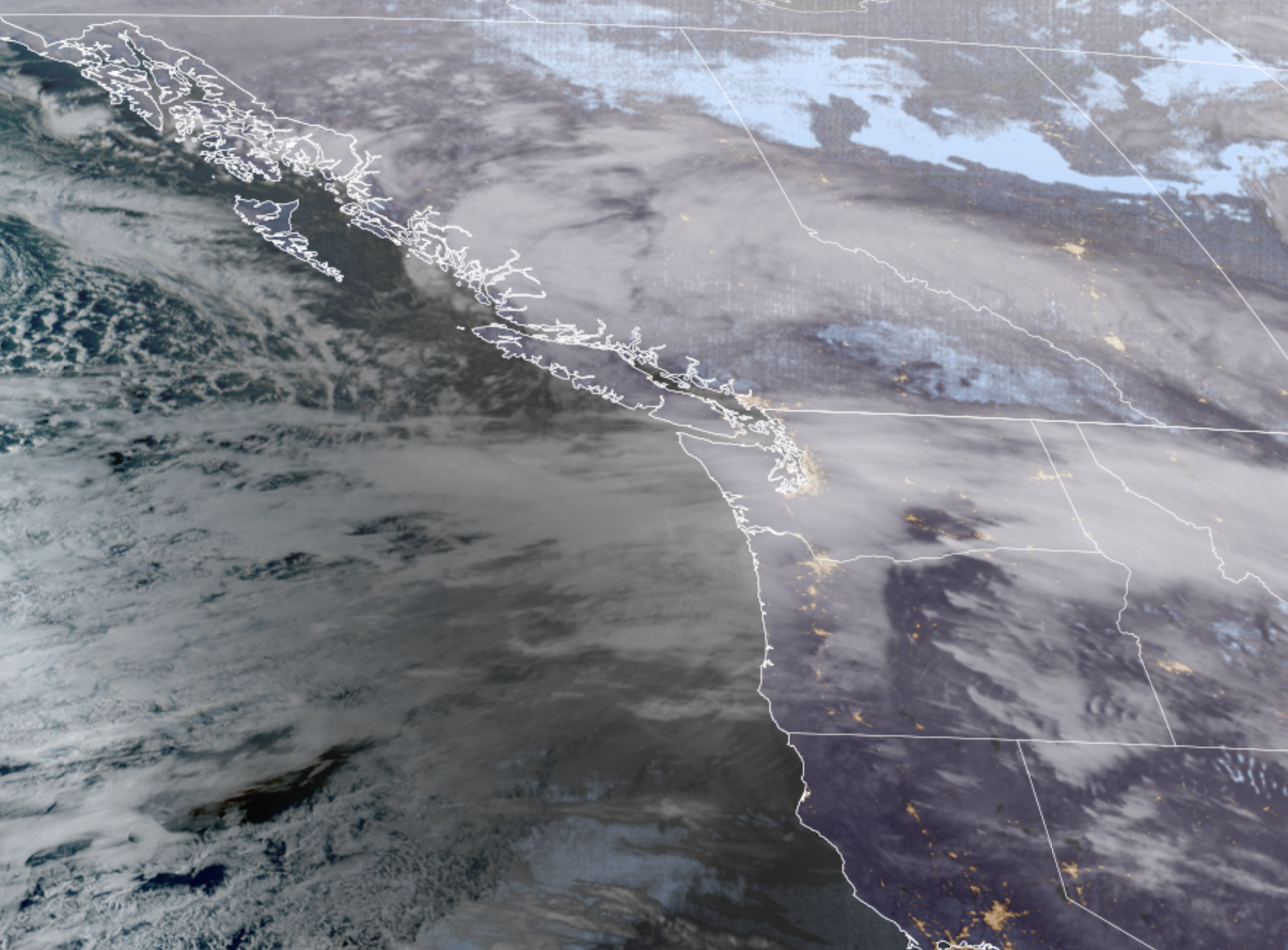
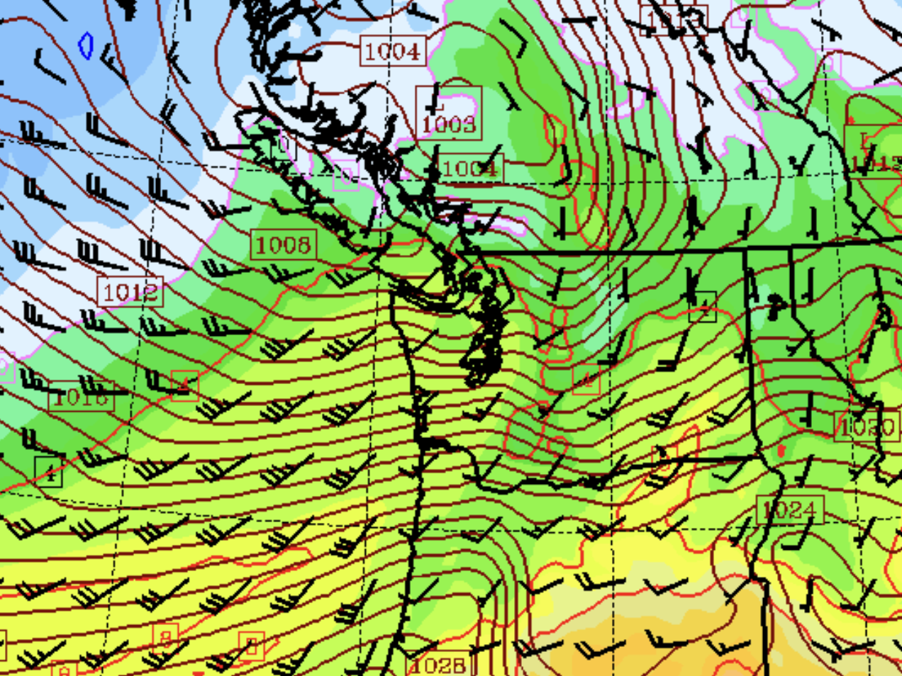
GOES-18 Satellite image showing large slug of moisture moving across the Pacific Ocean via strong jet stream and heading toward the Pacific NW. (NOAA/ CIRA / RAAM-B)
It’s a little late in the year for a windstorm, but don’t tell Mother Nature, who unleashed one of the stronger storms of the season.
To give an idea of how strong that jet stream is slamming into the region Wednesday night, the wind gauge atop the Alpental Ski Resort Summit at 5,200 feet recorded a gust of 134 mph Wednesday evening! Meanwhile, the Chinook Pass Summit (at 6,240 feet) reported a wind gust of 126 mph!
Pigtail Summit along White Pass (5,970 feet) recored an even 100 mph gust, while DirtyFace Rock in the Northern Cascades hit 76 mph!
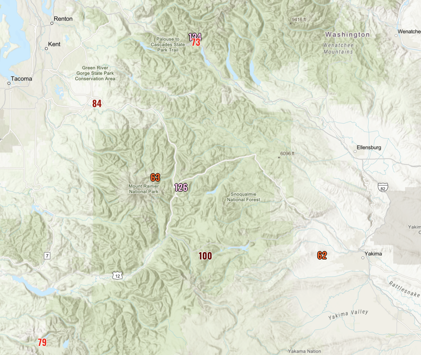
Triple digit wind speeds aren’t unheard of in the fall and winter on our mountain peaks during windstorms, but 134 and 126 mph is still mighty impressive.
You can imagine why the mountains have had Blizzard Warnings up all day!
EASTBOUND JETS TAKE ADVANTAGE:
With the very strong jet stream blowing at 200+ mph across the Pacific, TransPacific flights heading east sure looked to take advantage. Take a peek on FlightAware and look up flights from Asia to Seattle Wednesday and you’ll see that many flights eschewed taking more the northern circle route, which is shorter distance, for a more direct route that took advantage of the jet stream’s tail wind.
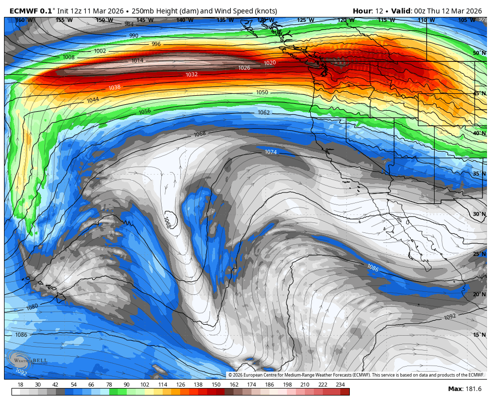
One flight I found, Hawaiian Air flight 824 from Tokyo-Narita to Sea-Tac, filed its flight plan at 570 mph but managed to score tail winds that pushed relative ground speeds well over 600 mph. In fact, there was a little while the jet reached 720 mph of ground speed!
Just, pity the poor folks trying to go west into the teeth of that jet!
SEATTLE CLOCKS WINDIEST DAY IN MONTHS
Of course, it’s been windy down here too. Here are some of the top wind speeds as of 10 p.m. with the peak of the wind storm in progress and still a few hours to go:
- Alpental Summit @ Snoqualmie: 134 mph
- Chinook Pass Summit: 126 mph
- Pigtail Summit at White Pass: 100 mph
- Cape Disappointment: 69 mph
- Hoquiam: 61 mph
- Freeland: 57 mph
- Everett: 54 mph
- Bellevue: 52 mph
- Seattle: 52 mph
- Shelton: 51 mph
- Forks: 51 mph
- North Bend: 51 mph
- Kingston: 50 mph
- Gig Harbor: 45 mph
For Seattle, the 52 mph gust at Sea-Tac Airport makes it not only the windiest day so far this year, but its the windiest day of the entire fall/winter stormy season!
(Our peak wind gust in 2026 so far was a puny 26 mph. The peak gust of the entire fall/winter season was 37 mph on Dec. 17. )
About 85,000 people were without power as of 10:30 p.m.
IT’S SO WINDY ON THE COAST, THE SEA SPRAY IS MESSING WITH THE RADAR
A look at the coastal radar out by Westport this evening shows an unusual “ground clutter” just in the near shore waters off Grays Harbor? What is that?
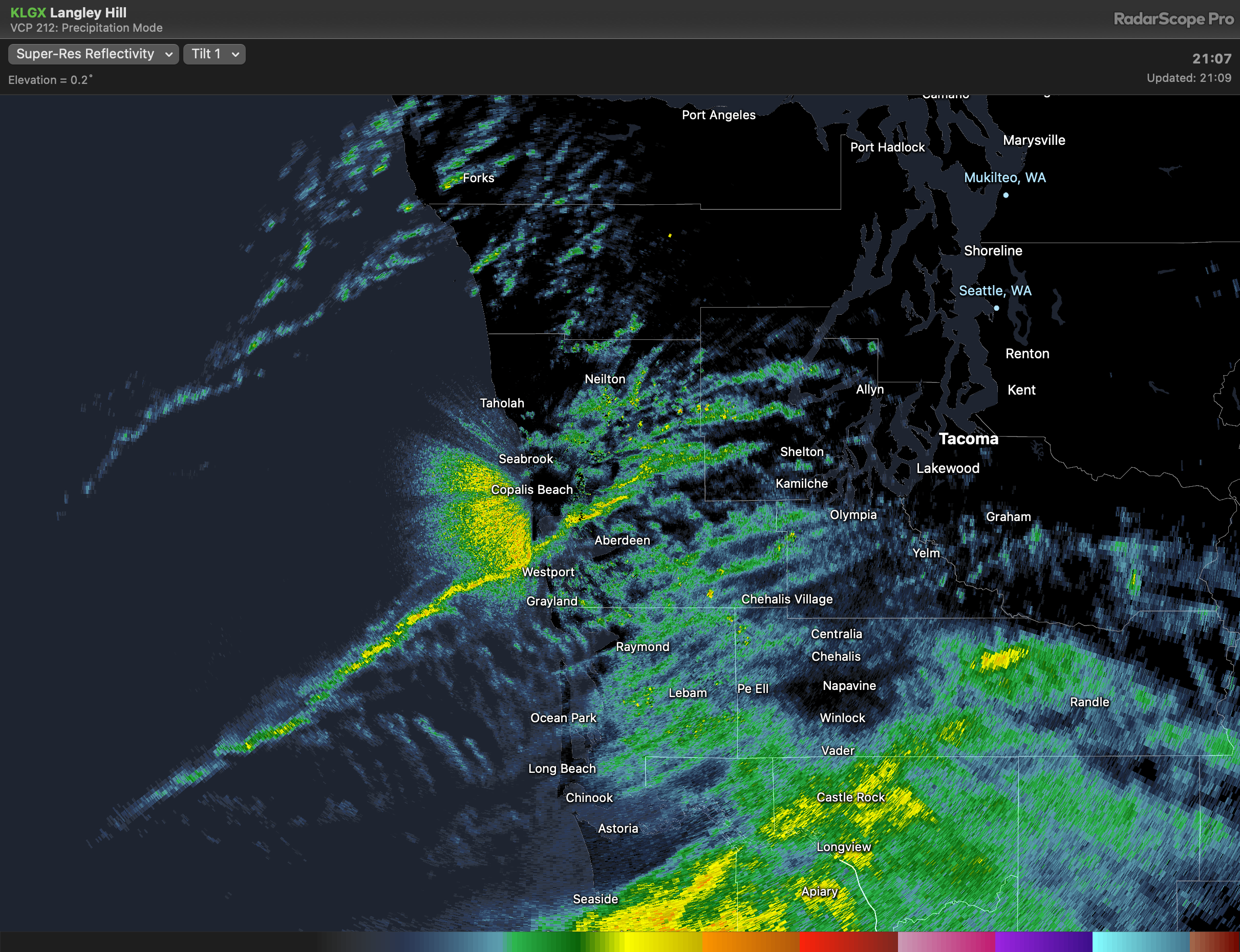
The strong winds (61 mph peak gust at Hoquiam) are churning the ocean so much and creating so much sea spray it’s messing with the radar beams, mimicking precipitation!
WHY SO WINDY FOR NOT SUCH A POTENT LOW?
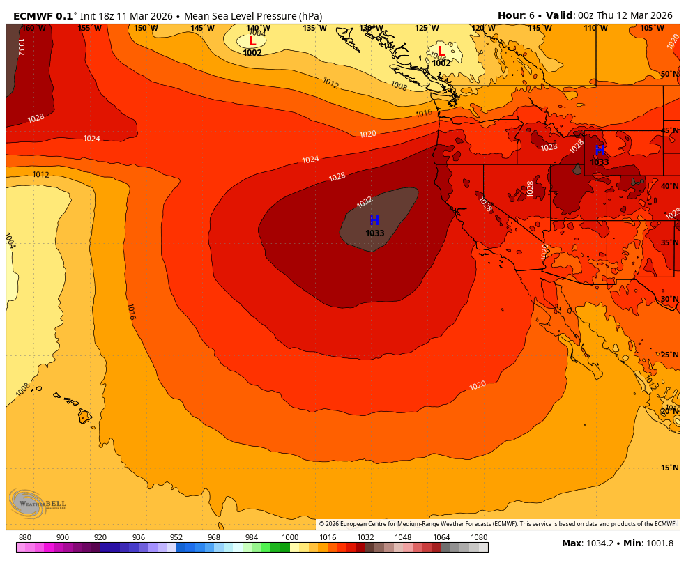
If you were to look at the low pressure center that’s come into B.C. tonight, at first glance you wouldn’t be impressed. The central pressure looks to be somewhere around 1003-1004 millibars. That is typically mere child’s play for a low.
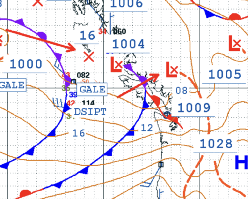
Usually when we get strong wind events we’re talking storm centers around 980 mb or lower. 1000 millibars we can do on a calm day. Standard sea level pressure is 1013.2 mb. Hoquiam despite blowing over 50 mph for hours recorded a pressure of 1014.7 mb at 7 p.m. — even slightly higher than standard pressure.
So why so windy? Hoquiam’s number is a clue; the hot weather going on the Desert Southwest and California is another. There is HUGE high pressure over much of the rest of the West right now.
That’s bringing a big difference in pressure to where even modest low centers can create some decent wind, as we’re seeing tonight; (also fueled by the very strong jet stream.)
The pressure “gradient” between Portland and Bellingham peaked at +14.30 mb as of 7 p.m. and most of our base wind storms we get here “only” get to about +12 or 13. So a bit of an unusual wind situation!
MORE TO EXPLORE
- Windstorm looms for Western Washington lowlands with blizzard conditions in Cascades
- Seattle finishes warmest La Nina winter on record
- It has finally snowed in Seattle this year… for 34 minutes (so far)
I live in Marysville. For the 2nd time since last fall we only had a little wind, very little if any rain and no power outages.
Everything was south of us, again. We have managed to duck 2 windstorms in a row. Since it already almost mid March I think we are safe until next winter which appears to be a strong El Nino.
Can hardly see your page with all the ad banners top and bottom! What happened?