Wild weather recap: Possible tornado near Long Beach, torrential rains slam Seattle

Possible tornado near Cape Disappointment on Nov. 5, 2025. (Photo courtesy: Mark Skaggs / @markskaggs10 on X)
The first of two storms to roll into the Northwest to end this week packed quite a punch, with torrential rains, vivid lightning, and even a sighted waterspout that likely became a tornado along the southern Washington coast.
Let’s begin with the possible tornado. The National Weather Service in Portland had issued a very rare Tornado Warning for Pacific County after radar indicated a likely tornado near Long Beach. Sure enough, several local weather enthusiasts who were down in the area chasing the storms got photos. The photo above is from storm chaser Mark Skaggs.

“Just spotted a waterspout and tornado crossing into Cape Disappointment State Park, WA!!” he posted on BlueSky.
Michael Snyder of Pacific Northwest Weather Watch was also there and said he would post video of the event later.
Before Wednesday, it had been 252 days since NWS Portland last issued a Tornado Warning and only the 5th Tornado Warning issued by that office since 2020.

(The southern Washington Coast is in NWS Portland’s forecast territory, but for reference, Seattle’s office has issued 12 since 2020 — most for along the coast for waterspouts.)
We’ll see if NWS Portland puts out a statement confirming the tornado. With no reported damage, it’s unlikely there will be an official storm survey.
SEATTLE GETS ROCKED
Meanwhile, closer to Seattle, it was waves after waves of squall lines, each bringing periods of drenching rains, and then at the end, added in some lightning to spice things up.
Hang on Seattle! pic.twitter.com/MpKANh3ZOj
— Scott Sistek (@ScottSeattleWx) November 6, 2025
One cell hit North Seattle particularly hard in Wednesday evening, with multiple lightning strikes touching down in the Lake Forest Park area.
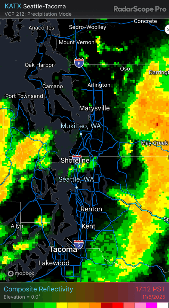
Seattle officially netted 0.67 inches of rain at Sea-Tac but many areas in North Seattle went well over an inch of rain, including the NWS office itself at Sand Point, which reported 1.12 inches and is the wettest day of the year so far.
Kenmore reported 1.74 inches and Roosevelt collected 1.52 inches.

WET AGAIN THURSDAY WITH ANOTHER ATMOSPHERIC RIVER
No rest for the dreary on Thursday as another atmospheric river storm comes in quickly on Wednesday’s storm for another very wet and blustery day.
There is even again a risk of thunderstorms after the front passes later in the day, but it’s not quite as unstable as Wednesday. Instead, expect just increasing puddles and gusty winds to 30-35 mph.
There is a Wind Advisory on the coast fro gusts up to 50 mph but the strongest winds look relegated there as the storm center stays offshore.
We are still on track for a tranquil and dry weekend with just lighter periods of rain at times next week.