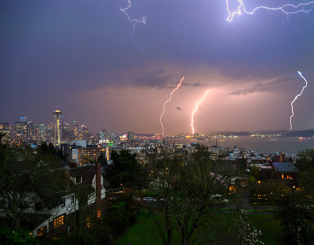
Seattle Lightning (Courtesy: Tim Durkan Photography)
Wake up, Goldilocks! The bears are coming home early.
I feel like my last post here advertising 5 days of “Goldilocks” weather — as in the temperatures juuuuust right — may have tempted a jinx because the forecast is starting to look more active now for later Tuesday into Wednesday and it might even feature a brief period of thunderstorms around Seattle and the Puget Sound area.
A wayward area of low pressure is swirling its way in from the Pacific Ocean and has its sights on heading ashore somewhere in Oregon late Tuesday into Wednesday. Earlier model projects had it pretty far south almost to the Oregon/California border if not into Northern California itself.
But many of the more recently projections — including the vaunted European model — are bringing the low center closer to more like central Oregon.
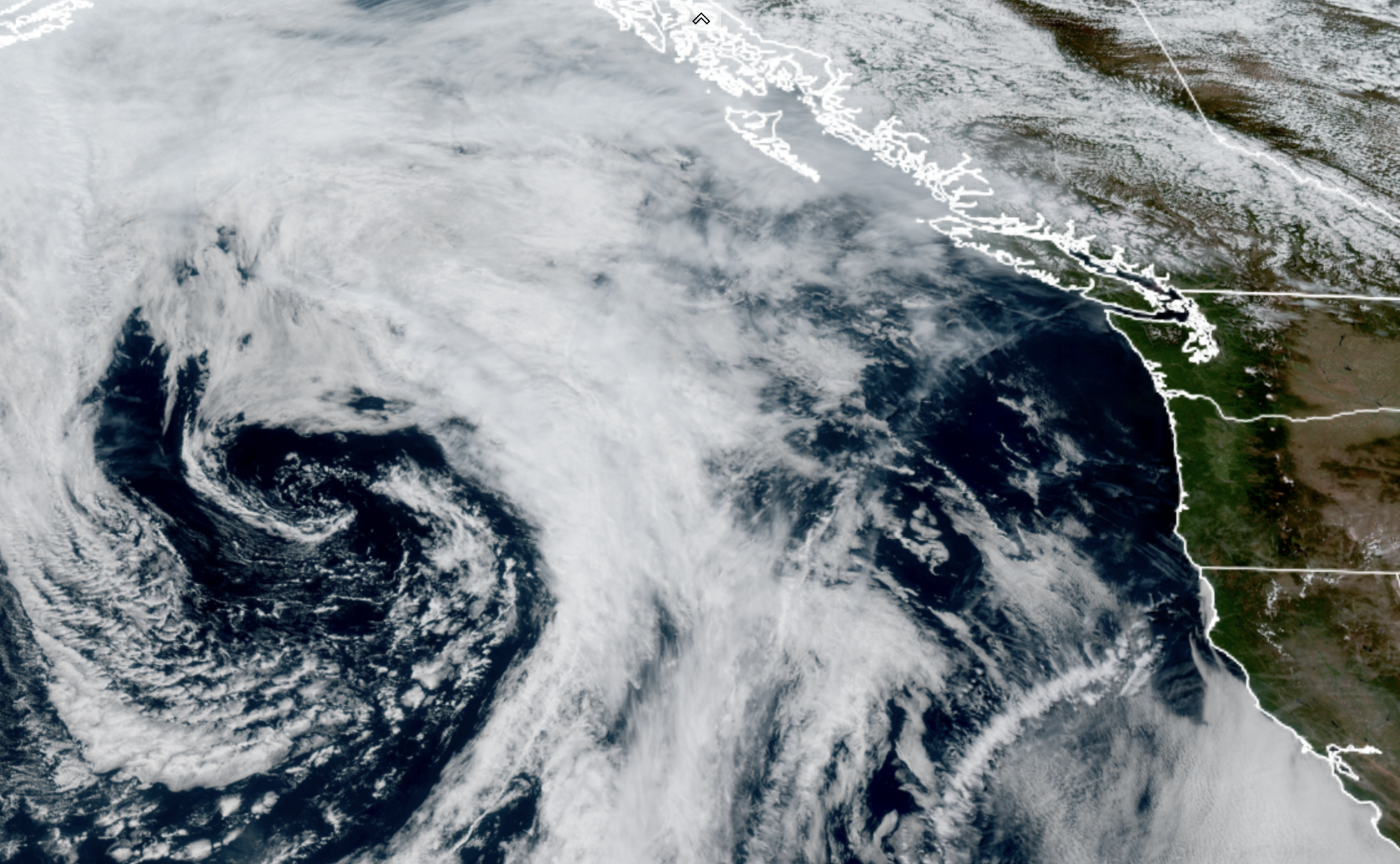
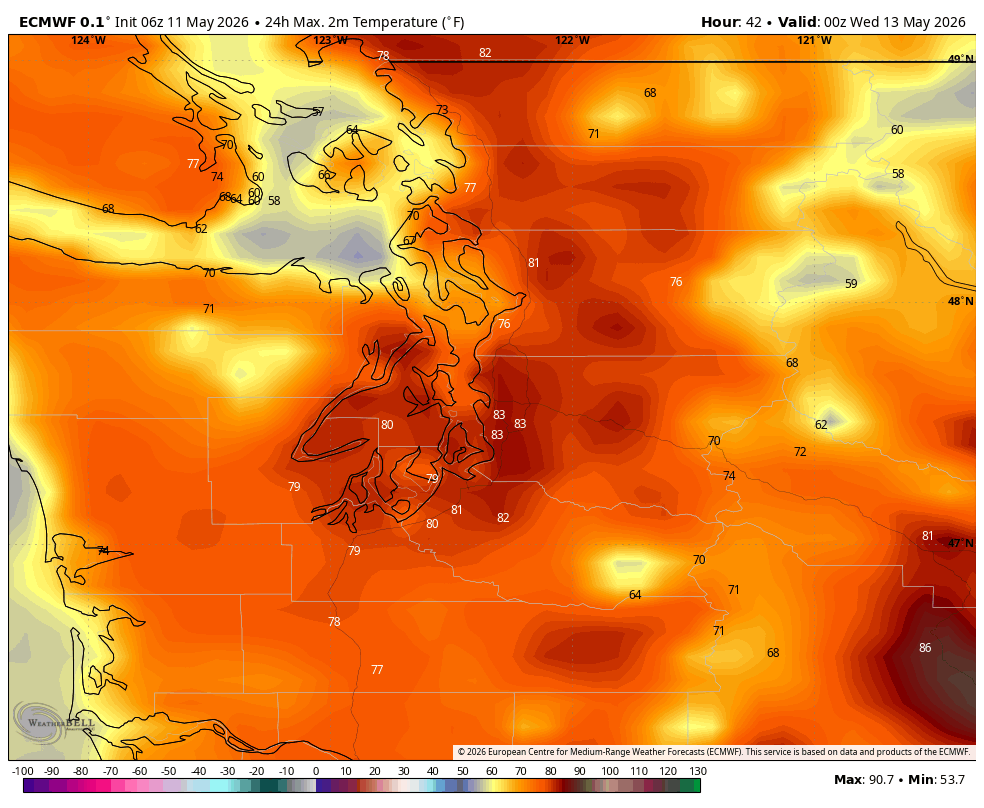
That would be close enough that Western Washington may get some fringe effects from the storm. Namely, the swirl around the low would pull up some warm, moist — and now unstable air from the south. At first, the approaching low will enhance the ridge over the Northwest Tuesday morning and allow a quick boost in temperatures. Then as the low approaches, it will push some of that warmer air north to where Tuesday at first will end up warmer than first thought.
Daytime highs around Seattle are now expected to reach into the upper 70s if not flirt with 80 degrees. It may even feel just a touch more humid but this doesn’t look too noticeable.
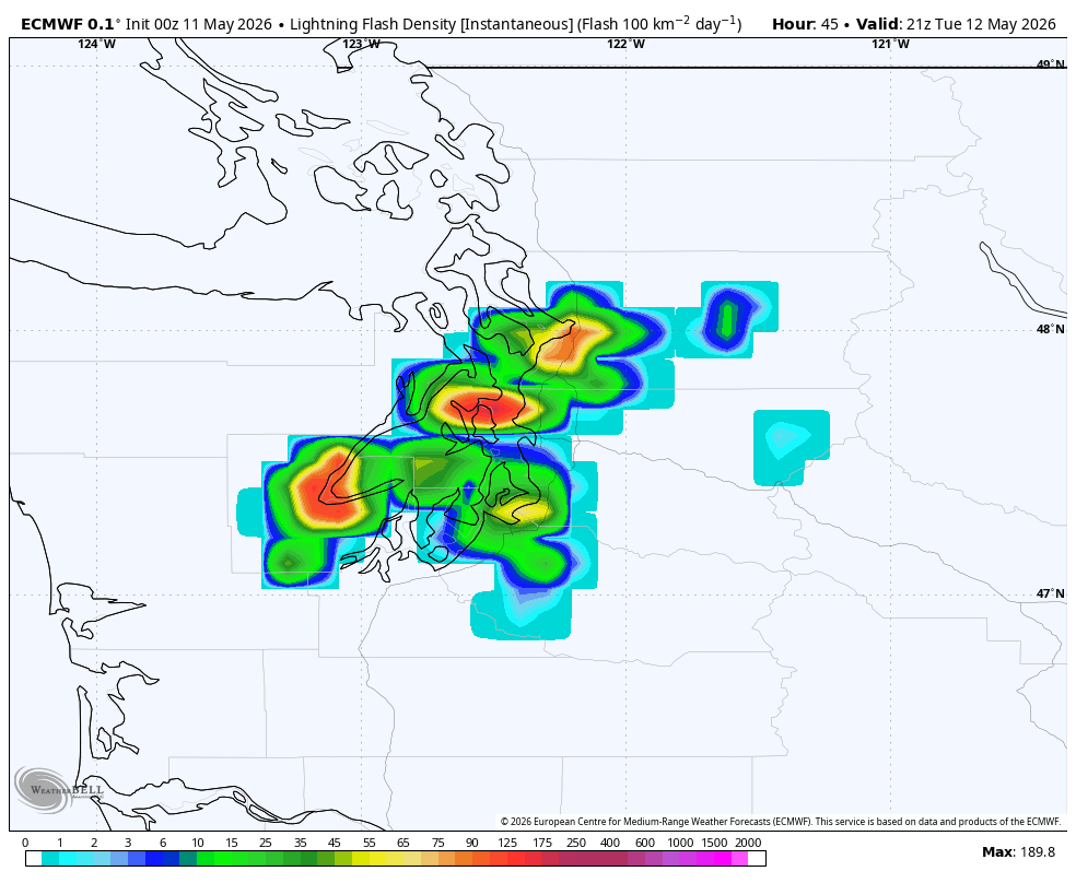
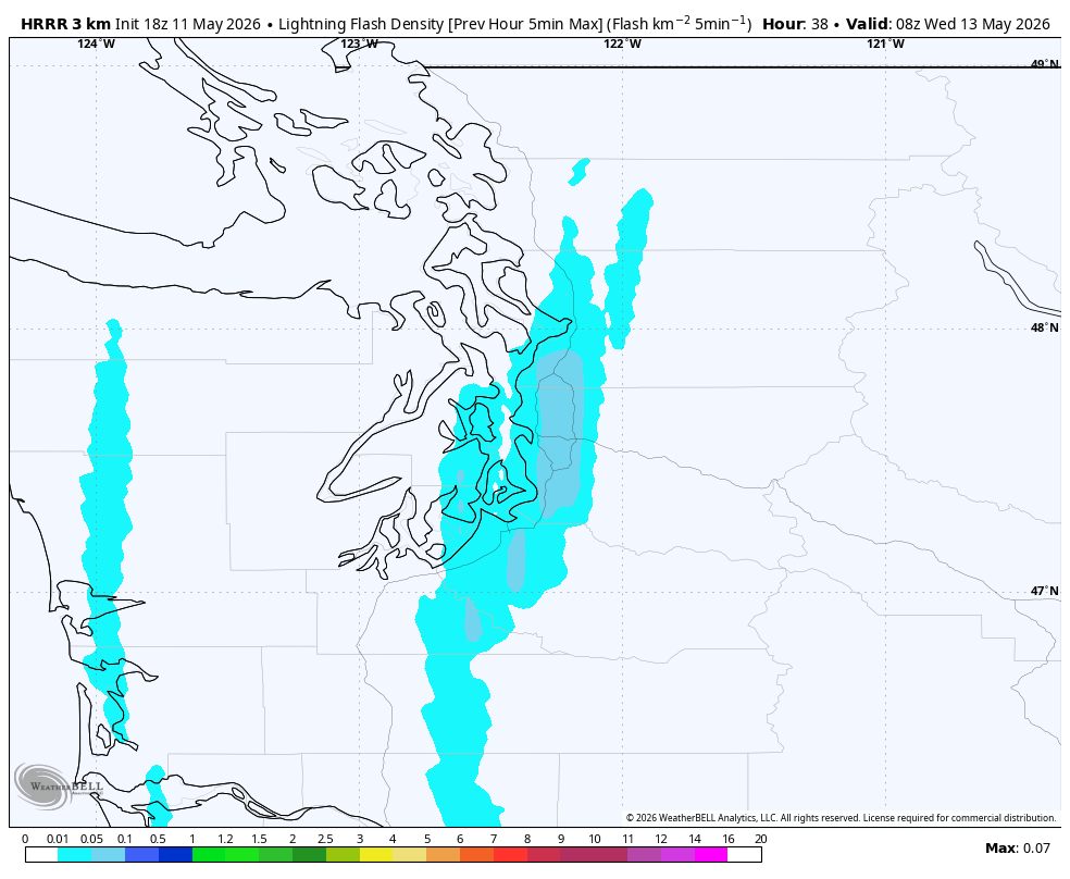
What *will* be noticeable are some storms that may initially fire in western Oregon during Tuesday afternoon as the low approaches there, then get pushed to the north into Western Washington with that southerly flow.
The forecast models are still varying enough that it’s difficult to get a high-confidence forecast with these storms, but some models swing a few thunderstorms up the I-5 corridor through Southwestern Washington and into the Puget Sound and Seattle area as early as late Tuesday afternoon into Tuesday evening; others are thinking more of an overnight affair into Wednesday morning. Better chances for thunderstorms are in the southern and central Cascades and southern Washington (closer to the low.)
April and May are what passes for thunderstorm season in the Seattle area, so this wouldn’t be too unusual. So far these storms are not looking too intense, and frankly, they don’t seem to last that long nor be that numerous. This is very unlike last May when we were dealing with that record-for-us severe weather and large hail threat (that ultimately fizzled); at this point it looks more garden variety Northwest thunderstorms.
Still, even “weak” thunderstorms are dangerous — it only takes one unlikely lightning shot to ruin your day. So if you are out enjoying the sun and warmth Tuesday, keep keen eye on the skies — these storms would be coming in from the south/southeast. And first sign of any rumbles, it’s time to get inside.
Thunderstorm chances hold through Tuesday night into early Wednesday morning then the thunderstorms chances fade but the low should drag in more rain showers behind it along with a pretty decent marine layer so expect cloudy skies Wednesday with patches of drizzle or even light showers at times — especially in the convergence zone areas — with much cooler temps down in the 60s.
This low does look like it’s going to kick off a big pattern change that will last about a week or so, if not more, of cooler, cloudier weather even even some chances of rain here and there — especially Friday into Saturday. Highs will stay generally in the upper 50s to low 60s which, if I know most of our Seattle rain fans on here — might be the TRUE Goldilocks weather forecast.