 Scott Sistek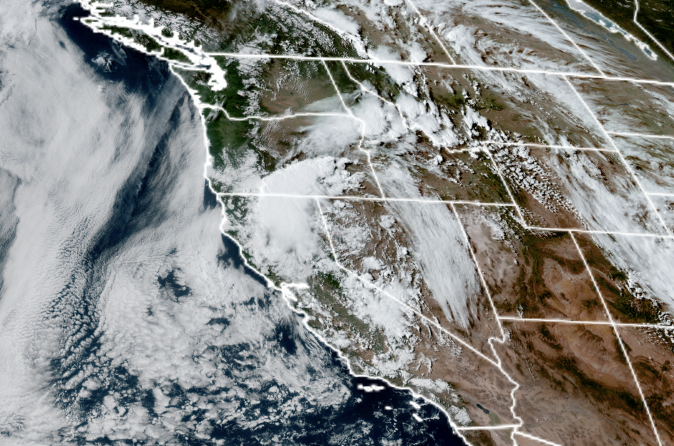
GOES-18 satellite of swirling low pressure center in California that will rotate thunderstorms into the Inland Northwest on Thursday. (NOAA / CIRA / RAAM-B)
First up: How to touch a nerve in Seattle:
- “What kind of dork dunks their fries in tartar sauce?”
- “Wow! Those Oklahoma City Thunder just might go back-to-back!”
- “Really? You wear socks AND sandals?”
- “Soccer is the most boring sport…”
- “Traffic was really a mess today on ‘the 5’”
and apparently… - “The unofficial start of summer in Seattle is Memorial Day weekend”
Yes, while most across the U.S. consider Memorial Day the “unofficial” start of summer, in Seattle YES, WE ALL KNOW it’s more like July 5th. But while it feels a bit like summer now — we’re going to revert back to spring too with some rain again soon.
Yet it’s nothing like what’s going on east of the mountains this week, where some thunderstorms have caught the attention of NOAA’s Storm Prediction Center. In fact, the most severe-iest weather in the U.S. Thursday looks to be right here in the Pacific Northwest… or at least the Inland Northwest.
For Western Washington, Thursday is more “false summer” with sunshine and highs warming even a bit more, nearing or even reaching 80 degrees in Seattle and low 80s in the warmer spots.
Not so, east of the mountains.
That low pressure center that swirled by here over Memorial Day weekend has parked itself over Lake Tahoe and on Thursday, will spin a mix of unstable air and moisture to the north and northwest across Eastern Oregon and Eastern Washington, creating a wide field of strong-to-severe thunderstorms.
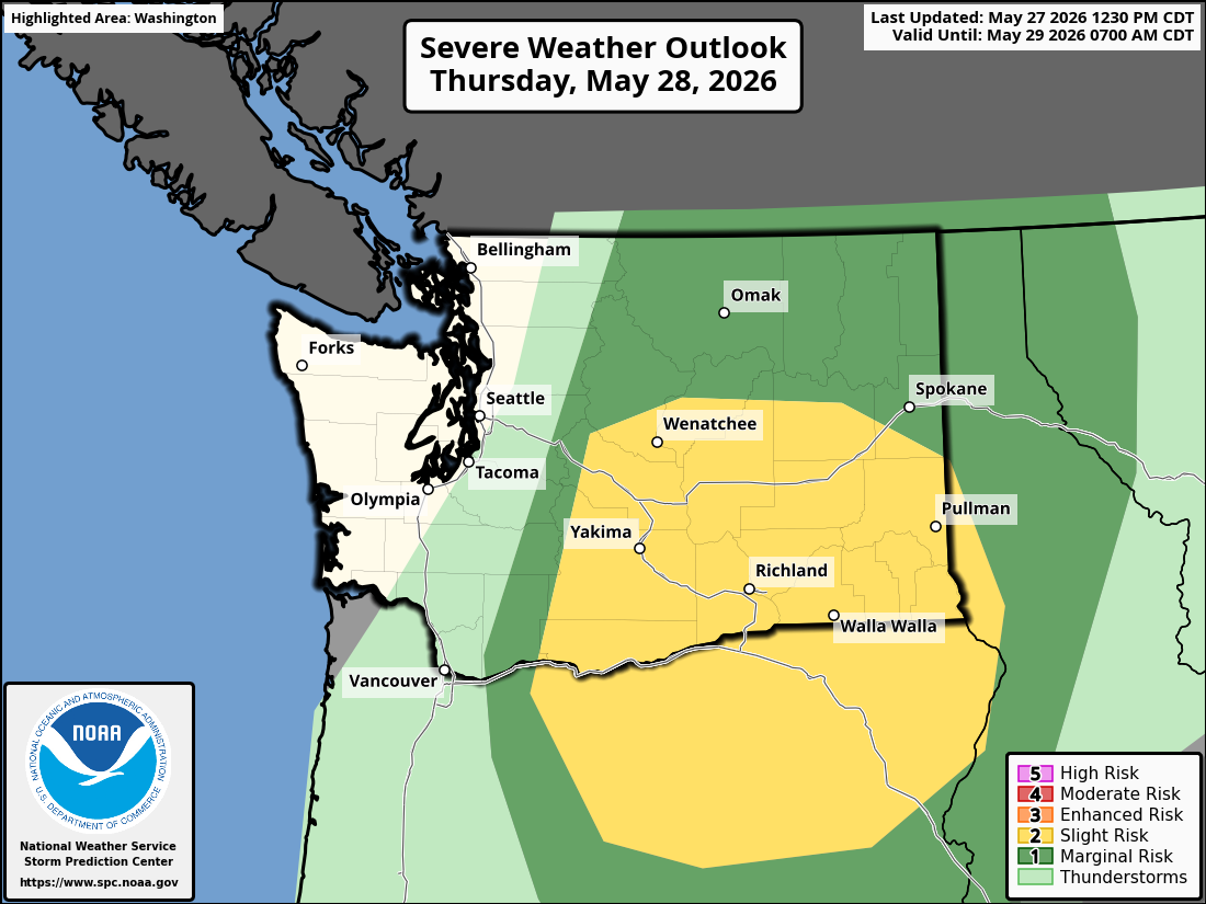
NOAA’s SPC has even highlighted an area in a Level 2 out of 5 severe weather threat that is bounded from about Wenatchee on the north, south through the Columbia Basin and the Columbia Gorge down to about John Day, Oregon. That level of severe risk isn’t unheard of over there, but it is fairly rare — usually just a couple of times a year.
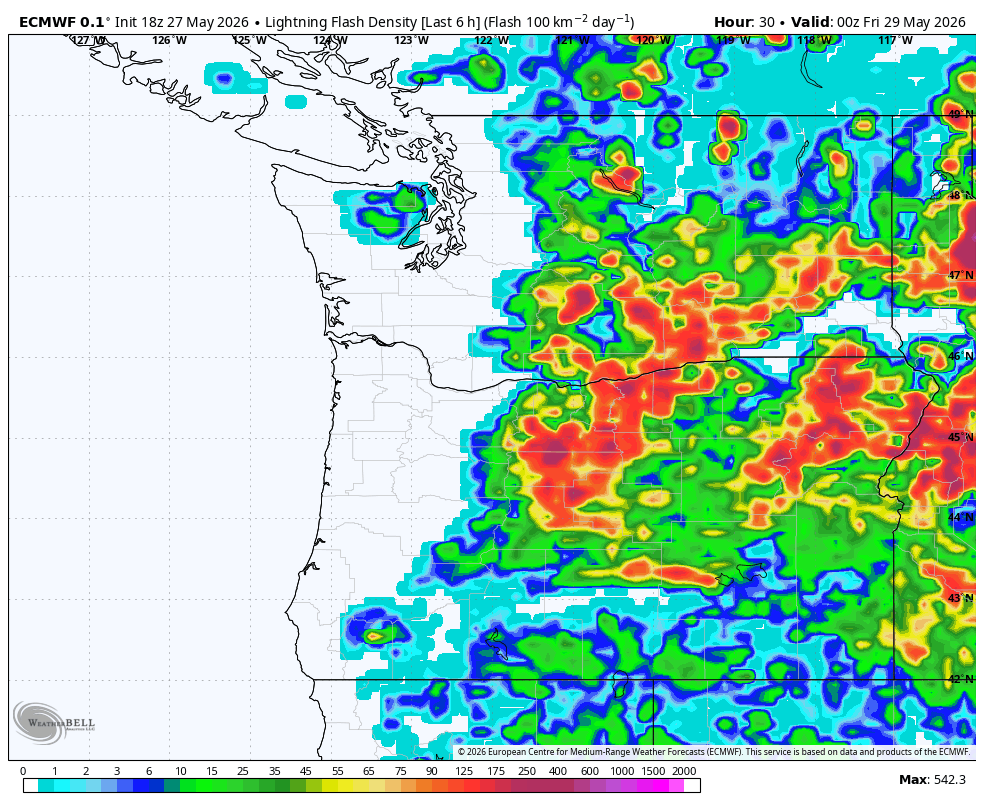
The good news is, the tornado risk is about nil (aah! Soccer term!), but there is a risk of thunderstorm-triggered damaging wind gusts of 60+ mph in the region, and a little lighter risk of large hail of 1” stones or greater. And of course, there looks to be plenty of lightning over there all across Central and Eastern Washington — even a little into the Cascades. So cross fingers we don’t spark any fires :/
ARE WE GOING TO GET ANY THUNDERSTORMS IN SEATTLE?
It doesn’t quuuuiiite look like it. The models are picking up on a line of what will originally likely be thunderstorms moving up from central Oregon into central Washington late Thursday, then pushing into the Cascades Thursday evening/night — and over into Western Washington overnight Thursday into Friday morning.
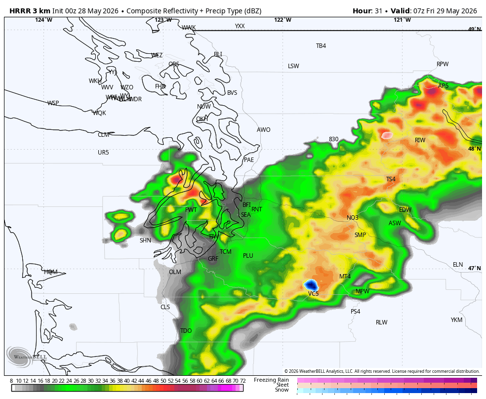
However, the models are pretty consistent that the storms will begin to lose their electrical punch after the sun sets, so by the time that line makes it up here, it’ll likely just have some leftover rain, but little, if any lightning — best chances, such as they are, along the Cascade foothills and in the mountains. If you do hear a few rumbles Thursday night, it could be thunder, but more likely your stomach asking for a midnight snack.
There will be some rain lingering Friday morning through about midday and then it’ll taper off to a few scattered showers, however, we’re expecting a pretty decent marine push on top of everything else, which will likely keep the day cloudy and much cooler with highs only in the 60s.
We begin a slow climb in temperatures through the weekend — a little less morning clouds and a little more sunshine each day with highs in the low-mid 60s over the weekend. By Monday we’ll be back in the 70s and the early forecast models have another punch of decently warm air for the middle of next week. Highs right now are showing the low 80s but with long-range model “heat inflation” (as in, warm days always seem to end up a little warmer than they first appear), I’d plan on mid-80s.
At this point, it doesn’t look like it’ll last too long, with cooling toward the end of next week. But probably still warm enough you’ll feel free to go barefoot in your sandals 🙂