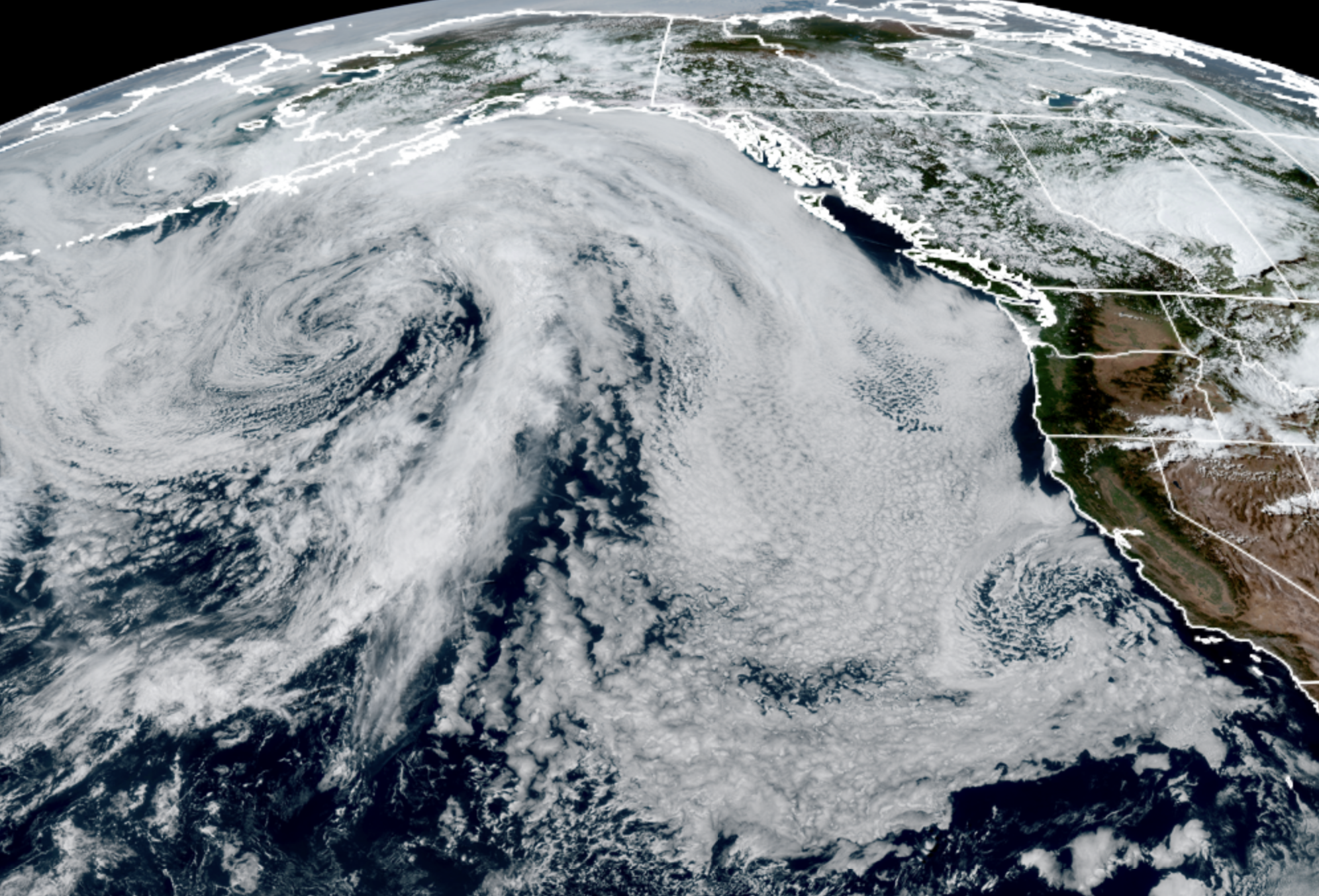
GOES 18 Satellite image for June 20, 2026 (NOAA / CIRA / RAAM-B)
I feel like the guy in the famous commercial attempting to settle the boisterous debate over whether their beverage is best because it “tastes great” or is “less filling” by shouting over their chants: “IT IS BOTH!”
Are you someone who declares Seattle weather’s great when skies are less filled with clouds? Are you instead someone who insists it’s Seattle’s fresh rainfall that tastes great?
It is rare that we can squeeze a heat wave AND rain streak into the same week forecast around here, but whether you’re a sun fan, or a rain fan, this budding forecast’s FOR YOU!*
(*YES, I know I’m mixing my brand slogans**.)
(**Also Gen Z: Ask your parents or nearest Gen X family member. It’ll slay for sure.***)
(*** That last comment was approved by my Gen Z daughter, though with an epic eyeroll.)
IT’S OK. THIS ANALOGY IS JUST PROBABLY NOT THE CHOICE OF THE NEW GENERATION….
Fair point, back to the weather: It’s another heat wave up first and Seattle will be set to ‘Do the Stew.’
In fact, this entire heat event looks like someone just stole the script from last week, only shoved it back a day. Sunday will jump in warmth and reach around the upper 70s to low 80s in Seattle with brief, if any morning clouds. Can’t ask for better weather for Father’s Day.
Our warm, easterly wind will start to energize on Monday which will end up being a warm-to-hot day across Western Washington. Highs should reach the 80s everywhere (even the coast) with upper 80s likely in the Seattle/Puget Sound area. If you want to “follow the script,” that would match the day Seattle hit 89 last week.
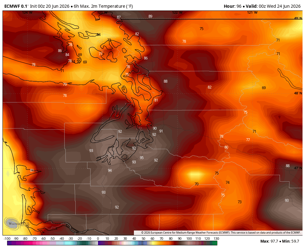
Tuesday is expected to be the hottest day of the week with highs reaching into the low 90s in the Puget Sound area (Seattle: 91 last week on peak day), and mid 90s south and east. The coast will start warm but cool off quick during the day.
A Heat Advisory is in effect for Monday and Tuesday for all of Western Washington except the coast where you won’t be hot enough to have heat concerns.
HI. I WANT MY SEATTLE SKIES WITH *MORE* FILLING….
Can do! We’ll begin the cooling process on Wednesday as the marine winds start to push their way into the I-5 corridor. Right now, it’s not a big push then, but it should be enough to get Seattle back into the 80s (FEELS LIKE WE’RE ALREADY IN THE 80s WITH THESE JOKES). It still looks very toasty for the next World Cup game at Lume…er…”Seattle Stadium.”
A stronger marine push comes for Thursday which should end up pretty similar to this Saturday with the morning clouds then sun with highs back into the 70s — though clouds will increase late in the day because…
Rain returns to the forecast for the first time in a few weeks for the end of the week. Long range models are getting more sold on the idea of an area of low pressure developing off B.C.’s Haida Gwaii on Friday and pushing a front through our area that would bring periods of light rain and much cooler temperatures that would stay in the 60s.
That low is then pegged to drop down the B.C. coast and move right through Western Washington on Saturday, peppering us with scattered showers through the weekend (especially Saturday) as highs stay in the 60s.
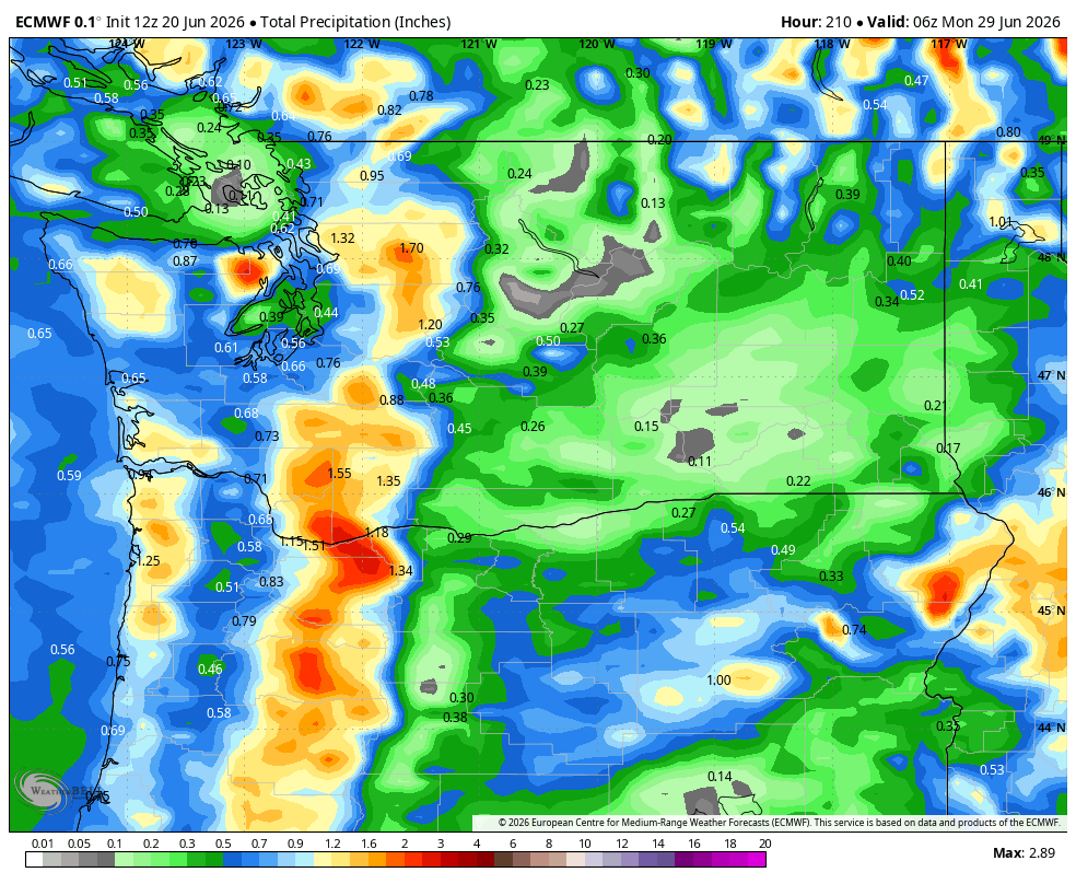
There is a weak signal for some potential thunderstorms Saturday so we’ll keep an eye there.
Drier and warmer weather returns for the start of next week with what initially look like fairly comfortable temperatures as we near the start of July. No matter if you like rain or heat, that should give most folk a smile.