High Wind Watch posted for coast as second in series of storms rolls toward Seattle and Northwest
 Scott Sistek
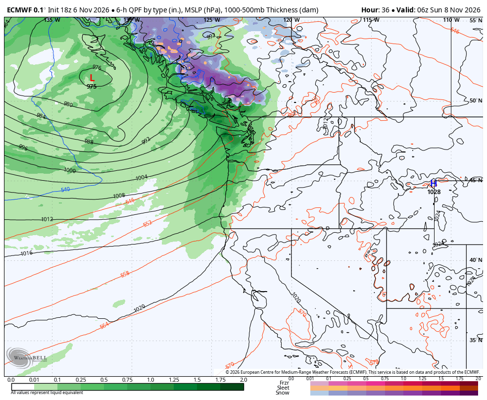
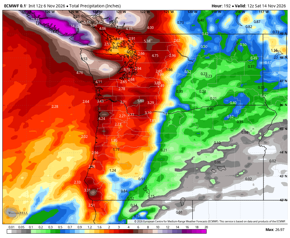
ECMWF total rainfall predicted over the next 7 days.
What to do on a dark and stormy night but maybe head to the local bowling alley and get in a few frames?
Seems it’s on Nature’s agenda this week, as she’s figuratively picked up her bowling shoes, got the little scoring pencil (well, I guess it’s all automated now?), picked out a suitably brightly colored bowling ball (The one with the big red “L” on it), and has taken her assigned spot at Pacific Ocean Alley.
And now she’ll just keep bowling storms toward the Pacific Northwest for the next few days, and it means more days with periods of gusty winds and heavy rain, with the added wrinkle of increasingly rough surf.
Already she took in a practice frame on Friday with a round of rain and some moderate wind gusts. Hoquiam hit a gust to 58 mph while the far North Sound had gusts around 45 mph (Everett hit 48 mph.)
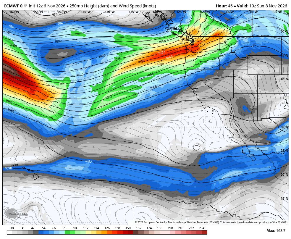
We’ll get a very brief lull between “frames” Friday night and Saturday morning before the next storm comes bowling across the Pacific and into the Northwest Saturday afternoon through Saturday night into Sunday.
This storm is expected to have a deeper low pressure center, so it’ll overall have more of a punch. But the storm center is once again veering off to the north and expected to make a more distant landfall in B.C. north of Vancouver Island or even into Haida Gwaii.
That will spare (ugh! Sorry! Even I eye-rolled as I typed that…) Seattle and the interior Puget Sound area from the strongest winds, instead relegating them to the more exposed coastline.
Thus, a High Wind Watch is now in effect for the Washington coast from Saturday afternoon through early Saturday night for southerly gusts up to 60 mph(!). That’s still pretty manageable for the coast for winds.
(The storm will bring some very heavy surf with waves of 21-26 feet. The National Weather Service has Storm Warnings for the offshore waters for gusts near 60 mph on the waters and high seas, plus powerful waves smashing on the beaches that can be extremely dangerous for beachgoers.
I know you might want to storm chase or be out razor clam digging, but be VERY wary of the power of the surf!)
For the inland spots, as mentioned before, we don’t have to worry quite as much about the strong winds that come from the storm making landfall since that will be far away, but we will get a punch of winds when the storm’s (more potent) cold front comes sliding in Saturday.
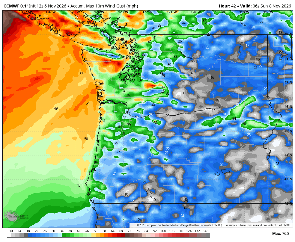
I’m going to hazard an educated guess the rest of Western Washington may get a Wind Advisory for late Saturday as the high resolution forecast models are predicting peak gusts around the 40-45 mph range with some higher isolated gusts to 50 mph in the Puget Sound area and North Sound — peak timing around 7-11 p.m.
That’s still pretty manageable for us too.
This storm, like Friday’s, also counts as an “atmospheric river” so it’ll be wet with about 2-4 inches of combined storm rain in the Olympics and North Cascades (autocorrect originally changed that to “Nothing Cascades”. Like the ski resorts need any more challenges in an El Niño winter 😛 )
That’s still pretty manageable for us.
Rain and wind taper off as we get into Sunday morning and we’ll get a little lull in the storms later Sunday into most of Monday. The Euro model has a peak gust of 3 mph Monday morning.
UH OH, YOU ONLY SAID “MOST” OF MONDAY??
Yes, actually Nature just took a break to grab a bite, but she’s ready to bowl a few more storms our way.
The first one is scheduled to strike (STOP IT, SCOTT!) late Monday with a second storm so close on the heels it will feel like one storm (even if it’s really two) but coming in.
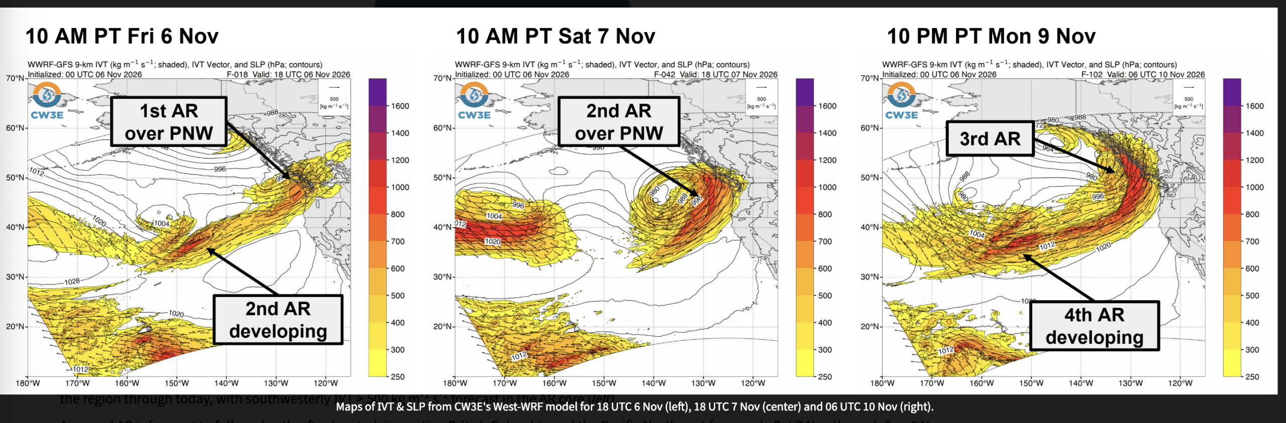
So far the forecast models indicate that with these two storms again, Nature has a pretty solid hook that is pulling the storm centers off well to our north.
So wind is not looking like much of an impactful factor (still blustery/gusty) except maybe along the coast again — unless you are one of those leaves feeling pretty proud of yourself for managing to stick to your tree this weekend. Then this storm could be your literal downfall.
Instead, these storms are more of a rainmaker with a more potent atmospheric river setup. This time around we’re looking about 3-7 inches of rain in the Olympics and Cascades — and that’s not Northern…I mean nothing.
But forecasts are only showing a low risk of flood impacts. NOAA’s ensemble models show only 10 river gauges with a 10% chance of exceeding “Action” stage (80% of flood stage height) and only 1 gauge with a 10% chance of reaching minor flood stage. You can probably guess which one that is (cough, cough, Skokomish…)
Snow levels remain rather high through the period so our highest peaks will get some snow but the passes are more wet than white. Stevens Pass may see some slush or light snow showers late Sunday but running out of moisture. Then it gets warm again.
Thus to recap, it’s a lot of rain and occasional bursts of wind, and the coast is going to take some lumps this weekend, but overall for the inland folks…
LET ME GUESS: “THAT’S PRETTY MANAGEABLE FOR US”?
Exactly. A lot of bark but in the grand scheme of things, not too much bite — maybe a few, scattered power outages and the coast will be pounded with surf. But overall, it’s sort of like the opposite of the killer bunny from Monty Python and the Holy Grail movie.
ANY MORE STORMS?
The stormy pattern looks to hold through the end of the week with more of the entire West Coast in play for rain. Still remains to be seen where the “bowling balls” end up rolling, but it does look wet-ish and blustery-ish (though still not particularly stormy up here yet.)
The super long range models are indicating a possible…(DON’T… YOU…DARE!) split (NOOOO!!!) in the jet stream that may dry us out a little bit as storms aim more toward California. Maybe be a good time to take advantage and clean out the…things on the edge of your home that collect leaves and debris off your roof. 😉
MORE TO EXPLORE:
- Why Seattle shouldn’t have to worry about this historic Polar Vortex event in the making
- Las Vegas rallies to beat Seattle in October rainfall with just minutes to spare
- What is a Kelvin wave? Why Seattle shouldn’t need to worry much about El Niño’s sidekick