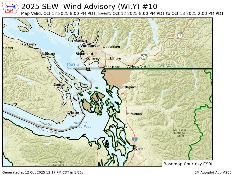
Wind Advisory for Whatcom County Sunday night.
We’re still a good 6 weeks away on the calendar from when wintry weather could even *think* of making an appearance around here, but a somewhat unusual pattern is taking shape Sunday night that at least gives wintry vibes.
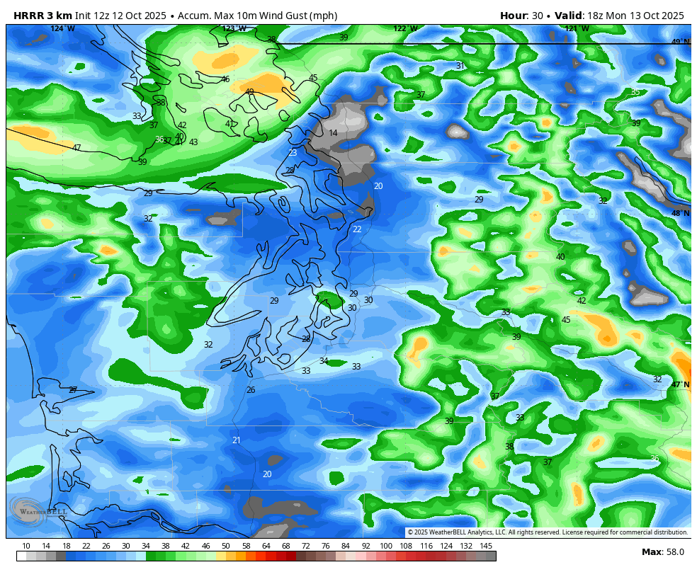
A sprawling and chilly low pressure center is on a journey south along the Pacific Coast, dropping from B.C. down along the Washington Coast on Sunday. It’s the source of our cool, showery weather today that’s bringing the first widespread snowfall to the Cascades.
But as the low continues its trek south, it’s going to draw in a period of gusty northeast winds from B.C.’s Fraser River Valley into Bellingham / Whatcom County and across the San Juan Islands. In fact, there’s now a Wind Advisory in effect from 8 p.m. Sunday through Monday morning for those two spots as wind gusts could now reach 45 mph.
With the trees still leafy, even though 45 mph is not a gaudy wind gust number, it could still be enough to trigger some power outages up there.
The strong winds are isolated to those two areas; it will just be a little breezy elsewhere but not significant or noteworthy.
“FRASER VALLEY WINDS”? ISN’T THAT A WINTER THING?
Yes — usually arctic chill-type wintry scenarios here are borne from a similar type of pattern, only in winter it’s when cold air entrenched in interior B.C. gets carried through the Fraser River Valley and shoots out into Whatcom County like an icy hair dryer, and is carried across the San Juan Islands.
In stronger cases, those winds can reach 50-70 mph and can spread cold, arctic air across all of Western Washington and even farther south. Temperatures drop well below freezing in Puget Sound area, and in Whatcom County, they can go single digits or teens with wind chills at or below zero.
In THIS case, it’s nowhere near as extreme. For one, it’s not that cold in the interior of BC yet — it’s still in the mid 40s there today. We’re just still WAY too early for a Fraser Wind to have much temperature impact. It will make for a chilly Sunday night up Whatcom County with temperatures in the 40s and a bit of a wind chill overnight.
But if you copy/paste this atmospheric setup again on like December 12, we’d be MUCH more excited about wintry weather impacts in the lowlands! Practice run?
As is, the cool, drier air will make for a sunny but autumn-chilly start to the work week with highs only in the upper 50s or near 60 and lows in the 30s to low 40s amid clear (and in some places, frosty!) nights. We get back to more regularly rainy weather later in the week.