First autumn storm of the season to bring gusty winds, drenching rain to Seattle
 Scott Sistek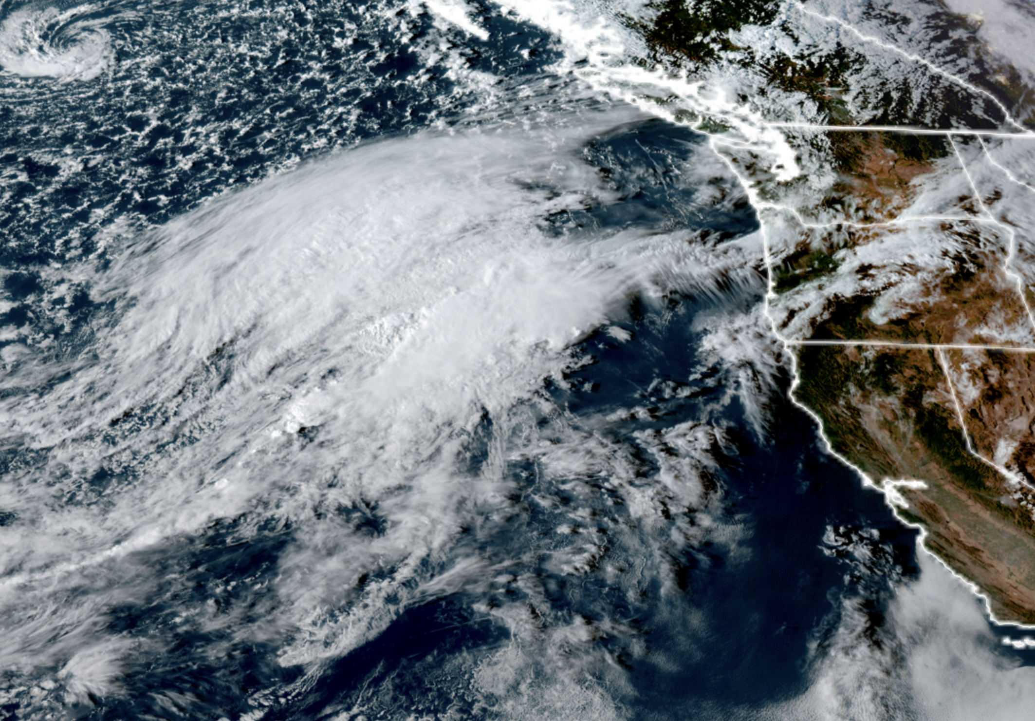
GOES-18 satellite image showing budding storm system developing off the Oregon Coast on Sept. 23, 2026. (NOAA / CIRA / RAAM-B)
Well, that didn’t take long! Our first windy event of the new season is already here, and autumn isn’t even a week old!
It’s like summer was getting ready to head out of the Pacific Northwest’s house, leaving instructions for a very antsy autumn…
SUMMER: “So, there are some leftover thunderstorms in the fridge and…”
AUTUMN: “Uh-huh, yeah…”
SUMMER: “Don’t forget to water the Peninsula at least twice a week — I always forget — but Sequim likes its rain shadow…”
AUTUMN: “Yep! Got it!” (as it starts to nudge summer toward the door…)
SUMMER: “Phone numbers are on the fridge in case of…”
AUTUMN (now opening front door) “OK, sure….”
SUMMER: (being shepherded to the porch) “Oh, El Niño may stop by and…”
AUTUMN: “Yeah, yeah, all set! Thanks summer! See you next year!” (Swiftly closes door…)
…(a few moments pass)…
AUTUMN, now alone in the house: “WOOO! I’M CALLING FRIENDS OVER AND ORDERING WIND AND RAIN AND CHILLY TEMPS. LET’S GO!!!!!”
===
It will certainly feel like autumn is now in charge Thursday and especially Friday as a low pressure center rolls into the Pacific Northwest, bringing some decent wind gusts – strongest gusts appear to be focusing into northern Oregon, but also southwestern Washington and the coast — and a decent round of soaking rains with a few possible scattered thunderstorms.
Dare we even say some of the higher mountains peaks may get their first dollop of snow?
It does feel like an autumn practice run as the low center develops off the Oregon Coast Thursday, eventually spreading rain into the Northwest Thursday afternoon and evening.
But let’s focus on the wind, which has the potential for the most impact.
The low center as of now looks like it’ll come ashore early Friday morning right around Astoria or Long Beach, give or take, then track across Southwestern Washington (south of the Puget Sound area) and then weaken as it heads across the southern Cascades into Eastern Washington. (Ironically, this would have been a GREAT Seattle snowstorm scenario had this been winter…)
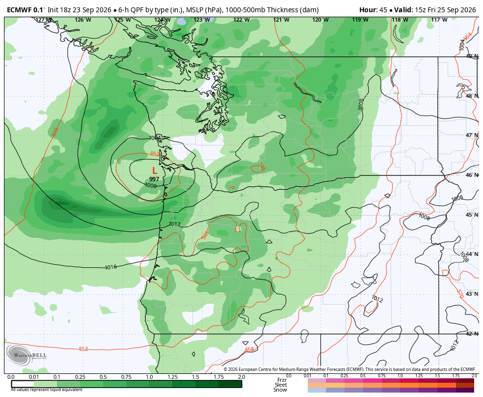
As we get back into the practice of tracking these sort of storms, remember the southern side of the low center is the windiest side. So with this storm, the strongest winds are expected to stay along the coast and in northern Oregon (including the Portland-Vancouver metro area) and Southwestern Washington — mainly south of Olympia, if not south of Chehalis (depending on how far north the low tracks.)
Gusts there Friday morning into early Friday afternoon could reach over 40 mph with maybe a few rogue gusts to 50 mph as the low moves inland. With still-leafy trees, that’s strong enough for some scattered power outages.
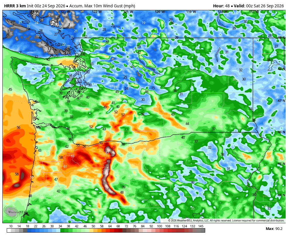
For the greater Seattle/Puget Sound area and points north on the northern side of the storm, wind speeds look less impactful, with gusts around 25-35 mph likely, mainly early-to-mid Friday afternoon. One exception is that we could see a few hours of gusty west winds coming down the Strait of Juan de Fuca Friday evening “chasing” after the storm. Gusts along the Strait and into like Whidbey and Camano Island might nudge close to 40 mph.
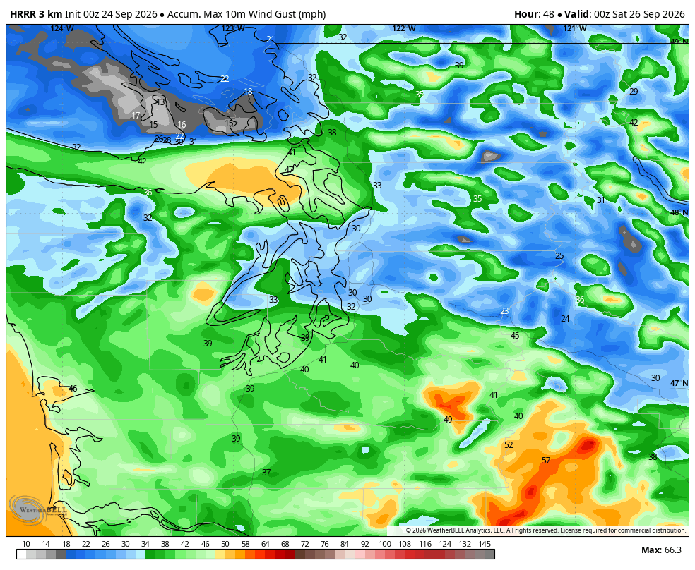
(Gusty winds of 30-45 mph will also sweep across Eastern Washington Friday afternoon and evening).
Winds will taper off in Western Washington Friday evening and be calm-ish by Friday night.
So overall, this is not a big, widespread impactful windstorm. Call it a “dry” run for future autumn storms.
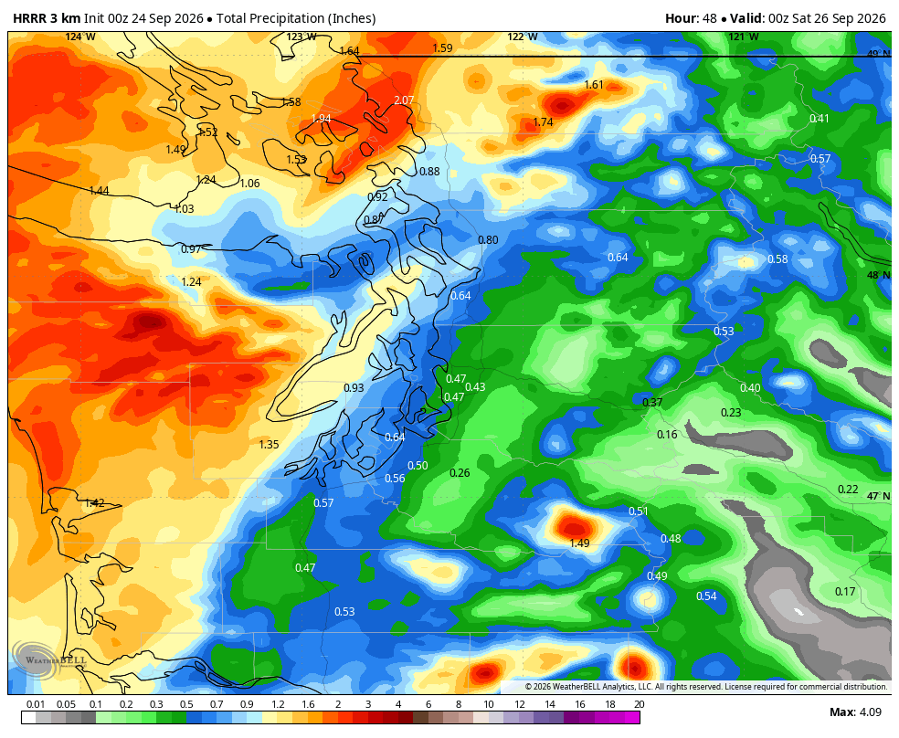
Speaking of “dry”, it won’t be. It’ll be rainy throughout the region from Thursday afternoon into Friday evening with about a half-inch of rain in the Puget Sound and Western Washington lowlands.
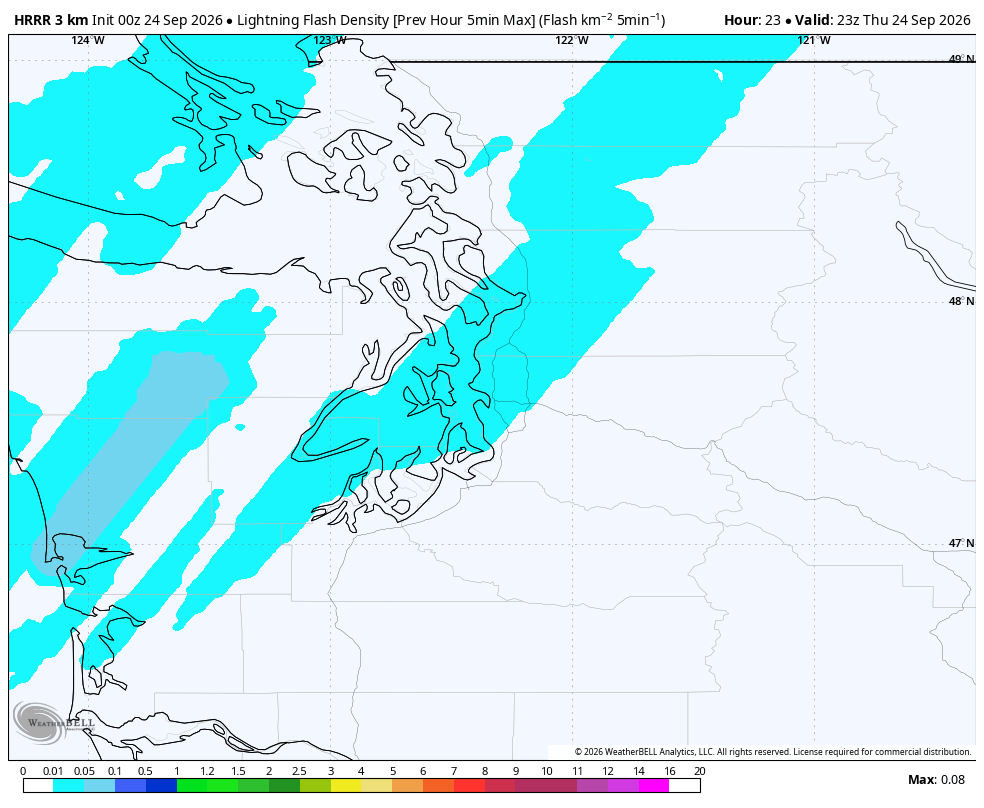
There is even a risk of a few thunderstorms around western Washington and northern Oregon on Thursday afternoon and evening as the front fringe of the moisture arrives.
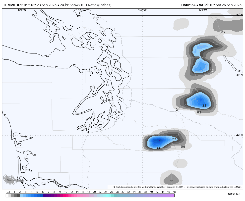
Snow levels look to drop to around 5,000-6,000 feet after the storm passes Friday for our first high-elevation snow. (Take that, Super El Niño!)
Also of note: Seattle’s high temperature may not make it out of the 50s on Friday! With the gusty winds, dare we say a bit of a wind chill?
The “autumn preview” expires Friday night and it looks like we’ll clear out just in time for a rather pleasant weekend. There may be some areas of fog and mist Saturday morning with the lingering moisture and chilly morning temperatures in the mid-upper 40s(!!!!!!) but the sun will eventually break out both weekend days with cool highs in the low 60s.
Dry weather holds Monday, then a few light showers are possible middle of next week as highs stay in the low-mid 60s. Long range models don’t have any forecast highs greater than the mid-60s over the next two weeks. Guess El Nino’s “house warming” gift is still in transit. 😉
MORE TO EXPLORE:
- First autumn in Seattle? Here’s a weather calendar for what to expect…
- Can you really make an egg stand on its end in Seattle on the first day of autumn?
- Here’s the ‘script’ Super El Niño’s have used for past Seattle winters. Now, toss it out.