Weak atmospheric river event brings rain, wind to Seattle before big weekend warmup
 Scott Sistek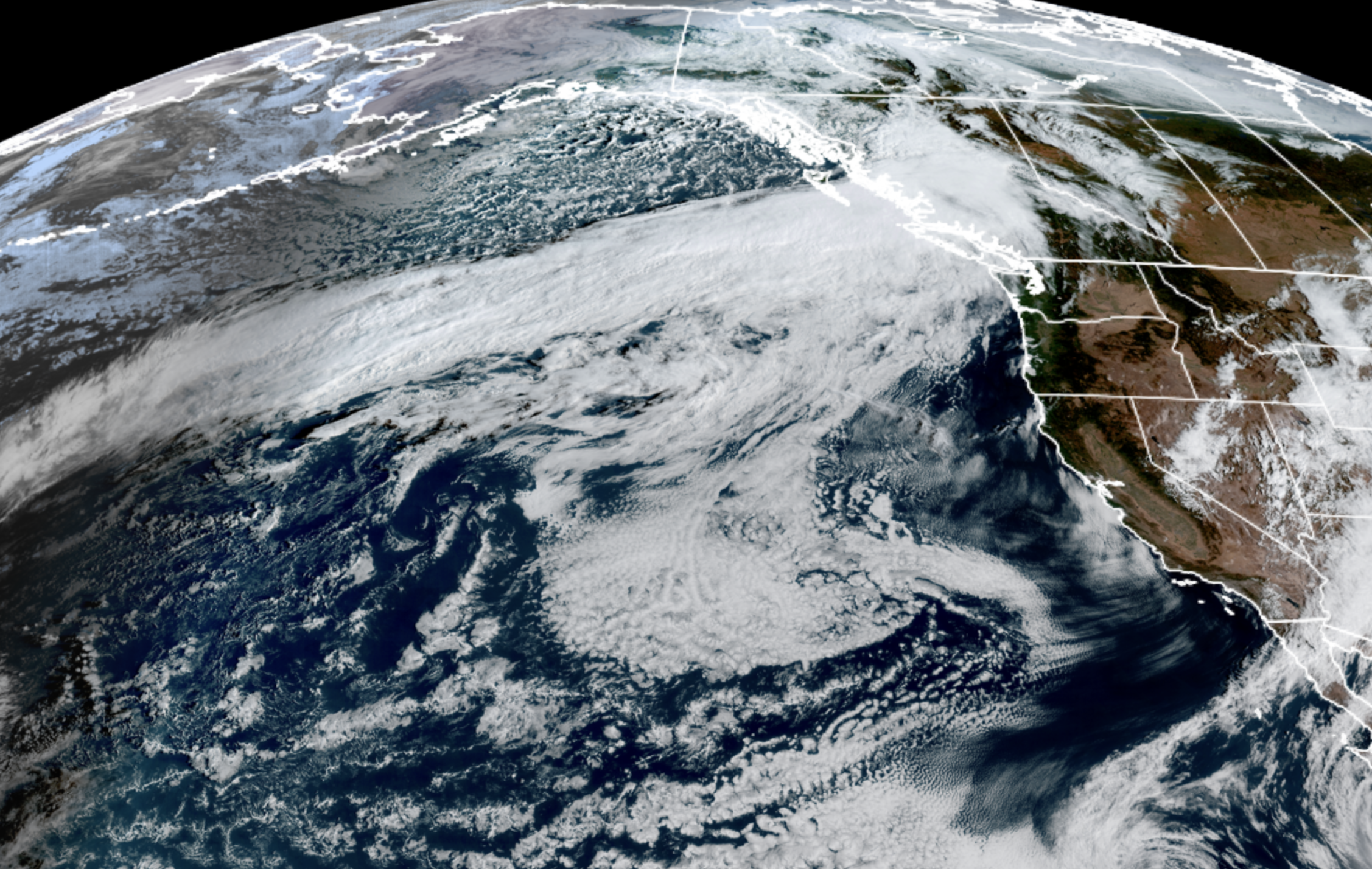
GOES-18 satellite image showing a long atmospheric river-type front stretching from B.C. well out into the North Pacific on Sept. 28, 2026. (NOAA / CIRA / RAAM-B)
Rare is the Seattle forecast when I can cover both sides of the sun fan vs. rain fan debate. But no matter which side of the weather coin you fall on, the forecast this week will bring a smile… At some point.
Rain fans get first dibs and we’re going to even flip the script from last Friday’s rain and wind that focused mostly on the areas south of Seattle, and this time soak the North Sound while tossing the breezes around a bit there as a weak atmospheric river event heads our way.
WAIT, ‘ATMOSPHERIC RIVER’ EVENT— ALREADY? IT’S STILL SEPTEMBER?!?
Yes with a minor *. With its current setup, this rain event could technically be called an “atmospheric river” as it has tapped into a little bit of tropical moisture, though it’s pretty weak by our typical AR standards and is not expected to cause any significant local impacts.
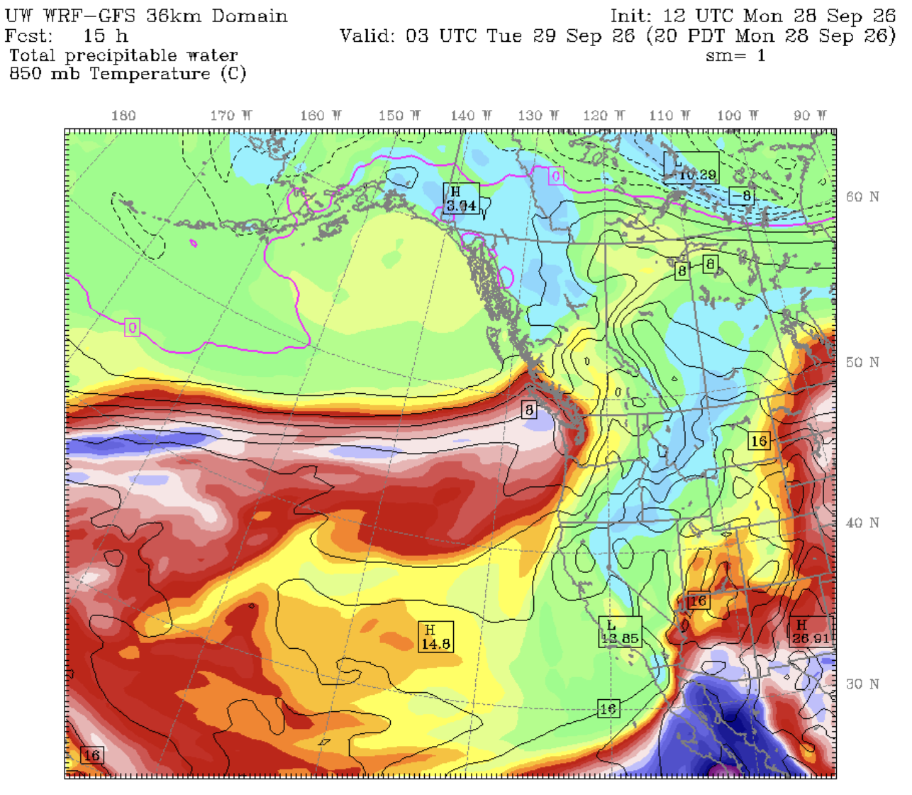
(For those new to the area, get used to the AR term as it’s become a popular and frequent part of the weather lexicon. It’s now a chic (though it is an official meteorological term) way to describe when weather systems tap into tropical moisture sources and feed a near literal “river of atmospheric moisture” along its boundary. They are common in the fall and winter along the West Coast — usually numbering in the dozens by the end of the season — and vary in strength, but are usually the culprits for our warm and rainy fall and winter events.
This particular one though is just some light to moderate rain and some wind. No biggie.
Where and when? The front that is currently sprawled across much of the northern Pacific Ocean and is pointed at British Columbia Monday will slowly slide south into Vancouver Island and far Northwestern Washington by Monday evening.
Then steady rains are likely from about Everett northward through Bellingham into Southern B.C. overnight Monday, with heavier rains the farther north you go. By daybreak, Bellingham could have a half inch of new rain.
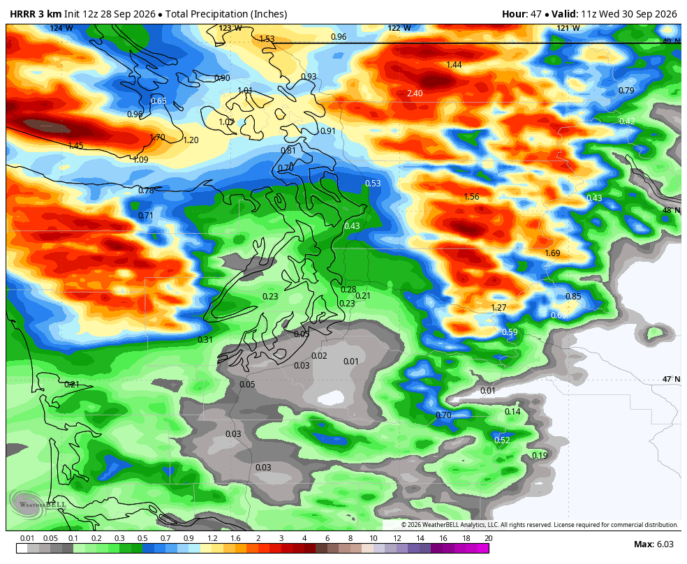
The rain looks to remain north of Everett until about late morning or midday — Seattle’s Tuesday morning commute still looks dry. But rain will slowly spread south into the Seattle/Puget Sound area by midday or so for a period of rain through the early afternoon. The front should pick up speed and sweep though the South Sound and the rest of Western Tuesday afternoon bringing just a brief 1-2 hours of rain. South Sound rainfall totals look pretty paltry.
Rain tapers off by the evening with the exception for a possible Convergence Zone in North Seattle and/or southern Snohomish County with a narrow band of lingering rain into late Tuesday evening.
WINDY TOO…
The frontal boundary will bring some gusty winds to the North Sound as well. Most areas should stay under 40 mph gusts but there is a Wind Advisory in effect from 2 a.m. to 2 p.m. Tuesday for the San Juan Islands and Bellingham/Whatcom County for potential gusts to 45 mph.
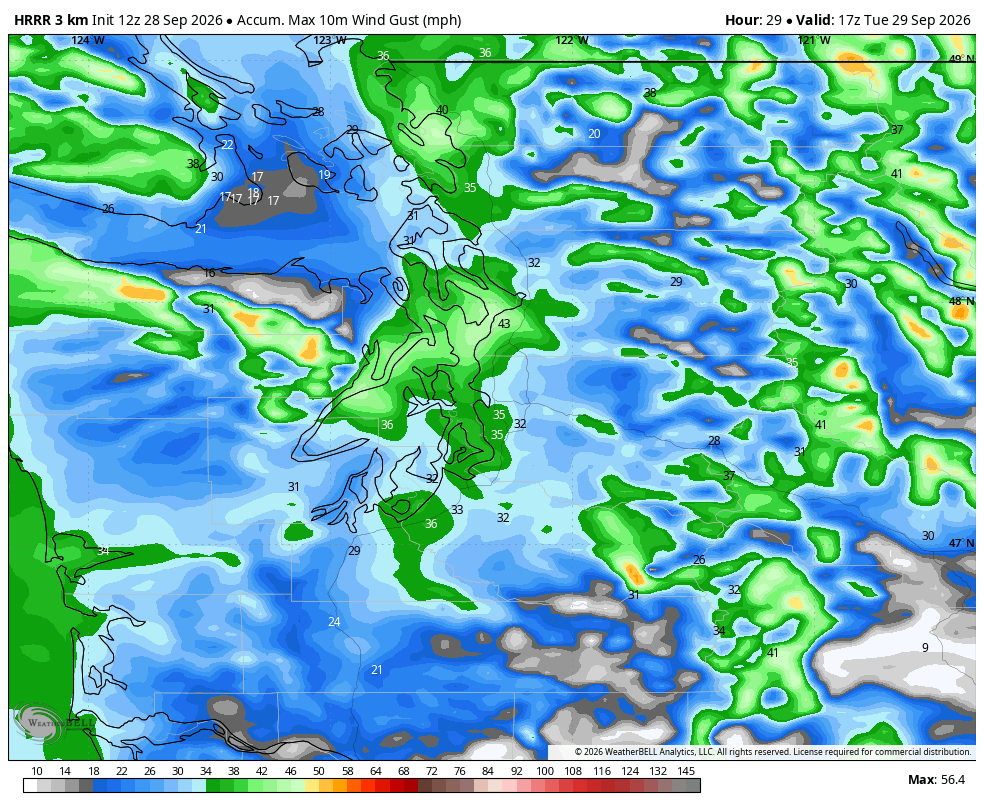
Shouldn’t be too much of an impact.
All rain and wind should taper off by Tuesday night.
OK SUN FAN HERE: I JUST READ 500 WORDS OF A GLOOMY FORECAST. WHERE’S MY SMILE?
Hopefully this qualifies! There could be some lingering patchy fog Wednesday morning, but otherwise we’re drying out for a while again with partly to mostly sunny skies Wednesday through Friday and highs in the 60s.
WAIT: HOW COME THAT SUN FORECAST ENDS ON ‘FRIDAY’? OH NO! NOT THE WEEKEND 😮
No wait! I broke out the weekend because it looks even sunnier!
Forecast models indicate both Saturday and Sunday could qualify as our usual summer rebound fake-out, and even bring in some easterly winds that could boost our high temperatures into the low-mid 70s! (Though some of the valleys might get stuck in some stubborn morning fog).
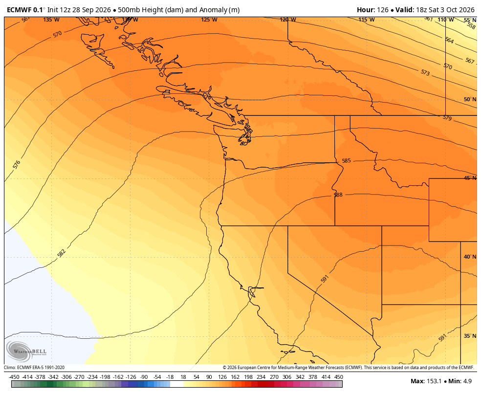
Meteorologist Dana Felton with the National Weather Service office in Seattle says the city averages about 2 days over 70 degrees in October — so the 3rd and 4th might fulfill the quota this year.
Beyond the weekend, the 6-10 and 8-14 day outlooks from NOAA indicate continued high confidence of above-average temperatures into mid-October.
So hopefully we’ve got it all covered:
Rain fans: 🙂
Sun fans: 🙂
Snow fans: 😕
Well, 2 out of 3….
MORE TO EXPLORE:
- Windstorm brings 101 mph gust to Mt. Rainier. Here’s where else it got windy.
- First autumn in Seattle? Here’s a weather calendar for what to expect…
- Here’s the ‘script’ Super El Niño’s have used for past Seattle winters. Now, toss it out.