 Scott Sistek
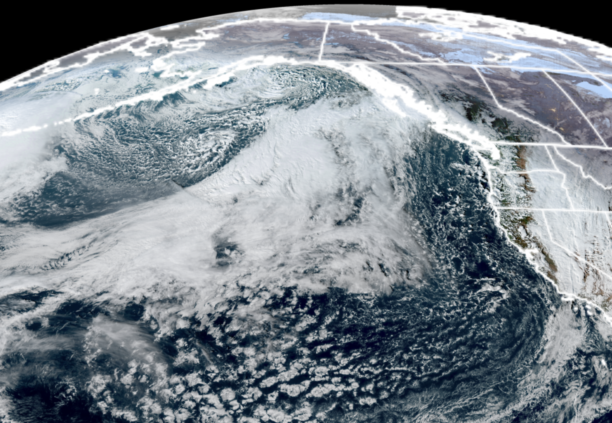
GOES-18 satellite image for Nov. 16, 2026. (NOAA / CIRA / RAAM-B)
Normally I start these long forecasts with a more formal “TL;DR/Too Long Didn’t Read” snippet but this one’s easy to mix into the main narrative: If you’re looking for any more big storms in the next week or so around Seattle, odds are pretty good right now you’re not going to find any.
(The following week however….)
A stormy-ish first half of November is going to start to ease off the gas a little bit as we head into the second half of the month. We’ll still have some “bouts of weather” here and there but now we’re going to start stretching out the breaks in between weather systems a little more.
If you enjoyed Monday’s sunny and calm day, you’ll like Tuesday equally as well as we have another partly to mostly sunny day on tap.
The next storm is currently spinning up out in the Pacific, once again making for an impressive view on the satellite image.
BUT! Unlike the last several storm centers that have “turned left” and headed into far northern B.C. or even Alaska, this storm is going to “turn right” and head instead straight for San Francisco. (Poor SF: First comes the Dark Skies, then comes the Dark Side to Levi Stadium the week after.)
That right turn is going to take most of the storminess away with it, with two exceptions:
First, there may be a brief period of breezy east winds through the Cascades passes and foothills Wednesday morning when the storm center is aligned due west of Washington on its journey south.
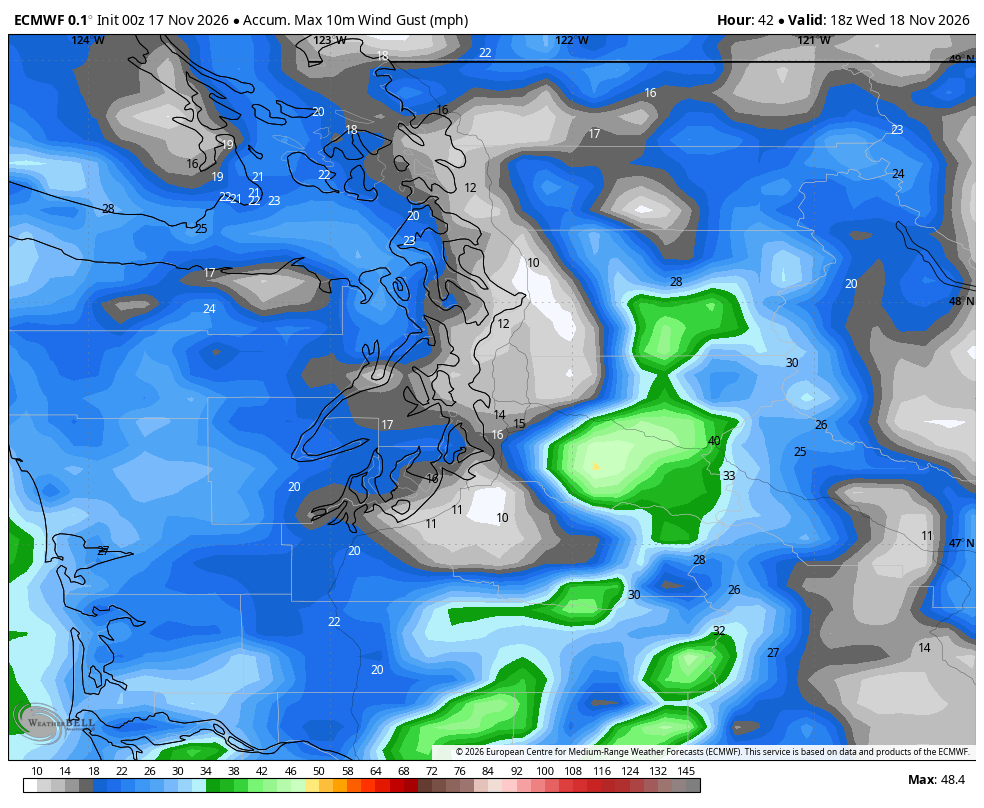
But these are not expected to be significant winds because the offshore storm isn’t super powerful and…it’s not cold in Eastern Washington to provide that extra arctic high pressure boost in pressure difference. So no big deal.
Second, the outer fringes of the cold front swirling around the storm maaaaay juuuuuust reach far enough north to bring some light rain to southwestern Washington on Wednesday, perhaps even stagger far enough north to have some light rain or sprinkles reach Seattle, but barely noticeable with just a few hundredths of an inch of rain, if any.
There may be a few widely scattered showers on Thursday but mostly dry time and just mostly cloudy. THIS WOULD BE BIG NEWS! Why?
November 19 is statistically the wettest day of the year. It rains nearly 75% of the time on this date (95 times since 1894.)
Friday looks dry and sunny, though could be a cold morning with some widespread and stubborn fog before the sun eventually burns through.
A new weather system drops down from the northwest over the weekend but parks well offshore for just some light, scattered showers around here.
THEN, NOVEMBER (FOR REALS) RETURNS?
After getting a week off, the weather pattern is looking potentially more active again next week which, of course, Thanksgiving week.
We say “potentially” because while the large scale weather pattern in the Pacific is looking conducive to spinning up some decent-sized storms, there’s still a lot of uncertainty where they’re going: “Left turn”? “Right turn”? (Gulp) Straight ahead?
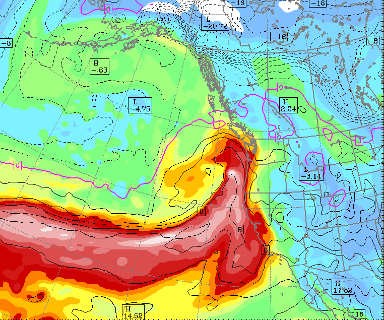
A few runs of some of the long range models have brought some storm centers coming ashore closer to home than these storms have been so far in November, which would present more of a traditional and widespread wind risk if true, not to mention heavy rain.
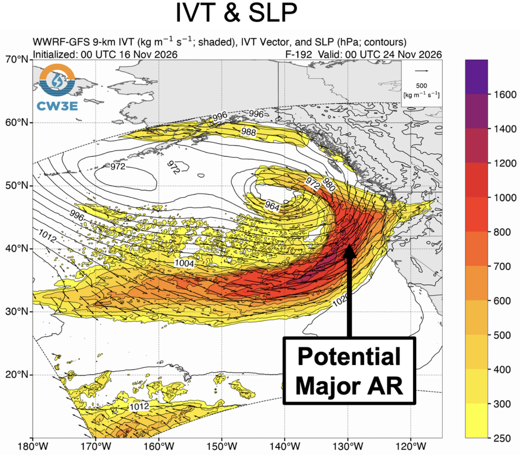
Also, the folks at the Center for Western Weather and Water Extremens, who monitor atmospheric rivers, wrote in their latest discussion: “Model guidance is showing the potential for a major (atmospheric river) event between Washington and central California during 23–25 Nov, but there is considerable uncertainty in the timing and location of AR activity.”
And NOAA’s Climate Prediction Center, which is more involved with longer range outlooks than the short term, also is giving a heads up about some low to moderate risk of heavy rain and strong winds along the West Coast at times next week.
(Where and how strong? Still in flux.)
KING TIDES MAY BECOME A ROYAL PAIN
Thanksgiving week is also when we return to the phase of the lunar cycle where king tides are going to be a factor (Nov. 23-27, and this month’s tides will be even higher than last month. Coastal flooding may become a serious factor if we have these strong, windy storms around to generate and push the waves again like last week, combining with low atmospheric pressure (which “pulls” at the water surface to raise sea levels a little) timed with the very high king tides.
Those of you in spots vulnerable to coastal flooding should start making initial plans for next week to be ready for flood defense.
But again, still very high uncertainty on any storm’s strength/track/evolution at this point. Just a “heads up” for now.
WHAT ABOUT MOUNTAIN SNOW?
Nothing cooking this week up there, sad to say. Next week’s potential storms are still leaning on the mild side, so snow may be relegated to high elevations again. Sigh. Skiers — have we reached the point yet of me needing to start digging up more of those Emergency Kittens videos?