Over 100,000 lose power as potent storm brings 60+ mph winds to Western Washington
 Scott Sistek

All lanes of SB I-5 near US 12 (MP 68) were blocked Saturday night due to a multi-vehicle collision and downed trees. (Photo: Washington State Patrol)
Over 100,000 people lost power across Western Washington Saturday evening as a very potent cold front swept through the region.
The storm system lashed the coast with severe winds for much of late Saturday afternoon and evening — especially the central Coast. Hoquiam recorded hours of wind gusts over 50-60 mph, with multiple recorded gusts over 65 mph and twice reaching a peak gust of 69 mph.
Gusts reached 40-50 mph across the Puget Sound area, with Sea-Tac recording a gust of 46 mph, Everett hit 48, and Bellevue clocked a gust of 50 mph.
With plenty of trees still somewhat leafy, the trees and branches were no match for the gusty winds. Washington had just over 115,000 customers without power as of 9:30 p.m. PST, according to PowerOutage.com. Nearly half of those outages were in Seattle, where Seattle City Light had about 46,000 customers in the dark.
In the South Sound’s Lewis County, winds brought trees down across the southbound lanes of I-5 near the U.S. 12 interchange (milepost 68.) The Washington State Patrol said multiple vehicles were involved in crashes, but they did not give the extent of any injuries.
The winds were from a powerful storm that even though it made landfall well to the north in central British Columbia, was still strong enough to bring blistering winds to the coast, and spawn a potent cold front across Western Washington.
The front’s convective properties caught the eyes of the National Weather Service’s Storm Prediction Center — essentially the nation’s severe weather center based in Norman, Oklahoma. They sent out a very-rare-for-the-Northwest “Mesoscale Convective Discussion” note that there could be a relatively brief but strong(er) burst of winds as this front moves onto the coast and across the Olympic Peninsula Saturday evening.
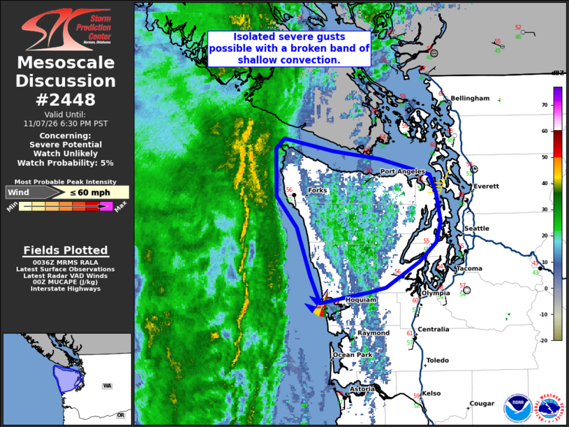
NOAA had even put the Olympic Peninsula in a Level 1 out of 5 severe weather threat box — though only for potential severe wind gusts (58 mph or more) – no risk of hail or tornadoes — or really even much of any lightning.
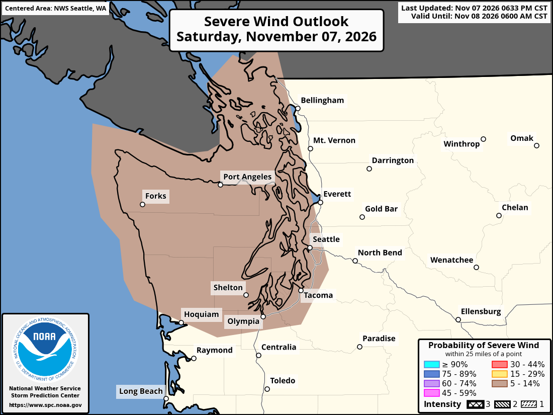
High Wind Warnings remained in effect until 4 a.m. Sunday along the coast for gusts to 60 mph, and Wind Advisories also stayed in effect for the Olympic Peninsula and I-5/Puget Sound area for continued possible gusts up to 45-50 mph.
Wind and rain will taper off for Sunday morning and the weather pattern will remain relatively calm into Monday, when another pair of storms take aim at Western Washington. These storms look as of now to be more about rain than wind.
MORE TO EXPLORE:
- Why Seattle shouldn’t have to worry about this historic Polar Vortex event in the making
- Las Vegas rallies to beat Seattle in October rainfall with just minutes to spare
- What is a Kelvin wave? Why Seattle shouldn’t need to worry much about El Niño’s sidekick