Storm brings first snow alerts of the season to the Cascades. (Don’t tell El Niño)
 Scott Sistek
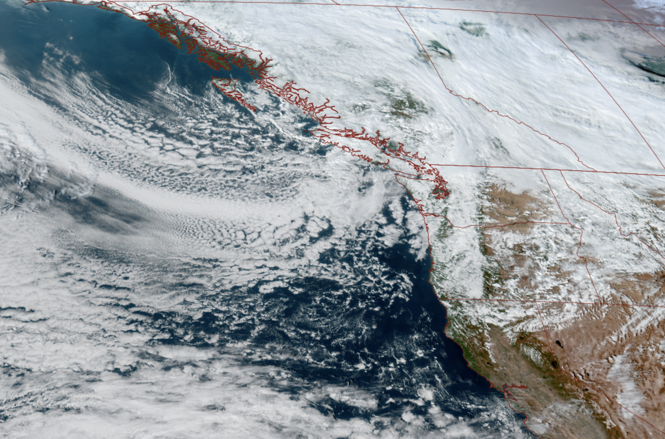
GOES-18 satellite image showing a big trough of low pressure swirling down from British Columbia toward the Pacific Northwest on Oct. 27, 2026. (NOAA / CIRA / RAAM-B)
We’ve heard all the talk about how with Super El Niño this could be a rather dismal winter season for snow in the mountains with potential for well-below-average snowpack. That’s likely still true…
But at least the seasonal tally won’t be 0!
TAKE THAT, SUPER GODZILLA WEATHERUS MAXIMUS EL NINO!*
(*- Please don’t take that as a taunting jinx.)
Another storm system is heading our way, but this one is a little bit of a cooler storm dropping in from British Columbia instead of over the milder Pacific, and that means we could see our first decent snowfall in the mountains — prompting the first mountain snow alerts of the season.
The Canadian-born system will start to arrive Tuesday night as it moves around Vancouver Island, before settling in just off the Washington Coast on Wednesday.
This system won’t be too impactful for the Seattle and western Washington lowlands. There’s not much wind involved, and the system will feature more in the way of frequent showers as opposed to hours of steady rain in the lowlands — though some of the passing showers could be briefly heavy. It’s actually not a whole lot different than the last day or two of this whole “MAKE UP YOUR MIND: IS IT RAINING OR SUNNY TODAY?”, just a bit rainier and cooler.
But snow levels will be dipping down to about 3,000-3,500 feet by Wednesday morning, and with upper level westerly winds smashing into the Cascades, feeding additional moisture, that should combine to bring multiple inches of snowfall.
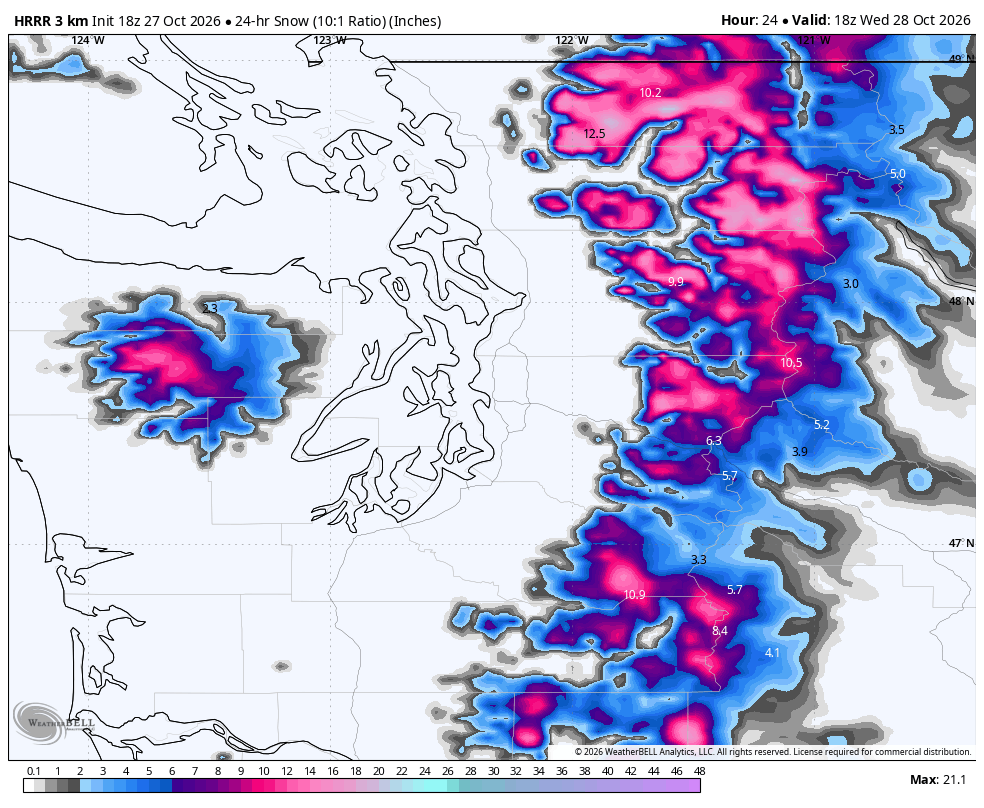
Our first official Winter Weather (Snow) Advisory for the central and north Cascades from Tuesday evening into Wednesday evening for as much as 4-8” of snow above 4,000 feet. That would put some decent accumulating snow at Stevens Pass, while Snoqualmie Pass will be on the fringe of the snow level but will still likely pick up a few inches.
HAH HAH EL NINO, IT’S SNOWING IN OCTOBER IN THE MOUNTAINS*
(*- Please don’t take that as a taunting jinx.)
Most of the snow will be Tuesday night so if you have any pass travel plans, that’s the most challenging time frame. But scattered snow showers will linger through Wednesday.
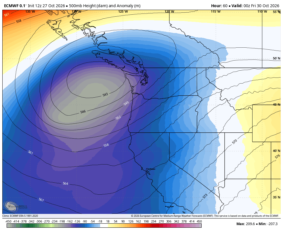
The rest of the week will feature that low center “stuck” swirling just off the Washington and northern Oregon Coast, rotating rain showers into Western Washington lowlands and continued snow showers in the mountains.
However, the low will be weakening as the week progresses, and lowland rain showers and mountains snow showers will be gradually decreasing each day and night in number and intensity through Friday.
Highs will stay on the relative cool side, only reaching the low-mid 50s in Seattle.
YEAH, EL NINO, NOT 70 DEGREES IN AUTUMN ANY MORE, EH?!
(*- Please don’t take that as a Canadian taunting jinx.)
Speaking of not scary forecasts (for now), Halloween may find a brief dry slot as that stubborn low should drift away and fizzle by then. Still a bit on the cool side with highs only reaching the mid 50s with temperatures dropping to around 50 by trick-or-treat time.
Sunday into early next week is leaning on the drier side as we begin the first few days of November, but the long range outlooks are flipping around and suggesting a bit of an overall wetter pattern…
And… a warmer than average pattern?
(El Niño is taking this as a taunting jinx, isn’t it…)
MORE TO EXPLORE:
- What is a Kelvin wave? Why Seattle shouldn’t need to worry much about El Niño’s sidekick
- Seattle has less rain than Las Vegas and Los Angeles this October
- First autumn in Seattle? Here’s a weather calendar for what to expect…
- Can you really make an egg stand on its end in Seattle on the first day of autumn?