Wind alerts posted in parts of Puget Sound area Friday as storm track shifts closer to Seattle
 Scott Sistek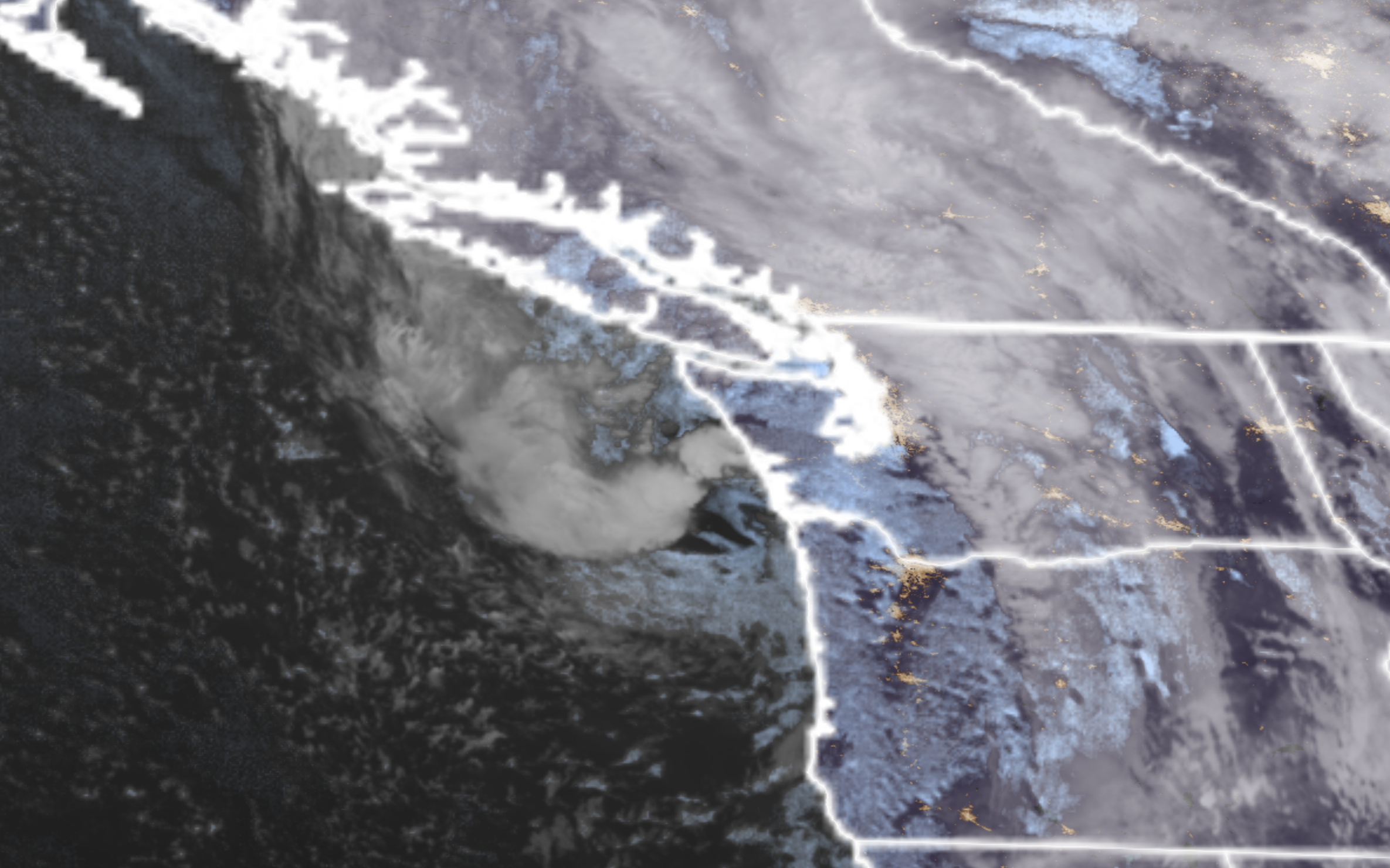
GOES-18 Satellite image showing a potent low pressure center heading into Western Washington on Sept. 25, 2026. (NOAA / CIRA / RAAM-B)
A potent-for-September low pressure system is set to bring our wind event of the autumn season Friday, with a shift in the forecasted track to the north now bringing potentially gusty winds of 40-45 mph more into the southern Puget Sound area during the late morning and afternoon hours.
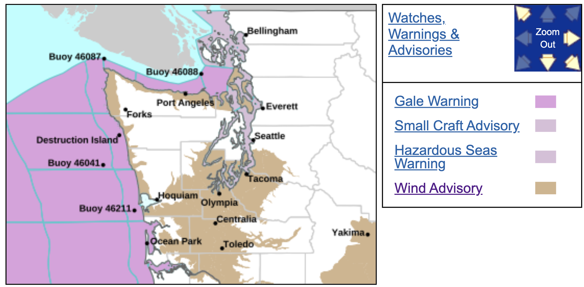
Wind Advisories are now in effect from about the Tacoma area south through Olympia to Oregon and out west to the coast through 5 p.m. Friday In addition, a second ares of Wind Advisories is in effect for the Strait of Juan de Fuca and Camano and Whidbey Island through 8 p.m. for a surge of westerly winds later Friday.
Surface pressure observations early Friday morning indicate the center of the low pressure area is a bit farther north than many of the main forecast model runs had earlier indicated. Now the preferred track of the storm has the low coming through the I-5 corridor about right over Seattle, as opposed to around Olympia in earlier forecasts.
The strongest winds in these kinds of storms are generally to the south of the low pressure center, which means the stronger wind field has shifted to the north, now reaching about as far north as Tacoma and South Seattle.
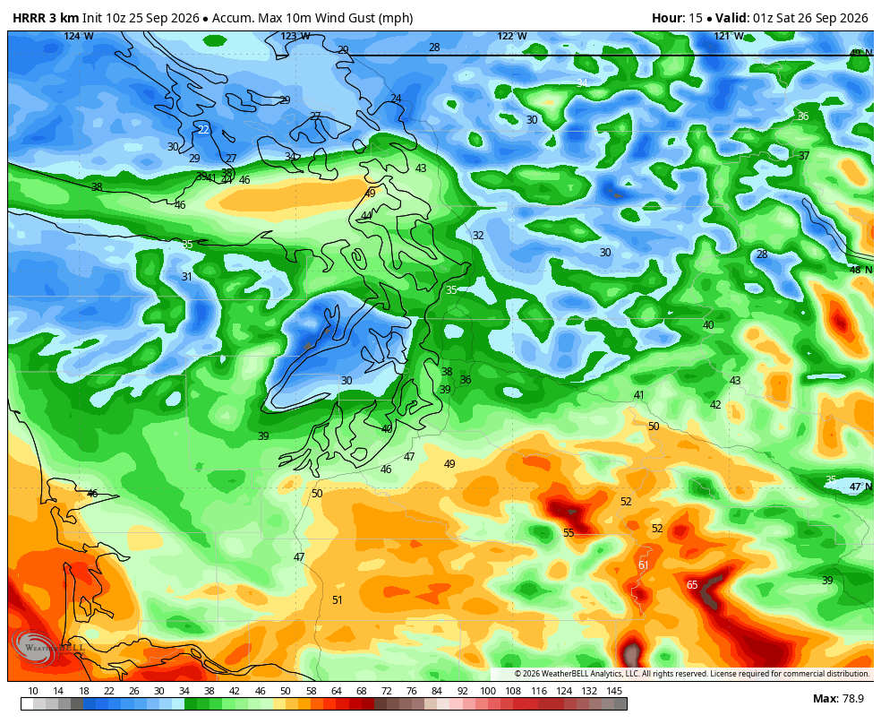
**NOTE: The Downtown Seattle, Bellevue/Eastside and Snohomish County/Everett Metro areas are NOT in the wind alert as you look to remain north of the low, and gusts are expected to stay under 40 mph. (More like 30-35 mph) **
Winds will pick up around mid-late Friday morning in Southwestern Washington, reaching the Tacoma-Olympia areas around 8-10 a.m., then tapering into the early afternoon.
🍃⛈️ A low pressure system will track through the region today. Winds are expected to pick up and become gusty late this morning into the afternoon for most. There is also a slight chance of thunderstorms throughout the day. Stay weather-ware if you’re out and about today!#wawx pic.twitter.com/ti53ORpsJz
— NWS Seattle (@NWSSeattle) September 25, 2026
Then, gusty westerly winds will move down the Strait of Juan de Fuca and into the northern Islands (Whidbey/Camano) into the early afternoon and evening. As it does so, southerly winds will taper off in the Puget Sound area.
** ANOTHER NOTE: There may briefly be an active Puget Sound Convergence Zone in the North Sound Friday afternoon/evening when the southerly winds from the main event collide with these westerly winds coming down the Strait of Juan de Fuca.
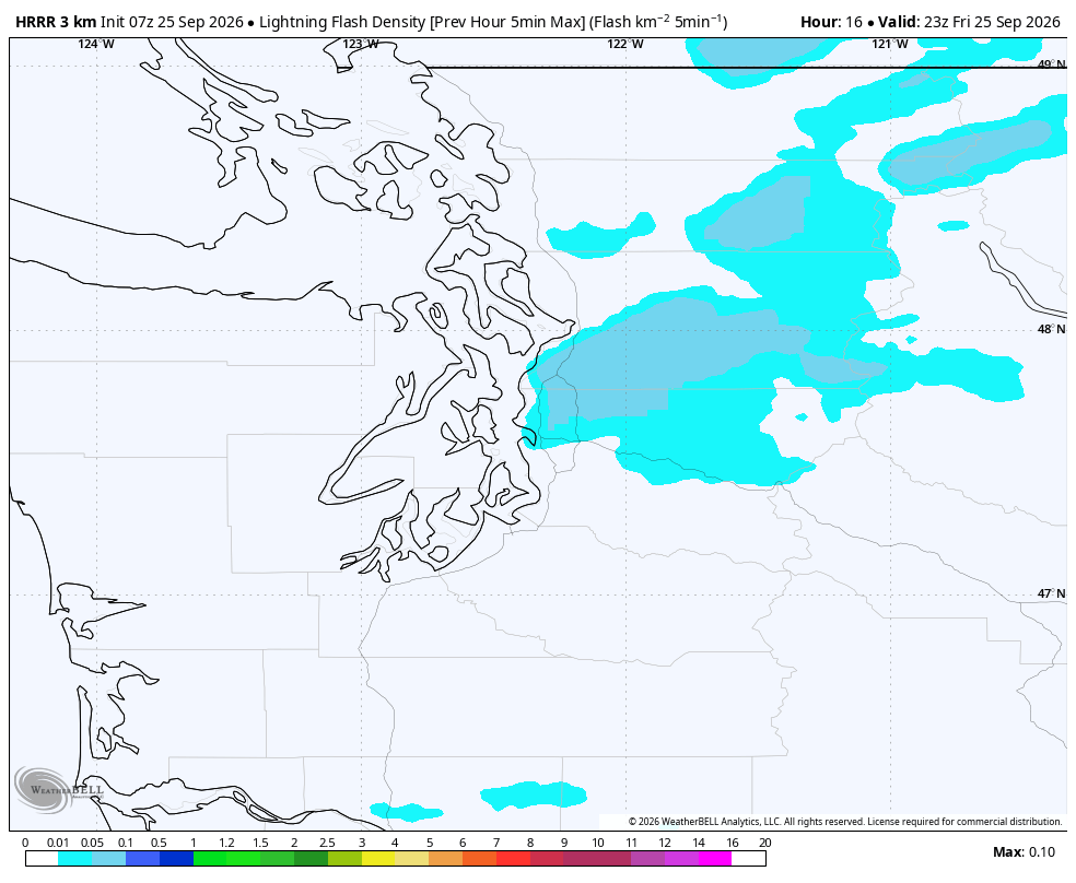
There could be some heavy rain and lighting in a narrow band where these winds collide. Likely area is around Everett/Southern Snohomish County but could be as far south as North Seattle.
TO REITERATE THOUGH: OVERALL, THIS IS STILL NOT A MAJOR WIND STORM
I want to stress this is NOT looking like a major, damaging windstorm — the storm still pales in comparison in its strength to windstorms that traditionally cause widespread outages or anything. Gusts of 40-45 mph will seem trivial in a month or two.
However, with trees still leafy, the first storms of these kind of wind speeds of the autumn season tend to cause more issues because the leafy trees “catch” more wind, plus the winds tend to be “nature’s pruner” and blows off any branches or other tree parts that may have died over the dry summer, and potentially into power lines. So we could see some scattered power outages today, especially in areas under the Wind Advisory.
All winds calm by Friday night and we’re looking at a much calmer weekend. Good practice run for when we get the more “regular”autumn wind storms later this year!