The forecast is about to get weird again, and I blame Bob…
Who’s “Bob”? It’s the name I’ve given the upper low pressure area that has been hanging around the past week and somehow *is set to keep bugging us for another week*.
A recap of Bob’s journey and road ahead:
Late last week, Bob was out in the Pacific with sights set on the Pacific Northwest as what was going to vanquish the heat gripping our region.
Remember the forecast of the low that was coming into our area for last Saturday then was going to “hit the wall” just off of coast as it crashed into the rebuilding high pressure ridge and retreat? That was Bob…
Well, Bob didn’t go far. Instead he’s been hanging out a few hundred miles offshore, swirling around in tandem with another low out to the southwest — not really close enough to us for rain, but just close enough to keep the I-5 corridor from the worst of the heat dome that’s been baking Eastern Washington and B.C. (Ummm, thanks… Bob?)
Over the past couple days, Bob grew tired of sharing the Eastern Pacific with a friend, and has since absorbed the second low into itself, becoming a little stronger as it began to trek back toward the Gulf of Alaska. (If you’ve ever played the online app where you move the hole around and it grows larger as it eats more of the country side… Yeah, like that.)
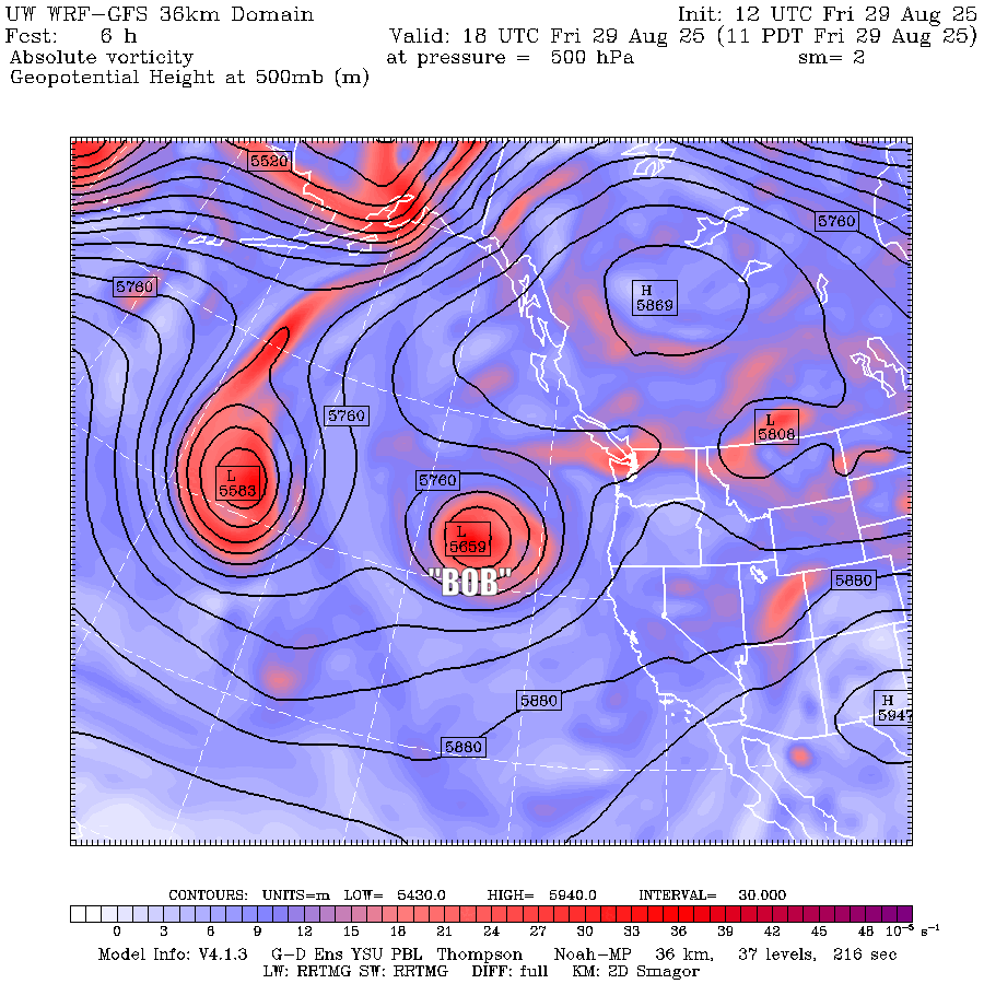
That’s where Bob is now, but he’s coming back for another visit. As he starts moving back our way Friday, little “mini-Bobs” (weak low pressure “vorticity maxes” ) will swing around through the west coast, bringing a risk of showers and isolated thunderstorms for Oregon and southwestern Washington,
Over this coming weekend, Bob will be back close enough to destabilize the atmosphere and send even more “mini-Bobs” across the Northwest, bringing a chance of showers — and thunderstorms — across Western Washington and Oregon. (Thunderstorm chances are higher Saturday than Sunday).
On next Monday — Bob will move right overhead of the Pacific Northwest, and is forecast to stay stuck there just swirling in place through at least Wednesday and possibly Thursday. That will keep things cool and showery through the week (maybe a lingering risk of thunderstorms Monday but we start cooling to where thunderstorms become less likely).
Finally — FINALLY — Bob appears to get scooped up and carried away later in the week… two weeks later. Bye Bob!
(I think 2 weeks in meteorology is like 12 years in dog years?)
While Bob won’t do much yet to clear out all the smoky haze, he will at least finally bring an end to the anomalous heat. Friday will still remain warm but as Bob gets closer and becomes entrenched, it’ll start a gradual cooling trend to where should be in the upper 60s and low 70s by early next week.